Duval County Boundary File 3k
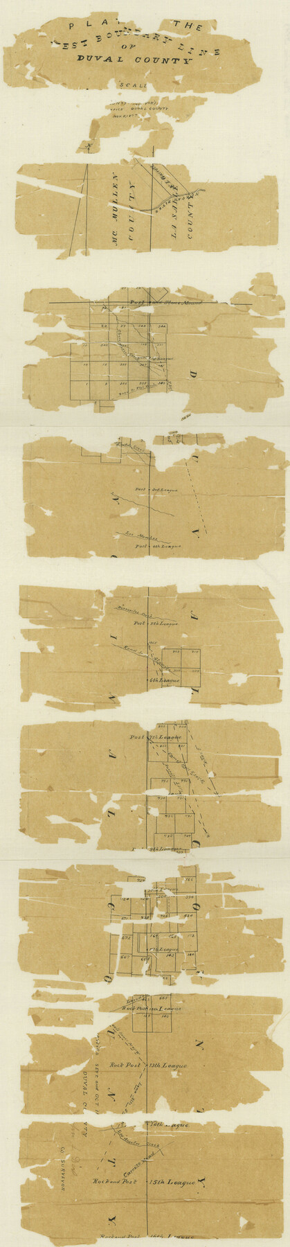
Plat of the West Boundary Line of Duval County
-
Map/Doc
52759
-
Collection
General Map Collection
-
Counties
Duval
-
Subjects
County Boundaries
-
Height x Width
30.1 x 7.0 inches
76.5 x 17.8 cm
Part of: General Map Collection
Taylor County Working Sketch 1

Print $20.00
- Digital $50.00
Taylor County Working Sketch 1
1924
Size 16.3 x 15.1 inches
Map/Doc 69610
El Paso County Sketch File 10

Print $52.00
- Digital $50.00
El Paso County Sketch File 10
1890
Size 8.4 x 5.4 inches
Map/Doc 21974
Kerr County Boundary File 3

Print $6.00
- Digital $50.00
Kerr County Boundary File 3
Size 11.3 x 8.8 inches
Map/Doc 55998
Val Verde County Rolled Sketch 44

Print $61.00
- Digital $50.00
Val Verde County Rolled Sketch 44
Size 10.2 x 15.3 inches
Map/Doc 49454
Montague County Working Sketch 1

Print $20.00
- Digital $50.00
Montague County Working Sketch 1
Size 18.7 x 32.5 inches
Map/Doc 71067
Right of Way and Track Map of The Missouri, Kansas & Texas Railway of Texas

Print $40.00
- Digital $50.00
Right of Way and Track Map of The Missouri, Kansas & Texas Railway of Texas
1918
Size 25.2 x 106.9 inches
Map/Doc 64531
Motley County Sketch File 31 (S)

Print $4.00
- Digital $50.00
Motley County Sketch File 31 (S)
1913
Size 14.4 x 6.7 inches
Map/Doc 32213
Crane County Rolled Sketch 20

Print $20.00
- Digital $50.00
Crane County Rolled Sketch 20
Size 44.5 x 34.6 inches
Map/Doc 8684
Val Verde County Working Sketch 117

Print $20.00
- Digital $50.00
Val Verde County Working Sketch 117
1993
Size 20.9 x 38.2 inches
Map/Doc 82841
Flight Mission No. DQN-2K, Frame 67, Calhoun County

Print $20.00
- Digital $50.00
Flight Mission No. DQN-2K, Frame 67, Calhoun County
1953
Size 18.6 x 22.3 inches
Map/Doc 84259
Flight Mission No. DAH-17M, Frame 24, Orange County

Print $20.00
- Digital $50.00
Flight Mission No. DAH-17M, Frame 24, Orange County
1953
Size 18.5 x 22.4 inches
Map/Doc 86887
Map of Fort Bend Co.

Print $20.00
- Digital $50.00
Map of Fort Bend Co.
1906
Size 38.4 x 43.8 inches
Map/Doc 87154
You may also like
Donley County Working Sketch 1

Print $20.00
- Digital $50.00
Donley County Working Sketch 1
1914
Size 19.0 x 19.7 inches
Map/Doc 68734
Map of Harrison County

Print $20.00
- Digital $50.00
Map of Harrison County
1871
Size 18.0 x 19.1 inches
Map/Doc 1117
Harris County Boundary File 39 (1)

Print $45.00
- Digital $50.00
Harris County Boundary File 39 (1)
Size 4.5 x 16.3 inches
Map/Doc 54326
Gaines County Sketch File 1

Print $20.00
- Digital $50.00
Gaines County Sketch File 1
Size 19.1 x 30.7 inches
Map/Doc 11521
Real County Rolled Sketch 18

Print $20.00
- Digital $50.00
Real County Rolled Sketch 18
Size 22.2 x 28.2 inches
Map/Doc 7461
Harris County Working Sketch 41

Print $20.00
- Digital $50.00
Harris County Working Sketch 41
1940
Size 37.8 x 29.9 inches
Map/Doc 65933
Duval County Working Sketch 21

Print $20.00
- Digital $50.00
Duval County Working Sketch 21
1941
Size 16.9 x 11.8 inches
Map/Doc 68745
Travis County State Real Property Sketch 2

Print $20.00
- Digital $50.00
Travis County State Real Property Sketch 2
1986
Size 34.0 x 35.5 inches
Map/Doc 61693
Map of Hays County

Print $20.00
- Digital $50.00
Map of Hays County
1877
Size 21.2 x 19.8 inches
Map/Doc 3646
Refugio County Rolled Sketch 8

Print $40.00
- Digital $50.00
Refugio County Rolled Sketch 8
1954
Size 53.9 x 46.7 inches
Map/Doc 9860
[Blocks C31, C32, C36-C39]
![91867, [Blocks C31, C32, C36-C39], Twichell Survey Records](https://historictexasmaps.com/wmedia_w700/maps/91867-1.tif.jpg)
Print $20.00
- Digital $50.00
[Blocks C31, C32, C36-C39]
Size 15.6 x 16.0 inches
Map/Doc 91867
McMullen County Sketch File 8

Print $4.00
- Digital $50.00
McMullen County Sketch File 8
1876
Size 8.6 x 8.8 inches
Map/Doc 31349