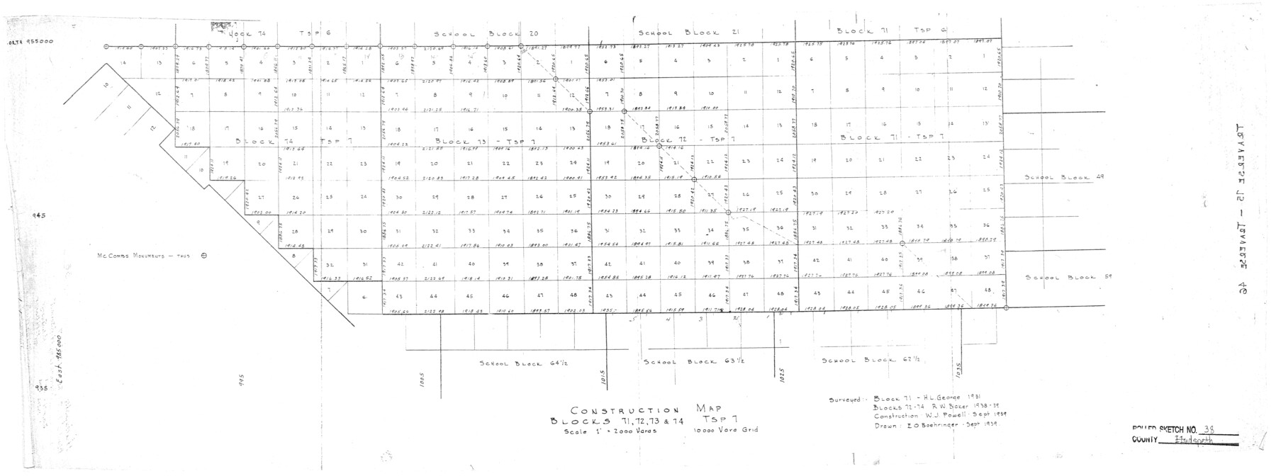
Hudspeth County Rolled Sketch 38
Construction Map - Blocks 71, 72, 73 & 74, Tsp. 7
-
Map/Doc
6251
-
Collection
General Map Collection
-
Object Dates
1939 (Creation Date)
10/13/1953 (File Date)
-
People and Organizations
R.W. Baker (Surveyor/Engineer)
H.L. George (Surveyor/Engineer)
W.J. Powell (Surveyor/Engineer)
E.O. Boehringer (Draftsman)
-
Counties
Hudspeth
-
Subjects
Surveying Rolled Sketch
-
Height x Width
18.0 x 37.5 inches
45.7 x 95.3 cm
-
Scale
1" = 2000 varas
Part of: General Map Collection
Lynn County Sketch File 21

Print $52.00
- Digital $50.00
Lynn County Sketch File 21
1913
Size 5.7 x 8.6 inches
Map/Doc 30528
Flight Mission No. CUG-3P, Frame 33, Kleberg County

Print $20.00
- Digital $50.00
Flight Mission No. CUG-3P, Frame 33, Kleberg County
1956
Size 18.4 x 22.2 inches
Map/Doc 86238
Menard County Working Sketch 6

Print $20.00
- Digital $50.00
Menard County Working Sketch 6
1924
Size 24.4 x 15.3 inches
Map/Doc 70953
Maverick County Sketch File 18

Print $14.00
- Digital $50.00
Maverick County Sketch File 18
1886
Size 12.8 x 8.1 inches
Map/Doc 31121
Flight Mission No. DQO-3K, Frame 14, Galveston County

Print $20.00
- Digital $50.00
Flight Mission No. DQO-3K, Frame 14, Galveston County
1952
Size 18.8 x 22.4 inches
Map/Doc 85055
Val Verde County Rolled Sketch 86

Print $20.00
- Digital $50.00
Val Verde County Rolled Sketch 86
2014
Size 11.9 x 18.4 inches
Map/Doc 93690
Gregg County Rolled Sketch 27

Print $137.00
- Digital $50.00
Gregg County Rolled Sketch 27
1933
Size 10.4 x 15.3 inches
Map/Doc 45625
Kinney County Rolled Sketch 10

Print $20.00
- Digital $50.00
Kinney County Rolled Sketch 10
1942
Size 22.9 x 20.4 inches
Map/Doc 6539
Angelina County Working Sketch 37

Print $20.00
- Digital $50.00
Angelina County Working Sketch 37
1958
Size 25.7 x 19.1 inches
Map/Doc 67120
Flight Mission No. CGI-3N, Frame 104, Cameron County

Print $20.00
- Digital $50.00
Flight Mission No. CGI-3N, Frame 104, Cameron County
1954
Size 18.6 x 22.3 inches
Map/Doc 84584
Refugio County Texas

Print $20.00
- Digital $50.00
Refugio County Texas
1896
Size 20.3 x 26.9 inches
Map/Doc 3985

You may also like
Falls County Sketch File 19

Print $4.00
- Digital $50.00
Falls County Sketch File 19
1871
Size 12.8 x 8.4 inches
Map/Doc 22386
Borden County Sketch File 6

Print $8.00
- Digital $50.00
Borden County Sketch File 6
1900
Size 11.2 x 8.7 inches
Map/Doc 14719
Stephens County Working Sketch 9

Print $20.00
- Digital $50.00
Stephens County Working Sketch 9
1920
Size 16.3 x 14.6 inches
Map/Doc 63952
Menard County Boundary File 3a

Print $4.00
- Digital $50.00
Menard County Boundary File 3a
Size 10.6 x 8.1 inches
Map/Doc 57074
Bandera County Sketch File 33

Print $40.00
- Digital $50.00
Bandera County Sketch File 33
1975
Size 14.4 x 17.5 inches
Map/Doc 14028
Morris County Rolled Sketch 2A

Print $20.00
- Digital $50.00
Morris County Rolled Sketch 2A
Size 24.0 x 18.7 inches
Map/Doc 10256
Edwards County Sketch File 35

Print $4.00
- Digital $50.00
Edwards County Sketch File 35
Size 11.3 x 8.9 inches
Map/Doc 21769
Houston County Sketch File 1b

Print $4.00
- Digital $50.00
Houston County Sketch File 1b
1857
Size 8.5 x 7.9 inches
Map/Doc 26744
Edwards County Boundary File 27e

Print $11.00
- Digital $50.00
Edwards County Boundary File 27e
Size 12.8 x 8.5 inches
Map/Doc 52906
Val Verde County Rolled Sketch 40

Print $40.00
- Digital $50.00
Val Verde County Rolled Sketch 40
Size 39.0 x 123.5 inches
Map/Doc 10073
St. Louis Southwestern Railway of Texas

Print $20.00
- Digital $50.00
St. Louis Southwestern Railway of Texas
1906
Size 22.2 x 30.5 inches
Map/Doc 64451
Dimmit County Working Sketch 58

Print $20.00
- Digital $50.00
Dimmit County Working Sketch 58
2017
Size 24.2 x 36.2 inches
Map/Doc 94121