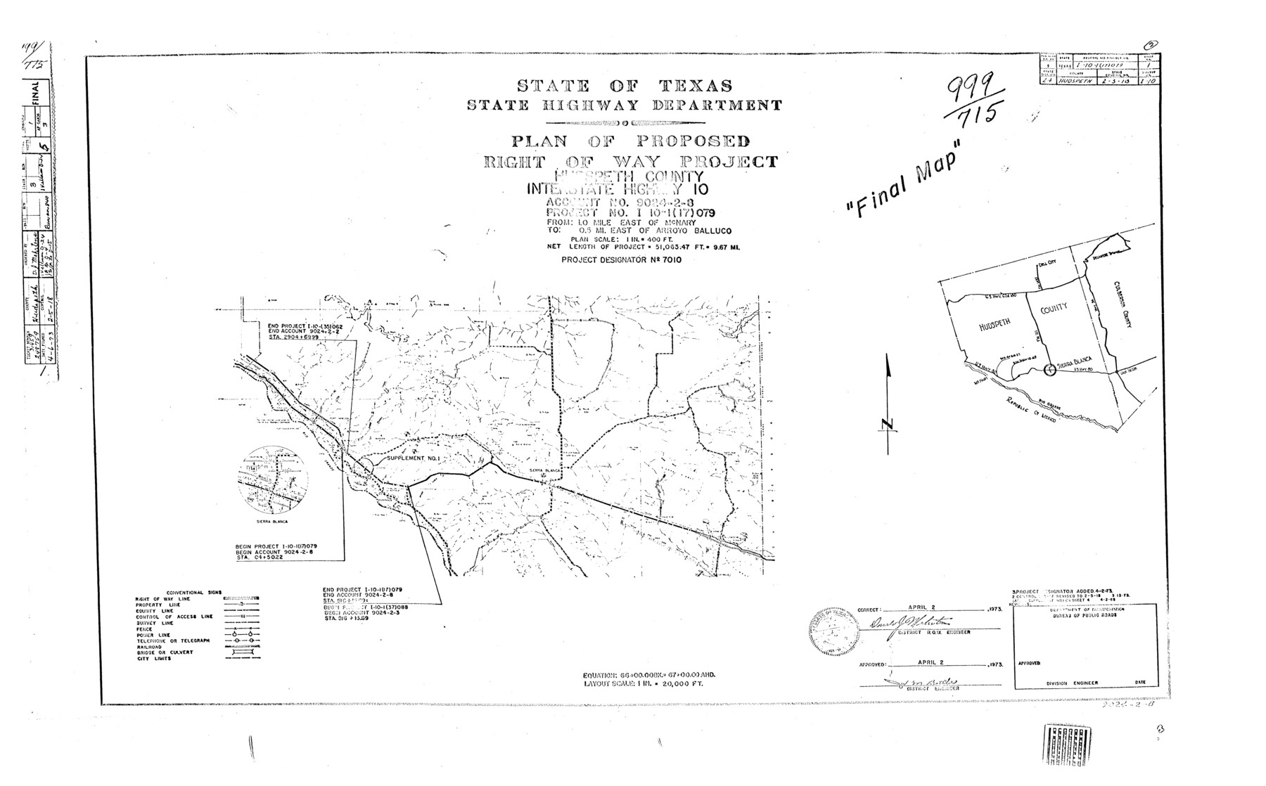
Hudspeth County Rolled Sketch 69
Plan of proposed right of way project, Hudspeth County, Interstate Highway 10
-
Map/Doc
6264
-
Collection
General Map Collection
-
Object Dates
1973/4/2 (Creation Date)
1989/3/20 (File Date)
-
People and Organizations
State Highway Department (Publisher)
-
Counties
Hudspeth
-
Subjects
Surveying Rolled Sketch
-
Height x Width
12.3 x 19.8 inches
31.2 x 50.3 cm
-
Medium
paper, photocopy
-
Scale
1" = 400 feet
Part of: General Map Collection
Webb County Sketch File 61

Print $6.00
- Digital $50.00
Webb County Sketch File 61
1944
Size 14.5 x 8.8 inches
Map/Doc 39859
Flight Mission No. CGI-3N, Frame 44, Cameron County

Print $20.00
- Digital $50.00
Flight Mission No. CGI-3N, Frame 44, Cameron County
1954
Size 18.9 x 22.5 inches
Map/Doc 84550
Live Oak County Sketch File 18

Print $11.00
- Digital $50.00
Live Oak County Sketch File 18
1895
Size 10.5 x 17.0 inches
Map/Doc 30284
West Part of Edwards County

Print $20.00
- Digital $50.00
West Part of Edwards County
1975
Size 35.5 x 23.2 inches
Map/Doc 77271
Hartley County Boundary File 1a

Print $50.00
- Digital $50.00
Hartley County Boundary File 1a
Size 14.1 x 8.8 inches
Map/Doc 54437
Burnet County Rolled Sketch 3

Print $20.00
- Digital $50.00
Burnet County Rolled Sketch 3
Size 23.7 x 26.2 inches
Map/Doc 5355
Lee County Working Sketch 9

Print $20.00
- Digital $50.00
Lee County Working Sketch 9
1979
Size 26.7 x 28.0 inches
Map/Doc 70388

Brewster County Rolled Sketch 114

Print $20.00
- Digital $50.00
Brewster County Rolled Sketch 114
1964
Size 11.1 x 18.4 inches
Map/Doc 5270
Duval County Boundary File 4

Print $40.00
- Digital $50.00
Duval County Boundary File 4
Size 39.5 x 13.7 inches
Map/Doc 52767
Cooke County Sketch File 22

Print $6.00
- Digital $50.00
Cooke County Sketch File 22
1870
Size 6.4 x 8.2 inches
Map/Doc 19267
Chambers County Sketch File 21

Print $20.00
- Digital $50.00
Chambers County Sketch File 21
Size 29.3 x 32.8 inches
Map/Doc 10331
You may also like
Uvalde County Working Sketch 65

Print $20.00
- Digital $50.00
Uvalde County Working Sketch 65
Size 34.8 x 43.0 inches
Map/Doc 69696

[Map of the Fort Worth & Denver City Railway]
![64432, [Map of the Fort Worth & Denver City Railway], General Map Collection](https://historictexasmaps.com/wmedia_w700/maps/64432.tif.jpg)
Print $40.00
- Digital $50.00
[Map of the Fort Worth & Denver City Railway]
1887
Size 21.3 x 122.7 inches
Map/Doc 64432
Travis County Rolled Sketch 30

Print $20.00
- Digital $50.00
Travis County Rolled Sketch 30
1943
Size 26.5 x 25.6 inches
Map/Doc 8032
Real County Working Sketch 56

Print $20.00
- Digital $50.00
Real County Working Sketch 56
1960
Size 31.1 x 23.9 inches
Map/Doc 71948
Chart of the Rio Bravo del Norte traced from a survey made by Henry Austin by Lieut. Bowman, 3d. Infy.

Print $20.00
- Digital $50.00
Chart of the Rio Bravo del Norte traced from a survey made by Henry Austin by Lieut. Bowman, 3d. Infy.
1866
Size 18.3 x 27.8 inches
Map/Doc 72889
Cooke County Working Sketch 15

Print $20.00
- Digital $50.00
Cooke County Working Sketch 15
1946
Size 29.9 x 23.5 inches
Map/Doc 68252
Concho County Sketch File 21

Print $6.00
- Digital $50.00
Concho County Sketch File 21
Size 7.3 x 11.1 inches
Map/Doc 19143
A Geographically Correct County Map of States Traversed by the St. Louis, Iron Mountain & Southern Railway and its Connections

Print $20.00
- Digital $50.00
A Geographically Correct County Map of States Traversed by the St. Louis, Iron Mountain & Southern Railway and its Connections
1877
Size 18.5 x 16.1 inches
Map/Doc 95782

Aransas County Rolled Sketch 2

Print $40.00
- Digital $50.00
Aransas County Rolled Sketch 2
1950
Size 42.5 x 48.6 inches
Map/Doc 73611
PSL Field Notes for Blocks A42 through A55 in Andrews County

PSL Field Notes for Blocks A42 through A55 in Andrews County
Map/Doc 81644