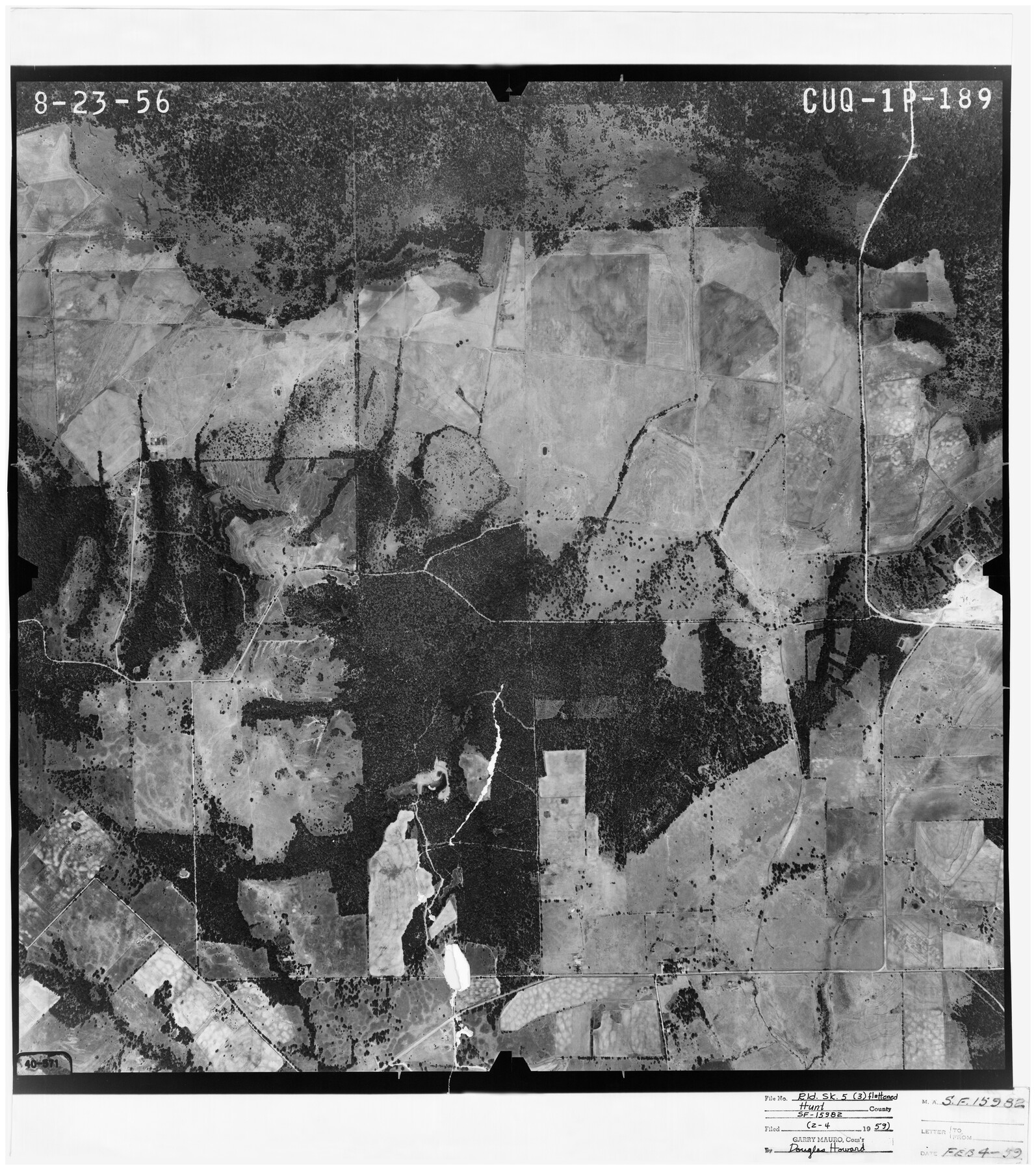
Hunt County Rolled Sketch 5
[Aerial photo relating to SF-15982]
-
Map/Doc
6270
-
Collection
General Map Collection
-
Object Dates
8/23/1956 (Creation Date)
2/4/1959 (File Date)
-
Counties
Hunt
-
Subjects
Cadastral Surveying Rolled Sketch
-
Height x Width
27.6 x 24.8 inches
70.1 x 63.0 cm
-
Medium
photograph
Part of: General Map Collection
Pecos County Working Sketch 113
![71586, Pecos County Working Sketch 113, General Map Collection](https://historictexasmaps.com/wmedia_w700/maps/71586.tif.jpg)
Print $40.00
- Digital $50.00
Pecos County Working Sketch 113
Size 36.1 x 58.2 inches
Map/Doc 71586
Archer County Sketch File C
![13574, Archer County Sketch File C, General Map Collection](https://historictexasmaps.com/wmedia_w700/pdf_converted_jpg/qi_pdf_thumbnail_9136.jpg)
Print $164.00
- Digital $50.00
Archer County Sketch File C
1899
Size 9.0 x 6.2 inches
Map/Doc 13574
Midland County Working Sketch 22
![71003, Midland County Working Sketch 22, General Map Collection](https://historictexasmaps.com/wmedia_w700/maps/71003.tif.jpg)
Print $40.00
- Digital $50.00
Midland County Working Sketch 22
Size 97.0 x 43.1 inches
Map/Doc 71003
Kendall County Sketch File 18
![28711, Kendall County Sketch File 18, General Map Collection](https://historictexasmaps.com/wmedia_w700/pdf_converted_jpg/qi_pdf_thumbnail_12400.jpg)
Print $4.00
- Digital $50.00
Kendall County Sketch File 18
1882
Size 10.0 x 6.7 inches
Map/Doc 28711
Hood County Rolled Sketch 6A
![6223, Hood County Rolled Sketch 6A, General Map Collection](https://historictexasmaps.com/wmedia_w700/maps/6223.tif.jpg)
Print $4.00
- Digital $50.00
Hood County Rolled Sketch 6A
1996
Size 19.9 x 26.5 inches
Map/Doc 6223
Burnet County Sketch File 27
![16730, Burnet County Sketch File 27, General Map Collection](https://historictexasmaps.com/wmedia_w700/pdf_converted_jpg/qi_pdf_thumbnail_9756.jpg)
Print $4.00
- Digital $50.00
Burnet County Sketch File 27
1874
Size 12.7 x 8.1 inches
Map/Doc 16730
Blanco County Sketch File 49
![14691, Blanco County Sketch File 49, General Map Collection](https://historictexasmaps.com/wmedia_w700/pdf_converted_jpg/qi_pdf_thumbnail_9467.jpg)
Print $12.00
- Digital $50.00
Blanco County Sketch File 49
Size 14.3 x 8.8 inches
Map/Doc 14691
Ward County Rolled Sketch 22
![10110, Ward County Rolled Sketch 22, General Map Collection](https://historictexasmaps.com/wmedia_w700/maps/10110-1.tif.jpg)
Print $40.00
- Digital $50.00
Ward County Rolled Sketch 22
1873
Size 69.2 x 18.0 inches
Map/Doc 10110
Bell County Sketch File 20a
![14408, Bell County Sketch File 20a, General Map Collection](https://historictexasmaps.com/wmedia_w700/pdf_converted_jpg/qi_pdf_thumbnail_9369.jpg)
Print $4.00
- Digital $50.00
Bell County Sketch File 20a
1855
Size 6.7 x 8.3 inches
Map/Doc 14408
Crosby County Sketch File 13a
![20036, Crosby County Sketch File 13a, General Map Collection](https://historictexasmaps.com/wmedia_w700/pdf_converted_jpg/qi_pdf_thumbnail_10542.jpg)
Print $44.00
- Digital $50.00
Crosby County Sketch File 13a
1903
Size 8.8 x 4.5 inches
Map/Doc 20036
Kimble County Sketch File 10
![28931, Kimble County Sketch File 10, General Map Collection](https://historictexasmaps.com/wmedia_w700/pdf_converted_jpg/qi_pdf_thumbnail_12450.jpg)
Print $23.00
- Digital $50.00
Kimble County Sketch File 10
Size 18.5 x 15.6 inches
Map/Doc 28931
Palo Pinto County Rolled Sketch 2
![9669, Palo Pinto County Rolled Sketch 2, General Map Collection](https://historictexasmaps.com/wmedia_w700/maps/9669.tif.jpg)
Print $20.00
- Digital $50.00
Palo Pinto County Rolled Sketch 2
1917
Size 37.5 x 43.8 inches
Map/Doc 9669
You may also like
Parker County Working Sketch 8
![71458, Parker County Working Sketch 8, General Map Collection](https://historictexasmaps.com/wmedia_w700/maps/71458.tif.jpg)
Print $20.00
- Digital $50.00
Parker County Working Sketch 8
Size 26.3 x 25.1 inches
Map/Doc 71458
Flight Mission No. CLL-1N, Frame 197, Willacy County
![87067, Flight Mission No. CLL-1N, Frame 197, Willacy County, General Map Collection](https://historictexasmaps.com/wmedia_w700/pdf_converted_jpg/qi_pdf_thumbnail_34201.jpg)
Print $20.00
- Digital $50.00
Flight Mission No. CLL-1N, Frame 197, Willacy County
1954
Size 18.4 x 22.1 inches
Map/Doc 87067
Gregg County Working Sketch 11a
![63277, Gregg County Working Sketch 11a, General Map Collection](https://historictexasmaps.com/wmedia_w700/maps/63277.tif.jpg)
Print $20.00
- Digital $50.00
Gregg County Working Sketch 11a
Size 26.2 x 32.9 inches
Map/Doc 63277
Brewster County Working Sketch 19
![67551, Brewster County Working Sketch 19, General Map Collection](https://historictexasmaps.com/wmedia_w700/maps/67551.tif.jpg)
Print $20.00
- Digital $50.00
Brewster County Working Sketch 19
Size 15.7 x 13.0 inches
Map/Doc 67551
Intracoastal Waterway - Galveston Bay to West Bay including Galveston Bay Entrance
![69935, Intracoastal Waterway - Galveston Bay to West Bay including Galveston Bay Entrance, General Map Collection](https://historictexasmaps.com/wmedia_w700/maps/69935.tif.jpg)
Print $20.00
- Digital $50.00
Intracoastal Waterway - Galveston Bay to West Bay including Galveston Bay Entrance
1961
Size 26.9 x 38.9 inches
Map/Doc 69935
Eastland County Working Sketch 1
![68782, Eastland County Working Sketch 1, General Map Collection](https://historictexasmaps.com/wmedia_w700/maps/68782.tif.jpg)
Print $3.00
- Digital $50.00
Eastland County Working Sketch 1
Size 13.8 x 11.0 inches
Map/Doc 68782
Slaughter Addition, Morton, Texas
![92541, Slaughter Addition, Morton, Texas, Twichell Survey Records](https://historictexasmaps.com/wmedia_w700/maps/92541.tif.jpg)
Print $3.00
- Digital $50.00
Slaughter Addition, Morton, Texas
1951
Size 16.6 x 11.8 inches
Map/Doc 92541
Aransas County Rolled Sketch 2
![73612, Aransas County Rolled Sketch 2, General Map Collection](https://historictexasmaps.com/wmedia_w700/maps/73612.tif.jpg)
Print $40.00
- Digital $50.00
Aransas County Rolled Sketch 2
1950
Size 54.7 x 50.5 inches
Map/Doc 73612
Brazoria County Sketch File 28a
![10954, Brazoria County Sketch File 28a, General Map Collection](https://historictexasmaps.com/wmedia_w700/pdf_converted_jpg/qi_pdf_thumbnail_7528.jpg)
Print $40.00
- Digital $50.00
Brazoria County Sketch File 28a
1913
Size 21.0 x 15.2 inches
Map/Doc 10954
Terrell County Sketch File 18
![37941, Terrell County Sketch File 18, General Map Collection](https://historictexasmaps.com/wmedia_w700/pdf_converted_jpg/qi_pdf_thumbnail_14472.jpg)
Print $8.00
- Digital $50.00
Terrell County Sketch File 18
1908
Size 9.1 x 4.4 inches
Map/Doc 37941
Map of the State of Texas from the Latest Authorities
![93901, Map of the State of Texas from the Latest Authorities, Holcomb Digital Map Collection](https://historictexasmaps.com/wmedia_w700/maps/93901.tif.jpg)
Print $20.00
- Digital $50.00
Map of the State of Texas from the Latest Authorities
1854
Size 13.1 x 16.1 inches
Map/Doc 93901
Reeves County Working Sketch 41
![63484, Reeves County Working Sketch 41, General Map Collection](https://historictexasmaps.com/wmedia_w700/maps/63484.tif.jpg)
Print $40.00
- Digital $50.00
Reeves County Working Sketch 41
Size 42.5 x 53.4 inches
Map/Doc 63484