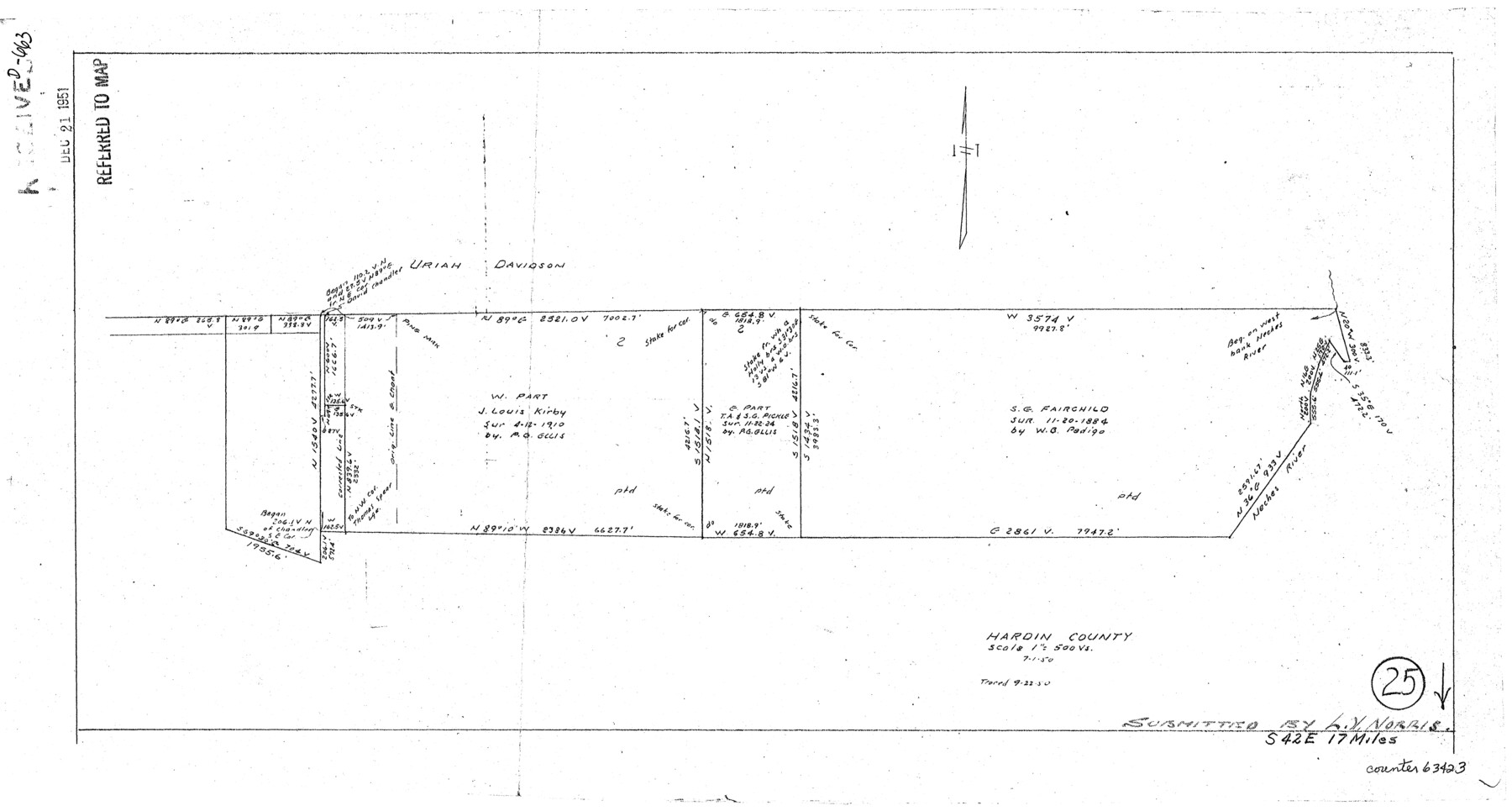
Hardin County Working Sketch 25
-
Map/Doc
63423
-
Collection
General Map Collection
-
Object Dates
7/1/1950 (Creation Date)
-
Counties
Hardin
-
Subjects
Surveying Working Sketch
-
Height x Width
10.8 x 20.1 inches
27.4 x 51.1 cm
-
Scale
1" = 500 varas
Part of: General Map Collection
Jasper County Working Sketch 7

Print $20.00
- Digital $50.00
Jasper County Working Sketch 7
1914
Size 24.2 x 26.3 inches
Map/Doc 66469
Burleson County Working Sketch 7

Print $20.00
- Digital $50.00
Burleson County Working Sketch 7
1980
Size 15.2 x 11.4 inches
Map/Doc 67726
2017 Official Travel Map, Texas

2017 Official Travel Map, Texas
2017
Size 33.6 x 36.4 inches
Map/Doc 94415

Throckmorton County Rolled Sketch 6B

Print $20.00
- Digital $50.00
Throckmorton County Rolled Sketch 6B
2004
Size 20.3 x 24.2 inches
Map/Doc 82490
Pecos County Rolled Sketch JAS-1

Print $40.00
- Digital $50.00
Pecos County Rolled Sketch JAS-1
1936
Size 41.8 x 63.8 inches
Map/Doc 76146
Pecos County Rolled Sketch 183

Print $20.00
- Digital $50.00
Pecos County Rolled Sketch 183
1982
Size 39.6 x 27.5 inches
Map/Doc 7302
Cass County Working Sketch 28

Print $20.00
- Digital $50.00
Cass County Working Sketch 28
1979
Size 16.0 x 16.8 inches
Map/Doc 67931
Runnels County Working Sketch 7

Print $20.00
- Digital $50.00
Runnels County Working Sketch 7
1929
Size 29.5 x 14.9 inches
Map/Doc 63603
Official Map of the State of Texas to accompany the Statistical and Descriptive Work, "Resources, Soil and Climate of Texas"

Print $20.00
- Digital $50.00
Official Map of the State of Texas to accompany the Statistical and Descriptive Work, "Resources, Soil and Climate of Texas"
1882
Size 31.1 x 33.1 inches
Map/Doc 2134
Gregg County Working Sketch 16

Print $20.00
- Digital $50.00
Gregg County Working Sketch 16
1944
Size 14.8 x 27.9 inches
Map/Doc 63283
Galveston County NRC Article 33.136 Sketch 43

Print $59.00
- Digital $50.00
Galveston County NRC Article 33.136 Sketch 43
2002
Size 24.7 x 36.9 inches
Map/Doc 87156
You may also like
Callahan County Rolled Sketch 25

Print $20.00
- Digital $50.00
Callahan County Rolled Sketch 25
1974
Size 18.4 x 22.5 inches
Map/Doc 5383
Maps & Lists Showing Prison Lands (Oil & Gas) Leased as of June 1955

Digital $50.00
Maps & Lists Showing Prison Lands (Oil & Gas) Leased as of June 1955
Size 11.2 x 8.7 inches
Map/Doc 62871
Greater Texas and the Coast Country - The Winter Garden

Greater Texas and the Coast Country - The Winter Garden
1911
Size 9.4 x 4.5 inches
Map/Doc 97057
E. N. Gustafson's survey of Northern Portion of Lake Austin, Matagorda Co., TX

Print $40.00
- Digital $50.00
E. N. Gustafson's survey of Northern Portion of Lake Austin, Matagorda Co., TX
1926
Size 43.0 x 52.5 inches
Map/Doc 2068
Map of the Fort Worth and Denver City Railway, through Wilbarger County Texas, 1882

Print $40.00
- Digital $50.00
Map of the Fort Worth and Denver City Railway, through Wilbarger County Texas, 1882
Size 22.6 x 79.4 inches
Map/Doc 64427
Val Verde County Working Sketch 117

Print $20.00
- Digital $50.00
Val Verde County Working Sketch 117
1993
Size 17.5 x 24.4 inches
Map/Doc 82848
Burleson County Working Sketch 5

Print $20.00
- Digital $50.00
Burleson County Working Sketch 5
1980
Size 34.8 x 27.6 inches
Map/Doc 67724
Duval County Working Sketch 31

Print $20.00
- Digital $50.00
Duval County Working Sketch 31
1950
Size 29.1 x 34.0 inches
Map/Doc 68755
Randall County Rolled Sketch 7

Print $20.00
- Digital $50.00
Randall County Rolled Sketch 7
1949
Size 18.9 x 22.1 inches
Map/Doc 7427
Republic Counties. December 29, 1845

Print $20.00
Republic Counties. December 29, 1845
2020
Size 24.5 x 21.7 inches
Map/Doc 96319
Brazos River Conservation and Reclamation District Official Boundary Line Survey

Print $20.00
- Digital $50.00
Brazos River Conservation and Reclamation District Official Boundary Line Survey
Size 37.1 x 24.7 inches
Map/Doc 90127
Williamson County Boundary File 1a

Print $4.00
- Digital $50.00
Williamson County Boundary File 1a
Size 11.0 x 8.4 inches
Map/Doc 59990