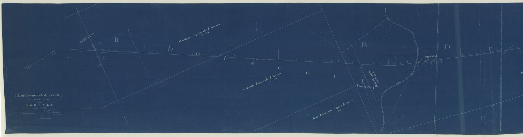
St. Louis, Brownsville & Mexico Railway Location Map from Mile 0 to Mile 20
Z-2-21
-
Map/Doc
64075
-
Collection
General Map Collection
-
Object Dates
1906/1/17 (Creation Date)
-
People and Organizations
Office of Chief Engineer (Publisher)
W. O. Homan (Surveyor/Engineer)
J. F. Hinckley (Surveyor/Engineer)
-
Counties
Cameron
-
Subjects
Railroads
-
Height x Width
19.5 x 74.5 inches
49.5 x 189.2 cm
-
Medium
blueprint/diazo
-
Scale
1" = 1000 feet
-
Comments
Segment 1. See counter no. 64076 for segment 2.
See counter 89280 for digital composite.
See counter nos. 64077 through 64080 for other related sheets and counters 89281 and 89282 for related digital composites. -
Features
SLB&M
Robstown
[Road] to Corpus Christi
TMRR
[Road] to Laredo
Driscoll
Agua Dulce Creek
Driscoll and Santa Gertrudis Trail
Driscoll Trail
Santa Gertrudis Trail
Part of: General Map Collection
Dallas County Rolled Sketch 1

Print $40.00
- Digital $50.00
Dallas County Rolled Sketch 1
1938
Size 22.7 x 78.5 inches
Map/Doc 8765
Ferguson State Farm

Print $20.00
- Digital $50.00
Ferguson State Farm
Size 19.2 x 20.4 inches
Map/Doc 62990
Galveston County Working Sketch 15

Print $20.00
- Digital $50.00
Galveston County Working Sketch 15
1978
Size 32.0 x 27.8 inches
Map/Doc 69352
Houston County Working Sketch 15

Print $20.00
- Digital $50.00
Houston County Working Sketch 15
1960
Size 26.3 x 20.0 inches
Map/Doc 66245
Wise County Sketch File 3

Print $4.00
- Digital $50.00
Wise County Sketch File 3
1856
Size 10.2 x 8.0 inches
Map/Doc 40528
Gray County Boundary File 10

Print $15.00
- Digital $50.00
Gray County Boundary File 10
Size 14.5 x 9.0 inches
Map/Doc 53905
Hardeman County Working Sketch 13

Print $20.00
- Digital $50.00
Hardeman County Working Sketch 13
1966
Size 35.8 x 45.7 inches
Map/Doc 63394
Blanco County Sketch File 12

Print $20.00
- Digital $50.00
Blanco County Sketch File 12
Size 15.0 x 19.8 inches
Map/Doc 10928
Grayson County

Print $20.00
- Digital $50.00
Grayson County
1935
Size 42.4 x 39.5 inches
Map/Doc 73162
Jack County Working Sketch 10

Print $20.00
- Digital $50.00
Jack County Working Sketch 10
1955
Size 24.4 x 18.6 inches
Map/Doc 66436
Flight Mission No. BRE-1P, Frame 49, Nueces County

Print $20.00
- Digital $50.00
Flight Mission No. BRE-1P, Frame 49, Nueces County
1956
Size 18.4 x 22.2 inches
Map/Doc 86638
Duval County Working Sketch 53

Print $20.00
- Digital $50.00
Duval County Working Sketch 53
1948
Size 34.7 x 37.5 inches
Map/Doc 68777
You may also like
Live Oak County Working Sketch 37

Print $40.00
- Digital $50.00
Live Oak County Working Sketch 37
2012
Size 34.4 x 48.7 inches
Map/Doc 93363
San Jacinto County Working Sketch 22

Print $20.00
- Digital $50.00
San Jacinto County Working Sketch 22
1940
Size 21.3 x 25.3 inches
Map/Doc 63735
Harris County Boundary File 39 (12)

Print $4.00
- Digital $50.00
Harris County Boundary File 39 (12)
Size 7.7 x 8.1 inches
Map/Doc 54339
Montague County Working Sketch 35

Print $20.00
- Digital $50.00
Montague County Working Sketch 35
1980
Size 24.8 x 31.9 inches
Map/Doc 71101
Burleson County Working Sketch 37

Print $20.00
- Digital $50.00
Burleson County Working Sketch 37
1982
Size 33.7 x 44.3 inches
Map/Doc 67756
Flight Mission No. CLL-1N, Frame 84, Willacy County

Print $20.00
- Digital $50.00
Flight Mission No. CLL-1N, Frame 84, Willacy County
1954
Size 18.5 x 22.2 inches
Map/Doc 87030
Culberson County Sketch File 13

Print $16.00
- Digital $50.00
Culberson County Sketch File 13
1912
Size 11.2 x 8.7 inches
Map/Doc 20146
Sutton County Boundary File 6

Print $10.00
- Digital $50.00
Sutton County Boundary File 6
Size 14.4 x 8.8 inches
Map/Doc 59070
Zavala County Sketch File 2

Print $22.00
- Digital $50.00
Zavala County Sketch File 2
Size 13.2 x 14.4 inches
Map/Doc 41261
Kerr County Working Sketch 14

Print $20.00
- Digital $50.00
Kerr County Working Sketch 14
1952
Size 26.5 x 24.5 inches
Map/Doc 70045
Newton County Working Sketch 27

Print $20.00
- Digital $50.00
Newton County Working Sketch 27
1953
Size 25.9 x 30.0 inches
Map/Doc 71273
Trinity County Working Sketch 24

Print $20.00
- Digital $50.00
Trinity County Working Sketch 24
2010
Size 18.2 x 36.5 inches
Map/Doc 89599