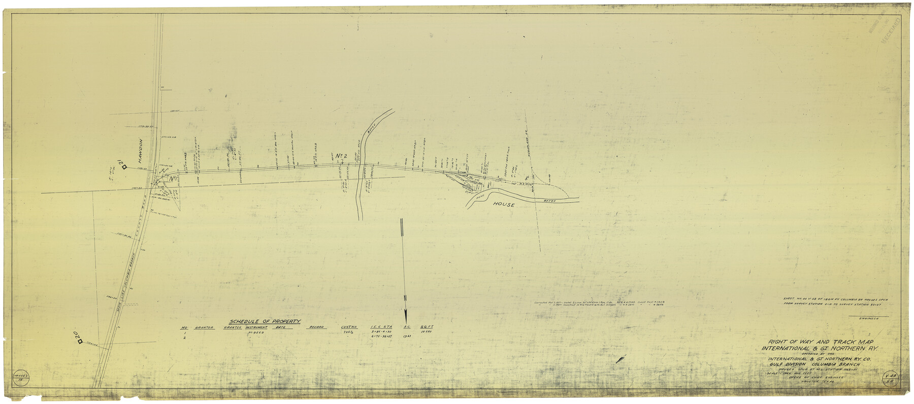
Right of Way and Track Map International & Gt. Northern Ry. operated by the International & Gt. Northern Ry. Co., Gulf Division, Columbia Branch
Houses Spur at M.L. Station 1163+01
Z-2-184
-
Map/Doc
64600
-
Collection
General Map Collection
-
Object Dates
6/30/1917 (Creation Date)
3/5/1927 (Revision Date)
-
Counties
Brazoria
-
Subjects
Railroads
-
Height x Width
25.1 x 57.0 inches
63.8 x 144.8 cm
-
Medium
blueprint/diazo
-
Scale
1" = 400 feet
-
Comments
See counter nos. 64594 through 64601 for other sheets.
-
Features
I&GN
Pond Bayou
House
Sugarland Railroad
Main line Columbia Branch
Part of: General Map Collection
Mills County Working Sketch 13

Print $20.00
- Digital $50.00
Mills County Working Sketch 13
1943
Size 27.4 x 28.7 inches
Map/Doc 71043
Nueces County Rolled Sketch 42

Print $45.00
Nueces County Rolled Sketch 42
1970
Size 27.6 x 39.2 inches
Map/Doc 6880
Index for Texas Railroad ROW & track maps available on microfilm at THD & Archives and Records

Print $2.00
- Digital $50.00
Index for Texas Railroad ROW & track maps available on microfilm at THD & Archives and Records
1977
Size 11.2 x 8.8 inches
Map/Doc 60756
Shackelford County Sketch File 2

Print $4.00
- Digital $50.00
Shackelford County Sketch File 2
1870
Size 9.3 x 9.0 inches
Map/Doc 36572
Smith County Working Sketch 17

Print $20.00
- Digital $50.00
Smith County Working Sketch 17
1994
Size 24.6 x 24.2 inches
Map/Doc 63902
Brown County Sketch File 19

Print $8.00
- Digital $50.00
Brown County Sketch File 19
1873
Size 12.8 x 8.2 inches
Map/Doc 16616
Flight Mission No. BRE-1P, Frame 57, Nueces County

Print $20.00
- Digital $50.00
Flight Mission No. BRE-1P, Frame 57, Nueces County
1956
Size 18.5 x 22.2 inches
Map/Doc 86646
Wood County Sketch File 5a

Print $4.00
- Digital $50.00
Wood County Sketch File 5a
1857
Size 10.1 x 8.0 inches
Map/Doc 40639
Chambers County Sketch File 10

Print $4.00
- Digital $50.00
Chambers County Sketch File 10
1869
Size 6.8 x 11.1 inches
Map/Doc 17550
Travis County Sketch File 56

Print $6.00
- Digital $50.00
Travis County Sketch File 56
1945
Size 14.2 x 9.0 inches
Map/Doc 38398
Jefferson County NRC Article 33.136 Sketch 13

Print $164.00
- Digital $50.00
Jefferson County NRC Article 33.136 Sketch 13
2019
Size 22.2 x 35.0 inches
Map/Doc 96447
Index for Texas Railroad ROW & track maps available on microfilm at THD & Archives and Records

Print $2.00
- Digital $50.00
Index for Texas Railroad ROW & track maps available on microfilm at THD & Archives and Records
1977
Size 11.2 x 8.8 inches
Map/Doc 60758
You may also like
Montague County Working Sketch 5

Print $20.00
- Digital $50.00
Montague County Working Sketch 5
1920
Size 24.9 x 20.9 inches
Map/Doc 71071
McCulloch County Working Sketch 14

Print $20.00
- Digital $50.00
McCulloch County Working Sketch 14
1990
Size 15.3 x 29.0 inches
Map/Doc 70689
A New Map of Texas

Print $20.00
- Digital $50.00
A New Map of Texas
1841
Size 17.6 x 16.2 inches
Map/Doc 93862
Flight Mission No. DCL-6C, Frame 98, Kenedy County

Print $20.00
- Digital $50.00
Flight Mission No. DCL-6C, Frame 98, Kenedy County
1943
Size 18.6 x 22.3 inches
Map/Doc 85928
Hemphill County Sketch File 2

Print $8.00
- Digital $50.00
Hemphill County Sketch File 2
1900
Size 10.3 x 8.4 inches
Map/Doc 26281
The Woodlands, a real hometown for people and companies

The Woodlands, a real hometown for people and companies
Size 39.7 x 26.4 inches
Map/Doc 94288
La Salle County Working Sketch 11

Print $20.00
- Digital $50.00
La Salle County Working Sketch 11
1929
Size 29.3 x 20.7 inches
Map/Doc 70312
Brewster County Sketch File NS-13

Print $4.00
- Digital $50.00
Brewster County Sketch File NS-13
1955
Size 11.1 x 8.8 inches
Map/Doc 16220

Flight Mission No. DAG-23K, Frame 146, Matagorda County

Print $20.00
- Digital $50.00
Flight Mission No. DAG-23K, Frame 146, Matagorda County
1953
Size 17.0 x 22.4 inches
Map/Doc 86494
Zavala County Sketch File 41

Print $20.00
- Digital $50.00
Zavala County Sketch File 41
1900
Size 24.0 x 21.6 inches
Map/Doc 12731
Hemphill County Working Sketch 5

Print $20.00
- Digital $50.00
Hemphill County Working Sketch 5
1940
Size 31.6 x 42.4 inches
Map/Doc 66100