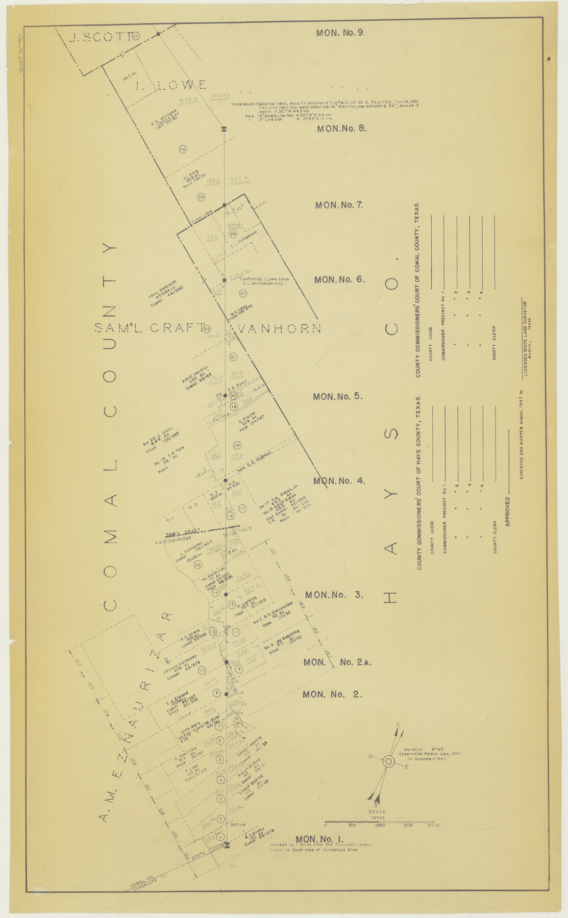
Hays County Boundary File
Hays and Comal County Line
K.7.93
-
Map/Doc
65496
-
Collection
General Map Collection
-
Object Dates
1947 (Creation Date)
-
People and Organizations
A.C. Kellersberger (Surveyor/Engineer)
-
Counties
Hays Comal
-
Subjects
County Boundaries
-
Height x Width
33.6 x 20.8 inches
85.3 x 52.8 cm
-
Medium
blueline
Part of: General Map Collection
Val Verde County Rolled Sketch 33
![8112, Val Verde County Rolled Sketch 33, General Map Collection](https://historictexasmaps.com/wmedia_w700/maps/8112.tif.jpg)
Print $20.00
- Digital $50.00
Val Verde County Rolled Sketch 33
1891
Size 27.8 x 28.2 inches
Map/Doc 8112
Travis County Rolled Sketch 59
![8050, Travis County Rolled Sketch 59, General Map Collection](https://historictexasmaps.com/wmedia_w700/maps/8050.tif.jpg)
Print $20.00
- Digital $50.00
Travis County Rolled Sketch 59
1987
Size 17.0 x 22.6 inches
Map/Doc 8050
Map of Asylum Lands
![2459, Map of Asylum Lands, General Map Collection](https://historictexasmaps.com/wmedia_w700/maps/2459-1.tif.jpg)
Print $20.00
- Digital $50.00
Map of Asylum Lands
1857
Size 28.4 x 18.5 inches
Map/Doc 2459
Presidio County Boundary File 3a
![58074, Presidio County Boundary File 3a, General Map Collection](https://historictexasmaps.com/wmedia_w700/pdf_converted_jpg/qi_pdf_thumbnail_16699.jpg)
Print $40.00
- Digital $50.00
Presidio County Boundary File 3a
Size 17.7 x 38.0 inches
Map/Doc 58074
Colorado River, Bonus Sheet
![65307, Colorado River, Bonus Sheet, General Map Collection](https://historictexasmaps.com/wmedia_w700/maps/65307.tif.jpg)
Print $6.00
- Digital $50.00
Colorado River, Bonus Sheet
1941
Size 24.2 x 30.4 inches
Map/Doc 65307
El Paso County Sketch File 33
![22128, El Paso County Sketch File 33, General Map Collection](https://historictexasmaps.com/wmedia_w700/pdf_converted_jpg/qi_pdf_thumbnail_11006.jpg)
Print $2.00
- Digital $50.00
El Paso County Sketch File 33
1983
Size 9.0 x 14.5 inches
Map/Doc 22128
Van Zandt County Sketch File 9a
![39393, Van Zandt County Sketch File 9a, General Map Collection](https://historictexasmaps.com/wmedia_w700/pdf_converted_jpg/qi_pdf_thumbnail_14825.jpg)
Print $4.00
- Digital $50.00
Van Zandt County Sketch File 9a
1858
Size 12.4 x 8.0 inches
Map/Doc 39393
San Patricio County Sketch File 49
![](https://historictexasmaps.com/wmedia_w700/pdf_converted_jpg/qi_pdf_thumbnail_69048.jpg)
Print $84.00
- Digital $50.00
San Patricio County Sketch File 49
1934
Size 9.1 x 11.4 inches
Map/Doc 36329
Andrews County
![4779, Andrews County, General Map Collection](https://historictexasmaps.com/wmedia_w700/maps/4779.tif.jpg)
Print $40.00
- Digital $50.00
Andrews County
1901
Size 42.5 x 55.2 inches
Map/Doc 4779
Hall County Sketch File 17
![24816, Hall County Sketch File 17, General Map Collection](https://historictexasmaps.com/wmedia_w700/pdf_converted_jpg/qi_pdf_thumbnail_11567.jpg)
Print $22.00
- Digital $50.00
Hall County Sketch File 17
1889
Size 8.2 x 10.0 inches
Map/Doc 24816
[William Steele Survey near Copano Bay]
![60285, [William Steele Survey near Copano Bay], General Map Collection](https://historictexasmaps.com/wmedia_w700/maps/60285.tif.jpg)
Print $3.00
- Digital $50.00
[William Steele Survey near Copano Bay]
1927
Size 14.9 x 9.8 inches
Map/Doc 60285
Flight Mission No. BRE-1P, Frame 138, Nueces County
![86698, Flight Mission No. BRE-1P, Frame 138, Nueces County, General Map Collection](https://historictexasmaps.com/wmedia_w700/pdf_converted_jpg/qi_pdf_thumbnail_33837.jpg)
Print $20.00
- Digital $50.00
Flight Mission No. BRE-1P, Frame 138, Nueces County
1956
Size 18.4 x 22.3 inches
Map/Doc 86698
You may also like
Matagorda County Boundary File 1a
![56889, Matagorda County Boundary File 1a, General Map Collection](https://historictexasmaps.com/wmedia_w700/pdf_converted_jpg/qi_pdf_thumbnail_16497.jpg)
Print $8.00
- Digital $50.00
Matagorda County Boundary File 1a
Size 14.2 x 8.6 inches
Map/Doc 56889
Travis County State Real Property Sketch 12
![88617, Travis County State Real Property Sketch 12, General Map Collection](https://historictexasmaps.com/wmedia_w700/pdf_converted_jpg/qi_pdf_thumbnail_34360.jpg)
Print $40.00
- Digital $50.00
Travis County State Real Property Sketch 12
2005
Size 24.0 x 35.6 inches
Map/Doc 88617
Mrs. Minnie Slaughter Veal's Subdivision of C. C. Slaughter Cattle Co. Division, Cochran County, Texas
![90296, Mrs. Minnie Slaughter Veal's Subdivision of C. C. Slaughter Cattle Co. Division, Cochran County, Texas, Twichell Survey Records](https://historictexasmaps.com/wmedia_w700/maps/90296-1.tif.jpg)
Print $20.00
- Digital $50.00
Mrs. Minnie Slaughter Veal's Subdivision of C. C. Slaughter Cattle Co. Division, Cochran County, Texas
Size 26.6 x 20.5 inches
Map/Doc 90296
Webb County Sketch File 44a
![12640, Webb County Sketch File 44a, General Map Collection](https://historictexasmaps.com/wmedia_w700/pdf_converted_jpg/qi_pdf_thumbnail_8910.jpg)
Print $20.00
- Digital $50.00
Webb County Sketch File 44a
1936
Size 29.4 x 18.2 inches
Map/Doc 12640
Briscoe County Boundary File 6
![50804, Briscoe County Boundary File 6, General Map Collection](https://historictexasmaps.com/wmedia_w700/pdf_converted_jpg/qi_pdf_thumbnail_15687.jpg)
Print $4.00
- Digital $50.00
Briscoe County Boundary File 6
Size 10.6 x 8.1 inches
Map/Doc 50804
Angelina River, Mud Creek, Sheet 4
![65078, Angelina River, Mud Creek, Sheet 4, General Map Collection](https://historictexasmaps.com/wmedia_w700/maps/65078.tif.jpg)
Print $4.00
- Digital $50.00
Angelina River, Mud Creek, Sheet 4
1937
Size 25.4 x 18.5 inches
Map/Doc 65078
Kleberg County Rolled Sketch 5
![6548, Kleberg County Rolled Sketch 5, General Map Collection](https://historictexasmaps.com/wmedia_w700/maps/6548.tif.jpg)
Print $20.00
- Digital $50.00
Kleberg County Rolled Sketch 5
Size 27.8 x 21.8 inches
Map/Doc 6548
Val Verde County Sketch File A1
![39038, Val Verde County Sketch File A1, General Map Collection](https://historictexasmaps.com/wmedia_w700/pdf_converted_jpg/qi_pdf_thumbnail_14764.jpg)
Print $6.00
- Digital $50.00
Val Verde County Sketch File A1
1895
Size 14.4 x 9.2 inches
Map/Doc 39038
Tom Green County Sketch File 71
![12447, Tom Green County Sketch File 71, General Map Collection](https://historictexasmaps.com/wmedia_w700/pdf_converted_jpg/qi_pdf_thumbnail_8733.jpg)
Print $20.00
- Digital $50.00
Tom Green County Sketch File 71
1948
Size 17.5 x 20.6 inches
Map/Doc 12447
[Right of Way and Track Map, the Missouri, Kansas and Texas Ry. of Texas - Henrietta Division]
![64760, [Right of Way and Track Map, the Missouri, Kansas and Texas Ry. of Texas - Henrietta Division], General Map Collection](https://historictexasmaps.com/wmedia_w700/maps/64760.tif.jpg)
Print $20.00
- Digital $50.00
[Right of Way and Track Map, the Missouri, Kansas and Texas Ry. of Texas - Henrietta Division]
1918
Size 11.8 x 26.9 inches
Map/Doc 64760
[F. W. & D. C. Ry. Co. Alignment and Right of Way Map, Clay County]
![64737, [F. W. & D. C. Ry. Co. Alignment and Right of Way Map, Clay County], General Map Collection](https://historictexasmaps.com/wmedia_w700/maps/64737-GC.tif.jpg)
Print $20.00
- Digital $50.00
[F. W. & D. C. Ry. Co. Alignment and Right of Way Map, Clay County]
1927
Size 18.6 x 11.8 inches
Map/Doc 64737
Kimble County Working Sketch Graphic Index, Sheet 2 (Sketches 47 to Most Recent)
![76607, Kimble County Working Sketch Graphic Index, Sheet 2 (Sketches 47 to Most Recent), General Map Collection](https://historictexasmaps.com/wmedia_w700/maps/76607.tif.jpg)
Print $40.00
- Digital $50.00
Kimble County Working Sketch Graphic Index, Sheet 2 (Sketches 47 to Most Recent)
1930
Size 41.1 x 49.0 inches
Map/Doc 76607