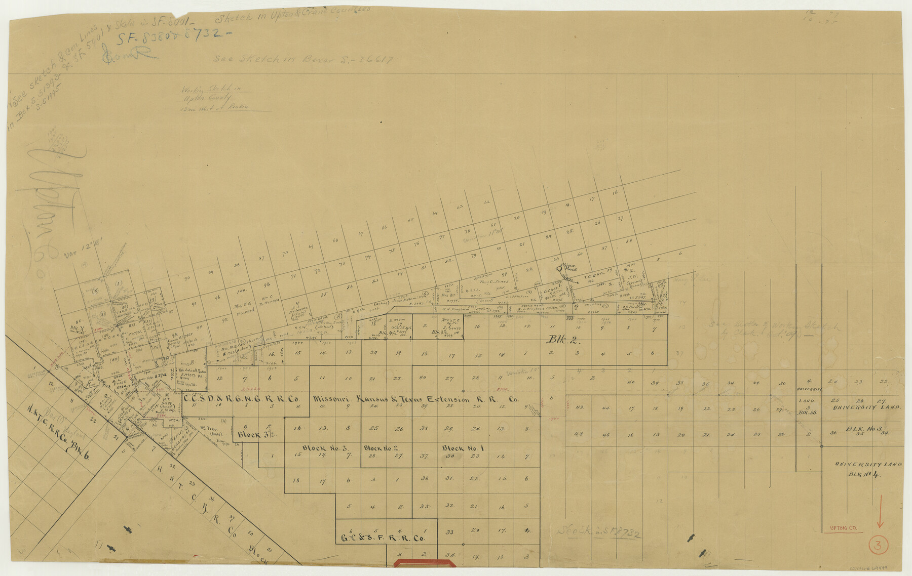
Upton County Working Sketch 3
-
Map/Doc
69499
-
Collection
General Map Collection
-
Counties
Upton
-
Subjects
Cadastral Surveying Working Sketch
-
Height x Width
21.4 x 33.8 inches
54.4 x 85.9 cm
Part of: General Map Collection
Harris County Historic Topographic 31
![65842, Harris County Historic Topographic 31, General Map Collection](https://historictexasmaps.com/wmedia_w700/maps/65842.tif.jpg)
Print $20.00
- Digital $50.00
Harris County Historic Topographic 31
1915
Size 29.2 x 22.7 inches
Map/Doc 65842
Greater Austin, Texas Streetmap
![94431, Greater Austin, Texas Streetmap, General Map Collection](https://historictexasmaps.com/wmedia_w700/maps/94431.tif.jpg)
Greater Austin, Texas Streetmap
Size 45.8 x 36.2 inches
Map/Doc 94431
Map showing lines of march and border patrols, in my Mexican Border Service, 1916-1917
![95822, Map showing lines of march and border patrols, in my Mexican Border Service, 1916-1917, General Map Collection](https://historictexasmaps.com/wmedia_w700/maps/95822.tif.jpg)
Print $20.00
- Digital $50.00
Map showing lines of march and border patrols, in my Mexican Border Service, 1916-1917
1916
Size 18.7 x 41.7 inches
Map/Doc 95822
Burnet County Boundary File 3
![50863, Burnet County Boundary File 3, General Map Collection](https://historictexasmaps.com/wmedia_w700/pdf_converted_jpg/qi_pdf_thumbnail_15698.jpg)
Print $18.00
- Digital $50.00
Burnet County Boundary File 3
Size 12.8 x 8.2 inches
Map/Doc 50863
Van Zandt County Rolled Sketch 6
![10311, Van Zandt County Rolled Sketch 6, General Map Collection](https://historictexasmaps.com/wmedia_w700/maps/10311-1.tif.jpg)
Print $3.00
- Digital $50.00
Van Zandt County Rolled Sketch 6
1946
Size 9.3 x 11.3 inches
Map/Doc 10311
Cameron County Rolled Sketch Z2
![5402, Cameron County Rolled Sketch Z2, General Map Collection](https://historictexasmaps.com/wmedia_w700/maps/5402.tif.jpg)
Print $20.00
- Digital $50.00
Cameron County Rolled Sketch Z2
1937
Size 23.7 x 40.9 inches
Map/Doc 5402
Rockwall County Boundary File 4
![58396, Rockwall County Boundary File 4, General Map Collection](https://historictexasmaps.com/wmedia_w700/pdf_converted_jpg/qi_pdf_thumbnail_16749.jpg)
Print $6.00
- Digital $50.00
Rockwall County Boundary File 4
Size 10.9 x 8.4 inches
Map/Doc 58396
Gaines County Working Sketch 27
![69327, Gaines County Working Sketch 27, General Map Collection](https://historictexasmaps.com/wmedia_w700/maps/69327.tif.jpg)
Print $20.00
- Digital $50.00
Gaines County Working Sketch 27
Size 17.4 x 36.7 inches
Map/Doc 69327
Galveston County Rolled Sketch WF
![5991, Galveston County Rolled Sketch WF, General Map Collection](https://historictexasmaps.com/wmedia_w700/maps/5991-1.tif.jpg)
Print $20.00
- Digital $50.00
Galveston County Rolled Sketch WF
Size 25.2 x 34.1 inches
Map/Doc 5991
A Map of That Part of Dallas County, lying in Nacogdoches Land District
![4525, A Map of That Part of Dallas County, lying in Nacogdoches Land District, General Map Collection](https://historictexasmaps.com/wmedia_w700/maps/4525.tif.jpg)
Print $20.00
- Digital $50.00
A Map of That Part of Dallas County, lying in Nacogdoches Land District
1854
Size 29.9 x 22.6 inches
Map/Doc 4525
[Folder for] Nautical Chart 11305: Texas Intracoastal Waterway, Laguna Madre, Rincon de San Jose to Chubby Island
![75913, [Folder for] Nautical Chart 11305: Texas Intracoastal Waterway, Laguna Madre, Rincon de San Jose to Chubby Island, General Map Collection](https://historictexasmaps.com/wmedia_w700/maps/75913.tif.jpg)
Print $20.00
- Digital $50.00
[Folder for] Nautical Chart 11305: Texas Intracoastal Waterway, Laguna Madre, Rincon de San Jose to Chubby Island
1976
Size 16.0 x 19.0 inches
Map/Doc 75913
Pecos County Rolled Sketch 105
![9717, Pecos County Rolled Sketch 105, General Map Collection](https://historictexasmaps.com/wmedia_w700/maps/9717.tif.jpg)
Print $20.00
- Digital $50.00
Pecos County Rolled Sketch 105
1940
Size 30.7 x 37.7 inches
Map/Doc 9717
You may also like
Potter County Rolled Sketch 13
![82476, Potter County Rolled Sketch 13, General Map Collection](https://historictexasmaps.com/wmedia_w700/maps/82476.tif.jpg)
Print $20.00
- Digital $50.00
Potter County Rolled Sketch 13
2004
Size 18.4 x 23.4 inches
Map/Doc 82476
San Angelo/Big Spring, Texas Street Map "A Traveler's Best Friend"
![94399, San Angelo/Big Spring, Texas Street Map "A Traveler's Best Friend", General Map Collection](https://historictexasmaps.com/wmedia_w700/maps/94399.tif.jpg)
San Angelo/Big Spring, Texas Street Map "A Traveler's Best Friend"
Size 37.5 x 24.9 inches
Map/Doc 94399
Hemphill County Rolled Sketch 10
![6192, Hemphill County Rolled Sketch 10, General Map Collection](https://historictexasmaps.com/wmedia_w700/maps/6192.tif.jpg)
Print $20.00
- Digital $50.00
Hemphill County Rolled Sketch 10
Size 19.4 x 27.6 inches
Map/Doc 6192
Zavala County Sketch File 1
![12725, Zavala County Sketch File 1, General Map Collection](https://historictexasmaps.com/wmedia_w700/pdf_converted_jpg/qi_pdf_thumbnail_8985.jpg)
Print $20.00
- Digital $50.00
Zavala County Sketch File 1
Size 28.5 x 22.7 inches
Map/Doc 12725
Presidio County Working Sketch 15
![71691, Presidio County Working Sketch 15, General Map Collection](https://historictexasmaps.com/wmedia_w700/maps/71691.tif.jpg)
Print $20.00
- Digital $50.00
Presidio County Working Sketch 15
Size 38.1 x 41.3 inches
Map/Doc 71691
Geological Map of Texas
![94091, Geological Map of Texas, General Map Collection](https://historictexasmaps.com/wmedia_w700/maps/94091-1.tif.jpg)
Print $20.00
- Digital $50.00
Geological Map of Texas
1919
Size 34.9 x 36.8 inches
Map/Doc 94091
Aransas County Working Sketch 12
![67179, Aransas County Working Sketch 12, General Map Collection](https://historictexasmaps.com/wmedia_w700/maps/67179.tif.jpg)
Print $20.00
- Digital $50.00
Aransas County Working Sketch 12
1950
Size 18.3 x 23.8 inches
Map/Doc 67179
Kimble County Rolled Sketch 20
![6511, Kimble County Rolled Sketch 20, General Map Collection](https://historictexasmaps.com/wmedia_w700/maps/6511.tif.jpg)
Print $20.00
- Digital $50.00
Kimble County Rolled Sketch 20
Size 14.6 x 18.1 inches
Map/Doc 6511
Andrews County Working Sketch 17
![67063, Andrews County Working Sketch 17, General Map Collection](https://historictexasmaps.com/wmedia_w700/maps/67063.tif.jpg)
Print $20.00
- Digital $50.00
Andrews County Working Sketch 17
1963
Size 30.7 x 27.1 inches
Map/Doc 67063
Jack County Working Sketch 17
![66443, Jack County Working Sketch 17, General Map Collection](https://historictexasmaps.com/wmedia_w700/maps/66443-1.tif.jpg)
Print $20.00
- Digital $50.00
Jack County Working Sketch 17
Size 25.9 x 27.4 inches
Map/Doc 66443
Brazoria County Working Sketch 20
![67505, Brazoria County Working Sketch 20, General Map Collection](https://historictexasmaps.com/wmedia_w700/maps/67505.tif.jpg)
Print $40.00
- Digital $50.00
Brazoria County Working Sketch 20
1951
Size 50.3 x 42.9 inches
Map/Doc 67505
Harris County Sketch File 76
![11665, Harris County Sketch File 76, General Map Collection](https://historictexasmaps.com/wmedia_w700/pdf_converted_jpg/qi_pdf_thumbnail_8097.jpg)
Print $20.00
- Digital $50.00
Harris County Sketch File 76
1948
Size 22.0 x 15.9 inches
Map/Doc 11665