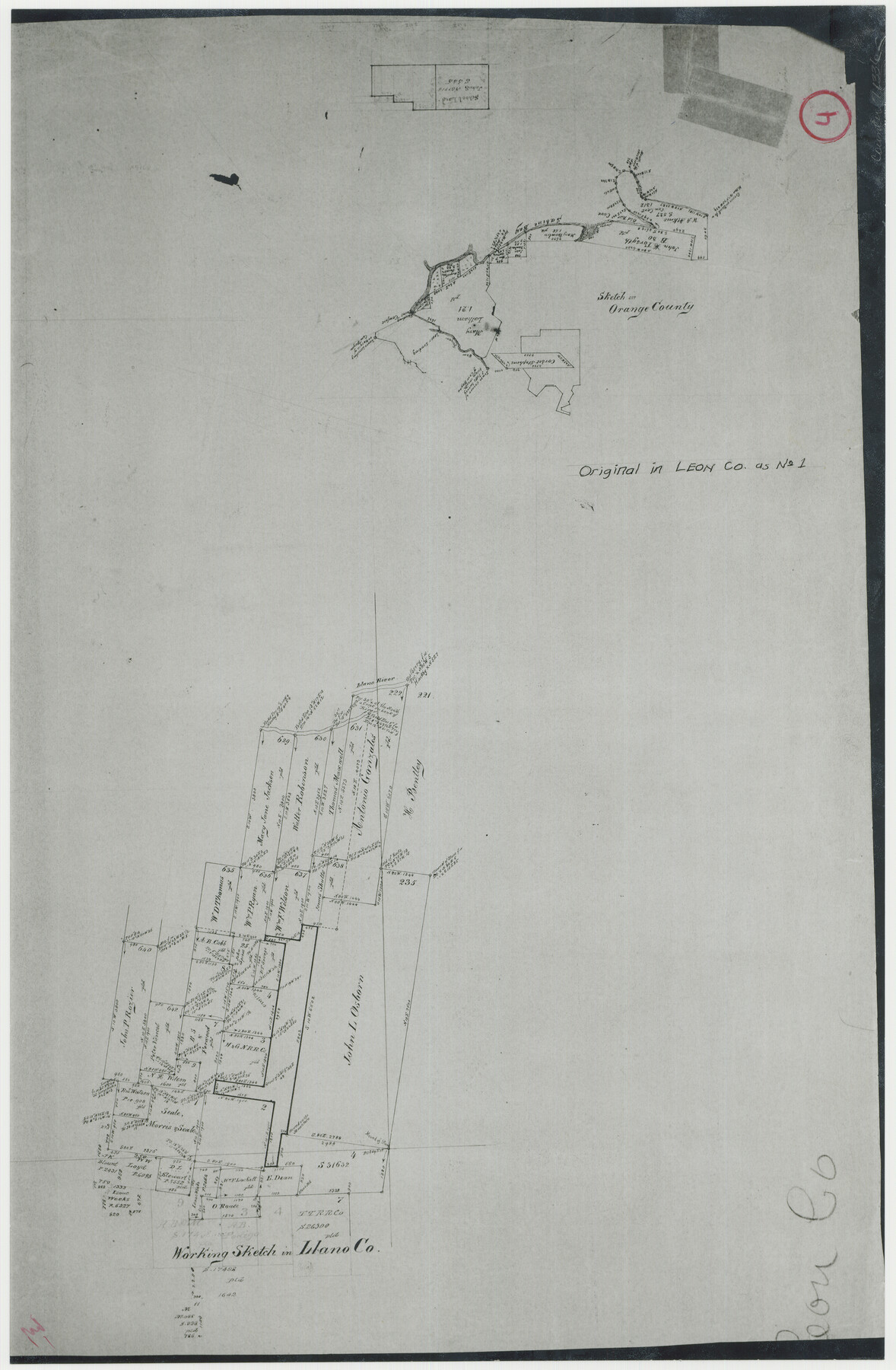
Orange County Working Sketch 4
-
Map/Doc
71336
-
Collection
General Map Collection
-
Counties
Orange
-
Subjects
Surveying Working Sketch
-
Height x Width
18.8 x 12.3 inches
47.8 x 31.2 cm
-
Comments
Inked manuscript original on the reverse of Leon Working Sketch 1, counter No. 70400.
Part of: General Map Collection
Location of the Southern Kansas Railway of Texas

Print $40.00
- Digital $50.00
Location of the Southern Kansas Railway of Texas
1887
Size 18.6 x 106.9 inches
Map/Doc 64181
Flight Mission No. CRK-3P, Frame 129, Refugio County

Print $20.00
- Digital $50.00
Flight Mission No. CRK-3P, Frame 129, Refugio County
1956
Size 18.5 x 22.4 inches
Map/Doc 86917
Intracoastal Waterway in Texas - Corpus Christi to Point Isabel including Arroyo Colorado to Mo. Pac. R.R. Bridge Near Harlingen

Print $20.00
- Digital $50.00
Intracoastal Waterway in Texas - Corpus Christi to Point Isabel including Arroyo Colorado to Mo. Pac. R.R. Bridge Near Harlingen
1933
Size 28.1 x 41.2 inches
Map/Doc 61845
Lipscomb County Boundary File 1

Print $16.00
- Digital $50.00
Lipscomb County Boundary File 1
Size 9.0 x 8.0 inches
Map/Doc 56307
Flight Mission No. DAH-10M, Frame 44, Orange County

Print $20.00
- Digital $50.00
Flight Mission No. DAH-10M, Frame 44, Orange County
1953
Size 18.6 x 22.4 inches
Map/Doc 86879
North Part of Brewster Co.

Print $20.00
- Digital $50.00
North Part of Brewster Co.
1956
Size 42.1 x 40.2 inches
Map/Doc 73088
Flight Mission No. CLL-1N, Frame 111, Willacy County

Print $20.00
- Digital $50.00
Flight Mission No. CLL-1N, Frame 111, Willacy County
1954
Size 18.4 x 22.2 inches
Map/Doc 87045
Karnes County

Print $20.00
- Digital $50.00
Karnes County
1921
Size 44.3 x 39.6 inches
Map/Doc 95551
Marion County Working Sketch 29

Print $20.00
- Digital $50.00
Marion County Working Sketch 29
1977
Size 20.4 x 16.1 inches
Map/Doc 70805
Medina County Rolled Sketch 17

Print $20.00
- Digital $50.00
Medina County Rolled Sketch 17
1979
Size 32.3 x 18.9 inches
Map/Doc 6750
Coleman County Sketch File 31

Print $20.00
- Digital $50.00
Coleman County Sketch File 31
Size 31.2 x 41.9 inches
Map/Doc 10339
Collin County

Print $20.00
- Digital $50.00
Collin County
1975
Size 42.2 x 39.4 inches
Map/Doc 77242
You may also like
Burnet County Sketch File 41

Print $8.00
- Digital $50.00
Burnet County Sketch File 41
1950
Size 11.8 x 8.6 inches
Map/Doc 16757
Mills County Boundary File 8

Print $10.00
- Digital $50.00
Mills County Boundary File 8
Size 14.2 x 8.7 inches
Map/Doc 57313
[Block K5, Section 13]
![91452, [Block K5, Section 13], Twichell Survey Records](https://historictexasmaps.com/wmedia_w700/maps/91452-1.tif.jpg)
Print $20.00
- Digital $50.00
[Block K5, Section 13]
Size 22.2 x 18.5 inches
Map/Doc 91452
Crockett County Sketch File 55

Print $6.00
- Digital $50.00
Crockett County Sketch File 55
1923
Size 11.2 x 8.5 inches
Map/Doc 19829
Duval County Working Sketch 30

Print $20.00
- Digital $50.00
Duval County Working Sketch 30
1950
Size 29.1 x 33.5 inches
Map/Doc 68754
McMullen County Working Sketch 53

Print $20.00
- Digital $50.00
McMullen County Working Sketch 53
1983
Size 18.1 x 18.7 inches
Map/Doc 70754
Hardin County Rolled Sketch 23

Print $20.00
- Digital $50.00
Hardin County Rolled Sketch 23
1982
Size 28.5 x 45.2 inches
Map/Doc 6091
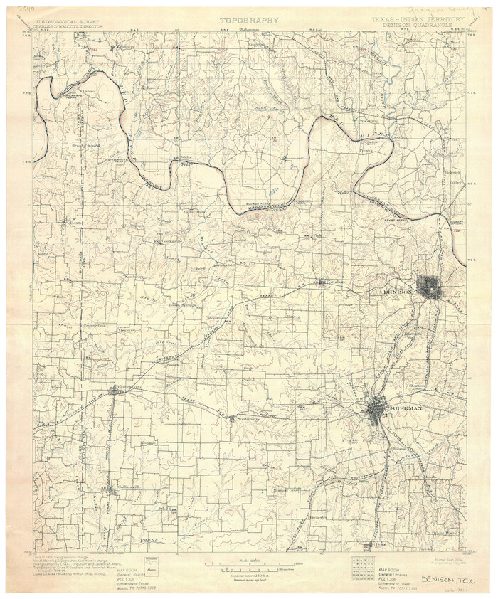
Texas-Indian Territory Denison Quadrangle
Print $20.00
- Digital $50.00
Texas-Indian Territory Denison Quadrangle
1901
Size 20.1 x 16.7 inches
Map/Doc 75110
Dallas County Sketch File 16

Print $4.00
- Digital $50.00
Dallas County Sketch File 16
Size 8.0 x 8.4 inches
Map/Doc 20435
Foard County Boundary File 1

Print $8.00
- Digital $50.00
Foard County Boundary File 1
Size 9.1 x 4.1 inches
Map/Doc 53500
General Highway Map, Kimble County, Texas

Print $20.00
General Highway Map, Kimble County, Texas
1961
Size 24.6 x 18.2 inches
Map/Doc 79553
Brewster County Sketch File S-26a

Print $18.00
- Digital $50.00
Brewster County Sketch File S-26a
1964
Size 11.1 x 8.7 inches
Map/Doc 15837