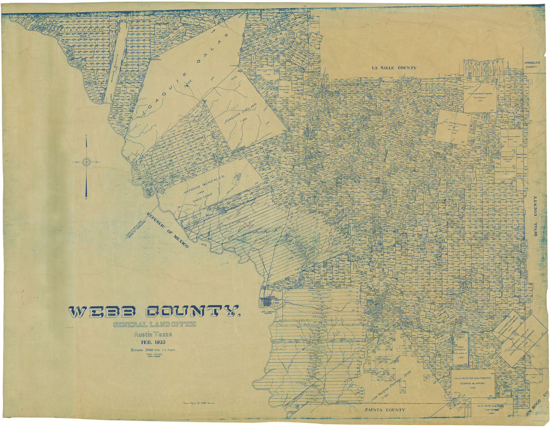
Webb County
-
Map/Doc
82053
-
Collection
General Map Collection
-
Object Dates
2/1933 (Creation Date)
-
People and Organizations
Tom G. Atlee (Draftsman)
-
Counties
Webb
-
Subjects
County
-
Height x Width
45.2 x 58.1 inches
114.8 x 147.6 cm
-
Scale
1" = 3000 varas
-
Comments
Traced April 8, 1933 by Beck.
-
Features
El Peloncillo
Palito Blanco Creek
Serrito Prieto Mountain
Las Pintas Creek
La Tinaja Creek
Saucilio Creek
Llave Creek
Santa Tomos Mountain
Santo Tomas Creek
Connel Barrim Mountain
Branch of Charco Escondido Creek
Carrecitos Creek
El Chacon Creek
Lava
Jacolon Hill
Abra Bonita Creek
Pesgadtto [sic]
Oilton
Rio Grande City Road
Becerra Creek
El Espejo Creek
Alta Callenota
Segura de Pelitas Blancas
Alberca Ravine
Alberca Ranch
La Pitero Creek
Charamusco Creek
Nueces River
El Almud
Los Dos Hermanos
San Lorenzo Creek
Pelito Blanco Creek
Magueyitos Hill
Magueiles Creek
San Cosimiro Creek
Los Olmos Creek
Jaconcinos Creek
San Coritas Creek
Pilotos Creek
La Espada Creek
San Padre Hill
San Pedro Creek
Little Apache Hill
El Vanado Creek
Abra Bonita Creek
Los Cristalos Creek
Cochioo Creek
La Parida Creek
Prieto Creek
Baranquitas Creek
Serrita Chaquita Creek
La Moca Creek
Tineia Escondida Creek
Buena Vista Creek
Rancharitas Creek
La Volanta Creek
Alamito Creek
Salado Creek
El Guisache Creek
Tanguecillas Creek
Carrizitos Creek
Webb
Tordillo Creek
Tejones Creek
Santa Isadal Creek
Zacatosa Creek
Santa Tomos
Cannel Darwin Post Office
Dolores
Charco Ventura Creek
Navajo Creek
Pato Creek
Arroyo del Relacion
Branch of Charco Escondito
Ortas Creek
Caliche Creek
El Pato Creek
Sloan Joyce Station
Rio Grande
Telita Station
Loyerombar
Orvil
Toledo Creek
El Gato Creek
Sada
Sanchez
Davis
Nya
Chacon
Arroyo de San Ignacio
Abra Bonita Creek
Zacate Creek
Laredo
Fort McIntosh
Chacon Creek
Reiser
Arroyo del Guernito
Torrecillas
Arroyo de los Angeles
Bruni
Laurel
Ocnoa
Aguilares
Arroyo Retama
Derromedero del Calvillo
Arroyo Salteador
El Sauz Creek
La Hoya Creek
Las Moritas Creek
San Juanito Creek
La Jarita Creek
Charcodelos Lasos Creek
Arroyo Sarrito Prieto
Nariacitos Creek
Laguna del Javali
Arroyo Bacerrito
La Bitara Creek
Las Blancas Creek
El Soez Creek
Canado de San Antran Creek
El Toro Hill
Cañon de Alberca
Cañon de Miranda
Laguna de Hilario
Laguna de Zocatorros
Part of: General Map Collection
Goliad County Sketch File A

Print $20.00
- Digital $50.00
Goliad County Sketch File A
1897
Size 30.6 x 32.9 inches
Map/Doc 10465
Trinity River, Trinidad Sheet

Print $20.00
- Digital $50.00
Trinity River, Trinidad Sheet
1928
Size 39.0 x 46.3 inches
Map/Doc 65183
Map of Uvalde Co.

Print $20.00
- Digital $50.00
Map of Uvalde Co.
Size 41.0 x 43.9 inches
Map/Doc 63090
Texas Gulf Coast Map from the Sabine River to the Rio Grande as subdivided for mineral development

Print $40.00
- Digital $50.00
Texas Gulf Coast Map from the Sabine River to the Rio Grande as subdivided for mineral development
1948
Size 44.0 x 69.2 inches
Map/Doc 2908
Fort Bend County Working Sketch 10

Print $20.00
- Digital $50.00
Fort Bend County Working Sketch 10
1934
Size 30.6 x 20.2 inches
Map/Doc 69216
Nautical Chart 885-SC Intracoastal Waterway - Ellender to Galveston Bay, Louisiana-Texas

Print $40.00
- Digital $50.00
Nautical Chart 885-SC Intracoastal Waterway - Ellender to Galveston Bay, Louisiana-Texas
1972
Size 16.4 x 60.1 inches
Map/Doc 69835
Clay County Sketch File 4

Print $22.00
- Digital $50.00
Clay County Sketch File 4
1854
Size 5.0 x 7.5 inches
Map/Doc 18392
Texas Gulf Coast Map from the Sabine River to the Rio Grande as subdivided for mineral development

Print $40.00
- Digital $50.00
Texas Gulf Coast Map from the Sabine River to the Rio Grande as subdivided for mineral development
1948
Size 49.3 x 55.7 inches
Map/Doc 2906
San Patricio County Rolled Sketch 42

Print $20.00
- Digital $50.00
San Patricio County Rolled Sketch 42
Size 18.6 x 37.3 inches
Map/Doc 7728
McLennan County Sketch File 8

Print $14.00
- Digital $50.00
McLennan County Sketch File 8
1858
Size 12.4 x 7.7 inches
Map/Doc 31251
Harris County Sketch File 106

Print $80.00
- Digital $50.00
Harris County Sketch File 106
1995
Size 11.3 x 8.8 inches
Map/Doc 25975
Hartley County Sketch File 1

Print $40.00
- Digital $50.00
Hartley County Sketch File 1
Size 9.7 x 18.4 inches
Map/Doc 11696
You may also like
Acts of the Visit of the Royal Commissioners (sometimes referred to as the “Visita General”) - Reynosa

Acts of the Visit of the Royal Commissioners (sometimes referred to as the “Visita General”) - Reynosa
1767
Size 14.1 x 9.3 inches
Map/Doc 94258
[Galveston, Harrisburg & San Antonio Railway]
![64408, [Galveston, Harrisburg & San Antonio Railway], General Map Collection](https://historictexasmaps.com/wmedia_w700/maps/64408.tif.jpg)
Print $20.00
- Digital $50.00
[Galveston, Harrisburg & San Antonio Railway]
1892
Size 13.5 x 33.6 inches
Map/Doc 64408
Kimble County Working Sketch 25

Print $20.00
- Digital $50.00
Kimble County Working Sketch 25
1937
Size 22.9 x 22.7 inches
Map/Doc 70093
Sutton County Sketch File 46

Print $4.00
- Digital $50.00
Sutton County Sketch File 46
1939
Size 11.3 x 8.8 inches
Map/Doc 37517
Coke County Sketch File 16

Print $20.00
- Digital $50.00
Coke County Sketch File 16
1902
Size 18.7 x 16.2 inches
Map/Doc 11108
Flight Mission No. DCL-4C, Frame 5, Kenedy County

Print $20.00
- Digital $50.00
Flight Mission No. DCL-4C, Frame 5, Kenedy County
1943
Size 18.6 x 22.3 inches
Map/Doc 85806
Bandera County Working Sketch 13

Print $20.00
- Digital $50.00
Bandera County Working Sketch 13
1932
Size 29.1 x 25.3 inches
Map/Doc 67606
Zavala County Working Sketch 30

Print $20.00
- Digital $50.00
Zavala County Working Sketch 30
1989
Size 36.8 x 28.1 inches
Map/Doc 62105
[Blocks 21, 22, 23, and 24]
![91110, [Blocks 21, 22, 23, and 24], Twichell Survey Records](https://historictexasmaps.com/wmedia_w700/maps/91110-1.tif.jpg)
Print $20.00
- Digital $50.00
[Blocks 21, 22, 23, and 24]
Size 14.0 x 12.8 inches
Map/Doc 91110
Carson County Working Sketch 3

Print $20.00
- Digital $50.00
Carson County Working Sketch 3
1922
Size 18.3 x 26.3 inches
Map/Doc 67874
Jones County Boundary File 1

Print $78.00
- Digital $50.00
Jones County Boundary File 1
1882
Size 10.7 x 8.2 inches
Map/Doc 55633
Brazoria County Sketch File 10a

Print $50.00
- Digital $50.00
Brazoria County Sketch File 10a
1912
Size 7.1 x 8.7 inches
Map/Doc 14940