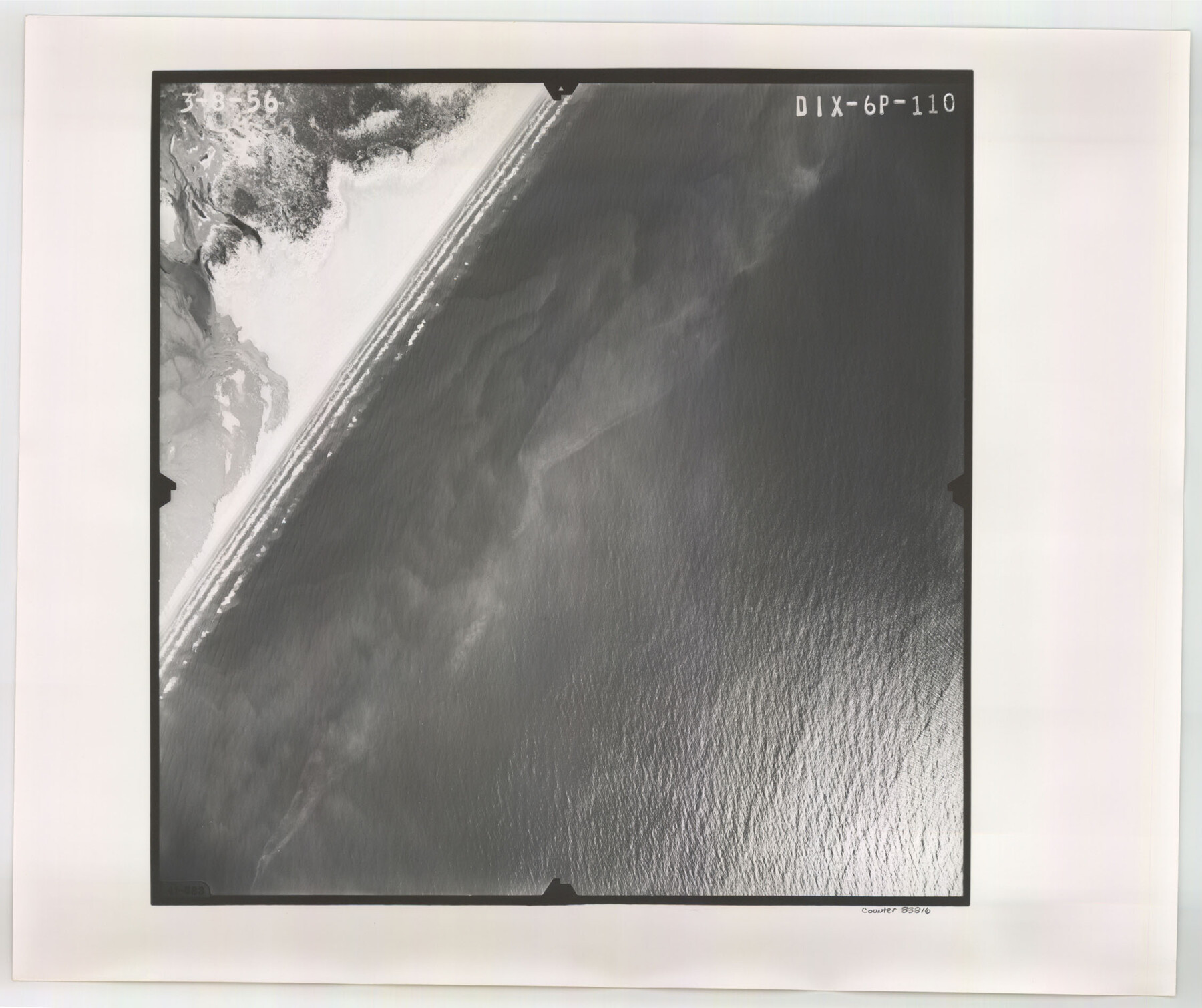
Flight Mission No. DIX-6P, Frame 110, Aransas County
DIX-6P-110
-
Map/Doc
83816
-
Collection
General Map Collection
-
Object Dates
1956/3/8 (Creation Date)
-
People and Organizations
U. S. Department of Agriculture (Publisher)
-
Counties
Aransas
-
Subjects
Aerial Photograph
-
Height x Width
19.7 x 23.4 inches
50.0 x 59.4 cm
-
Comments
Flown by V. L. Beavers and Associates of San Antonio, Texas.
Part of: General Map Collection
Floyd County Rolled Sketch 8

Print $20.00
- Digital $50.00
Floyd County Rolled Sketch 8
1947
Size 29.6 x 19.9 inches
Map/Doc 5882
Yoakum County Sketch File 18

Print $24.00
- Digital $50.00
Yoakum County Sketch File 18
1898
Size 11.5 x 9.0 inches
Map/Doc 40820
Current Miscellaneous File 16

Print $20.00
- Digital $50.00
Current Miscellaneous File 16
1951
Size 10.7 x 8.2 inches
Map/Doc 73830
Edwards County Sketch File 17

Print $20.00
- Digital $50.00
Edwards County Sketch File 17
Size 31.8 x 18.3 inches
Map/Doc 11429
Official Map of the City of Bryan from Actual Survey [West Part]
![76864, Official Map of the City of Bryan from Actual Survey [West Part], General Map Collection](https://historictexasmaps.com/wmedia_w700/maps/76864.tif.jpg)
Print $40.00
- Digital $50.00
Official Map of the City of Bryan from Actual Survey [West Part]
1898
Size 52.5 x 27.4 inches
Map/Doc 76864
[Surveys in Austin's Colony along the Colorado River]
![171, [Surveys in Austin's Colony along the Colorado River], General Map Collection](https://historictexasmaps.com/wmedia_w700/maps/171.tif.jpg)
Print $20.00
- Digital $50.00
[Surveys in Austin's Colony along the Colorado River]
1830
Size 30.5 x 12.7 inches
Map/Doc 171
Garza County Sketch File 11

Print $4.00
- Digital $50.00
Garza County Sketch File 11
1901
Size 11.3 x 8.8 inches
Map/Doc 24066
Webb County Rolled Sketch 35

Print $20.00
- Digital $50.00
Webb County Rolled Sketch 35
1939
Size 23.1 x 12.7 inches
Map/Doc 8190
Map of the East Part of Tom Green County

Print $20.00
- Digital $50.00
Map of the East Part of Tom Green County
1894
Size 21.5 x 23.1 inches
Map/Doc 4083
Nueces County Sketch File 12A

Print $20.00
- Digital $50.00
Nueces County Sketch File 12A
1889
Size 28.1 x 23.0 inches
Map/Doc 42177

[Surveys along Green's Creek and the North Bosque River]
![69756, [Surveys along Green's Creek and the North Bosque River], General Map Collection](https://historictexasmaps.com/wmedia_w700/maps/69756.tif.jpg)
Print $2.00
- Digital $50.00
[Surveys along Green's Creek and the North Bosque River]
1846
Size 11.9 x 8.1 inches
Map/Doc 69756
You may also like
Galveston County Sketch File 38

Print $8.00
- Digital $50.00
Galveston County Sketch File 38
1908
Size 6.8 x 7.8 inches
Map/Doc 23441
Culberson County Rolled Sketch 52

Print $20.00
- Digital $50.00
Culberson County Rolled Sketch 52
1966
Size 19.1 x 24.9 inches
Map/Doc 5671

Loving County Working Sketch 16

Print $40.00
- Digital $50.00
Loving County Working Sketch 16
1973
Size 33.3 x 54.1 inches
Map/Doc 70649
Dimmit County Working Sketch 55

Print $20.00
- Digital $50.00
Dimmit County Working Sketch 55
1996
Size 33.7 x 34.3 inches
Map/Doc 68716
Terry County Sketch File 6

Print $8.00
- Digital $50.00
Terry County Sketch File 6
1924
Size 11.2 x 8.7 inches
Map/Doc 38026
Working Sketch in Crockett County

Print $20.00
- Digital $50.00
Working Sketch in Crockett County
1923
Size 23.2 x 29.6 inches
Map/Doc 90315
Galveston County NRC Article 33.136 Sketch 80

Print $24.00
- Digital $50.00
Galveston County NRC Article 33.136 Sketch 80
2014
Size 36.0 x 24.0 inches
Map/Doc 94987
Jackson County Sketch File 5

Print $4.00
- Digital $50.00
Jackson County Sketch File 5
1876
Size 12.7 x 8.2 inches
Map/Doc 27628
Bell County Working Sketch 5

Print $20.00
- Digital $50.00
Bell County Working Sketch 5
1942
Size 26.9 x 21.0 inches
Map/Doc 67345
Concho County Sketch File 44

Print $6.00
- Digital $50.00
Concho County Sketch File 44
1952
Size 14.3 x 8.8 inches
Map/Doc 19207
Van Zandt County Working Sketch 9

Print $20.00
- Digital $50.00
Van Zandt County Working Sketch 9
1982
Size 12.6 x 11.7 inches
Map/Doc 72259