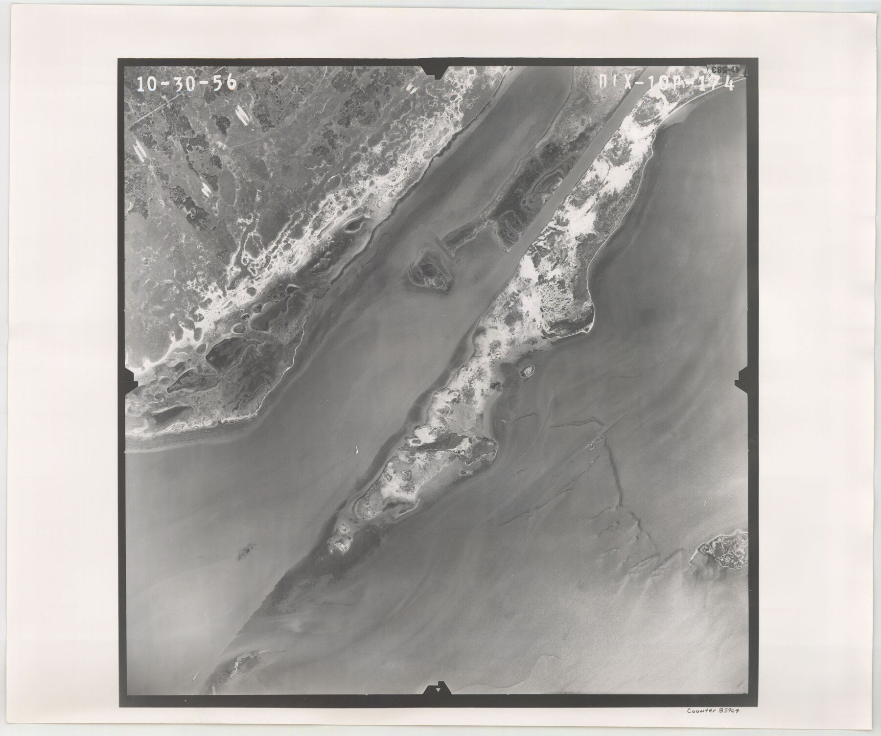
Flight Mission No. DIX-10P, Frame 174, Aransas County
DIX-10P-174
-
Map/Doc
83964
-
Collection
General Map Collection
-
Object Dates
1956/10/30 (Creation Date)
-
People and Organizations
U. S. Department of Agriculture (Publisher)
-
Counties
Aransas
-
Subjects
Aerial Photograph
-
Height x Width
18.5 x 22.2 inches
47.0 x 56.4 cm
-
Comments
Flown by V. L. Beavers and Associates of San Antonio, Texas.
Part of: General Map Collection
Travis County Appraisal District Plat Map 2_2011

Print $20.00
- Digital $50.00
Travis County Appraisal District Plat Map 2_2011
Size 21.4 x 26.4 inches
Map/Doc 94211
Flight Mission No. DCL-7C, Frame 25, Kenedy County

Print $20.00
- Digital $50.00
Flight Mission No. DCL-7C, Frame 25, Kenedy County
1943
Size 15.4 x 15.4 inches
Map/Doc 86017
Webb County Working Sketch 79

Print $20.00
- Digital $50.00
Webb County Working Sketch 79
1977
Size 31.0 x 28.3 inches
Map/Doc 72446
Brazoria County NRC Article 33.136 Sketch 8

Print $20.00
- Digital $50.00
Brazoria County NRC Article 33.136 Sketch 8
2006
Size 17.1 x 11.2 inches
Map/Doc 83649
Grayson County Rolled Sketch 2

Print $20.00
- Digital $50.00
Grayson County Rolled Sketch 2
1951
Size 25.5 x 42.5 inches
Map/Doc 6030
Atascosa County Rolled Sketch 22

Print $40.00
- Digital $50.00
Atascosa County Rolled Sketch 22
1917
Size 57.5 x 26.5 inches
Map/Doc 8921
PSL Field Notes for Blocks C1, C2, and C3 in Pecos and Reeves Counties

PSL Field Notes for Blocks C1, C2, and C3 in Pecos and Reeves Counties
Map/Doc 81669
Orange County Working Sketch 54a

Print $40.00
- Digital $50.00
Orange County Working Sketch 54a
2008
Size 22.9 x 48.0 inches
Map/Doc 88742
Jeff Davis County Working Sketch 4

Print $20.00
- Digital $50.00
Jeff Davis County Working Sketch 4
1916
Size 14.3 x 15.2 inches
Map/Doc 66499
Flight Mission No. CUG-3P, Frame 45, Kleberg County

Print $20.00
- Digital $50.00
Flight Mission No. CUG-3P, Frame 45, Kleberg County
1956
Size 18.4 x 22.1 inches
Map/Doc 86250
Reclamation & Navigation Map of Trinity River Flood Plain

Print $40.00
- Digital $50.00
Reclamation & Navigation Map of Trinity River Flood Plain
1930
Size 24.3 x 75.8 inches
Map/Doc 65178
Bexar County Boundary File 2a

Print $12.00
- Digital $50.00
Bexar County Boundary File 2a
Size 10.0 x 8.1 inches
Map/Doc 50530
You may also like
Hood County Working Sketch 21

Print $20.00
- Digital $50.00
Hood County Working Sketch 21
1991
Size 28.4 x 24.9 inches
Map/Doc 66215
[Gulf, Colorado & Santa Fe Railway line through Fort Bend Co.]
![64212, [Gulf, Colorado & Santa Fe Railway line through Fort Bend Co.], General Map Collection](https://historictexasmaps.com/wmedia_w700/maps/64212.tif.jpg)
Print $20.00
- Digital $50.00
[Gulf, Colorado & Santa Fe Railway line through Fort Bend Co.]
1898
Size 14.2 x 33.5 inches
Map/Doc 64212
Matagorda County NRC Article 33.136 Sketch 19

Print $24.00
Matagorda County NRC Article 33.136 Sketch 19
2023
Map/Doc 97268
[Texas Gulf Coast]
![72677, [Texas Gulf Coast], General Map Collection](https://historictexasmaps.com/wmedia_w700/maps/72677.tif.jpg)
Print $20.00
- Digital $50.00
[Texas Gulf Coast]
Size 27.3 x 18.2 inches
Map/Doc 72677
Map of San Saba County

Print $20.00
- Digital $50.00
Map of San Saba County
1858
Size 21.6 x 23.5 inches
Map/Doc 4019
Flight Mission No. DQN-7K, Frame 8, Calhoun County

Print $20.00
- Digital $50.00
Flight Mission No. DQN-7K, Frame 8, Calhoun County
1953
Size 18.5 x 22.2 inches
Map/Doc 84459
Hopkins County Sketch File 16a

Print $4.00
- Digital $50.00
Hopkins County Sketch File 16a
Size 12.1 x 7.6 inches
Map/Doc 26715
Hartley County Boundary File 1a

Print $50.00
- Digital $50.00
Hartley County Boundary File 1a
Size 14.1 x 8.8 inches
Map/Doc 54437

Maverick County Sketch File 28

Print $4.00
- Digital $50.00
Maverick County Sketch File 28
1893
Size 11.0 x 8.9 inches
Map/Doc 31163
Culberson County Sketch File 34

Print $8.00
- Digital $50.00
Culberson County Sketch File 34
1958
Size 9.3 x 7.9 inches
Map/Doc 20291
Map of McLennan County

Print $40.00
- Digital $50.00
Map of McLennan County
1896
Size 48.8 x 53.7 inches
Map/Doc 7952