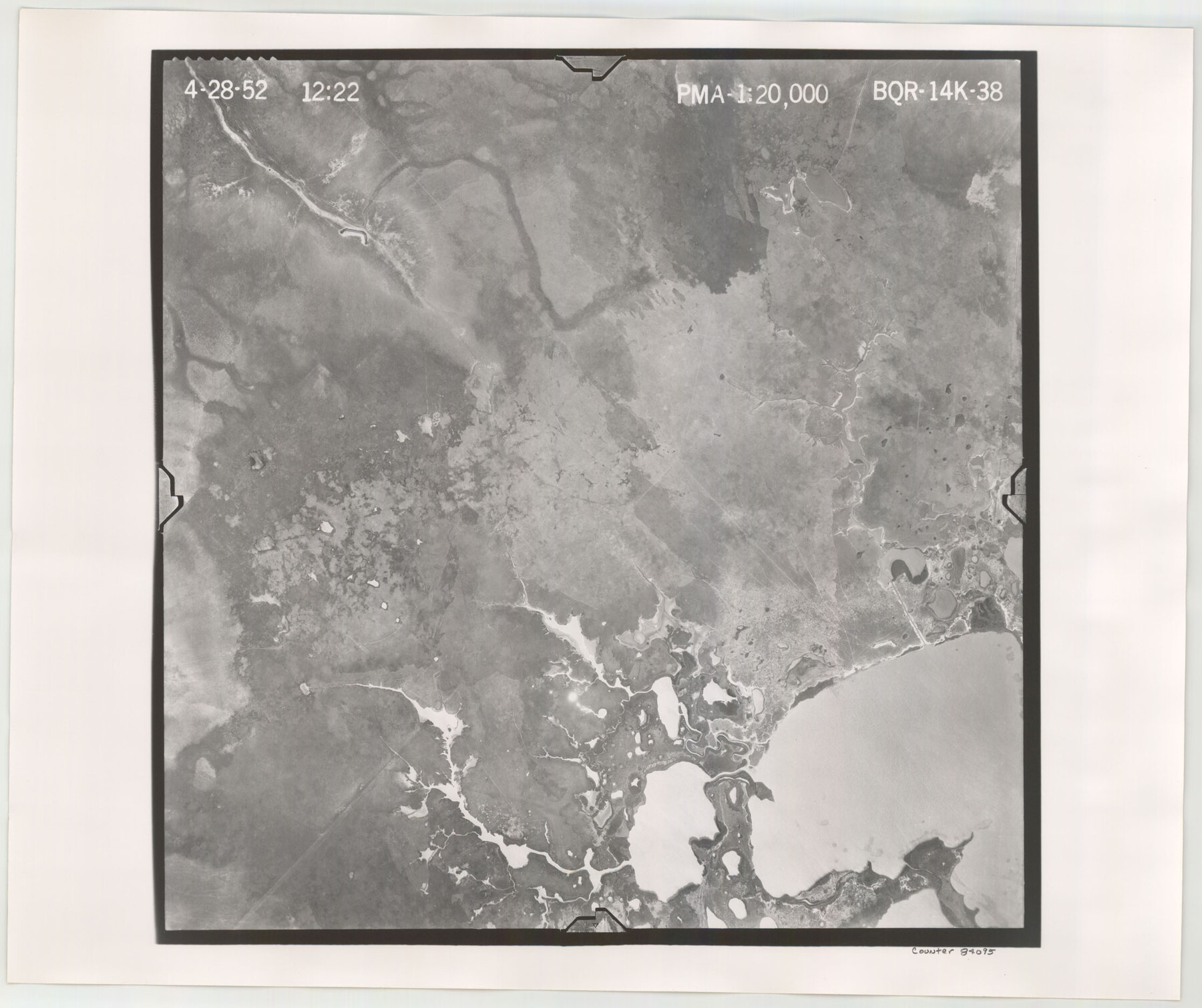
Flight Mission No. BQR-14K, Frame 38, Brazoria County
BQR-14K-38
-
Map/Doc
84095
-
Collection
General Map Collection
-
Object Dates
1952/4/28 (Creation Date)
-
People and Organizations
U. S. Department of Agriculture (Publisher)
-
Counties
Brazoria
-
Subjects
Aerial Photograph
-
Height x Width
18.8 x 22.3 inches
47.8 x 56.6 cm
-
Comments
Flown by Aero Exploration Company of Tulsa, Oklahoma.
Part of: General Map Collection
Wilbarger County Sketch File 2

Print $4.00
- Digital $50.00
Wilbarger County Sketch File 2
1862
Size 8.9 x 7.9 inches
Map/Doc 40164
Erath County Working Sketch 4

Print $20.00
- Digital $50.00
Erath County Working Sketch 4
1919
Size 31.7 x 28.6 inches
Map/Doc 69085
Flight Mission No. BRE-2P, Frame 36, Nueces County

Print $20.00
- Digital $50.00
Flight Mission No. BRE-2P, Frame 36, Nueces County
1956
Size 18.5 x 22.7 inches
Map/Doc 86738
Kleberg County Boundary File 1

Print $10.00
- Digital $50.00
Kleberg County Boundary File 1
Size 9.3 x 5.9 inches
Map/Doc 64961
Polk County Sketch File 33

Print $4.00
- Digital $50.00
Polk County Sketch File 33
Size 4.4 x 8.2 inches
Map/Doc 34230
Kendall County Sketch File 7

Print $4.00
- Digital $50.00
Kendall County Sketch File 7
1848
Size 8.2 x 10.4 inches
Map/Doc 28688
Nueces County Rolled Sketch 2

Print $20.00
- Digital $50.00
Nueces County Rolled Sketch 2
1907
Size 18.4 x 35.8 inches
Map/Doc 6865
Brewster County Rolled Sketch 131

Print $20.00
- Digital $50.00
Brewster County Rolled Sketch 131
1975
Size 30.0 x 32.3 inches
Map/Doc 8522
San Patricio County Rolled Sketch 38A

Print $20.00
- Digital $50.00
San Patricio County Rolled Sketch 38A
1958
Size 26.6 x 23.5 inches
Map/Doc 7589
Blanco County Sketch File 39

Print $4.00
- Digital $50.00
Blanco County Sketch File 39
Size 8.6 x 13.9 inches
Map/Doc 14650
Gregg County Working Sketch 2

Print $20.00
- Digital $50.00
Gregg County Working Sketch 2
1931
Size 16.8 x 13.6 inches
Map/Doc 63268
Presidio County Sketch File 95

Print $22.00
- Digital $50.00
Presidio County Sketch File 95
1958
Size 12.7 x 16.4 inches
Map/Doc 34773
You may also like
[North line of Hansford, Ochiltree and Lipscomb Counties]
![93190, [North line of Hansford, Ochiltree and Lipscomb Counties], Twichell Survey Records](https://historictexasmaps.com/wmedia_w700/maps/93190-1.tif.jpg)
Print $40.00
- Digital $50.00
[North line of Hansford, Ochiltree and Lipscomb Counties]
Size 89.3 x 16.8 inches
Map/Doc 93190
North Line of Lynn County and South Line of Lubbock County

Print $20.00
- Digital $50.00
North Line of Lynn County and South Line of Lubbock County
1892
Size 8.0 x 34.2 inches
Map/Doc 91393
[Surveys along the Nueces River in San Patricio County]
![69737, [Surveys along the Nueces River in San Patricio County], General Map Collection](https://historictexasmaps.com/wmedia_w700/maps/69737.tif.jpg)
Print $2.00
- Digital $50.00
[Surveys along the Nueces River in San Patricio County]
1842
Size 8.8 x 9.9 inches
Map/Doc 69737
Controlled Mosaic by Jack Amman Photogrammetric Engineers, Inc - Sheet 42

Print $20.00
- Digital $50.00
Controlled Mosaic by Jack Amman Photogrammetric Engineers, Inc - Sheet 42
1954
Size 20.0 x 24.0 inches
Map/Doc 83499
Working Sketch in Mitchell, Sterling, and Coke Co's.

Print $20.00
- Digital $50.00
Working Sketch in Mitchell, Sterling, and Coke Co's.
1925
Size 34.2 x 30.7 inches
Map/Doc 91840
Cameron County Sketch File 15

Print $26.00
- Digital $50.00
Cameron County Sketch File 15
1999
Size 11.2 x 8.7 inches
Map/Doc 17320
General Highway Map, Culberson County, Texas

Print $20.00
General Highway Map, Culberson County, Texas
1961
Size 24.9 x 18.2 inches
Map/Doc 79427
Potter County Sketch File 11

Print $4.00
- Digital $50.00
Potter County Sketch File 11
1890
Size 14.0 x 8.8 inches
Map/Doc 34397
Galveston County Aerial Photograph Index Sheet 1

Print $20.00
- Digital $50.00
Galveston County Aerial Photograph Index Sheet 1
1953
Size 23.4 x 19.2 inches
Map/Doc 83692
Kinney County Sketch File 29

Print $20.00
- Digital $50.00
Kinney County Sketch File 29
1933
Size 15.5 x 21.1 inches
Map/Doc 11947
Gregg County Sketch File 13

Print $32.00
- Digital $50.00
Gregg County Sketch File 13
1934
Size 13.9 x 8.7 inches
Map/Doc 24597
Mirando City, Webb County, Texas

Print $40.00
- Digital $50.00
Mirando City, Webb County, Texas
1937
Size 60.0 x 36.2 inches
Map/Doc 10132