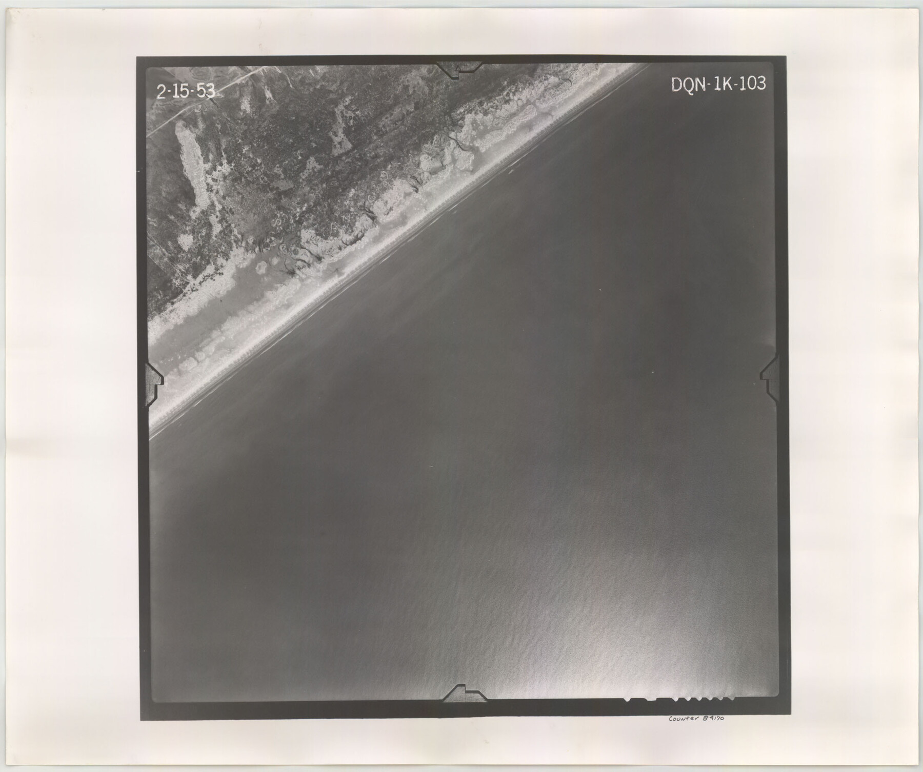
Flight Mission No. DQN-1K, Frame 103, Calhoun County
DQN-1K-103
-
Map/Doc
84170
-
Collection
General Map Collection
-
Object Dates
1953/2/15 (Creation Date)
-
People and Organizations
U. S. Department of Agriculture (Publisher)
-
Counties
Calhoun
-
Subjects
Aerial Photograph
-
Height x Width
18.5 x 22.1 inches
47.0 x 56.1 cm
-
Comments
Flown by Aero Exploration Company of Tulsa, Oklahoma.
Part of: General Map Collection
Upshur County Sketch File 15

Print $20.00
- Digital $50.00
Upshur County Sketch File 15
1934
Size 20.7 x 31.2 inches
Map/Doc 12505
Burleson County Working Sketch 39

Print $20.00
- Digital $50.00
Burleson County Working Sketch 39
1985
Size 15.3 x 18.7 inches
Map/Doc 67758
Map of Leon County

Print $40.00
- Digital $50.00
Map of Leon County
Size 49.7 x 42.0 inches
Map/Doc 66900
Uvalde County Working Sketch 66

Print $20.00
- Digital $50.00
Uvalde County Working Sketch 66
1942
Size 20.9 x 21.3 inches
Map/Doc 75968
Galveston County Rolled Sketch V

Print $20.00
- Digital $50.00
Galveston County Rolled Sketch V
1934
Size 38.7 x 30.3 inches
Map/Doc 5992
Railroad Track Map, H&TCRRCo., Falls County, Texas

Print $4.00
- Digital $50.00
Railroad Track Map, H&TCRRCo., Falls County, Texas
1918
Size 11.7 x 18.5 inches
Map/Doc 62854
Johnson County Working Sketch 6

Print $20.00
- Digital $50.00
Johnson County Working Sketch 6
1951
Size 30.6 x 32.6 inches
Map/Doc 66619
Coke County Sketch File 32

Print $8.00
- Digital $50.00
Coke County Sketch File 32
1949
Size 11.1 x 8.5 inches
Map/Doc 18645
Brazoria County Rolled Sketch 49

Print $20.00
- Digital $50.00
Brazoria County Rolled Sketch 49
1948
Size 23.8 x 36.2 inches
Map/Doc 5184
Colorado County Sketch File 8

Print $4.00
- Digital $50.00
Colorado County Sketch File 8
1861
Size 12.4 x 8.5 inches
Map/Doc 18927
Plats of the Resurvey of Clark's Texas-New Mexico Boundary by the U. S. Boundary Commission, 1911

Print $180.00
Plats of the Resurvey of Clark's Texas-New Mexico Boundary by the U. S. Boundary Commission, 1911
1911
Map/Doc 81690
Uvalde County Working Sketch 41

Print $20.00
- Digital $50.00
Uvalde County Working Sketch 41
1975
Size 15.6 x 27.4 inches
Map/Doc 72111
You may also like
Jefferson County Rolled Sketch 18

Print $40.00
- Digital $50.00
Jefferson County Rolled Sketch 18
1931
Size 19.1 x 72.8 inches
Map/Doc 9282
[Texas & Pacific Railway through Callahan County]
![64233, [Texas & Pacific Railway through Callahan County], General Map Collection](https://historictexasmaps.com/wmedia_w700/maps/64233.tif.jpg)
Print $20.00
- Digital $50.00
[Texas & Pacific Railway through Callahan County]
1918
Size 20.5 x 9.4 inches
Map/Doc 64233
Hidalgo County Rolled Sketch 18

Print $20.00
- Digital $50.00
Hidalgo County Rolled Sketch 18
Size 34.0 x 18.3 inches
Map/Doc 6213
Hidalgo County Sketch File 17

Print $6.00
- Digital $50.00
Hidalgo County Sketch File 17
1950
Size 14.5 x 8.8 inches
Map/Doc 26443
[Right of Way & Track Map, The Texas & Pacific Ry. Co. Main Line]
![64688, [Right of Way & Track Map, The Texas & Pacific Ry. Co. Main Line], General Map Collection](https://historictexasmaps.com/wmedia_w700/maps/64688.tif.jpg)
Print $20.00
- Digital $50.00
[Right of Way & Track Map, The Texas & Pacific Ry. Co. Main Line]
Size 11.0 x 19.0 inches
Map/Doc 64688

Mapa del Ferro-Carril del Rio Grande, Condado de Cameron Texas

Mapa del Ferro-Carril del Rio Grande, Condado de Cameron Texas
Size 18.4 x 72.5 inches
Map/Doc 94564
Wilbarger County Sketch File 23

Print $4.00
- Digital $50.00
Wilbarger County Sketch File 23
1887
Size 14.2 x 8.8 inches
Map/Doc 40223
Parts of Garza and Lynn Counties

Print $20.00
- Digital $50.00
Parts of Garza and Lynn Counties
1925
Size 23.1 x 17.0 inches
Map/Doc 91341
Gaines County Working Sketch 17

Print $20.00
- Digital $50.00
Gaines County Working Sketch 17
1964
Size 47.6 x 34.5 inches
Map/Doc 69317
El Paso County Working Sketch 40

Print $20.00
- Digital $50.00
El Paso County Working Sketch 40
1992
Size 21.5 x 24.0 inches
Map/Doc 69062