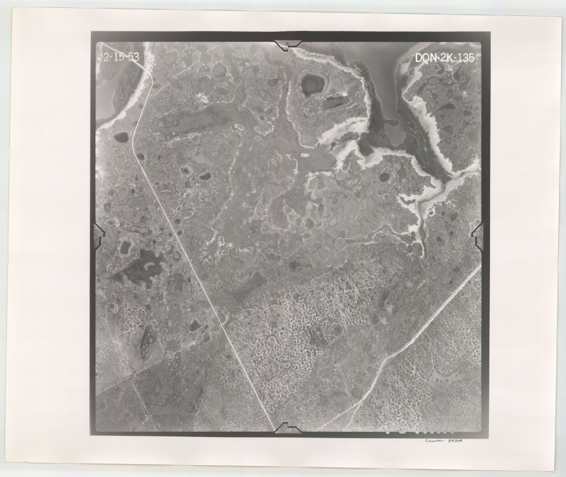
Flight Mission No. DQN-2K, Frame 135, Calhoun County
DQN-2K-135
-
Map/Doc
84304
-
Collection
General Map Collection
-
Object Dates
1953/2/15 (Creation Date)
-
People and Organizations
U. S. Department of Agriculture (Publisher)
-
Counties
Calhoun
-
Subjects
Aerial Photograph
-
Height x Width
19.0 x 22.5 inches
48.3 x 57.2 cm
-
Comments
Flown by Aero Exploration Company of Tulsa, Oklahoma.
Part of: General Map Collection
Andrews County

Print $20.00
- Digital $50.00
Andrews County
1887
Size 22.8 x 25.8 inches
Map/Doc 3230
Val Verde County Sketch File 51

Print $10.00
- Digital $50.00
Val Verde County Sketch File 51
1959
Size 9.8 x 8.7 inches
Map/Doc 39320
[Cotton Belt, St. Louis Southwestern Railway of Texas, Alignment through Smith County]
![64380, [Cotton Belt, St. Louis Southwestern Railway of Texas, Alignment through Smith County], General Map Collection](https://historictexasmaps.com/wmedia_w700/maps/64380.tif.jpg)
Print $20.00
- Digital $50.00
[Cotton Belt, St. Louis Southwestern Railway of Texas, Alignment through Smith County]
1903
Size 21.4 x 29.7 inches
Map/Doc 64380
Henderson County Working Sketch 7

Print $20.00
- Digital $50.00
Henderson County Working Sketch 7
1922
Size 12.5 x 18.8 inches
Map/Doc 66140
PSL Field Notes for Blocks 60, 61, 62, 83, 84, 85, 88, 89, 90, 91, 92, and 93 in Culberson County

PSL Field Notes for Blocks 60, 61, 62, 83, 84, 85, 88, 89, 90, 91, 92, and 93 in Culberson County
Map/Doc 81667

Jasper County Sketch File 17

Print $20.00
- Digital $50.00
Jasper County Sketch File 17
1886
Size 27.5 x 35.4 inches
Map/Doc 10505
[Sketch for Mineral Application 13439 - Bed Lost Lake, Walle Merritt]
![65577, [Sketch for Mineral Application 13439 - Bed Lost Lake, Walle Merritt], General Map Collection](https://historictexasmaps.com/wmedia_w700/maps/65577.tif.jpg)
Print $20.00
- Digital $50.00
[Sketch for Mineral Application 13439 - Bed Lost Lake, Walle Merritt]
1925
Size 31.1 x 29.9 inches
Map/Doc 65577
Motley County Sketch File 30 (S)

Print $40.00
- Digital $50.00
Motley County Sketch File 30 (S)
1905
Size 16.1 x 17.1 inches
Map/Doc 42147
Fort Bend County State Real Property Sketch 17

Print $20.00
- Digital $50.00
Fort Bend County State Real Property Sketch 17
1985
Size 17.8 x 22.8 inches
Map/Doc 61665
Kinney County Working Sketch 13

Print $20.00
- Digital $50.00
Kinney County Working Sketch 13
1941
Size 20.3 x 23.9 inches
Map/Doc 70195
San Saba County Sketch File 17

Print $8.00
- Digital $50.00
San Saba County Sketch File 17
1918
Size 11.4 x 8.8 inches
Map/Doc 36456
You may also like
Wheeler County Sketch File 4

Print $30.00
- Digital $50.00
Wheeler County Sketch File 4
1886
Size 9.1 x 8.4 inches
Map/Doc 40000
Newton County Sketch File 2

Print $6.00
- Digital $50.00
Newton County Sketch File 2
Size 14.0 x 10.7 inches
Map/Doc 32358
Hutson Addition to Umbarger, sec. 76, Blk. B-5, Randall Co., Texas

Print $20.00
- Digital $50.00
Hutson Addition to Umbarger, sec. 76, Blk. B-5, Randall Co., Texas
Size 30.5 x 29.5 inches
Map/Doc 92155
Sterling County Rolled Sketch 14

Print $20.00
- Digital $50.00
Sterling County Rolled Sketch 14
Size 22.3 x 26.6 inches
Map/Doc 7848

Wavell Empresario Colony. Proposed, March 9, 1826

Print $20.00
Wavell Empresario Colony. Proposed, March 9, 1826
2020
Size 16.0 x 21.7 inches
Map/Doc 96009
Neches River, Box Creek Sheet Cross Section

Print $6.00
- Digital $50.00
Neches River, Box Creek Sheet Cross Section
1940
Size 37.0 x 18.8 inches
Map/Doc 65079
Llano County Sketch File 8

Print $10.00
- Digital $50.00
Llano County Sketch File 8
1885
Size 14.1 x 8.8 inches
Map/Doc 30364
Wharton County Sketch File 4a

Print $4.00
- Digital $50.00
Wharton County Sketch File 4a
1876
Size 12.7 x 8.1 inches
Map/Doc 39919
Kimble County Working Sketch 15

Print $20.00
- Digital $50.00
Kimble County Working Sketch 15
1923
Size 22.4 x 22.1 inches
Map/Doc 70083
[Townships 1 through 5 North, Blocks 34, 35, and 36]
![92587, [Townships 1 through 5 North, Blocks 34, 35, and 36], Twichell Survey Records](https://historictexasmaps.com/wmedia_w700/maps/92587-1.tif.jpg)
Print $20.00
- Digital $50.00
[Townships 1 through 5 North, Blocks 34, 35, and 36]
Size 41.7 x 21.4 inches
Map/Doc 92587
Val Verde County Sketch File A2

Print $10.00
- Digital $50.00
Val Verde County Sketch File A2
1916
Size 14.5 x 9.1 inches
Map/Doc 39041