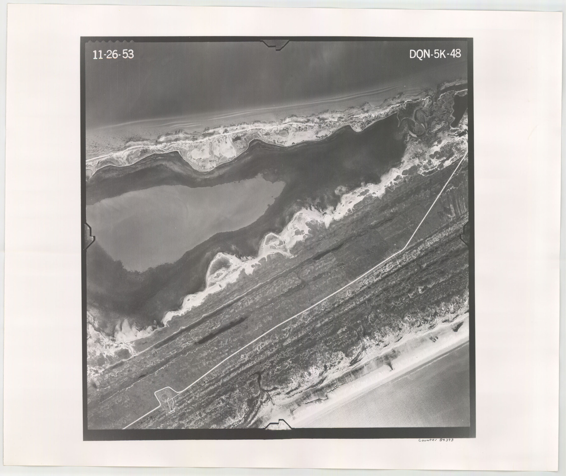
Flight Mission No. DQN-5K, Frame 48, Calhoun County
DQN-5K-48
-
Map/Doc
84393
-
Collection
General Map Collection
-
Object Dates
1953/11/26 (Creation Date)
-
People and Organizations
U. S. Department of Agriculture (Publisher)
-
Counties
Calhoun
-
Subjects
Aerial Photograph
-
Height x Width
18.7 x 22.2 inches
47.5 x 56.4 cm
-
Comments
Flown by Aero Exploration Company of Tulsa, Oklahoma.
Part of: General Map Collection
[Missouri, Kansas & Texas Line Map through Bastrop County]
![64032, [Missouri, Kansas & Texas Line Map through Bastrop County], General Map Collection](https://historictexasmaps.com/wmedia_w700/maps/64032.tif.jpg)
Print $40.00
- Digital $50.00
[Missouri, Kansas & Texas Line Map through Bastrop County]
1916
Size 25.4 x 106.0 inches
Map/Doc 64032
Galveston County Boundary File 32

Print $52.00
- Digital $50.00
Galveston County Boundary File 32
Size 16.7 x 13.6 inches
Map/Doc 53658
Map showing contour of lake to be formed by the Marshall-Ford Dam on the Colorado River in Travis County, Texas and the land surveys crossed by this contour and contiguous to the lake

Print $20.00
- Digital $50.00
Map showing contour of lake to be formed by the Marshall-Ford Dam on the Colorado River in Travis County, Texas and the land surveys crossed by this contour and contiguous to the lake
1937
Size 22.6 x 18.8 inches
Map/Doc 60292
Sketch of coast of Texas, Laguna Madre from Pt. of Rocks to Corpus Christi [and accompanying letter]
![72964, Sketch of coast of Texas, Laguna Madre from Pt. of Rocks to Corpus Christi [and accompanying letter], General Map Collection](https://historictexasmaps.com/wmedia_w700/maps/72964.tif.jpg)
Print $2.00
- Digital $50.00
Sketch of coast of Texas, Laguna Madre from Pt. of Rocks to Corpus Christi [and accompanying letter]
Size 11.2 x 8.8 inches
Map/Doc 72964
Wharton County Working Sketch 6

Print $20.00
- Digital $50.00
Wharton County Working Sketch 6
1990
Size 24.7 x 21.1 inches
Map/Doc 72470
Nueces County Rolled Sketch GT

Print $20.00
- Digital $50.00
Nueces County Rolled Sketch GT
1924
Size 24.9 x 38.6 inches
Map/Doc 7169
Pecos County Rolled Sketch 78

Print $40.00
- Digital $50.00
Pecos County Rolled Sketch 78
1930
Size 52.6 x 44.1 inches
Map/Doc 9705

Archer County

Print $20.00
- Digital $50.00
Archer County
1926
Size 42.9 x 37.8 inches
Map/Doc 73070
Liberty County Rolled Sketch N

Print $20.00
- Digital $50.00
Liberty County Rolled Sketch N
Size 44.7 x 38.5 inches
Map/Doc 10180
Duval County Sketch File 17

Print $20.00
- Digital $50.00
Duval County Sketch File 17
1876
Size 19.0 x 17.8 inches
Map/Doc 11383
Galveston County NRC Article 33.136 Sketch 86

Print $42.00
- Digital $50.00
Galveston County NRC Article 33.136 Sketch 86
2018
Size 24.0 x 36.0 inches
Map/Doc 95388
You may also like

Orange County Sketch File 43

Print $4.00
- Digital $50.00
Orange County Sketch File 43
1873
Size 8.2 x 10.3 inches
Map/Doc 33385
Brazoria County NRC Article 33.136 Sketch 10

Print $23.00
- Digital $50.00
Brazoria County NRC Article 33.136 Sketch 10
2007
Size 25.7 x 35.7 inches
Map/Doc 87933
Dawson County Rolled Sketch 7

Print $20.00
- Digital $50.00
Dawson County Rolled Sketch 7
Size 18.5 x 39.3 inches
Map/Doc 5692
Menard County Boundary File 7

Print $6.00
- Digital $50.00
Menard County Boundary File 7
Size 10.5 x 8.1 inches
Map/Doc 57089
Williamson County Boundary File 5

Print $233.00
- Digital $50.00
Williamson County Boundary File 5
Size 14.4 x 8.8 inches
Map/Doc 60023
Newton County Rolled Sketch 22

Print $20.00
- Digital $50.00
Newton County Rolled Sketch 22
1957
Size 20.8 x 28.7 inches
Map/Doc 6849
Cameron County Rolled Sketch 17

Print $20.00
- Digital $50.00
Cameron County Rolled Sketch 17
1937
Size 47.0 x 34.0 inches
Map/Doc 61788
Flight Mission No. DQO-3K, Frame 23, Galveston County

Print $20.00
- Digital $50.00
Flight Mission No. DQO-3K, Frame 23, Galveston County
1952
Size 18.8 x 22.5 inches
Map/Doc 85064
Udell -V- Hughes Sketch

Print $20.00
- Digital $50.00
Udell -V- Hughes Sketch
Size 28.8 x 19.4 inches
Map/Doc 90481
[Sketch showing Block M-20, Sections 9 through 46 and Block 22, Sections 1 through 12]
![91717, [Sketch showing Block M-20, Sections 9 through 46 and Block 22, Sections 1 through 12], Twichell Survey Records](https://historictexasmaps.com/wmedia_w700/maps/91717-1.tif.jpg)
Print $3.00
- Digital $50.00
[Sketch showing Block M-20, Sections 9 through 46 and Block 22, Sections 1 through 12]
Size 10.9 x 13.9 inches
Map/Doc 91717
Flight Mission No. DCL-4C, Frame 120, Kenedy County

Print $20.00
- Digital $50.00
Flight Mission No. DCL-4C, Frame 120, Kenedy County
1943
Size 18.6 x 22.5 inches
Map/Doc 85819