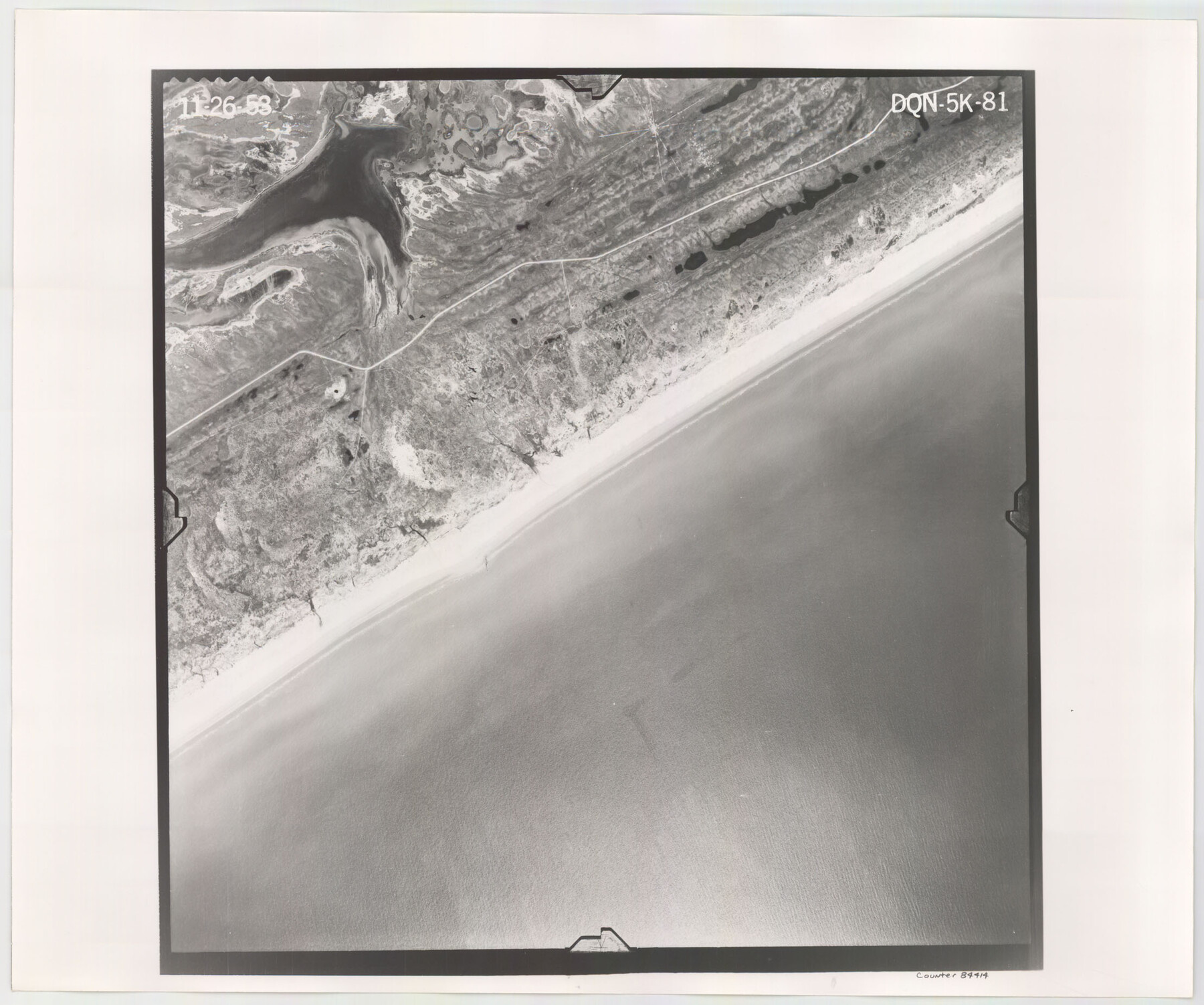
Flight Mission No. DQN-5K, Frame 81, Calhoun County
DQN-5K-81
-
Map/Doc
84414
-
Collection
General Map Collection
-
Object Dates
1953/11/26 (Creation Date)
-
People and Organizations
U. S. Department of Agriculture (Publisher)
-
Counties
Calhoun
-
Subjects
Aerial Photograph
-
Height x Width
18.5 x 22.2 inches
47.0 x 56.4 cm
-
Comments
Flown by Aero Exploration Company of Tulsa, Oklahoma.
Part of: General Map Collection
Wise County Sketch File 16 and 17

Print $4.00
- Digital $50.00
Wise County Sketch File 16 and 17
1856
Size 13.1 x 8.3 inches
Map/Doc 40551

Harris County Sketch File 57

Print $15.00
- Digital $50.00
Harris County Sketch File 57
1919
Size 8.8 x 7.7 inches
Map/Doc 25473
Mason County Working Sketch 10

Print $40.00
- Digital $50.00
Mason County Working Sketch 10
1949
Size 42.4 x 49.7 inches
Map/Doc 70846
Oldham County Working Sketch 6

Print $40.00
- Digital $50.00
Oldham County Working Sketch 6
1981
Size 32.4 x 50.4 inches
Map/Doc 71328
Flight Mission No. BRA-7M, Frame 204, Jefferson County

Print $20.00
- Digital $50.00
Flight Mission No. BRA-7M, Frame 204, Jefferson County
1953
Size 18.6 x 22.3 inches
Map/Doc 85572
Reagan County Working Sketch 11

Print $20.00
- Digital $50.00
Reagan County Working Sketch 11
1943
Size 19.4 x 20.9 inches
Map/Doc 71851
Matagorda County Sketch File 4

Print $4.00
- Digital $50.00
Matagorda County Sketch File 4
1876
Size 7.9 x 12.8 inches
Map/Doc 30734
Midland County Working Sketch 6

Print $20.00
- Digital $50.00
Midland County Working Sketch 6
1950
Size 41.2 x 30.9 inches
Map/Doc 70986

[Sketch for Mineral Applications 26885-6 - Reagan and Crockett Cos., W. H. Bland]
![65672, [Sketch for Mineral Applications 26885-6 - Reagan and Crockett Cos., W. H. Bland], General Map Collection](https://historictexasmaps.com/wmedia_w700/maps/65672-1.tif.jpg)
Print $40.00
- Digital $50.00
[Sketch for Mineral Applications 26885-6 - Reagan and Crockett Cos., W. H. Bland]
Size 51.1 x 37.3 inches
Map/Doc 65672
Runnels County Rolled Sketch 36

Print $40.00
- Digital $50.00
Runnels County Rolled Sketch 36
1950
Size 66.6 x 45.0 inches
Map/Doc 9869
You may also like
Hudspeth County Working Sketch 39

Print $20.00
- Digital $50.00
Hudspeth County Working Sketch 39
1980
Size 37.1 x 37.0 inches
Map/Doc 66324
Lynn County Sketch File A

Print $2.00
- Digital $50.00
Lynn County Sketch File A
1905
Size 8.6 x 6.3 inches
Map/Doc 30477
Childress County Rolled Sketch 8

Print $20.00
- Digital $50.00
Childress County Rolled Sketch 8
1889
Size 12.4 x 22.2 inches
Map/Doc 5442
Duval County Sketch File 41

Print $20.00
- Digital $50.00
Duval County Sketch File 41
1936
Size 19.6 x 17.2 inches
Map/Doc 11397
Brewster County Rolled Sketch 60

Print $40.00
- Digital $50.00
Brewster County Rolled Sketch 60
1942
Size 42.9 x 48.0 inches
Map/Doc 16960
Morton, Cochran County, Texas / Morton Cemetery First Addition, Cochran County, Texas

Print $20.00
- Digital $50.00
Morton, Cochran County, Texas / Morton Cemetery First Addition, Cochran County, Texas
Size 37.4 x 40.3 inches
Map/Doc 89853
Angelina County Working Sketch 7

Print $20.00
- Digital $50.00
Angelina County Working Sketch 7
1920
Size 25.5 x 23.7 inches
Map/Doc 67088
Val Verde County Working Sketch 51

Print $20.00
- Digital $50.00
Val Verde County Working Sketch 51
1952
Size 24.5 x 30.0 inches
Map/Doc 72186
Ward County Working Sketch 49

Print $40.00
- Digital $50.00
Ward County Working Sketch 49
1974
Size 54.8 x 37.1 inches
Map/Doc 72355
St. Louis Southwestern Railway of Texas

Print $20.00
- Digital $50.00
St. Louis Southwestern Railway of Texas
1906
Size 22.2 x 30.5 inches
Map/Doc 64451
Flight Mission No. CRC-3R, Frame 40, Chambers County

Print $20.00
- Digital $50.00
Flight Mission No. CRC-3R, Frame 40, Chambers County
1956
Size 18.6 x 22.3 inches
Map/Doc 84813
Coleman County Working Sketch 20

Print $20.00
- Digital $50.00
Coleman County Working Sketch 20
1953
Size 32.7 x 41.9 inches
Map/Doc 68086