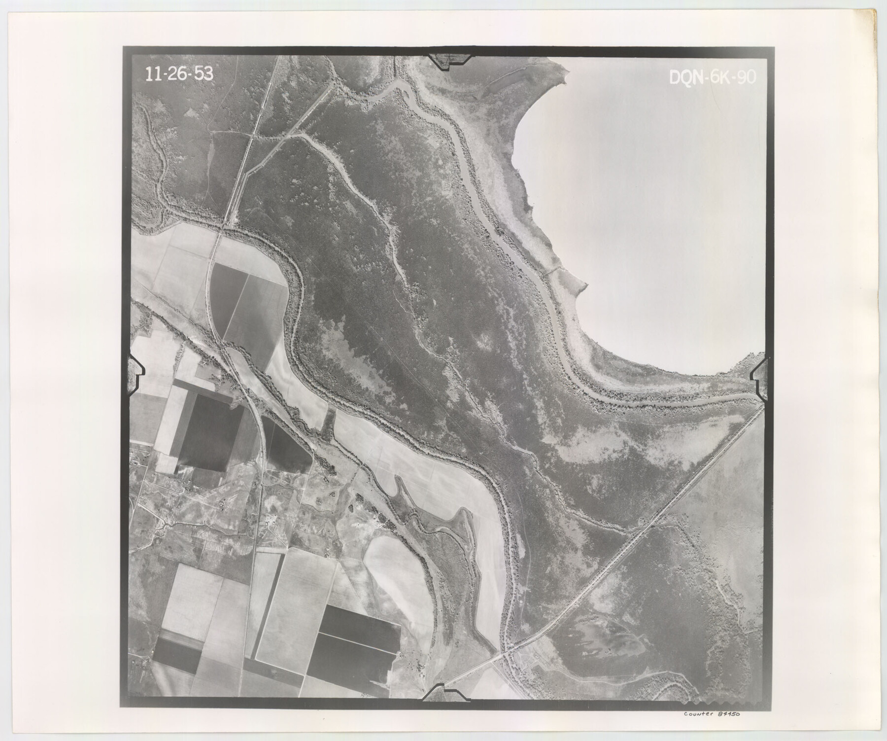
Flight Mission No. DQN-6K, Frame 90, Calhoun County
DQN-6K-90
-
Map/Doc
84450
-
Collection
General Map Collection
-
Object Dates
1953/11/26 (Creation Date)
-
People and Organizations
U. S. Department of Agriculture (Publisher)
-
Counties
Calhoun
-
Subjects
Aerial Photograph
-
Height x Width
18.6 x 22.2 inches
47.2 x 56.4 cm
-
Comments
Flown by Aero Exploration Company of Tulsa, Oklahoma.
Part of: General Map Collection
Liberty County Working Sketch 65

Print $20.00
- Digital $50.00
Liberty County Working Sketch 65
1970
Size 27.6 x 47.3 inches
Map/Doc 70525
Flight Mission No. DAG-17K, Frame 77, Matagorda County

Print $20.00
- Digital $50.00
Flight Mission No. DAG-17K, Frame 77, Matagorda County
1952
Size 16.7 x 16.3 inches
Map/Doc 86336
Flight Mission No. BRA-3M, Frame 191, Jefferson County

Print $20.00
- Digital $50.00
Flight Mission No. BRA-3M, Frame 191, Jefferson County
1953
Size 18.6 x 22.3 inches
Map/Doc 85406
(A No. 2) Preliminary Sketch Showing the positions of Davis's South Shoal and other Dangers recently discovered by the Coast Survey and the soundings on the Old South Shoal, Bass Rip, Old Man, Pochick Rip &c.

Print $20.00
- Digital $50.00
(A No. 2) Preliminary Sketch Showing the positions of Davis's South Shoal and other Dangers recently discovered by the Coast Survey and the soundings on the Old South Shoal, Bass Rip, Old Man, Pochick Rip &c.
1846
Size 19.7 x 21.8 inches
Map/Doc 97203
Hale County Sketch File 26

Print $40.00
- Digital $50.00
Hale County Sketch File 26
1911
Size 20.7 x 54.4 inches
Map/Doc 10471
Nueces County NRC Article 33.136 Sketch 16

Print $68.00
- Digital $50.00
Nueces County NRC Article 33.136 Sketch 16
2012
Size 22.0 x 17.0 inches
Map/Doc 94804
Reeves County Working Sketch 44

Print $20.00
- Digital $50.00
Reeves County Working Sketch 44
1974
Size 46.9 x 32.1 inches
Map/Doc 63487
Caldwell County Sketch File 2

Print $40.00
- Digital $50.00
Caldwell County Sketch File 2
1877
Size 12.9 x 20.0 inches
Map/Doc 11030
[Galveston, Harrisburg & San Antonio through El Paso County]
![64015, [Galveston, Harrisburg & San Antonio through El Paso County], General Map Collection](https://historictexasmaps.com/wmedia_w700/maps/64015.tif.jpg)
Print $20.00
- Digital $50.00
[Galveston, Harrisburg & San Antonio through El Paso County]
1907
Size 13.5 x 33.7 inches
Map/Doc 64015
Map of the City of Galveston, Texas

Print $40.00
- Digital $50.00
Map of the City of Galveston, Texas
1883
Size 37.2 x 66.3 inches
Map/Doc 96981
Hudspeth County Working Sketch 7

Print $40.00
- Digital $50.00
Hudspeth County Working Sketch 7
1935
Size 92.4 x 33.6 inches
Map/Doc 66288
Kent County Rolled Sketch 4

Print $20.00
- Digital $50.00
Kent County Rolled Sketch 4
1950
Size 22.1 x 31.1 inches
Map/Doc 6475
You may also like
Flight Mission No. DQN-5K, Frame 146, Calhoun County

Print $20.00
- Digital $50.00
Flight Mission No. DQN-5K, Frame 146, Calhoun County
1953
Size 18.6 x 22.2 inches
Map/Doc 84421
Reeves County Boundary File 73a

Print $16.00
- Digital $50.00
Reeves County Boundary File 73a
Size 13.3 x 8.2 inches
Map/Doc 58208
Pecos County Sketch File 108

Print $4.00
- Digital $50.00
Pecos County Sketch File 108
1974
Size 14.3 x 8.6 inches
Map/Doc 34037
Corpus Christi Bay, Texas

Print $40.00
- Digital $50.00
Corpus Christi Bay, Texas
1867
Size 31.9 x 48.8 inches
Map/Doc 73468
Flight Mission No. CGI-4N, Frame 189, Cameron County

Print $20.00
- Digital $50.00
Flight Mission No. CGI-4N, Frame 189, Cameron County
1955
Size 18.5 x 22.2 inches
Map/Doc 84692
Uvalde County Working Sketch 47

Print $20.00
- Digital $50.00
Uvalde County Working Sketch 47
1979
Size 29.7 x 24.8 inches
Map/Doc 72117
Reeves County Working Sketch 44
Print $20.00
- Digital $50.00
Reeves County Working Sketch 44
1974
Size 46.9 x 32.1 inches
Map/Doc 63487
Blanco County Sketch File 32

Print $4.00
- Digital $50.00
Blanco County Sketch File 32
1888
Size 8.5 x 11.1 inches
Map/Doc 14633
[Sketch Number 1, Block LC2 and Adjacent Leagues]
![91476, [Sketch Number 1, Block LC2 and Adjacent Leagues], Twichell Survey Records](https://historictexasmaps.com/wmedia_w700/maps/91476-1.tif.jpg)
Print $20.00
- Digital $50.00
[Sketch Number 1, Block LC2 and Adjacent Leagues]
Size 25.6 x 40.8 inches
Map/Doc 91476
Terrell County Working Sketch 84b

Print $20.00
- Digital $50.00
Terrell County Working Sketch 84b
1992
Size 25.2 x 42.7 inches
Map/Doc 69606
Lavaca County Sketch File 4

Print $6.00
- Digital $50.00
Lavaca County Sketch File 4
Size 8.2 x 15.3 inches
Map/Doc 29636
Jackson County Sketch File 5

Print $4.00
- Digital $50.00
Jackson County Sketch File 5
1876
Size 12.7 x 8.2 inches
Map/Doc 27628