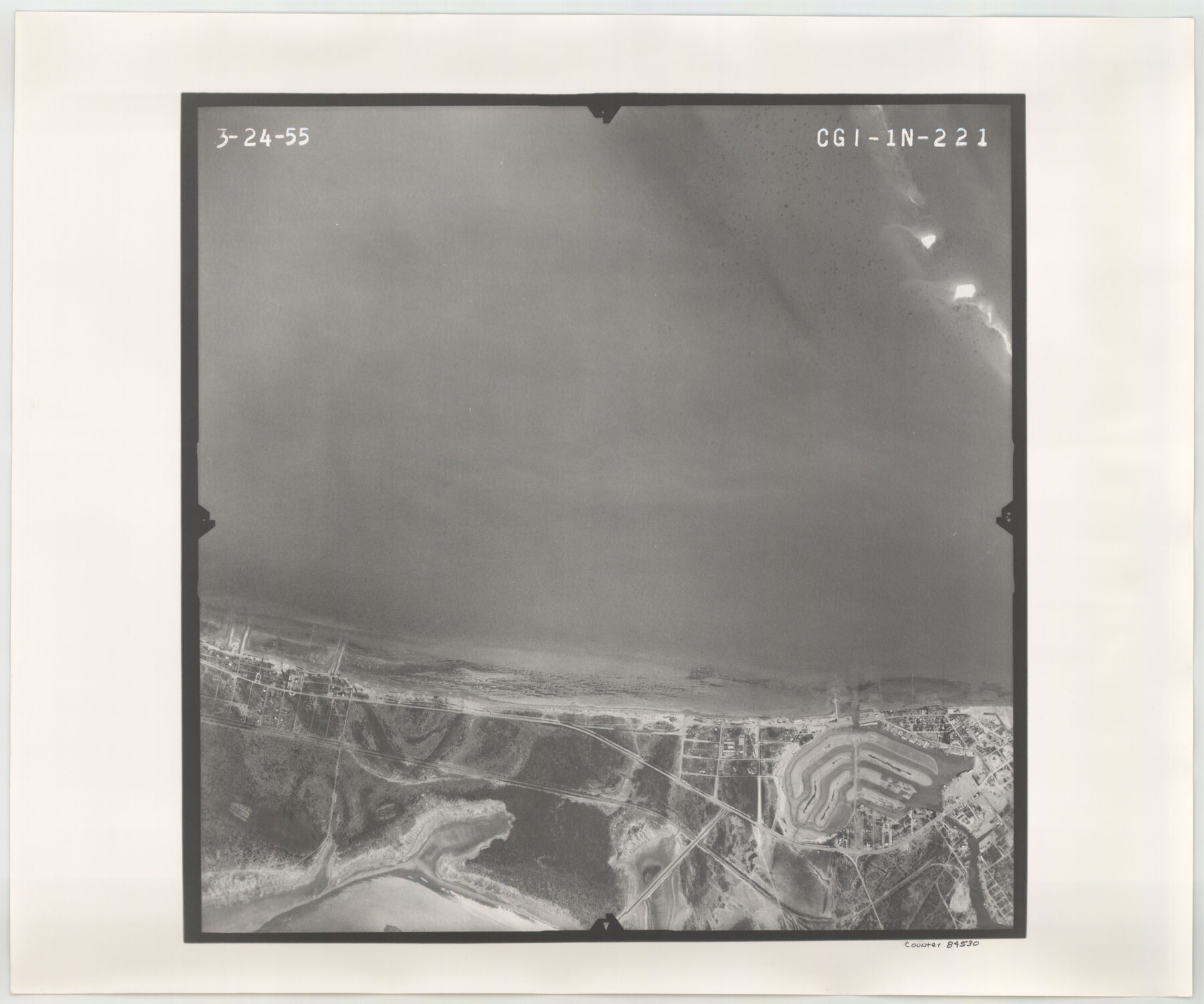
Flight Mission No. CGI-1N, Frame 221, Cameron County
CGI-1N-221
-
Map/Doc
84530
-
Collection
General Map Collection
-
Object Dates
1955/3/24 (Creation Date)
-
People and Organizations
U. S. Department of Agriculture (Publisher)
-
Counties
Cameron
-
Subjects
Aerial Photograph
-
Height x Width
18.5 x 22.2 inches
47.0 x 56.4 cm
-
Comments
Flown by Puckett Aerial Surveys, Inc. of Jackson, Mississippi.
Part of: General Map Collection
DeWitt County Working Sketch 2b

Print $20.00
- Digital $50.00
DeWitt County Working Sketch 2b
1940
Size 25.1 x 30.0 inches
Map/Doc 68647
Sabine County Rolled Sketch 2

Print $20.00
- Digital $50.00
Sabine County Rolled Sketch 2
1949
Size 33.3 x 20.8 inches
Map/Doc 7551
Jasper County Working Sketch 20

Print $20.00
- Digital $50.00
Jasper County Working Sketch 20
1940
Size 27.2 x 45.0 inches
Map/Doc 66482
Brewster County Working Sketch 1

Print $20.00
- Digital $50.00
Brewster County Working Sketch 1
1904
Size 27.4 x 25.8 inches
Map/Doc 67534
Callahan County Sketch File 10

Print $40.00
- Digital $50.00
Callahan County Sketch File 10
Size 21.7 x 24.7 inches
Map/Doc 11039
Presidio County Rolled Sketch A-2

Print $20.00
- Digital $50.00
Presidio County Rolled Sketch A-2
1889
Size 36.9 x 43.9 inches
Map/Doc 9770
San Patricio County Rolled Sketch 52

Print $20.00
- Digital $50.00
San Patricio County Rolled Sketch 52
1994
Size 36.7 x 39.4 inches
Map/Doc 7737
[Cotton Belt, St. Louis Southwestern Railway of Texas, Alignment through Smith County]
![64381, [Cotton Belt, St. Louis Southwestern Railway of Texas, Alignment through Smith County], General Map Collection](https://historictexasmaps.com/wmedia_w700/maps/64381.tif.jpg)
Print $20.00
- Digital $50.00
[Cotton Belt, St. Louis Southwestern Railway of Texas, Alignment through Smith County]
1903
Size 21.3 x 29.4 inches
Map/Doc 64381
Gregg County Rolled Sketch 13

Print $64.00
- Digital $50.00
Gregg County Rolled Sketch 13
1940
Size 10.5 x 15.5 inches
Map/Doc 45439
Map of Kimble County

Print $20.00
- Digital $50.00
Map of Kimble County
1879
Size 18.7 x 28.9 inches
Map/Doc 3765
Crane County Rolled Sketch 22

Print $20.00
- Digital $50.00
Crane County Rolled Sketch 22
1990
Size 12.5 x 19.3 inches
Map/Doc 5578
Presidio County Rolled Sketch 76

Print $20.00
- Digital $50.00
Presidio County Rolled Sketch 76
Size 24.3 x 36.4 inches
Map/Doc 9777
You may also like

Clay County Boundary File 10

Print $6.00
- Digital $50.00
Clay County Boundary File 10
Size 14.2 x 8.8 inches
Map/Doc 51397
Map of Maverick County

Print $20.00
- Digital $50.00
Map of Maverick County
1875
Size 36.3 x 23.7 inches
Map/Doc 3849
Calhoun County Sketch File 19

Print $70.00
- Digital $50.00
Calhoun County Sketch File 19
1998
Size 11.1 x 8.1 inches
Map/Doc 35992
General Highway Map, Angelina County, Texas

Print $20.00
General Highway Map, Angelina County, Texas
1961
Size 25.1 x 18.1 inches
Map/Doc 79349
Ector County Working Sketch 19

Print $40.00
- Digital $50.00
Ector County Working Sketch 19
1958
Size 65.8 x 37.6 inches
Map/Doc 68862
DeWitt County Boundary File 25 1/2

Print $34.00
- Digital $50.00
DeWitt County Boundary File 25 1/2
Size 8.5 x 4.0 inches
Map/Doc 52522
Lampasas County Sketch File 16 1/2

Print $4.00
- Digital $50.00
Lampasas County Sketch File 16 1/2
Size 8.4 x 8.6 inches
Map/Doc 29428
Working Sketch in Crockett County

Print $20.00
- Digital $50.00
Working Sketch in Crockett County
1927
Size 25.6 x 22.7 inches
Map/Doc 90304
Roberts County Working Sketch 25

Print $20.00
- Digital $50.00
Roberts County Working Sketch 25
1982
Size 23.0 x 20.4 inches
Map/Doc 63551
Flight Mission No. BRE-1P, Frame 152, Nueces County

Print $20.00
- Digital $50.00
Flight Mission No. BRE-1P, Frame 152, Nueces County
1956
Size 18.4 x 22.3 inches
Map/Doc 86712
Flight Mission No. BRA-16M, Frame 161, Jefferson County

Print $20.00
- Digital $50.00
Flight Mission No. BRA-16M, Frame 161, Jefferson County
1953
Size 18.5 x 22.3 inches
Map/Doc 85759