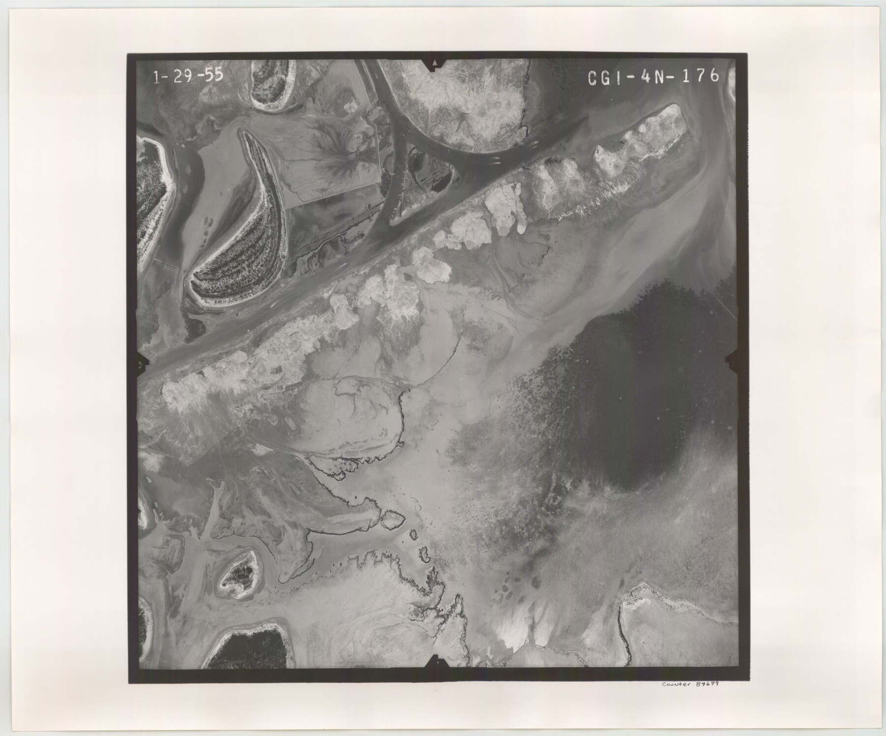
Flight Mission No. CGI-4N, Frame 176, Cameron County
CGI-4N-176
-
Map/Doc
84679
-
Collection
General Map Collection
-
Object Dates
1955/1/29 (Creation Date)
-
People and Organizations
U. S. Department of Agriculture (Publisher)
-
Counties
Cameron
-
Subjects
Aerial Photograph
-
Height x Width
18.5 x 22.2 inches
47.0 x 56.4 cm
-
Comments
Flown by Puckett Aerial Surveys, Inc. of Jackson, Mississippi.
Part of: General Map Collection
Schleicher County

Print $40.00
- Digital $50.00
Schleicher County
1898
Size 33.7 x 53.5 inches
Map/Doc 16811
Falls County Sketch File 23

Print $20.00
- Digital $50.00
Falls County Sketch File 23
1921
Size 24.8 x 36.3 inches
Map/Doc 11467
Flight Mission No. BRA-8M, Frame 135, Jefferson County

Print $20.00
- Digital $50.00
Flight Mission No. BRA-8M, Frame 135, Jefferson County
1953
Size 18.7 x 22.3 inches
Map/Doc 85631
[Map Showing Parmer, Castro, Bailey, Lamb, Cochran & Hockley Counties, Texas]
![1762, [Map Showing Parmer, Castro, Bailey, Lamb, Cochran & Hockley Counties, Texas], General Map Collection](https://historictexasmaps.com/wmedia_w700/maps/1762.tif.jpg)
Print $40.00
- Digital $50.00
[Map Showing Parmer, Castro, Bailey, Lamb, Cochran & Hockley Counties, Texas]
1910
Size 55.3 x 40.1 inches
Map/Doc 1762
The History of Texas; or the Emigrant's, Farmer's, and Politician's Guide to the Character, Climate, Soil and Productions of that Country: Geographically Arranged from Personal Observation and Experience

The History of Texas; or the Emigrant's, Farmer's, and Politician's Guide to the Character, Climate, Soil and Productions of that Country: Geographically Arranged from Personal Observation and Experience
1836
Size 7.6 x 9.1 inches
Map/Doc 94038
Liberty County Rolled Sketch 15

Print $20.00
- Digital $50.00
Liberty County Rolled Sketch 15
2015
Size 36.1 x 24.4 inches
Map/Doc 94023

Castro County Rolled Sketch 11

Print $20.00
- Digital $50.00
Castro County Rolled Sketch 11
1940
Size 20.2 x 25.3 inches
Map/Doc 5420
Nueces County NRC Article 33.136 Sketch 1

Print $274.00
- Digital $50.00
Nueces County NRC Article 33.136 Sketch 1
2002
Size 24.5 x 36.3 inches
Map/Doc 87920
North end of Brazos Island

Print $20.00
- Digital $50.00
North end of Brazos Island
Size 26.0 x 18.2 inches
Map/Doc 72916

Pecos County Rolled Sketch 77

Print $20.00
- Digital $50.00
Pecos County Rolled Sketch 77
1930
Size 38.4 x 23.4 inches
Map/Doc 7238
You may also like
Donley County Sketch File 21

Print $4.00
- Digital $50.00
Donley County Sketch File 21
Size 8.4 x 9.5 inches
Map/Doc 21256
[Area to the West and North of the Abraham Winfrey survey 11]
![90222, [Area to the West and North of the Abraham Winfrey survey 11], Twichell Survey Records](https://historictexasmaps.com/wmedia_w700/maps/90222-1.tif.jpg)
Print $20.00
- Digital $50.00
[Area to the West and North of the Abraham Winfrey survey 11]
1920
Size 25.7 x 22.5 inches
Map/Doc 90222
Fort Bend County

Print $20.00
- Digital $50.00
Fort Bend County
1892
Size 29.3 x 25.7 inches
Map/Doc 3551
Working Sketch in Hutchinson County

Print $20.00
- Digital $50.00
Working Sketch in Hutchinson County
1922
Size 16.9 x 13.6 inches
Map/Doc 91251
Leon County Rolled Sketch 27

Print $40.00
- Digital $50.00
Leon County Rolled Sketch 27
1990
Size 54.3 x 45.0 inches
Map/Doc 9436
Map of Denton County, Texas

Print $20.00
- Digital $50.00
Map of Denton County, Texas
Size 22.8 x 19.4 inches
Map/Doc 711
Polk County Sketch File 39

Print $24.00
- Digital $50.00
Polk County Sketch File 39
Size 8.3 x 13.3 inches
Map/Doc 34278
Bastrop County Boundary File 4

Print $48.00
- Digital $50.00
Bastrop County Boundary File 4
1925
Size 11.2 x 8.7 inches
Map/Doc 50324
[Galveston, Harrisburg & San Antonio Railroad from Cuero to Stockdale]
![64189, [Galveston, Harrisburg & San Antonio Railroad from Cuero to Stockdale], General Map Collection](https://historictexasmaps.com/wmedia_w700/maps/64189.tif.jpg)
Print $20.00
- Digital $50.00
[Galveston, Harrisburg & San Antonio Railroad from Cuero to Stockdale]
1907
Size 13.8 x 34.0 inches
Map/Doc 64189
Fisher County Sketch File 20

Print $66.00
- Digital $50.00
Fisher County Sketch File 20
Size 9.3 x 9.1 inches
Map/Doc 22616
General Highway Map Travis County

Print $20.00
- Digital $50.00
General Highway Map Travis County
1952
Size 17.2 x 12.5 inches
Map/Doc 92288
Jack County Sketch File 13

Print $4.00
- Digital $50.00
Jack County Sketch File 13
Size 10.3 x 8.0 inches
Map/Doc 27537