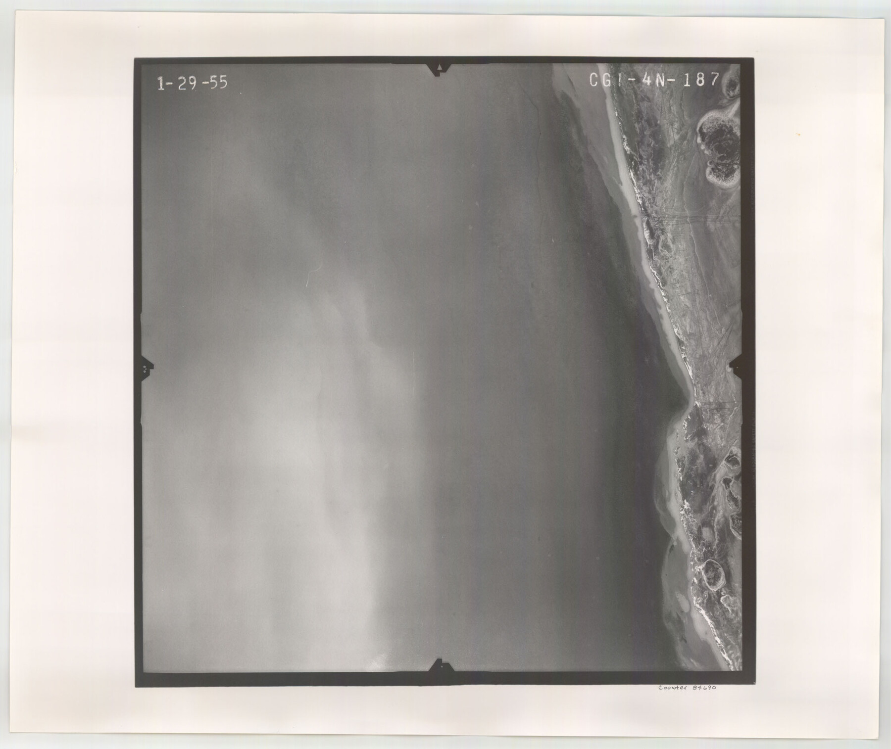
Flight Mission No. CGI-4N, Frame 187, Cameron County
CGI-4N-187
-
Map/Doc
84690
-
Collection
General Map Collection
-
Object Dates
1955/1/29 (Creation Date)
-
People and Organizations
U. S. Department of Agriculture (Publisher)
-
Counties
Cameron
-
Subjects
Aerial Photograph
-
Height x Width
18.8 x 22.4 inches
47.8 x 56.9 cm
-
Comments
Flown by Puckett Aerial Surveys, Inc. of Jackson, Mississippi.
Part of: General Map Collection
Kinney County Working Sketch 54

Print $20.00
- Digital $50.00
Kinney County Working Sketch 54
1981
Size 40.0 x 32.8 inches
Map/Doc 70236
Lee County Working Sketch 22

Print $20.00
- Digital $50.00
Lee County Working Sketch 22
2010
Size 29.2 x 29.6 inches
Map/Doc 89271
Franklin County Working Sketch Graphic Index

Print $20.00
- Digital $50.00
Franklin County Working Sketch Graphic Index
1942
Size 40.3 x 16.2 inches
Map/Doc 76546
Texas Intracoastal Waterway - Port O'Connor to San Antonio Bay, Including Pass Cavallo

Print $20.00
- Digital $50.00
Texas Intracoastal Waterway - Port O'Connor to San Antonio Bay, Including Pass Cavallo
1957
Size 28.1 x 40.0 inches
Map/Doc 73372
Childress Co.

Print $20.00
- Digital $50.00
Childress Co.
1978
Size 44.6 x 33.7 inches
Map/Doc 77237
Jeff Davis County Sketch File 44

Print $8.00
- Digital $50.00
Jeff Davis County Sketch File 44
1886
Size 8.5 x 8.0 inches
Map/Doc 28071
Flight Mission No. DQN-2K, Frame 73, Calhoun County

Print $20.00
- Digital $50.00
Flight Mission No. DQN-2K, Frame 73, Calhoun County
1953
Size 18.5 x 22.2 inches
Map/Doc 84265
Reeves County Working Sketch 18

Print $20.00
- Digital $50.00
Reeves County Working Sketch 18
1961
Size 24.7 x 40.2 inches
Map/Doc 63461
Travis County State Real Property Sketch 1

Print $20.00
- Digital $50.00
Travis County State Real Property Sketch 1
1985
Size 34.9 x 23.3 inches
Map/Doc 61691
Brazoria County Working Sketch 47

Print $40.00
- Digital $50.00
Brazoria County Working Sketch 47
1988
Size 35.3 x 59.9 inches
Map/Doc 67532
Wichita County Sketch File 19a

Print $20.00
- Digital $50.00
Wichita County Sketch File 19a
1892
Size 27.0 x 21.7 inches
Map/Doc 12682

You may also like
Soil Map - Reconnoissance Survey - South Texas Sheet

Print $20.00
- Digital $50.00
Soil Map - Reconnoissance Survey - South Texas Sheet
1909
Size 28.6 x 37.8 inches
Map/Doc 97267
Coke County Rolled Sketch 17

Print $20.00
- Digital $50.00
Coke County Rolled Sketch 17
1953
Size 36.1 x 45.2 inches
Map/Doc 8631
Mitchell County

Print $20.00
- Digital $50.00
Mitchell County
1880
Size 26.2 x 23.5 inches
Map/Doc 3883
Somervell County

Print $20.00
- Digital $50.00
Somervell County
1884
Size 25.1 x 24.2 inches
Map/Doc 4042
Jeff Davis County Working Sketch 40

Print $20.00
- Digital $50.00
Jeff Davis County Working Sketch 40
1981
Size 19.6 x 37.6 inches
Map/Doc 66535
Brooks County Sketch File 9

Print $2.00
- Digital $50.00
Brooks County Sketch File 9
1988
Size 14.4 x 8.8 inches
Map/Doc 16571
Map of Robertson County

Print $20.00
- Digital $50.00
Map of Robertson County
1873
Size 28.0 x 21.6 inches
Map/Doc 83003
The Republic County of Colorado. January 1, 1838

Print $20.00
The Republic County of Colorado. January 1, 1838
2020
Size 18.4 x 21.7 inches
Map/Doc 96120
General Highway Map, Potter County, Texas

Print $20.00
General Highway Map, Potter County, Texas
1940
Size 24.6 x 18.3 inches
Map/Doc 79220
Tom Green County Sketch File 2

Print $4.00
- Digital $50.00
Tom Green County Sketch File 2
Size 9.6 x 7.6 inches
Map/Doc 38161
Jones County Working Sketch 8

Print $20.00
- Digital $50.00
Jones County Working Sketch 8
1979
Size 25.3 x 20.9 inches
Map/Doc 66646
Flight Mission No. CUG-1P, Frame 52, Kleberg County

Print $20.00
- Digital $50.00
Flight Mission No. CUG-1P, Frame 52, Kleberg County
1956
Size 18.5 x 22.2 inches
Map/Doc 86130