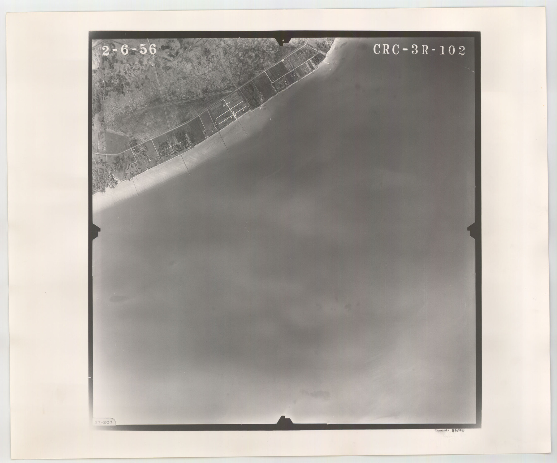
Flight Mission No. CRC-3R, Frame 102, Chambers County
CRC-3R-102
-
Map/Doc
84840
-
Collection
General Map Collection
-
Object Dates
1956/2/6 (Creation Date)
-
People and Organizations
U. S. Department of Agriculture (Publisher)
-
Counties
Chambers
-
Subjects
Aerial Photograph
-
Height x Width
18.7 x 22.5 inches
47.5 x 57.2 cm
-
Comments
Flown by Jack Ammann Photogrammetric Engineers, Inc. of San Antonio, Texas.
Part of: General Map Collection
Hemphill County Rolled Sketch 13

Print $20.00
- Digital $50.00
Hemphill County Rolled Sketch 13
1905
Size 20.7 x 28.9 inches
Map/Doc 6193
Throckmorton County Sketch File 7

Print $8.00
- Digital $50.00
Throckmorton County Sketch File 7
Size 14.3 x 8.8 inches
Map/Doc 38090
Flight Mission No. DQN-2K, Frame 92, Calhoun County

Print $20.00
- Digital $50.00
Flight Mission No. DQN-2K, Frame 92, Calhoun County
1953
Size 18.6 x 22.2 inches
Map/Doc 84282
Montgomery County Working Sketch 68

Print $20.00
- Digital $50.00
Montgomery County Working Sketch 68
1972
Size 25.9 x 33.7 inches
Map/Doc 71175
Chambers County Sketch File 58

Print $2.00
- Digital $50.00
Chambers County Sketch File 58
1995
Size 9.1 x 14.7 inches
Map/Doc 18108
Gray County Boundary File 4

Print $34.00
- Digital $50.00
Gray County Boundary File 4
Size 11.4 x 8.9 inches
Map/Doc 53876
Gulf Intracoastal Waterway, Tex. - Aransas Bay to Corpus Christi Bay - Modified Route of Main Channel/Dredging

Print $20.00
- Digital $50.00
Gulf Intracoastal Waterway, Tex. - Aransas Bay to Corpus Christi Bay - Modified Route of Main Channel/Dredging
1958
Size 31.3 x 42.6 inches
Map/Doc 61894
America's Fun-Tier: Texas 1966 Official State Highway Map

Digital $50.00
America's Fun-Tier: Texas 1966 Official State Highway Map
Size 28.0 x 36.2 inches
Map/Doc 94323
Frio County Rolled Sketch 14

Print $20.00
- Digital $50.00
Frio County Rolled Sketch 14
1949
Size 25.3 x 32.9 inches
Map/Doc 5921

Dimmit County Working Sketch 29
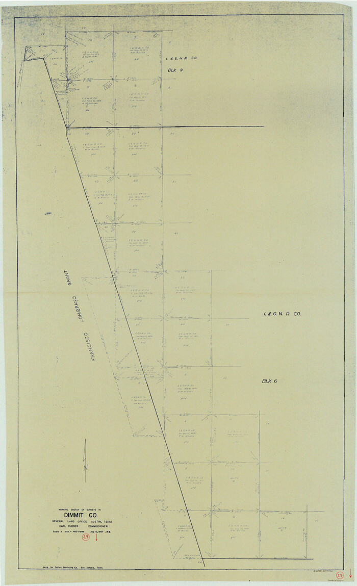
Print $40.00
- Digital $50.00
Dimmit County Working Sketch 29
1957
Size 58.1 x 36.2 inches
Map/Doc 68690
Wood County Working Sketch 18

Print $20.00
- Digital $50.00
Wood County Working Sketch 18
1959
Size 31.5 x 27.6 inches
Map/Doc 62018
You may also like
Reagan County Sketch File 5

Print $12.00
- Digital $50.00
Reagan County Sketch File 5
1927
Size 11.2 x 8.7 inches
Map/Doc 34980
Flight Mission No. CLL-4N, Frame 35, Willacy County

Print $20.00
- Digital $50.00
Flight Mission No. CLL-4N, Frame 35, Willacy County
1954
Size 18.3 x 22.0 inches
Map/Doc 87108
Erath County Sketch File 1

Print $4.00
- Digital $50.00
Erath County Sketch File 1
Size 3.9 x 8.1 inches
Map/Doc 22253
Culberson County Sketch File 18

Print $8.00
- Digital $50.00
Culberson County Sketch File 18
Size 14.3 x 8.8 inches
Map/Doc 20185

Carta Hidrografica

Print $20.00
- Digital $50.00
Carta Hidrografica
1897
Size 26.0 x 34.3 inches
Map/Doc 96803
Gray County Rolled Sketch 3

Print $105.00
- Digital $50.00
Gray County Rolled Sketch 3
Size 10.6 x 15.5 inches
Map/Doc 45287
Washington County

Print $20.00
- Digital $50.00
Washington County
1976
Size 30.4 x 45.6 inches
Map/Doc 77451
Flight Mission No. BQR-5K, Frame 67, Brazoria County

Print $20.00
- Digital $50.00
Flight Mission No. BQR-5K, Frame 67, Brazoria County
1952
Size 18.7 x 22.5 inches
Map/Doc 84012
Fractional Township No. 8 South Range No. 2 West of the Indian Meridian, Indian Territory

Print $20.00
- Digital $50.00
Fractional Township No. 8 South Range No. 2 West of the Indian Meridian, Indian Territory
1898
Size 19.2 x 24.4 inches
Map/Doc 75196
Texas and Mexico showing Houston and Texas Central System of Railways

Print $20.00
- Digital $50.00
Texas and Mexico showing Houston and Texas Central System of Railways
1885
Size 29.0 x 21.6 inches
Map/Doc 94274
Cameron County Sketch File 15

Print $26.00
- Digital $50.00
Cameron County Sketch File 15
1999
Size 11.2 x 8.7 inches
Map/Doc 17320