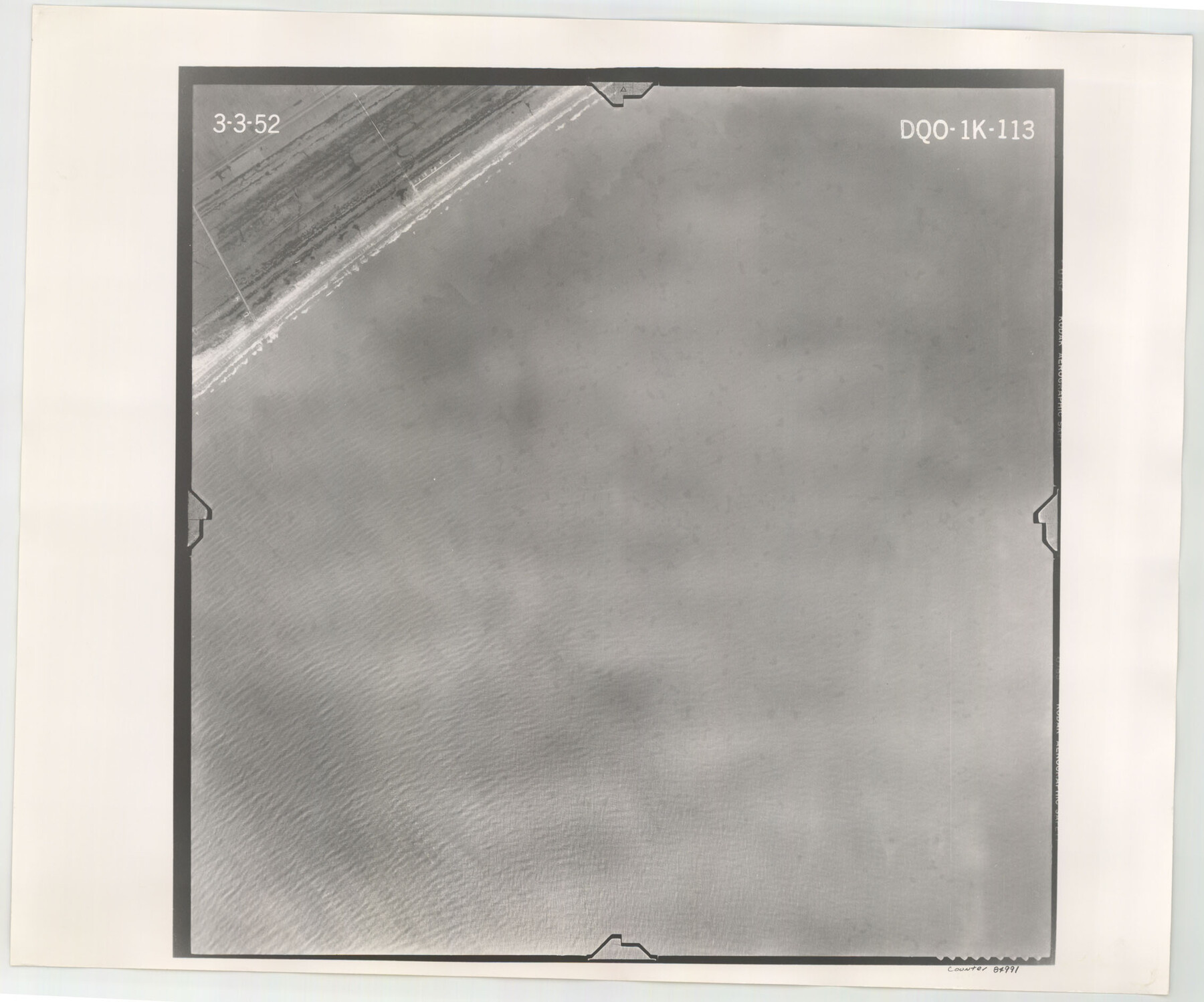
Flight Mission No. DQO-1K, Frame 113, Galveston County
DQO-1K-113
-
Map/Doc
84991
-
Collection
General Map Collection
-
Object Dates
1952/3/3 (Creation Date)
-
People and Organizations
U. S. Department of Agriculture (Publisher)
-
Counties
Galveston
-
Subjects
Aerial Photograph
-
Height x Width
18.9 x 22.7 inches
48.0 x 57.7 cm
-
Comments
Flown by Aero Exploration Company of Tulsa, Oklahoma.
Part of: General Map Collection
Maverick County Rolled Sketch 17

Print $20.00
- Digital $50.00
Maverick County Rolled Sketch 17
1910
Size 20.2 x 31.7 inches
Map/Doc 6710
Coleman County Rolled Sketch 6

Print $20.00
- Digital $50.00
Coleman County Rolled Sketch 6
Size 20.9 x 14.4 inches
Map/Doc 5529
Newton County Working Sketch 36

Print $20.00
- Digital $50.00
Newton County Working Sketch 36
1960
Size 29.9 x 39.1 inches
Map/Doc 71282
Sketch of coast of Texas, Laguna Madre from Pt. of Rocks to Corpus Christi [and accompanying letter]
![72962, Sketch of coast of Texas, Laguna Madre from Pt. of Rocks to Corpus Christi [and accompanying letter], General Map Collection](https://historictexasmaps.com/wmedia_w700/maps/72962.tif.jpg)
Print $20.00
- Digital $50.00
Sketch of coast of Texas, Laguna Madre from Pt. of Rocks to Corpus Christi [and accompanying letter]
1881
Size 26.5 x 18.3 inches
Map/Doc 72962
Flight Mission No. CGI-3N, Frame 45, Cameron County

Print $20.00
- Digital $50.00
Flight Mission No. CGI-3N, Frame 45, Cameron County
1954
Size 18.5 x 22.2 inches
Map/Doc 84551
Nueces County Rolled Sketch 125

Print $34.00
Nueces County Rolled Sketch 125
1998
Size 18.1 x 25.0 inches
Map/Doc 7160
Terry County Working Sketch 3

Print $40.00
- Digital $50.00
Terry County Working Sketch 3
1953
Size 125.9 x 28.4 inches
Map/Doc 62108
Live Oak County Sketch File 34

Print $28.00
- Digital $50.00
Live Oak County Sketch File 34
1963
Size 31.0 x 23.9 inches
Map/Doc 12011
Flight Mission No. CGI-2N, Frame 183, Cameron County

Print $20.00
- Digital $50.00
Flight Mission No. CGI-2N, Frame 183, Cameron County
1954
Size 18.7 x 22.2 inches
Map/Doc 84543
Flight Mission No. DQO-2K, Frame 96, Galveston County

Print $20.00
- Digital $50.00
Flight Mission No. DQO-2K, Frame 96, Galveston County
1952
Size 18.8 x 22.4 inches
Map/Doc 85023
Henderson County Rolled Sketch 11

Print $20.00
- Digital $50.00
Henderson County Rolled Sketch 11
1915
Size 29.5 x 42.6 inches
Map/Doc 75947
Denton County Sketch File 3

Print $4.00
- Digital $50.00
Denton County Sketch File 3
1855
Size 12.5 x 8.2 inches
Map/Doc 20688
You may also like
Willacy County Sketch File 1

Print $30.00
- Digital $50.00
Willacy County Sketch File 1
1981
Size 11.2 x 8.6 inches
Map/Doc 40234
Montague County Working Sketch 38

Print $20.00
- Digital $50.00
Montague County Working Sketch 38
1990
Size 14.9 x 15.6 inches
Map/Doc 71104
[Sketch for Mineral Application 21493 - Clay County]
![65625, [Sketch for Mineral Application 21493 - Clay County], General Map Collection](https://historictexasmaps.com/wmedia_w700/maps/65625-1.tif.jpg)
Print $40.00
- Digital $50.00
[Sketch for Mineral Application 21493 - Clay County]
Size 62.4 x 34.8 inches
Map/Doc 65625
Val Verde County Working Sketch 88

Print $20.00
- Digital $50.00
Val Verde County Working Sketch 88
1973
Size 29.0 x 36.9 inches
Map/Doc 72223

Reagan County Working Sketch 33
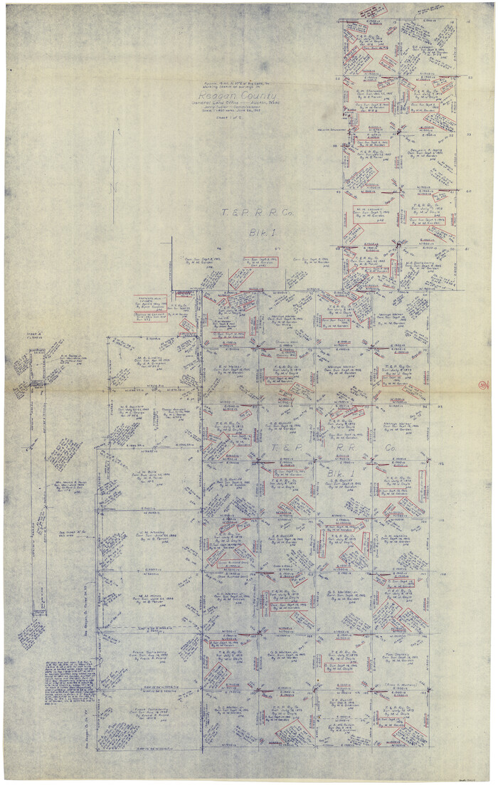
Print $40.00
- Digital $50.00
Reagan County Working Sketch 33
1965
Size 66.2 x 42.0 inches
Map/Doc 71875
Bailey County Sketch File 8

Print $6.00
- Digital $50.00
Bailey County Sketch File 8
1913
Size 8.8 x 14.3 inches
Map/Doc 13962
Hartley County Rolled Sketch 2

Print $20.00
- Digital $50.00
Hartley County Rolled Sketch 2
Size 41.2 x 27.6 inches
Map/Doc 6158
Morris County Rolled Sketch 2A

Print $20.00
- Digital $50.00
Morris County Rolled Sketch 2A
Size 22.7 x 17.7 inches
Map/Doc 10227
Travis County Rolled Sketch 16

Print $20.00
- Digital $50.00
Travis County Rolled Sketch 16
1940
Size 21.0 x 18.4 inches
Map/Doc 8018
Burleson County Working Sketch 20

Print $20.00
- Digital $50.00
Burleson County Working Sketch 20
1980
Size 19.5 x 16.6 inches
Map/Doc 67739
Trinity County Sketch File 1

Print $4.00
- Digital $50.00
Trinity County Sketch File 1
1855
Size 8.3 x 8.2 inches
Map/Doc 38488