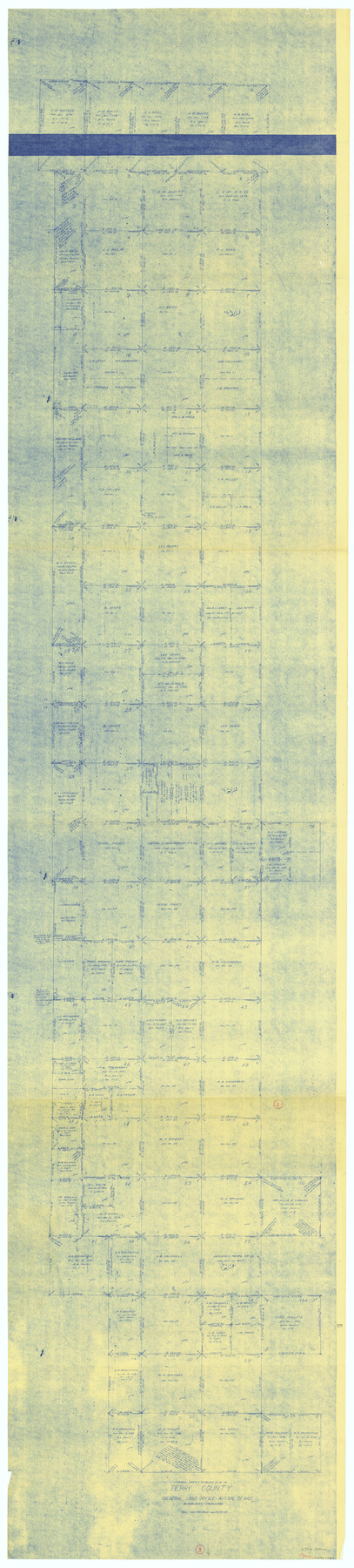
Terry County Working Sketch 3
-
Map/Doc
62108
-
Collection
General Map Collection
-
Object Dates
1/28/1953 (Creation Date)
-
People and Organizations
Herman Forbes (Draftsman)
-
Counties
Terry
-
Subjects
Surveying Working Sketch
-
Height x Width
125.9 x 28.4 inches
319.8 x 72.1 cm
-
Scale
1" = 400 varas
Part of: General Map Collection
Walker County Working Sketch 17

Print $20.00
- Digital $50.00
Walker County Working Sketch 17
1982
Size 19.9 x 20.8 inches
Map/Doc 72297
Flight Mission No. BRA-16M, Frame 176, Jefferson County

Print $20.00
- Digital $50.00
Flight Mission No. BRA-16M, Frame 176, Jefferson County
1953
Size 18.7 x 22.3 inches
Map/Doc 85774
Flight Mission No. CRC-4R, Frame 181, Chambers County

Print $20.00
- Digital $50.00
Flight Mission No. CRC-4R, Frame 181, Chambers County
1956
Size 18.5 x 22.2 inches
Map/Doc 84932
Terrell County Sketch File 33

Print $20.00
- Digital $50.00
Terrell County Sketch File 33
1924
Size 18.2 x 27.6 inches
Map/Doc 12427

Public School Land Field Note Volume Index

Public School Land Field Note Volume Index
2023
Size 8.5 x 11.0 inches
Map/Doc 97176
Travis County Working Sketch 61

Print $20.00
- Digital $50.00
Travis County Working Sketch 61
1995
Size 20.9 x 24.7 inches
Map/Doc 69445
Stonewall County

Print $20.00
- Digital $50.00
Stonewall County
1933
Size 40.3 x 34.5 inches
Map/Doc 77428
Tom Green County Rolled Sketch 11

Print $20.00
- Digital $50.00
Tom Green County Rolled Sketch 11
Size 33.0 x 27.9 inches
Map/Doc 7998
Denton County Sketch File 43

Print $20.00
- Digital $50.00
Denton County Sketch File 43
2006
Size 11.0 x 8.5 inches
Map/Doc 83610
[Sketch for Mineral Application 1112 - Colorado River, H. E. Chambers]
![65640, [Sketch for Mineral Application 1112 - Colorado River, H. E. Chambers], General Map Collection](https://historictexasmaps.com/wmedia_w700/maps/65640.tif.jpg)
Print $20.00
- Digital $50.00
[Sketch for Mineral Application 1112 - Colorado River, H. E. Chambers]
1918
Size 17.2 x 28.3 inches
Map/Doc 65640
Frio County Rolled Sketch 17

Print $20.00
- Digital $50.00
Frio County Rolled Sketch 17
1953
Size 32.4 x 44.5 inches
Map/Doc 8907
You may also like
Val Verde County Sketch File Z14

Print $20.00
- Digital $50.00
Val Verde County Sketch File Z14
1899
Size 22.1 x 20.6 inches
Map/Doc 12556
[Parts of Blocks Z, L, M-21, M-15, and 46]
![91831, [Parts of Blocks Z, L, M-21, M-15, and 46], Twichell Survey Records](https://historictexasmaps.com/wmedia_w700/maps/91831-1.tif.jpg)
Print $20.00
- Digital $50.00
[Parts of Blocks Z, L, M-21, M-15, and 46]
Size 21.2 x 16.7 inches
Map/Doc 91831
Map of Cass County

Print $20.00
- Digital $50.00
Map of Cass County
1847
Size 21.3 x 18.4 inches
Map/Doc 3368
Hutchinson County

Print $20.00
- Digital $50.00
Hutchinson County
1891
Size 19.7 x 24.5 inches
Map/Doc 91155
Cameron County Working Sketch 1

Print $20.00
- Digital $50.00
Cameron County Working Sketch 1
Size 42.8 x 30.1 inches
Map/Doc 67880
State of Texas

Print $40.00
- Digital $50.00
State of Texas
1965
Size 42.8 x 52.5 inches
Map/Doc 2095
Martin County Rolled Sketch 8

Print $20.00
- Digital $50.00
Martin County Rolled Sketch 8
Size 28.8 x 20.9 inches
Map/Doc 6668
Houston County Working Sketch 33

Print $40.00
- Digital $50.00
Houston County Working Sketch 33
1987
Size 37.6 x 58.7 inches
Map/Doc 66263
Live Oak County Sketch File 7

Print $4.00
- Digital $50.00
Live Oak County Sketch File 7
1875
Size 8.8 x 8.3 inches
Map/Doc 30259
Hardin County Working Sketch 28

Print $20.00
- Digital $50.00
Hardin County Working Sketch 28
1956
Size 18.8 x 18.9 inches
Map/Doc 63426
Parker County Sketch File 30

Print $4.00
- Digital $50.00
Parker County Sketch File 30
Size 6.4 x 7.0 inches
Map/Doc 33570
Walker County Sketch File 6

Print $4.00
- Digital $50.00
Walker County Sketch File 6
1876
Size 8.1 x 6.1 inches
Map/Doc 39557