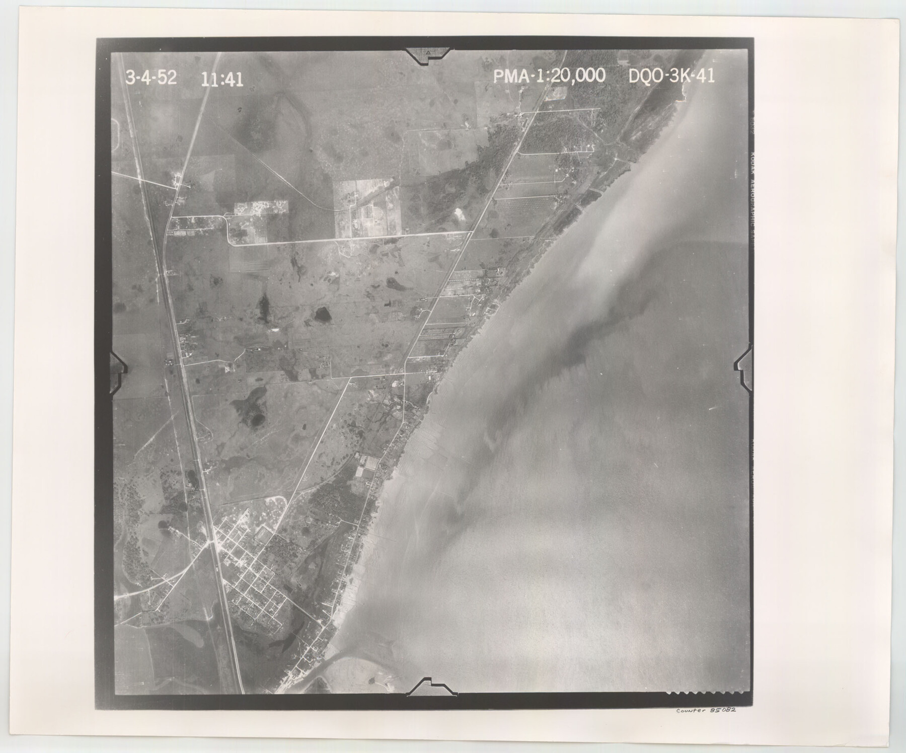
Flight Mission No. DQO-3K, Frame 41, Galveston County
DQO-3K-41
-
Map/Doc
85082
-
Collection
General Map Collection
-
Object Dates
1952/3/4 (Creation Date)
-
People and Organizations
U. S. Department of Agriculture (Publisher)
-
Counties
Galveston
-
Subjects
Aerial Photograph
-
Height x Width
18.7 x 22.5 inches
47.5 x 57.2 cm
-
Comments
Flown by Aero Exploration Company of Tulsa, Oklahoma.
Part of: General Map Collection
Flight Mission No. BQY-4M, Frame 70, Harris County

Print $20.00
- Digital $50.00
Flight Mission No. BQY-4M, Frame 70, Harris County
1953
Size 18.7 x 22.4 inches
Map/Doc 85279
Coryell County Sketch File 1

Print $13.00
- Digital $50.00
Coryell County Sketch File 1
1852
Size 15.9 x 11.0 inches
Map/Doc 19334
Guadalupe County Sketch File 15a

Print $9.00
- Digital $50.00
Guadalupe County Sketch File 15a
Size 10.3 x 8.2 inches
Map/Doc 24687
Uvalde County Working Sketch 5

Print $20.00
- Digital $50.00
Uvalde County Working Sketch 5
1927
Size 13.4 x 18.0 inches
Map/Doc 72075
Montgomery County Working Sketch 5

Print $20.00
- Digital $50.00
Montgomery County Working Sketch 5
1932
Size 31.6 x 37.0 inches
Map/Doc 71111
Comal County Working Sketch 11

Print $20.00
- Digital $50.00
Comal County Working Sketch 11
1978
Size 33.2 x 35.2 inches
Map/Doc 68177
Texas-Oklahoma Paris Quadrangle

Print $20.00
- Digital $50.00
Texas-Oklahoma Paris Quadrangle
Size 22.3 x 18.4 inches
Map/Doc 75107

Washington County Sketch File 2

Print $4.00
- Digital $50.00
Washington County Sketch File 2
1855
Size 8.3 x 12.5 inches
Map/Doc 39646
Clay County Sketch File 42

Print $20.00
- Digital $50.00
Clay County Sketch File 42
Size 22.8 x 31.0 inches
Map/Doc 11093
Hopkins County Sketch File 22

Print $4.00
- Digital $50.00
Hopkins County Sketch File 22
1870
Size 10.2 x 8.1 inches
Map/Doc 26730
United States - Gulf Coast - Galveston to Rio Grande

Print $20.00
- Digital $50.00
United States - Gulf Coast - Galveston to Rio Grande
1919
Size 26.5 x 18.2 inches
Map/Doc 72747
You may also like
Flight Mission No. BQY-4M, Frame 42, Harris County

Print $20.00
- Digital $50.00
Flight Mission No. BQY-4M, Frame 42, Harris County
1953
Size 18.7 x 22.4 inches
Map/Doc 85257
Kleberg County Rolled Sketch 10-40

Print $20.00
- Digital $50.00
Kleberg County Rolled Sketch 10-40
1952
Size 38.1 x 34.0 inches
Map/Doc 9392

Atascosa County Boundary File 3

Print $18.00
- Digital $50.00
Atascosa County Boundary File 3
Size 8.7 x 8.5 inches
Map/Doc 50168
Map of Refugio County

Print $20.00
- Digital $50.00
Map of Refugio County
1875
Size 20.9 x 28.2 inches
Map/Doc 3988
General Highway Map, Tom Green County, Texas

Print $20.00
General Highway Map, Tom Green County, Texas
1961
Size 18.4 x 25.0 inches
Map/Doc 79678
Gulf of Mexico

Print $20.00
- Digital $50.00
Gulf of Mexico
1961
Size 36.6 x 43.3 inches
Map/Doc 73551
Hunt County Working Sketch 4

Print $20.00
- Digital $50.00
Hunt County Working Sketch 4
1923
Size 21.3 x 30.5 inches
Map/Doc 66351
Grant of Miguel Rabago

Print $2.00
- Digital $50.00
Grant of Miguel Rabago
Size 8.6 x 8.4 inches
Map/Doc 76047
Bexar County Rolled Sketch 6

Print $40.00
- Digital $50.00
Bexar County Rolled Sketch 6
Size 36.6 x 54.9 inches
Map/Doc 81902
Jones County Sketch File 19

Print $56.00
- Digital $50.00
Jones County Sketch File 19
1875
Size 11.1 x 8.6 inches
Map/Doc 28516
San Jacinto County Working Sketch 10

Print $20.00
- Digital $50.00
San Jacinto County Working Sketch 10
1935
Size 40.1 x 40.1 inches
Map/Doc 63723