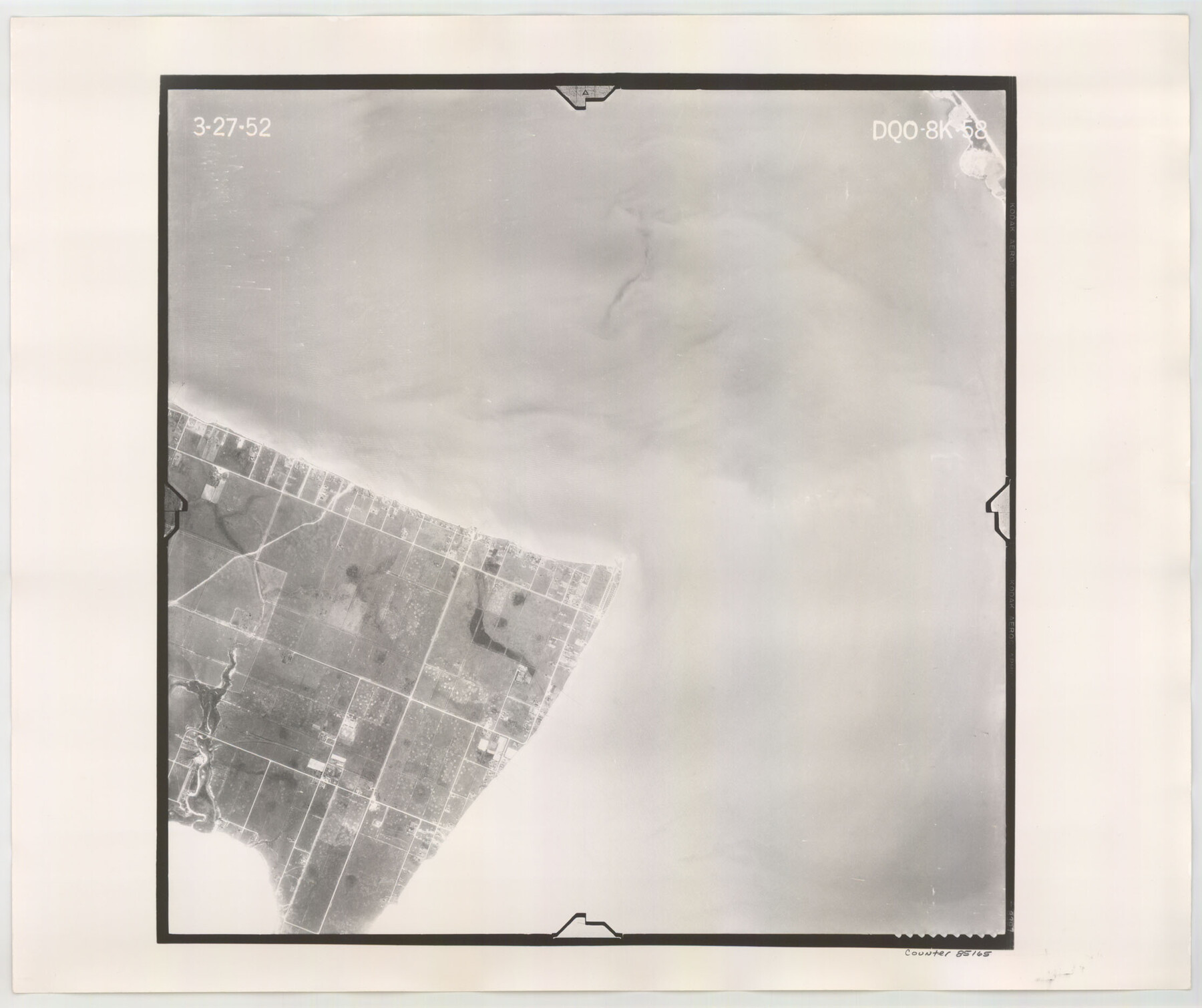
Flight Mission No. DQO-8K, Frame 58, Galveston County
DQO-8K-58
-
Map/Doc
85165
-
Collection
General Map Collection
-
Object Dates
1952/3/27 (Creation Date)
-
People and Organizations
U. S. Department of Agriculture (Publisher)
-
Counties
Galveston
-
Subjects
Aerial Photograph
-
Height x Width
18.7 x 22.3 inches
47.5 x 56.6 cm
-
Comments
Flown by Aero Exploration Company of Tulsa, Oklahoma.
Part of: General Map Collection
Bandera County Working Sketch 41

Print $20.00
- Digital $50.00
Bandera County Working Sketch 41
1977
Size 31.3 x 37.7 inches
Map/Doc 67637
Kerr County Working Sketch 5

Print $20.00
- Digital $50.00
Kerr County Working Sketch 5
1947
Size 21.9 x 19.8 inches
Map/Doc 70036
Flight Mission No. DAG-17K, Frame 141, Matagorda County

Print $20.00
- Digital $50.00
Flight Mission No. DAG-17K, Frame 141, Matagorda County
1952
Size 16.3 x 16.4 inches
Map/Doc 86358
Zapata County Sketch File 4a

Print $4.00
- Digital $50.00
Zapata County Sketch File 4a
1891
Size 14.2 x 8.8 inches
Map/Doc 40908
Aransas County NRC Article 33.136 Sketch 2

Print $26.00
- Digital $50.00
Aransas County NRC Article 33.136 Sketch 2
2001
Size 18.6 x 24.2 inches
Map/Doc 61643

Culberson County Working Sketch 34

Print $20.00
- Digital $50.00
Culberson County Working Sketch 34
1962
Size 35.2 x 26.0 inches
Map/Doc 68487
DeWitt County Working Sketch 2b

Print $20.00
- Digital $50.00
DeWitt County Working Sketch 2b
1940
Size 25.1 x 30.0 inches
Map/Doc 68647
Jim Hogg County Sketch File 10

Print $22.00
- Digital $50.00
Jim Hogg County Sketch File 10
1947
Size 14.3 x 8.7 inches
Map/Doc 28423
Val Verde County Sketch File A1 1/2

Print $20.00
- Digital $50.00
Val Verde County Sketch File A1 1/2
Size 24.8 x 17.3 inches
Map/Doc 12539
Flight Mission No. BRE-2P, Frame 72, Nueces County

Print $20.00
- Digital $50.00
Flight Mission No. BRE-2P, Frame 72, Nueces County
1956
Size 18.5 x 22.2 inches
Map/Doc 86767
Leon County Rolled Sketch 6

Print $20.00
- Digital $50.00
Leon County Rolled Sketch 6
1951
Size 31.7 x 37.1 inches
Map/Doc 6596
You may also like
Mills County Boundary File 1b

Print $4.00
- Digital $50.00
Mills County Boundary File 1b
Size 10.6 x 8.1 inches
Map/Doc 57276
Official map of Dallas County, Texas

Print $20.00
Official map of Dallas County, Texas
1886
Size 22.7 x 17.3 inches
Map/Doc 93592
Val Verde County Working Sketch 3

Print $20.00
- Digital $50.00
Val Verde County Working Sketch 3
Size 17.5 x 24.1 inches
Map/Doc 72138
Andrews County Working Sketch 3

Print $40.00
- Digital $50.00
Andrews County Working Sketch 3
1953
Size 78.9 x 35.8 inches
Map/Doc 67049

Bosque County Sketch File 26

Print $4.00
- Digital $50.00
Bosque County Sketch File 26
1868
Size 8.1 x 7.5 inches
Map/Doc 14811
Galveston Bay, Texas

Print $20.00
- Digital $50.00
Galveston Bay, Texas
1905
Size 24.8 x 18.5 inches
Map/Doc 65390
Coryell County Sketch File 3

Print $4.00
- Digital $50.00
Coryell County Sketch File 3
1852
Size 8.3 x 10.1 inches
Map/Doc 19340
Map of Pecos County

Print $40.00
- Digital $50.00
Map of Pecos County
1895
Size 58.1 x 63.4 inches
Map/Doc 16788
Presidio County Working Sketch 77

Print $20.00
- Digital $50.00
Presidio County Working Sketch 77
1964
Size 36.0 x 39.0 inches
Map/Doc 71754
El Paso County Boundary File 13

Print $37.00
- Digital $50.00
El Paso County Boundary File 13
Size 11.1 x 8.6 inches
Map/Doc 53161
Irion County Working Sketch 11

Print $20.00
- Digital $50.00
Irion County Working Sketch 11
1959
Size 43.6 x 30.6 inches
Map/Doc 66420