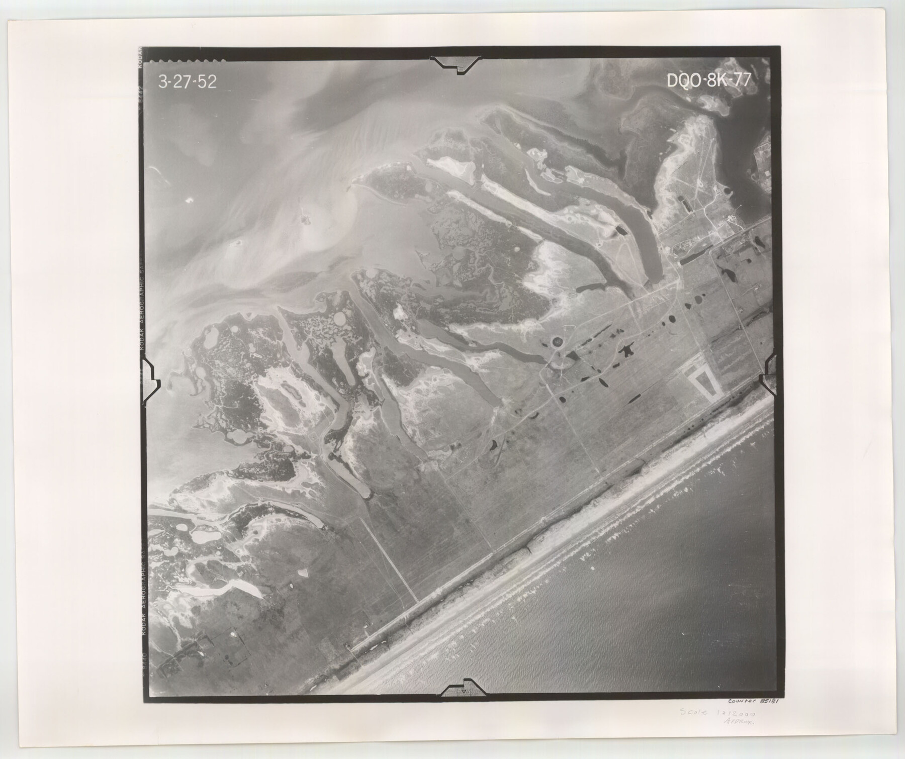
Flight Mission No. DQO-8K, Frame 77, Galveston County
DQO-8K-77
-
Map/Doc
85181
-
Collection
General Map Collection
-
Object Dates
1952/3/27 (Creation Date)
-
People and Organizations
U. S. Department of Agriculture (Publisher)
-
Counties
Galveston
-
Subjects
Aerial Photograph
-
Height x Width
18.9 x 22.5 inches
48.0 x 57.2 cm
-
Comments
Flown by Aero Exploration Company of Tulsa, Oklahoma.
Part of: General Map Collection
Sterling County Rolled Sketch 15

Print $20.00
- Digital $50.00
Sterling County Rolled Sketch 15
Size 30.0 x 31.2 inches
Map/Doc 9947
Map of Texas and Pacific Ry. Company's Surveys in the 80 Mile Reserve

Print $40.00
- Digital $50.00
Map of Texas and Pacific Ry. Company's Surveys in the 80 Mile Reserve
1885
Map/Doc 2241
[Surveys along the San Antonio Road and Cottonwood Creek]
![233, [Surveys along the San Antonio Road and Cottonwood Creek], General Map Collection](https://historictexasmaps.com/wmedia_w700/maps/233.tif.jpg)
Print $2.00
- Digital $50.00
[Surveys along the San Antonio Road and Cottonwood Creek]
1847
Size 9.1 x 8.3 inches
Map/Doc 233

[Surveys along the Nueces River, San Patricio District]
![69738, [Surveys along the Nueces River, San Patricio District], General Map Collection](https://historictexasmaps.com/wmedia_w700/maps/69738.tif.jpg)
Print $2.00
- Digital $50.00
[Surveys along the Nueces River, San Patricio District]
1842
Size 10.3 x 7.9 inches
Map/Doc 69738
Crockett County Rolled Sketch 79

Print $40.00
- Digital $50.00
Crockett County Rolled Sketch 79
1954
Size 37.3 x 48.3 inches
Map/Doc 8724
[Surveys in Burleson County]
![78355, [Surveys in Burleson County], General Map Collection](https://historictexasmaps.com/wmedia_w700/maps/78355.tif.jpg)
Print $20.00
- Digital $50.00
[Surveys in Burleson County]
Size 19.6 x 28.3 inches
Map/Doc 78355
[Sketch for Mineral Application 11108 - Greens Bayou]
![2786, [Sketch for Mineral Application 11108 - Greens Bayou], General Map Collection](https://historictexasmaps.com/wmedia_w700/maps/2786-1.tif.jpg)
Print $20.00
- Digital $50.00
[Sketch for Mineral Application 11108 - Greens Bayou]
1922
Size 46.0 x 21.0 inches
Map/Doc 2786
Blanco County Sketch File 43

Print $6.00
- Digital $50.00
Blanco County Sketch File 43
1901
Size 9.7 x 6.2 inches
Map/Doc 14666

"The Texas and Pacific Railway Company Reservation and Land Grant"

Print $38.00
- Digital $50.00
"The Texas and Pacific Railway Company Reservation and Land Grant"
1962
Size 9.3 x 6.5 inches
Map/Doc 62213
Harris County Working Sketch 34

Print $40.00
- Digital $50.00
Harris County Working Sketch 34
1937
Size 37.5 x 52.1 inches
Map/Doc 65926
You may also like
San Saba County

Print $20.00
- Digital $50.00
San Saba County
1987
Size 46.3 x 42.5 inches
Map/Doc 73284
Spanish land grants (other than porciones) in the trans-Nueces

Spanish land grants (other than porciones) in the trans-Nueces
2009
Size 11.0 x 8.5 inches
Map/Doc 94046
Republic Counties. December 29, 1845

Print $20.00
Republic Counties. December 29, 1845
2020
Size 24.5 x 21.7 inches
Map/Doc 96319
Hudspeth County Working Sketch 22

Print $40.00
- Digital $50.00
Hudspeth County Working Sketch 22
1967
Size 45.8 x 62.8 inches
Map/Doc 66304
Andrews County Working Sketch 4

Print $20.00
- Digital $50.00
Andrews County Working Sketch 4
1954
Size 42.8 x 19.2 inches
Map/Doc 67050
[Surveys in the Jasper District]
![69734, [Surveys in the Jasper District], General Map Collection](https://historictexasmaps.com/wmedia_w700/maps/69734.tif.jpg)
Print $2.00
- Digital $50.00
[Surveys in the Jasper District]
1847
Size 9.4 x 6.9 inches
Map/Doc 69734
[East Line of Capitol Leagues 220, 221, and 228]
![90678, [East Line of Capitol Leagues 220, 221, and 228], Twichell Survey Records](https://historictexasmaps.com/wmedia_w700/maps/90678-1.tif.jpg)
Print $20.00
- Digital $50.00
[East Line of Capitol Leagues 220, 221, and 228]
Size 12.8 x 22.0 inches
Map/Doc 90678
General Highway Map, Hansford County, Texas

Print $20.00
General Highway Map, Hansford County, Texas
1961
Size 18.0 x 24.5 inches
Map/Doc 79497
Edwards County Rolled Sketch JF

Print $20.00
- Digital $50.00
Edwards County Rolled Sketch JF
1915
Size 25.2 x 30.5 inches
Map/Doc 5819
Dickens County Sketch File D2

Print $44.00
- Digital $50.00
Dickens County Sketch File D2
Size 27.2 x 19.1 inches
Map/Doc 20839
General Highway Map, Collingsworth County, Texas

Print $20.00
General Highway Map, Collingsworth County, Texas
1961
Size 18.1 x 24.6 inches
Map/Doc 79415
Jack County Sketch File 16a

Print $4.00
- Digital $50.00
Jack County Sketch File 16a
1885
Size 8.3 x 11.8 inches
Map/Doc 27551