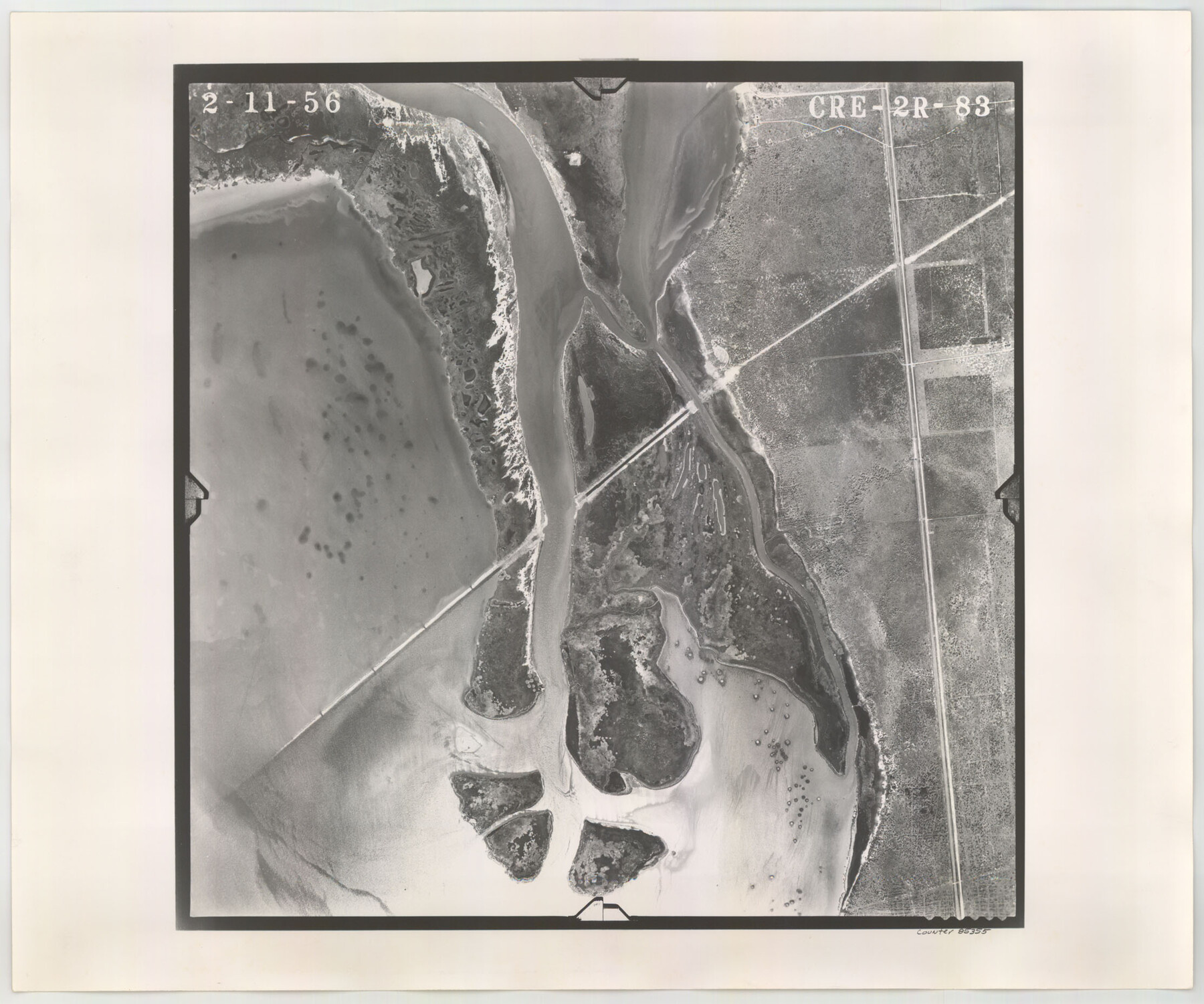
Flight Mission No. CRE-2R, Frame 83, Jackson County
CRE-2R-83
- 
                          Map/Doc85355
- 
                            CollectionGeneral Map Collection
- 
                            Object Dates1956/2/11 (Creation Date)
- 
                            People and OrganizationsU. S. Department of Agriculture (Publisher)
- 
                            CountiesJackson
- 
                            SubjectsAerial Photograph
- 
                            Height x Width18.6 x 22.3 inches47.2 x 56.6 cm
- 
                            CommentsFlown by Jack Ammann Photogrammetric Engineers of San Antonio, Texas.
Part of: General Map Collection
            Reagan County Working Sketch 11


                                            Print $20.00                    
                                             -                         Digital $50.00                                    
                Reagan County Working Sketch 11
1943
Size 19.4 x 20.9 inches
                                Map/Doc 71851
            
            United States - Gulf Coast Texas - Northern part of Laguna Madre


                                            Print $20.00                    
                                             -                         Digital $50.00                                    
                United States - Gulf Coast Texas - Northern part of Laguna Madre
1923
Size 26.7 x 18.2 inches
                                Map/Doc 72930
            
            Interfaith's Official Map: The Woodlands, a real hometown for people and companies


            Interfaith's Official Map: The Woodlands, a real hometown for people and companies
1997
Size 36.7 x 22.5 inches
                                Map/Doc 94285
            
            Coast Chart No. 210 Aransas Pass and Corpus Christi Bay with the coast to latitude 27° 12' Texas


                                            Print $20.00                    
                                             -                         Digital $50.00                                    
                Coast Chart No. 210 Aransas Pass and Corpus Christi Bay with the coast to latitude 27° 12' Texas
1887
Size 27.6 x 18.2 inches
                                Map/Doc 72789
            
            McMullen County Working Sketch 12


                                            Print $20.00                    
                                             -                         Digital $50.00                                    
                McMullen County Working Sketch 12
1938
Size 23.4 x 26.8 inches
                                Map/Doc 70713
            
            Hudspeth County Working Sketch 16


                                            Print $40.00                    
                                             -                         Digital $50.00                                    
                Hudspeth County Working Sketch 16
Size 22.2 x 56.6 inches
                                Map/Doc 69649
            
            Blanco County Sketch File 5


                                            Print $4.00                    
                                             -                         Digital $50.00                                    
                Blanco County Sketch File 5
1860
Size 9.3 x 8.3 inches
                                Map/Doc 14582
            
            Kleberg County Rolled Sketch 10-43


                                            Print $20.00                    
                                             -                         Digital $50.00                                    
                Kleberg County Rolled Sketch 10-43
1951
Size 37.2 x 34.9 inches
                                Map/Doc 9395
            
            Loving County Rolled Sketch 19


                                            Print $20.00                    
                                             -                         Digital $50.00                                    
                Loving County Rolled Sketch 19
2020
Size 24.4 x 35.3 inches
                                Map/Doc 96575
            
            McMullen County Rolled Sketch 14


                                            Print $20.00                    
                                             -                         Digital $50.00                                    
                McMullen County Rolled Sketch 14
1946
Size 33.3 x 41.0 inches
                                Map/Doc 6731
            
            Flight Mission No. CLL-1N, Frame 88, Willacy County


                                            Print $20.00                    
                                             -                         Digital $50.00                                    
                Flight Mission No. CLL-1N, Frame 88, Willacy County
1954
Size 18.4 x 22.1 inches
                                Map/Doc 87034
            
            Washington County


                                            Print $20.00                    
                                             -                         Digital $50.00                                    
                Washington County
1871
Size 11.9 x 27.7 inches
                                Map/Doc 4123
            You may also like
            Lampasas County Working Sketch 13


                                            Print $6.00                    
                                             -                         Digital $50.00                                    
                Lampasas County Working Sketch 13
1973
Size 34.4 x 27.7 inches
                                Map/Doc 70290
            
            Right of Way & Track Map, St. Louis, Brownsville & Mexico Ry. operated by St. Louis, Brownsville & Mexico Ry. Co.


                                            Print $40.00                    
                                             -                         Digital $50.00                                    
                Right of Way & Track Map, St. Louis, Brownsville & Mexico Ry. operated by St. Louis, Brownsville & Mexico Ry. Co.
1919
Size 25.5 x 57.1 inches
                                Map/Doc 64624
            
            Navarro County Working Sketch 14


                                            Print $20.00                    
                                             -                         Digital $50.00                                    
                Navarro County Working Sketch 14
1981
Size 36.8 x 33.1 inches
                                Map/Doc 71244
            
            Right of Way & Track Map, St. Louis, Brownsville & Mexico Ry. operated by St. Louis, Brownsville & Mexico Ry. Co.


                                            Print $40.00                    
                                             -                         Digital $50.00                                    
                Right of Way & Track Map, St. Louis, Brownsville & Mexico Ry. operated by St. Louis, Brownsville & Mexico Ry. Co.
1919
Size 25.6 x 57.1 inches
                                Map/Doc 64616
            
            Terrell County Working Sketch 3a


                                            Print $20.00                    
                                             -                         Digital $50.00                                    
                Terrell County Working Sketch 3a
1912
Size 26.1 x 21.2 inches
                                Map/Doc 62152
            
            Travis County Rolled Sketch 26


                                            Print $20.00                    
                                             -                         Digital $50.00                                    
                Travis County Rolled Sketch 26
1945
Size 24.6 x 25.2 inches
                                Map/Doc 8028
            
            Plat in Pecos County, Texas


                                            Print $20.00                    
                                             -                         Digital $50.00                                    
                Plat in Pecos County, Texas
Size 33.2 x 23.1 inches
                                Map/Doc 91601
            
            Boundary between Republic of Texas and US from Logan's Ferry to Red River - surveyed in 1841


                                            Print $20.00                    
                                             -                         Digital $50.00                                    
                Boundary between Republic of Texas and US from Logan's Ferry to Red River - surveyed in 1841
1841
Size 19.4 x 27.4 inches
                                Map/Doc 65415
            
            Rhyne Simpson Quirt Ave. Addition to the City of Lubbock


                                            Print $20.00                    
                                             -                         Digital $50.00                                    
                Rhyne Simpson Quirt Ave. Addition to the City of Lubbock
1951
Size 17.2 x 21.2 inches
                                Map/Doc 92878
            
            Flight Mission No. DQO-1K, Frame 19, Galveston County


                                            Print $20.00                    
                                             -                         Digital $50.00                                    
                Flight Mission No. DQO-1K, Frame 19, Galveston County
1952
Size 18.9 x 22.6 inches
                                Map/Doc 84978
            
            Central United States [Verso]
            
                                    ![94195, Central United States [Verso], General Map Collection](https://historictexasmaps.com/wmedia_w700/maps/94195.tif.jpg) 


    ![94195, Central United States [Verso], General Map Collection](https://historictexasmaps.com/wmedia_w700/maps/94195.tif.jpg) 
                                
            Central United States [Verso]
1958
Size 18.5 x 38.7 inches
                                Map/Doc 94195
             
                            