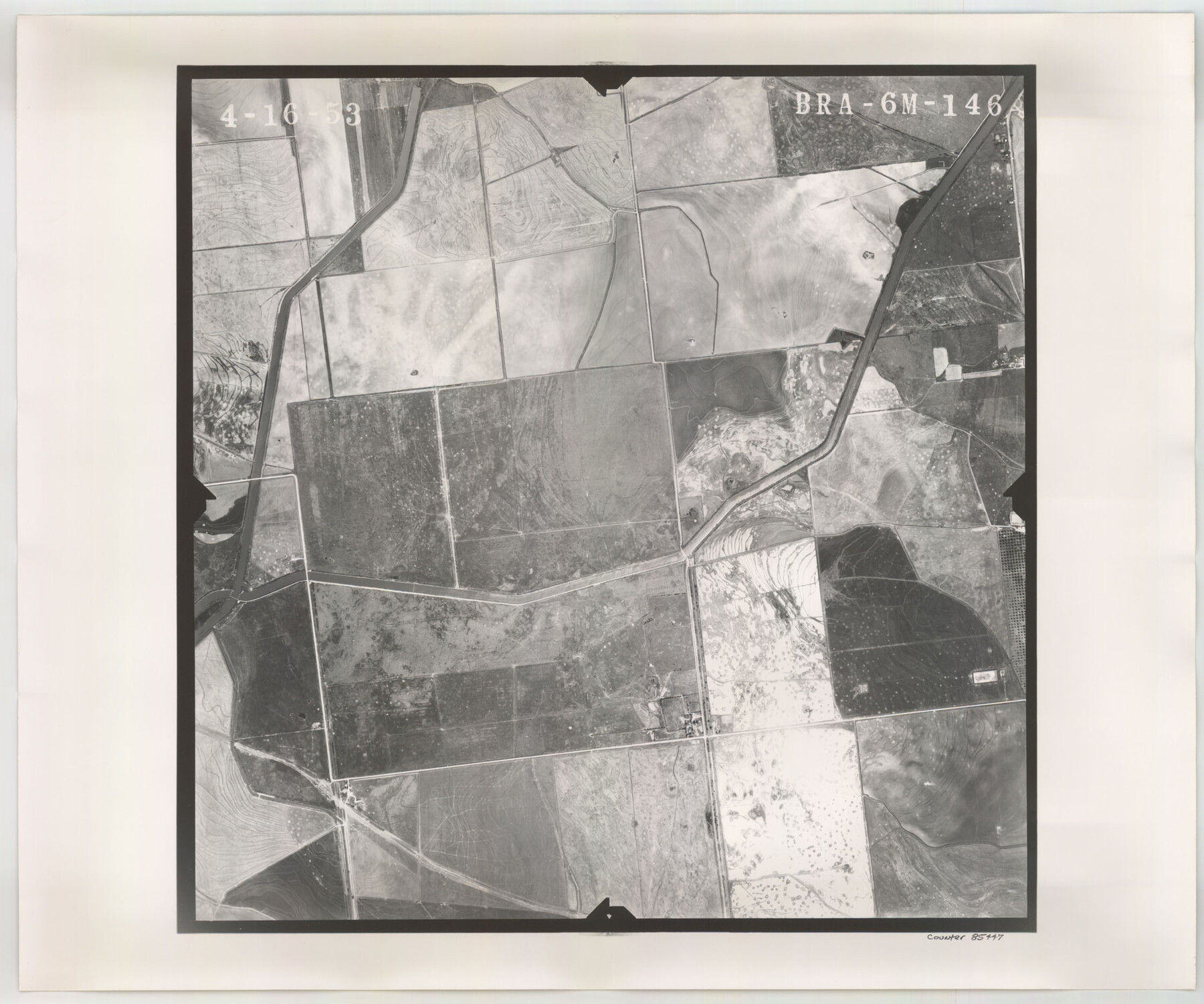
Flight Mission No. BRA-6M, Frame 146, Jefferson County
BRA-6M-146
- 
                          Map/Doc85447
- 
                            CollectionGeneral Map Collection
- 
                            Object Dates1953/4/16 (Creation Date)
- 
                            People and OrganizationsU. S. Department of Agriculture (Publisher)
- 
                            CountiesJefferson
- 
                            SubjectsAerial Photograph
- 
                            Height x Width18.6 x 22.3 inches47.2 x 56.6 cm
- 
                            CommentsFlown by Jack Ammann Photogrammetric Engineers of San Antonio, Texas.
Part of: General Map Collection
            Gonzales County Working Sketch 11


                                            Print $20.00                    
                                             -                         Digital $50.00                                    
                Gonzales County Working Sketch 11
1981
Size 22.2 x 11.3 inches
                                Map/Doc 63227
            
            Red River Co.


                                            Print $20.00                    
                                             -                         Digital $50.00                                    
                Red River Co.
1905
Size 46.7 x 39.6 inches
                                Map/Doc 66994
            
            Flight Mission No. DAG-22K, Frame 85, Matagorda County


                                            Print $20.00                    
                                             -                         Digital $50.00                                    
                Flight Mission No. DAG-22K, Frame 85, Matagorda County
1953
Size 15.7 x 15.4 inches
                                Map/Doc 86469
            
            Duval County Working Sketch 38


                                            Print $20.00                    
                                             -                         Digital $50.00                                    
                Duval County Working Sketch 38
1960
Size 18.3 x 22.8 inches
                                Map/Doc 68762
            
            Louisiana and Texas Intracoastal Waterway - Gilchrist to Port Bolivar, Maintenance Dredging - Sheet 2


                                            Print $20.00                    
                                             -                         Digital $50.00                                    
                Louisiana and Texas Intracoastal Waterway - Gilchrist to Port Bolivar, Maintenance Dredging - Sheet 2
1937
Size 31.0 x 40.8 inches
                                Map/Doc 61821
            
            Lynn County Sketch File 6


                                            Print $20.00                    
                                             -                         Digital $50.00                                    
                Lynn County Sketch File 6
1928
Size 24.2 x 36.7 inches
                                Map/Doc 10529
            
            Wharton County Working Sketch 21


                                            Print $20.00                    
                                             -                         Digital $50.00                                    
                Wharton County Working Sketch 21
1937
Size 16.9 x 20.8 inches
                                Map/Doc 72485
            
            [Sketch of expeditions, trails in Jones, Taylor, Shackelford, Callahan, Buchanan/Stephens and Eastland Counties]
            
                                    ![65405, [Sketch of expeditions, trails in Jones, Taylor, Shackelford, Callahan, Buchanan/Stephens and Eastland Counties], General Map Collection](https://historictexasmaps.com/wmedia_w700/maps/65405.tif.jpg) 


    ![65405, [Sketch of expeditions, trails in Jones, Taylor, Shackelford, Callahan, Buchanan/Stephens and Eastland Counties], General Map Collection](https://historictexasmaps.com/wmedia_w700/maps/65405.tif.jpg) 
                                
            
                                            Print $4.00                    
                                             -                         Digital $50.00                                    
                [Sketch of expeditions, trails in Jones, Taylor, Shackelford, Callahan, Buchanan/Stephens and Eastland Counties]
1873
Size 10.8 x 18.3 inches
                                Map/Doc 65405
            
            Flight Mission No. DCL-6C, Frame 139, Kenedy County


                                            Print $20.00                    
                                             -                         Digital $50.00                                    
                Flight Mission No. DCL-6C, Frame 139, Kenedy County
1943
Size 18.7 x 22.3 inches
                                Map/Doc 85965
            
            Colorado County Sketch File 35


                                            Print $13.00                    
                                             -                         Digital $50.00                                    
                Colorado County Sketch File 35
2005
Size 44.0 x 28.0 inches
                                Map/Doc 83564
            
            Atascosa County


                                            Print $20.00                    
                                             -                         Digital $50.00                                    
                Atascosa County
1873
Size 22.2 x 23.1 inches
                                Map/Doc 3249
            
            Rusk County Working Sketch 10


                                            Print $20.00                    
                                             -                         Digital $50.00                                    
                Rusk County Working Sketch 10
1980
Size 22.4 x 20.6 inches
                                Map/Doc 63645
            You may also like
            Harris County Sketch File 20a


                                            Print $4.00                    
                                             -                         Digital $50.00                                    
                Harris County Sketch File 20a
Size 8.8 x 14.4 inches
                                Map/Doc 25371
            
            Jackson County Sketch File 13


                                            Print $40.00                    
                                             -                         Digital $50.00                                    
                Jackson County Sketch File 13
Size 29.0 x 18.6 inches
                                Map/Doc 11839
            
            Travis County Working Sketch 68


                                            Print $20.00                    
                                             -                         Digital $50.00                                    
                Travis County Working Sketch 68
2019
Size 23.8 x 36.0 inches
                                Map/Doc 95687
            
            [St. L. S-W. Ry. of Texas Map of Lufkin Branch in Cherokee County Texas]
            
                                    ![64017, [St. L. S-W. Ry. of Texas Map of Lufkin Branch in Cherokee County Texas], General Map Collection](https://historictexasmaps.com/wmedia_w700/maps/64017.tif.jpg) 


    ![64017, [St. L. S-W. Ry. of Texas Map of Lufkin Branch in Cherokee County Texas], General Map Collection](https://historictexasmaps.com/wmedia_w700/maps/64017.tif.jpg) 
                                
            
                                            Print $40.00                    
                                             -                         Digital $50.00                                    
                [St. L. S-W. Ry. of Texas Map of Lufkin Branch in Cherokee County Texas]
1912
Size 22.8 x 121.4 inches
                                Map/Doc 64017
            
            Upton County Working Sketch 23


                                            Print $20.00                    
                                             -                         Digital $50.00                                    
                Upton County Working Sketch 23
1953
Size 21.4 x 20.0 inches
                                Map/Doc 69519
            
            Shelby County Working Sketch 23a


                                            Print $20.00                    
                                             -                         Digital $50.00                                    
                Shelby County Working Sketch 23a
1983
Size 28.1 x 31.0 inches
                                Map/Doc 63876
            
            [Map of the River Sabine from its mouth on the Gulf of Mexico in the sea to Logan's Ferry in Latitude 31° 58' 24" North]
            
                                    ![94005, [Map of the River Sabine from its mouth on the Gulf of Mexico in the sea to Logan's Ferry in Latitude 31° 58' 24" North], General Map Collection](https://historictexasmaps.com/wmedia_w700/maps/94005.tif.jpg) 


    ![94005, [Map of the River Sabine from its mouth on the Gulf of Mexico in the sea to Logan's Ferry in Latitude 31° 58' 24" North], General Map Collection](https://historictexasmaps.com/wmedia_w700/maps/94005.tif.jpg) 
                                
            
                                            Print $20.00                    
                                             -                         Digital $50.00                                    
                [Map of the River Sabine from its mouth on the Gulf of Mexico in the sea to Logan's Ferry in Latitude 31° 58' 24" North]
Size 31.5 x 31.3 inches
                                Map/Doc 94005
            
            Callahan County Working Sketch 12


                                            Print $20.00                    
                                             -                         Digital $50.00                                    
                Callahan County Working Sketch 12
1969
Size 25.6 x 38.5 inches
                                Map/Doc 67894
            
            Brooks County Working Sketch 5


                                            Print $20.00                    
                                             -                         Digital $50.00                                    
                Brooks County Working Sketch 5
1906
Size 29.8 x 16.3 inches
                                Map/Doc 67789
            
            Orange County Sabine River Leases 1,2,3,4


                                            Print $20.00                    
                                             -                         Digital $50.00                                    
                Orange County Sabine River Leases 1,2,3,4
1950
Size 36.5 x 22.4 inches
                                Map/Doc 1931
            
            Treaty to Resolve Pending Boundary Differences and Maintain the Rio Grande and Colorado River as the International Boundary Between the United States of American and Mexico


                                            Print $4.00                    
                                             -                         Digital $50.00                                    
                Treaty to Resolve Pending Boundary Differences and Maintain the Rio Grande and Colorado River as the International Boundary Between the United States of American and Mexico
1970
Size 12.1 x 19.0 inches
                                Map/Doc 83099
            
            Dimmit County Sketch File 20 1/2


                                            Print $43.00                    
                                             -                         Digital $50.00                                    
                Dimmit County Sketch File 20 1/2
Size 9.0 x 8.6 inches
                                Map/Doc 21104
            