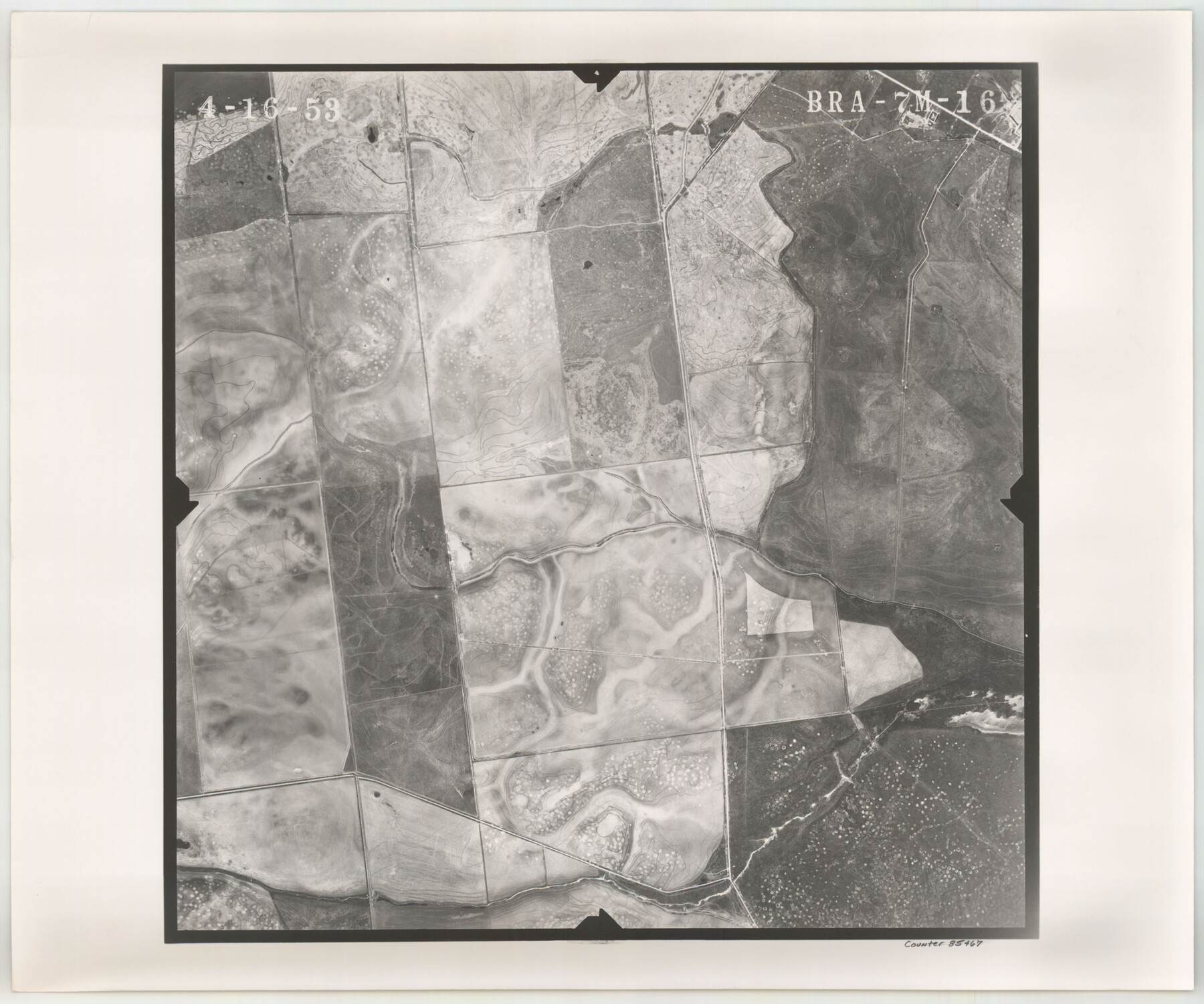
Flight Mission No. BRA-7M, Frame 16, Jefferson County
BRA-7M-16
-
Map/Doc
85467
-
Collection
General Map Collection
-
Object Dates
1953/4/16 (Creation Date)
-
People and Organizations
U. S. Department of Agriculture (Publisher)
-
Counties
Jefferson
-
Subjects
Aerial Photograph
-
Height x Width
18.5 x 22.2 inches
47.0 x 56.4 cm
-
Comments
Flown by Jack Ammann Photogrammetric Engineers of San Antonio, Texas.
Part of: General Map Collection
Sabine County Working Sketch 6

Print $20.00
- Digital $50.00
Sabine County Working Sketch 6
1918
Size 17.5 x 17.6 inches
Map/Doc 63677
Howard County Sketch File 8

Print $3.00
- Digital $50.00
Howard County Sketch File 8
Size 20.8 x 18.7 inches
Map/Doc 11796

Flight Mission No. CUG-1P, Frame 47, Kleberg County

Print $20.00
- Digital $50.00
Flight Mission No. CUG-1P, Frame 47, Kleberg County
1956
Size 18.7 x 22.4 inches
Map/Doc 86125
Flight Mission No. BRA-7M, Frame 85, Jefferson County

Print $20.00
- Digital $50.00
Flight Mission No. BRA-7M, Frame 85, Jefferson County
1953
Size 18.7 x 22.4 inches
Map/Doc 85507
Flight Mission No. BRE-2P, Frame 130, Nueces County

Print $20.00
- Digital $50.00
Flight Mission No. BRE-2P, Frame 130, Nueces County
1956
Size 18.6 x 22.3 inches
Map/Doc 86803
Montague County Working Sketch 43

Print $20.00
- Digital $50.00
Montague County Working Sketch 43
2010
Size 23.3 x 27.2 inches
Map/Doc 89284
Crosby County Working Sketch Graphic Index

Print $20.00
- Digital $50.00
Crosby County Working Sketch Graphic Index
1927
Size 41.8 x 37.4 inches
Map/Doc 76513
Bandera County Working Sketch 5

Print $3.00
- Digital $50.00
Bandera County Working Sketch 5
1915
Size 12.0 x 9.0 inches
Map/Doc 67598
Lamb County Sketch File 18

Print $4.00
- Digital $50.00
Lamb County Sketch File 18
1979
Size 14.3 x 8.9 inches
Map/Doc 29381
Crockett County Sketch File 35b

Print $20.00
- Digital $50.00
Crockett County Sketch File 35b
Size 13.9 x 8.8 inches
Map/Doc 19736
Coast Chart No. 210 Aransas Pass and Corpus Christi Bay with the coast to latitude 27° 12' Texas

Print $20.00
- Digital $50.00
Coast Chart No. 210 Aransas Pass and Corpus Christi Bay with the coast to latitude 27° 12' Texas
1913
Size 27.9 x 18.3 inches
Map/Doc 72805
You may also like
Right of Way and Track Map of The Missouri, Kansas & Texas Railway of Texas

Print $40.00
- Digital $50.00
Right of Way and Track Map of The Missouri, Kansas & Texas Railway of Texas
1918
Size 24.9 x 53.1 inches
Map/Doc 64537
[Lubbock County Sketch, Blocks D7, A, and vicinity]
![91310, [Lubbock County Sketch, Blocks D7, A, and vicinity], Twichell Survey Records](https://historictexasmaps.com/wmedia_w700/maps/91310-1.tif.jpg)
Print $20.00
- Digital $50.00
[Lubbock County Sketch, Blocks D7, A, and vicinity]
1945
Size 18.2 x 29.2 inches
Map/Doc 91310

Map of La Salle County

Print $20.00
- Digital $50.00
Map of La Salle County
1879
Size 26.2 x 25.3 inches
Map/Doc 3799
Presidio County Rolled Sketch A-2

Print $20.00
- Digital $50.00
Presidio County Rolled Sketch A-2
1889
Size 36.9 x 43.9 inches
Map/Doc 9770
Yoakum County

Print $20.00
- Digital $50.00
Yoakum County
1932
Size 47.1 x 35.6 inches
Map/Doc 63139
Duval County Sketch File 29

Print $6.00
- Digital $50.00
Duval County Sketch File 29
1932
Size 14.6 x 8.8 inches
Map/Doc 21336
Ellis County Sketch File 12

Print $60.00
- Digital $50.00
Ellis County Sketch File 12
1860
Size 12.9 x 16.1 inches
Map/Doc 21849
The Republic County of Milam. Proposed, Late Fall 1837

Print $20.00
The Republic County of Milam. Proposed, Late Fall 1837
2020
Size 19.9 x 21.7 inches
Map/Doc 96225
Colorado County Working Sketch 27

Print $20.00
- Digital $50.00
Colorado County Working Sketch 27
1979
Size 29.1 x 23.3 inches
Map/Doc 68127
Kinney County Working Sketch 19

Print $20.00
- Digital $50.00
Kinney County Working Sketch 19
1948
Size 32.0 x 35.7 inches
Map/Doc 70201
Jones County Sketch File 17

Print $20.00
- Digital $50.00
Jones County Sketch File 17
1910
Size 17.2 x 29.4 inches
Map/Doc 11902