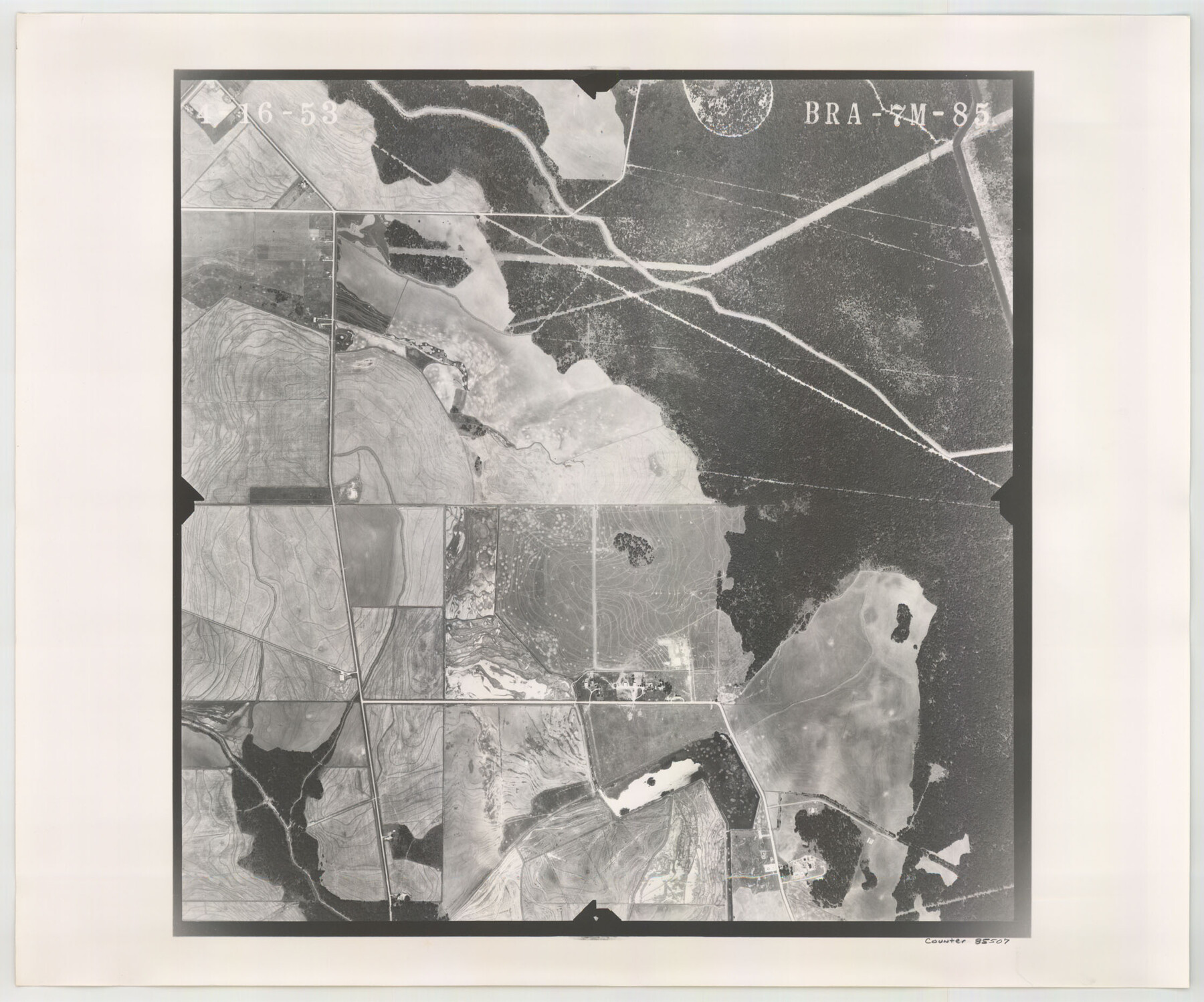
Flight Mission No. BRA-7M, Frame 85, Jefferson County
BRA-7M-85
-
Map/Doc
85507
-
Collection
General Map Collection
-
Object Dates
1953/4/16 (Creation Date)
-
People and Organizations
U. S. Department of Agriculture (Publisher)
-
Counties
Jefferson
-
Subjects
Aerial Photograph
-
Height x Width
18.7 x 22.4 inches
47.5 x 56.9 cm
-
Comments
Flown by Jack Ammann Photogrammetric Engineers of San Antonio, Texas.
Part of: General Map Collection
Hale County Sketch File 15

Print $20.00
- Digital $50.00
Hale County Sketch File 15
Size 22.7 x 18.6 inches
Map/Doc 11596
Refugio County Sketch File 13

Print $5.00
- Digital $50.00
Refugio County Sketch File 13
Size 8.2 x 10.3 inches
Map/Doc 35265
Presidio County Rolled Sketch A-1

Print $20.00
- Digital $50.00
Presidio County Rolled Sketch A-1
1889
Size 26.8 x 32.0 inches
Map/Doc 9769
Kaufman County Working Sketch 3

Print $2.00
- Digital $50.00
Kaufman County Working Sketch 3
1922
Size 11.9 x 8.0 inches
Map/Doc 66666
Map of the United States, Canada and a part of Mexico to illustrate Olney's school geography

Print $20.00
- Digital $50.00
Map of the United States, Canada and a part of Mexico to illustrate Olney's school geography
1844
Size 12.1 x 19.0 inches
Map/Doc 93537
Padre Island National Seashore

Print $4.00
- Digital $50.00
Padre Island National Seashore
Size 16.0 x 22.2 inches
Map/Doc 60525
Flight Mission No. DIX-10P, Frame 183, Aransas County

Print $20.00
- Digital $50.00
Flight Mission No. DIX-10P, Frame 183, Aransas County
1956
Size 18.4 x 22.1 inches
Map/Doc 83973
Stephens County

Print $20.00
- Digital $50.00
Stephens County
1940
Size 42.4 x 40.7 inches
Map/Doc 95644
Jackson County Sketch File A2 (1)

Print $20.00
- Digital $50.00
Jackson County Sketch File A2 (1)
1899
Size 18.2 x 22.5 inches
Map/Doc 11848
Right-of-Way and Track Map, Houston and Brazos Valley Ry. Co. operated by the Houston and Brazos Valley Ry. Co.

Print $40.00
- Digital $50.00
Right-of-Way and Track Map, Houston and Brazos Valley Ry. Co. operated by the Houston and Brazos Valley Ry. Co.
1918
Size 24.9 x 56.5 inches
Map/Doc 64608
Brazos County Working Sketch 9

Print $20.00
- Digital $50.00
Brazos County Working Sketch 9
1982
Size 36.2 x 48.8 inches
Map/Doc 67484
Webb County Sketch File F

Print $6.00
- Digital $50.00
Webb County Sketch File F
1900
Size 10.7 x 15.1 inches
Map/Doc 39699
You may also like
Nautical Chart 152-SC - Galveston Bay, Texas

Print $20.00
- Digital $50.00
Nautical Chart 152-SC - Galveston Bay, Texas
1972
Size 15.2 x 33.5 inches
Map/Doc 69891
Rail Road Map of Pennsylvania

Print $40.00
- Digital $50.00
Rail Road Map of Pennsylvania
1893
Size 38.4 x 58.1 inches
Map/Doc 97108
Matagorda County Sketch File 2

Print $6.00
- Digital $50.00
Matagorda County Sketch File 2
1866
Size 15.9 x 10.8 inches
Map/Doc 30730
Map of Parmer County

Print $20.00
- Digital $50.00
Map of Parmer County
1900
Size 47.8 x 41.3 inches
Map/Doc 16786
Terrell County Sketch File 16

Print $24.00
- Digital $50.00
Terrell County Sketch File 16
1902
Size 12.1 x 8.8 inches
Map/Doc 37924
Burnet County Working Sketch 17

Print $20.00
- Digital $50.00
Burnet County Working Sketch 17
1979
Size 41.1 x 34.4 inches
Map/Doc 67860
Hudspeth County Sketch File 11b

Print $16.00
- Digital $50.00
Hudspeth County Sketch File 11b
Size 14.2 x 8.9 inches
Map/Doc 26914
Sketch of work done by Erath and Green in August 1846 on the north fork of Cow Bayou

Print $2.00
- Digital $50.00
Sketch of work done by Erath and Green in August 1846 on the north fork of Cow Bayou
1846
Size 9.8 x 7.9 inches
Map/Doc 78373
Bell County Sketch File 26b

Print $40.00
- Digital $50.00
Bell County Sketch File 26b
Size 14.7 x 21.1 inches
Map/Doc 10917
Coke County Sketch File 35

Print $6.00
- Digital $50.00
Coke County Sketch File 35
1967
Size 14.2 x 8.6 inches
Map/Doc 18649
Oil Map of Texas and Oklahoma showing the location and approximate area of the Oil and Gas Fields

Print $20.00
- Digital $50.00
Oil Map of Texas and Oklahoma showing the location and approximate area of the Oil and Gas Fields
1920
Size 20.8 x 23.9 inches
Map/Doc 95897
The Republic County of Shelby. February 1, 1842

Print $20.00
The Republic County of Shelby. February 1, 1842
2020
Size 20.0 x 21.7 inches
Map/Doc 96283