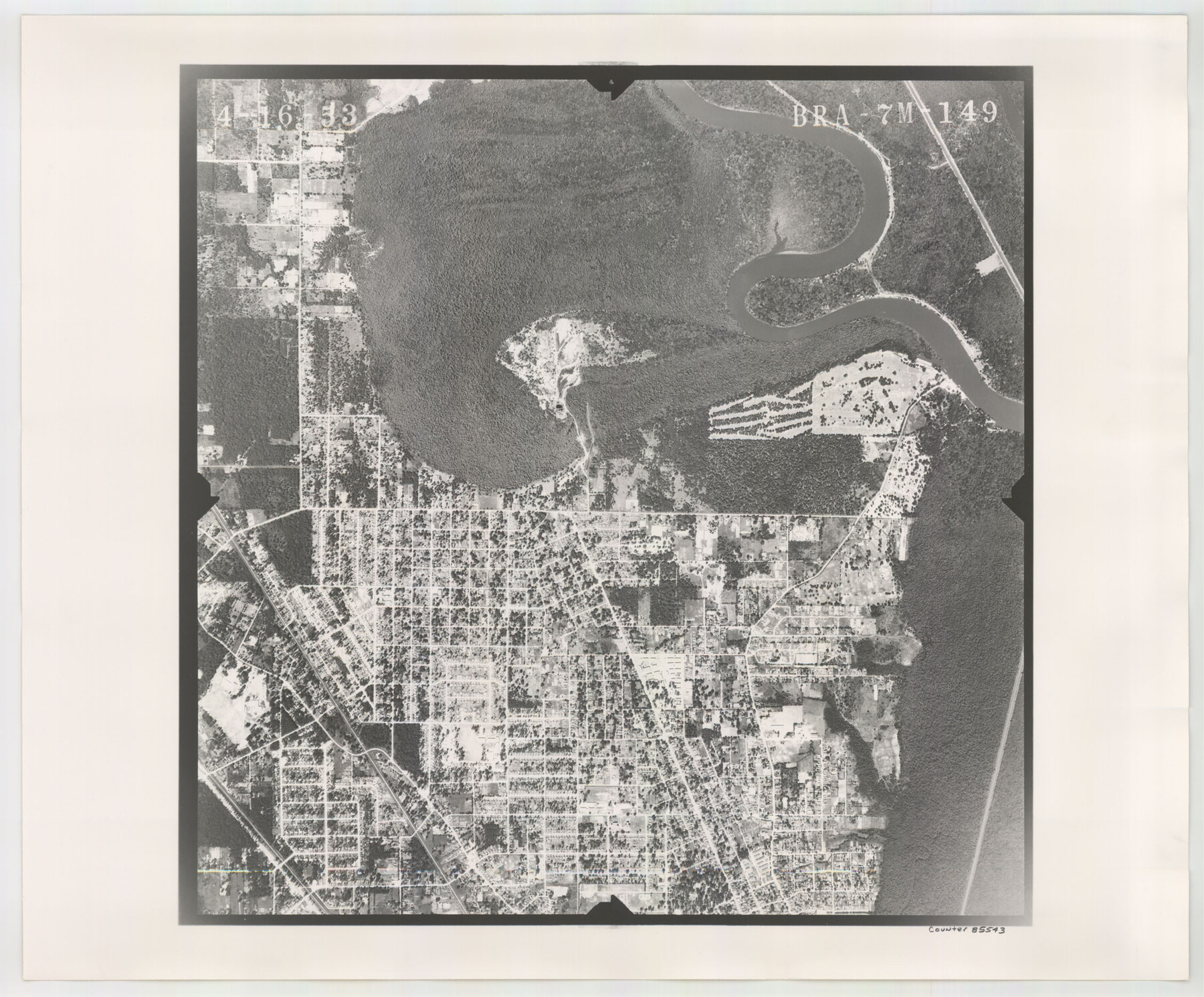
Flight Mission No. BRA-7M, Frame 149, Jefferson County
BRA-7M-149
-
Map/Doc
85543
-
Collection
General Map Collection
-
Object Dates
1953/4/16 (Creation Date)
-
People and Organizations
U. S. Department of Agriculture (Publisher)
-
Counties
Jefferson
-
Subjects
Aerial Photograph
-
Height x Width
18.7 x 22.5 inches
47.5 x 57.2 cm
-
Comments
Flown by Jack Ammann Photogrammetric Engineers of San Antonio, Texas.
Part of: General Map Collection
Flight Mission No. DAG-23K, Frame 170, Matagorda County

Print $20.00
- Digital $50.00
Flight Mission No. DAG-23K, Frame 170, Matagorda County
1953
Size 18.6 x 22.4 inches
Map/Doc 86508
Lipscomb County Working Sketch 9

Print $20.00
- Digital $50.00
Lipscomb County Working Sketch 9
1995
Size 44.1 x 22.3 inches
Map/Doc 70585
Railroad Track Map, H&TCRRCo., Falls County, Texas

Print $4.00
- Digital $50.00
Railroad Track Map, H&TCRRCo., Falls County, Texas
1918
Size 11.9 x 18.5 inches
Map/Doc 62832
Garza County Rolled Sketch 9

Print $20.00
- Digital $50.00
Garza County Rolled Sketch 9
1913
Size 33.8 x 43.8 inches
Map/Doc 9054
Aransas County Working Sketch 6

Print $20.00
- Digital $50.00
Aransas County Working Sketch 6
1943
Size 26.0 x 35.5 inches
Map/Doc 67173
Collingsworth County

Print $20.00
- Digital $50.00
Collingsworth County
1880
Size 24.9 x 20.0 inches
Map/Doc 3420
Palo Pinto County Sketch File 25

Print $26.00
- Digital $50.00
Palo Pinto County Sketch File 25
1874
Size 10.1 x 8.9 inches
Map/Doc 33404
Presidio County Rolled Sketch 95

Print $20.00
- Digital $50.00
Presidio County Rolled Sketch 95
1949
Size 45.4 x 37.5 inches
Map/Doc 9781
Chambers County Working Sketch 28

Print $20.00
- Digital $50.00
Chambers County Working Sketch 28
1982
Size 28.7 x 42.3 inches
Map/Doc 68011
Val Verde County Working Sketch 19

Print $40.00
- Digital $50.00
Val Verde County Working Sketch 19
1928
Size 48.5 x 43.5 inches
Map/Doc 72154

Flight Mission No. BQR-4K, Frame 66, Brazoria County

Print $20.00
- Digital $50.00
Flight Mission No. BQR-4K, Frame 66, Brazoria County
1952
Size 18.8 x 22.5 inches
Map/Doc 83999
You may also like
Lee County Working Sketch 19

Print $20.00
- Digital $50.00
Lee County Working Sketch 19
1991
Size 33.1 x 20.1 inches
Map/Doc 70398
Concho County Working Sketch 21

Print $20.00
- Digital $50.00
Concho County Working Sketch 21
1957
Size 36.4 x 36.0 inches
Map/Doc 68203
Brazos Santiago, Texas

Print $20.00
- Digital $50.00
Brazos Santiago, Texas
1900
Size 18.3 x 26.8 inches
Map/Doc 73033
[North County Line]
![90521, [North County Line], Twichell Survey Records](https://historictexasmaps.com/wmedia_w700/maps/90521-1.tif.jpg)
Print $3.00
- Digital $50.00
[North County Line]
Size 17.3 x 6.6 inches
Map/Doc 90521
Fisher County Working Sketch 6

Print $20.00
- Digital $50.00
Fisher County Working Sketch 6
1929
Size 38.7 x 33.6 inches
Map/Doc 69140
Atascosa County Sketch File 27b

Print $10.00
- Digital $50.00
Atascosa County Sketch File 27b
1875
Size 12.6 x 8.2 inches
Map/Doc 13801
Jones County Working Sketch 1

Print $20.00
- Digital $50.00
Jones County Working Sketch 1
Size 21.1 x 11.2 inches
Map/Doc 66639
Right of Way & Track Map San Antonio & Aransas Pass Railway Co.

Print $40.00
- Digital $50.00
Right of Way & Track Map San Antonio & Aransas Pass Railway Co.
1919
Size 24.8 x 55.8 inches
Map/Doc 64038
General Highway Map, Deaf Smith County, Texas

Print $20.00
General Highway Map, Deaf Smith County, Texas
1961
Size 24.5 x 18.1 inches
Map/Doc 79437
Map of Texas and the Countries Adjacent

Map of Texas and the Countries Adjacent
1844
Size 19.0 x 29.6 inches
Map/Doc 94561
Map of Comal County

Print $20.00
- Digital $50.00
Map of Comal County
1897
Size 40.0 x 45.8 inches
Map/Doc 66780
Gulf Intracoastal Waterway - Aransas Bay to Corpus Christi Bay - Modified Route Main Channel

Print $20.00
- Digital $50.00
Gulf Intracoastal Waterway - Aransas Bay to Corpus Christi Bay - Modified Route Main Channel
1960
Size 30.9 x 42.8 inches
Map/Doc 61900