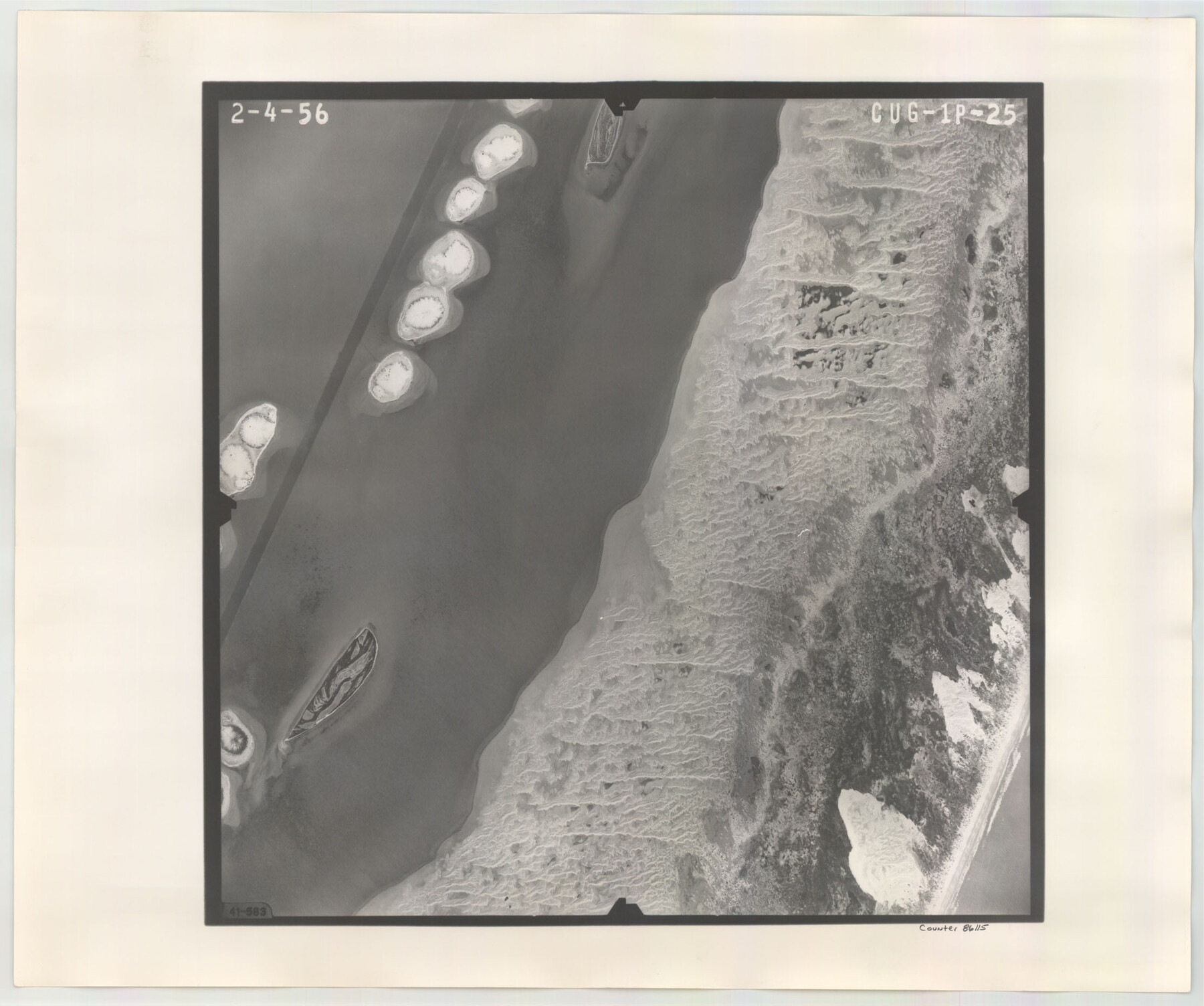
Flight Mission No. CUG-1P, Frame 25, Kleberg County
CUG-1P-25
-
Map/Doc
86115
-
Collection
General Map Collection
-
Object Dates
1956/2/4 (Creation Date)
-
People and Organizations
U. S. Department of Agriculture (Publisher)
-
Counties
Kleberg
-
Subjects
Aerial Photograph
-
Height x Width
18.6 x 22.3 inches
47.2 x 56.6 cm
-
Comments
Flown by V. L. Beavers and Associates of San Antonio, Texas.
Part of: General Map Collection
Calhoun County NRC Article 33.136 Sketch 12

Print $24.00
Calhoun County NRC Article 33.136 Sketch 12
2023
Map/Doc 97271
Carson County Sketch File 2

Print $20.00
- Digital $50.00
Carson County Sketch File 2
1888
Size 19.5 x 21.1 inches
Map/Doc 11054
Wharton County Sketch File A3

Print $26.00
- Digital $50.00
Wharton County Sketch File A3
1899
Size 18.2 x 18.6 inches
Map/Doc 12671
Roberts County Working Sketch 11

Print $40.00
- Digital $50.00
Roberts County Working Sketch 11
1966
Size 57.6 x 38.6 inches
Map/Doc 63537
Medina County Working Sketch 2

Print $20.00
- Digital $50.00
Medina County Working Sketch 2
1942
Size 30.3 x 31.0 inches
Map/Doc 70917
Harris County Working Sketch 60

Print $20.00
- Digital $50.00
Harris County Working Sketch 60
1953
Size 31.8 x 35.2 inches
Map/Doc 65952
Cameron County Rolled Sketch Z1

Print $20.00
- Digital $50.00
Cameron County Rolled Sketch Z1
1937
Size 23.4 x 41.4 inches
Map/Doc 5401
Anderson County Boundary File 7

Print $10.00
- Digital $50.00
Anderson County Boundary File 7
Size 14.4 x 8.9 inches
Map/Doc 49751
Flight Mission No. DIX-3P, Frame 59, Aransas County

Print $20.00
- Digital $50.00
Flight Mission No. DIX-3P, Frame 59, Aransas County
1956
Size 17.6 x 21.1 inches
Map/Doc 83761
Jasper County Sketch File 24

Print $4.00
- Digital $50.00
Jasper County Sketch File 24
1925
Size 10.9 x 8.3 inches
Map/Doc 27824

Nueces County Aerial Photograph Index Sheet 21

Print $20.00
- Digital $50.00
Nueces County Aerial Photograph Index Sheet 21
1938
Size 24.3 x 20.2 inches
Map/Doc 86842
You may also like
Sketch Showing D. Rubin Surveys

Print $20.00
- Digital $50.00
Sketch Showing D. Rubin Surveys
1926
Size 35.1 x 24.5 inches
Map/Doc 91165
Montgomery County Sketch File 19

Print $24.00
- Digital $50.00
Montgomery County Sketch File 19
1931
Size 9.0 x 7.0 inches
Map/Doc 31835
Jeff Davis County Sketch File 37

Print $8.00
- Digital $50.00
Jeff Davis County Sketch File 37
1953
Size 11.3 x 8.7 inches
Map/Doc 28050
Jasper County Sketch File 13

Print $4.00
- Digital $50.00
Jasper County Sketch File 13
1880
Size 12.1 x 8.7 inches
Map/Doc 27804
Runnels County Working Sketch 27

Print $20.00
- Digital $50.00
Runnels County Working Sketch 27
1957
Size 27.1 x 22.1 inches
Map/Doc 63623
Moore County Sketch File 6

Print $16.00
- Digital $50.00
Moore County Sketch File 6
1902
Size 7.3 x 8.6 inches
Map/Doc 31939
Matagorda County Aerial Photograph Index Sheet 4

Print $20.00
- Digital $50.00
Matagorda County Aerial Photograph Index Sheet 4
1953
Size 23.6 x 19.5 inches
Map/Doc 83725
Coke County Boundary File 6

Print $62.00
- Digital $50.00
Coke County Boundary File 6
Size 7.2 x 37.9 inches
Map/Doc 51615
Map of Duval County, Texas

Print $20.00
- Digital $50.00
Map of Duval County, Texas
1880
Size 29.8 x 22.6 inches
Map/Doc 712
[Sketch of counties just south of the Panhandle]
![90913, [Sketch of counties just south of the Panhandle], Twichell Survey Records](https://historictexasmaps.com/wmedia_w700/maps/90913-1.tif.jpg)
Print $20.00
- Digital $50.00
[Sketch of counties just south of the Panhandle]
Size 42.7 x 34.8 inches
Map/Doc 90913
Montgomery County Working Sketch 60

Print $20.00
- Digital $50.00
Montgomery County Working Sketch 60
1963
Size 24.3 x 42.7 inches
Map/Doc 71167
Tom Green County Rolled Sketch 7

Print $20.00
- Digital $50.00
Tom Green County Rolled Sketch 7
Size 37.0 x 40.0 inches
Map/Doc 9998