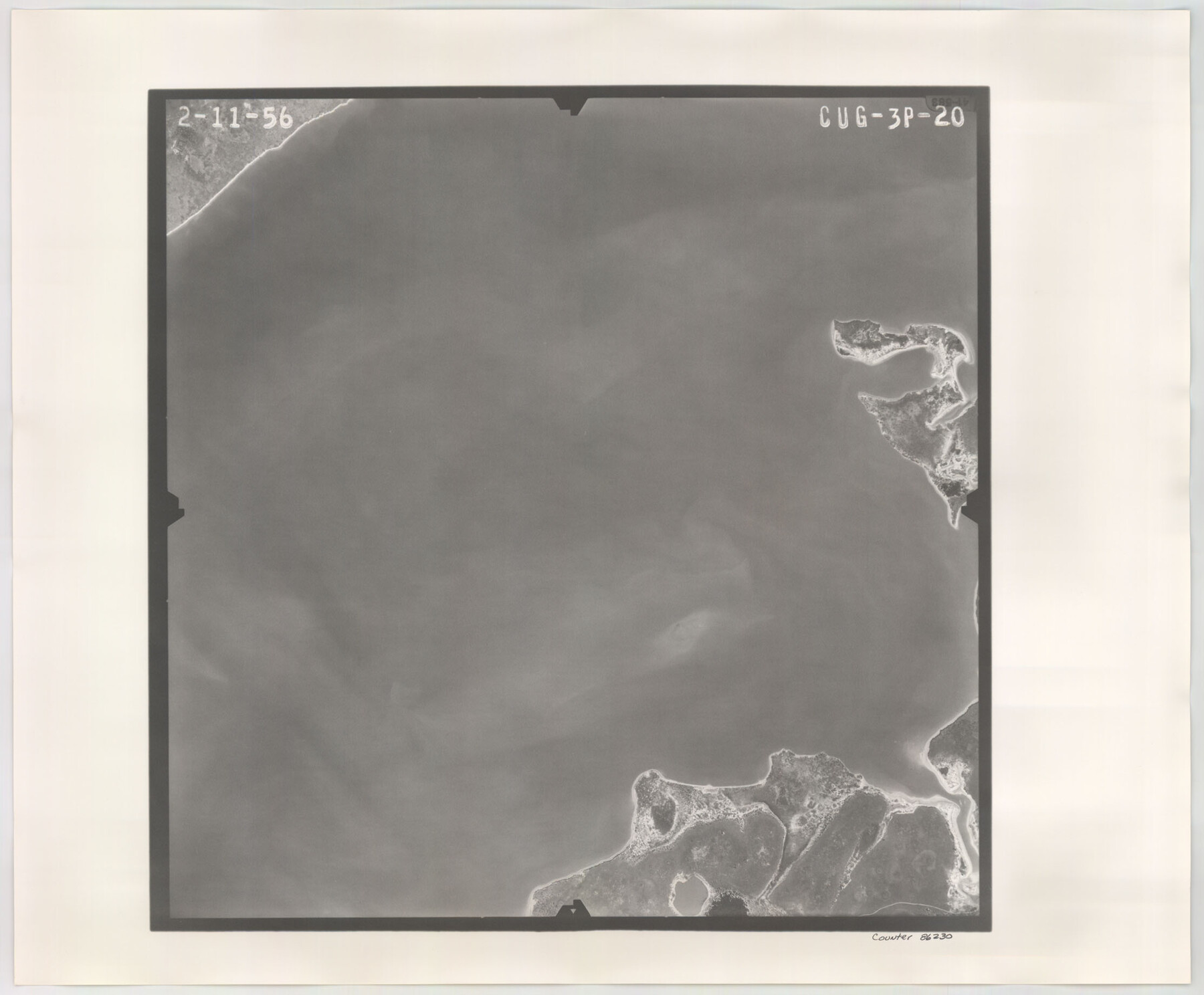
Flight Mission No. CUG-3P, Frame 20, Kleberg County
CUG-3P-20
-
Map/Doc
86230
-
Collection
General Map Collection
-
Object Dates
1956/2/11 (Creation Date)
-
People and Organizations
U. S. Department of Agriculture (Publisher)
-
Counties
Kleberg
-
Subjects
Aerial Photograph
-
Height x Width
18.4 x 22.3 inches
46.7 x 56.6 cm
-
Comments
Flown by V. L. Beavers and Associates of San Antonio, Texas.
Part of: General Map Collection
Freestone County Working Sketch 23
![69265, Freestone County Working Sketch 23, General Map Collection](https://historictexasmaps.com/wmedia_w700/maps/69265.tif.jpg)
Print $4.00
- Digital $50.00
Freestone County Working Sketch 23
Size 20.1 x 17.0 inches
Map/Doc 69265
Ellis County Sketch File 10
![21845, Ellis County Sketch File 10, General Map Collection](https://historictexasmaps.com/wmedia_w700/pdf_converted_jpg/qi_pdf_thumbnail_10972.jpg)
Print $40.00
- Digital $50.00
Ellis County Sketch File 10
1860
Size 12.7 x 16.1 inches
Map/Doc 21845
Roberts County Working Sketch 29
![63555, Roberts County Working Sketch 29, General Map Collection](https://historictexasmaps.com/wmedia_w700/maps/63555.tif.jpg)
Print $20.00
- Digital $50.00
Roberts County Working Sketch 29
Size 18.6 x 34.8 inches
Map/Doc 63555
Map of Archer County
![3240, Map of Archer County, General Map Collection](https://historictexasmaps.com/wmedia_w700/maps/3240-1.tif.jpg)
Print $20.00
- Digital $50.00
Map of Archer County
1886
Size 24.4 x 20.5 inches
Map/Doc 3240
Irion County Rolled Sketch 4
![6319, Irion County Rolled Sketch 4, General Map Collection](https://historictexasmaps.com/wmedia_w700/maps/6319.tif.jpg)
Print $20.00
- Digital $50.00
Irion County Rolled Sketch 4
Size 25.6 x 36.4 inches
Map/Doc 6319
Edwards County Sketch File 12
![21690, Edwards County Sketch File 12, General Map Collection](https://historictexasmaps.com/wmedia_w700/pdf_converted_jpg/qi_pdf_thumbnail_10934.jpg)
Print $16.00
- Digital $50.00
Edwards County Sketch File 12
Size 14.6 x 9.1 inches
Map/Doc 21690
Travis County Sketch File 67
![38446, Travis County Sketch File 67, General Map Collection](https://historictexasmaps.com/wmedia_w700/pdf_converted_jpg/qi_pdf_thumbnail_14605.jpg)
Print $10.00
- Digital $50.00
Travis County Sketch File 67
1951
Size 14.3 x 9.0 inches
Map/Doc 38446
[St. L. S-W. Ry. of Texas Map of Lufkin Branch in Angelina County, Texas]
![64560, [St. L. S-W. Ry. of Texas Map of Lufkin Branch in Angelina County, Texas], General Map Collection](https://historictexasmaps.com/wmedia_w700/maps/64560.tif.jpg)
Print $40.00
- Digital $50.00
[St. L. S-W. Ry. of Texas Map of Lufkin Branch in Angelina County, Texas]
1913
Size 25.7 x 121.3 inches
Map/Doc 64560
Montague County Working Sketch 37
![71103, Montague County Working Sketch 37, General Map Collection](https://historictexasmaps.com/wmedia_w700/maps/71103.tif.jpg)
Print $2.00
- Digital $50.00
Montague County Working Sketch 37
Size 16.7 x 12.9 inches
Map/Doc 71103
Calhoun County Rolled Sketch 3
![5361, Calhoun County Rolled Sketch 3, General Map Collection](https://historictexasmaps.com/wmedia_w700/maps/05361.tif.jpg)
Print $20.00
- Digital $50.00
Calhoun County Rolled Sketch 3
Size 28.0 x 21.9 inches
Map/Doc 5361
Edwards County Working Sketch 18
![68894, Edwards County Working Sketch 18, General Map Collection](https://historictexasmaps.com/wmedia_w700/maps/68894.tif.jpg)
Print $20.00
- Digital $50.00
Edwards County Working Sketch 18
Size 34.3 x 37.0 inches
Map/Doc 68894
Wichita County Sketch File 37
![40160, Wichita County Sketch File 37, General Map Collection](https://historictexasmaps.com/wmedia_w700/pdf_converted_jpg/qi_pdf_thumbnail_15046.jpg)
Print $4.00
- Digital $50.00
Wichita County Sketch File 37
1906
Size 9.6 x 8.6 inches
Map/Doc 40160
You may also like
Nueces County Sketch File 48
![32663, Nueces County Sketch File 48, General Map Collection](https://historictexasmaps.com/wmedia_w700/pdf_converted_jpg/qi_pdf_thumbnail_13371.jpg)
Print $20.00
- Digital $50.00
Nueces County Sketch File 48
1978
Size 14.1 x 8.5 inches
Map/Doc 32663
A New & Correct Map of the Trading Part of the West Indies, including the Seat of War between Gr. Britain and France Likewise the British Empire in America, with the French and Spanish Settlements adjacent thereto
![93826, A New & Correct Map of the Trading Part of the West Indies, including the Seat of War between Gr. Britain and France Likewise the British Empire in America, with the French and Spanish Settlements adjacent thereto, Holcomb Digital Map Collection](https://historictexasmaps.com/wmedia_w700/maps/93826.tif.jpg)
Print $20.00
- Digital $50.00
A New & Correct Map of the Trading Part of the West Indies, including the Seat of War between Gr. Britain and France Likewise the British Empire in America, with the French and Spanish Settlements adjacent thereto
1759
Size 27.4 x 41.4 inches
Map/Doc 93826
Presidio County Rolled Sketch 80A
![7367, Presidio County Rolled Sketch 80A, General Map Collection](https://historictexasmaps.com/wmedia_w700/maps/7367.tif.jpg)
Print $20.00
- Digital $50.00
Presidio County Rolled Sketch 80A
Size 26.9 x 28.9 inches
Map/Doc 7367
Jefferson County Working Sketch 15
![66558, Jefferson County Working Sketch 15, General Map Collection](https://historictexasmaps.com/wmedia_w700/maps/66558-1.tif.jpg)
Print $20.00
- Digital $50.00
Jefferson County Working Sketch 15
Size 24.5 x 28.6 inches
Map/Doc 66558
Terry County Rolled Sketch 8
![7982, Terry County Rolled Sketch 8, General Map Collection](https://historictexasmaps.com/wmedia_w700/maps/7982.tif.jpg)
Print $20.00
- Digital $50.00
Terry County Rolled Sketch 8
Size 31.7 x 22.3 inches
Map/Doc 7982
La Salle County Rolled Sketch 6
![10738, La Salle County Rolled Sketch 6, General Map Collection](https://historictexasmaps.com/wmedia_w700/maps/10738-1.tif.jpg)
Print $40.00
- Digital $50.00
La Salle County Rolled Sketch 6
1941
Size 43.0 x 66.0 inches
Map/Doc 10738
Map of Drum, Oyster & Bastrop Bays & vicinity in Brazoria County showing subdivision for mineral development
![65808, Map of Drum, Oyster & Bastrop Bays & vicinity in Brazoria County showing subdivision for mineral development, General Map Collection](https://historictexasmaps.com/wmedia_w700/maps/65808.tif.jpg)
Print $20.00
- Digital $50.00
Map of Drum, Oyster & Bastrop Bays & vicinity in Brazoria County showing subdivision for mineral development
Size 36.8 x 47.3 inches
Map/Doc 65808
Ochiltree County Sketch File 1
![](https://historictexasmaps.com/wmedia_w700/pdf_converted_jpg/qi_pdf_thumbnail_67605.jpg)
Print $20.00
- Digital $50.00
Ochiltree County Sketch File 1
1888
Size 30.4 x 26.8 inches
Map/Doc 42201
Randall County, Texas
![747, Randall County, Texas, Maddox Collection](https://historictexasmaps.com/wmedia_w700/maps/747-1.tif.jpg)
Print $20.00
- Digital $50.00
Randall County, Texas
1887
Size 19.4 x 16.7 inches
Map/Doc 747
Presidio County Sketch File E
![11702, Presidio County Sketch File E, General Map Collection](https://historictexasmaps.com/wmedia_w700/pdf_converted_jpg/qi_pdf_thumbnail_8124.jpg)
Print $20.00
- Digital $50.00
Presidio County Sketch File E
Size 15.9 x 20.0 inches
Map/Doc 11702
Orange County Working Sketch 2
![71334, Orange County Working Sketch 2, General Map Collection](https://historictexasmaps.com/wmedia_w700/maps/71334.tif.jpg)
Print $20.00
- Digital $50.00
Orange County Working Sketch 2
Size 12.8 x 13.1 inches
Map/Doc 71334
Nueces County
![66957, Nueces County, General Map Collection](https://historictexasmaps.com/wmedia_w700/maps/66957.tif.jpg)
Print $20.00
- Digital $50.00
Nueces County
1913
Size 26.4 x 34.1 inches
Map/Doc 66957