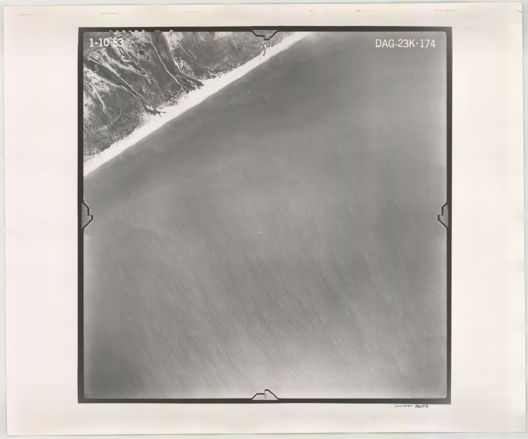
Flight Mission No. DAG-23K, Frame 174, Matagorda County
DAG-23K-174
-
Map/Doc
86512
-
Collection
General Map Collection
-
Object Dates
1953/1/10 (Creation Date)
-
People and Organizations
U. S. Department of Agriculture (Publisher)
-
Counties
Matagorda
-
Subjects
Aerial Photograph
-
Height x Width
18.5 x 22.3 inches
47.0 x 56.6 cm
-
Comments
Flown by Aero Exploration Company of Tulsa, Oklahoma.
Part of: General Map Collection
Floyd County Sketch File A1

Print $4.00
- Digital $50.00
Floyd County Sketch File A1
Size 9.2 x 7.9 inches
Map/Doc 22686
San Luis Pass to East Matagorda Bay

Print $20.00
- Digital $50.00
San Luis Pass to East Matagorda Bay
1973
Size 35.0 x 46.8 inches
Map/Doc 69968
Harris County Sketch File C

Print $4.00
- Digital $50.00
Harris County Sketch File C
1866
Size 5.9 x 9.8 inches
Map/Doc 25311
Smith Co. showing location of Texas and Pacific Railway

Print $20.00
- Digital $50.00
Smith Co. showing location of Texas and Pacific Railway
1872
Size 19.5 x 21.6 inches
Map/Doc 64139
Presidio County Sketch File 69b

Print $6.00
- Digital $50.00
Presidio County Sketch File 69b
1919
Size 11.2 x 8.8 inches
Map/Doc 34666
Jasper County Sketch File 6

Print $26.00
- Digital $50.00
Jasper County Sketch File 6
1867
Size 12.8 x 8.2 inches
Map/Doc 27771
Outer Continental Shelf Leasing Maps (Louisiana Offshore Operations)

Print $20.00
- Digital $50.00
Outer Continental Shelf Leasing Maps (Louisiana Offshore Operations)
1955
Size 16.2 x 13.0 inches
Map/Doc 76084
Bexar County Working Sketch 8

Print $20.00
- Digital $50.00
Bexar County Working Sketch 8
1954
Size 26.8 x 25.2 inches
Map/Doc 67324
Real County Rolled Sketch 3

Print $20.00
- Digital $50.00
Real County Rolled Sketch 3
1955
Size 14.6 x 23.3 inches
Map/Doc 7453
Maverick County Working Sketch 18

Print $20.00
- Digital $50.00
Maverick County Working Sketch 18
1975
Size 44.4 x 35.3 inches
Map/Doc 70910
McCulloch County Sketch File 11

Print $14.00
- Digital $50.00
McCulloch County Sketch File 11
1929
Size 11.2 x 8.8 inches
Map/Doc 31191
Flight Mission No. CRC-3R, Frame 99, Chambers County

Print $20.00
- Digital $50.00
Flight Mission No. CRC-3R, Frame 99, Chambers County
1956
Size 18.7 x 22.4 inches
Map/Doc 84837
You may also like
Harris County Working Sketch 28

Print $20.00
- Digital $50.00
Harris County Working Sketch 28
Size 34.4 x 43.1 inches
Map/Doc 65920
Gonzales County

Print $20.00
- Digital $50.00
Gonzales County
1871
Size 17.2 x 25.8 inches
Map/Doc 3593
General Highway Map, San Augustine County, Texas

Print $20.00
General Highway Map, San Augustine County, Texas
1961
Size 24.6 x 18.1 inches
Map/Doc 79645
Val Verde County

Print $20.00
- Digital $50.00
Val Verde County
1944
Size 42.0 x 37.0 inches
Map/Doc 63103
[Peter's Colony surveys in Stephens County]
![75986, [Peter's Colony surveys in Stephens County], General Map Collection](https://historictexasmaps.com/wmedia_w700/maps/75986.tif.jpg)
Print $20.00
- Digital $50.00
[Peter's Colony surveys in Stephens County]
Size 25.3 x 21.1 inches
Map/Doc 75986
Brooks County Working Sketch 15

Print $20.00
- Digital $50.00
Brooks County Working Sketch 15
1944
Size 30.5 x 20.5 inches
Map/Doc 67799
Working Sketch in Terrell County

Print $3.00
- Digital $50.00
Working Sketch in Terrell County
1927
Size 17.1 x 9.5 inches
Map/Doc 92911
Hays County Rolled Sketch 23

Print $20.00
- Digital $50.00
Hays County Rolled Sketch 23
Size 20.1 x 19.4 inches
Map/Doc 6179
Galveston County Rolled Sketch 18

Print $20.00
- Digital $50.00
Galveston County Rolled Sketch 18
1958
Size 24.1 x 32.0 inches
Map/Doc 5956
Denton County Sketch File 11

Print $4.00
- Digital $50.00
Denton County Sketch File 11
1856
Size 5.1 x 8.6 inches
Map/Doc 20709
Flight Mission No. BQR-4K, Frame 65, Brazoria County

Print $20.00
- Digital $50.00
Flight Mission No. BQR-4K, Frame 65, Brazoria County
1952
Size 18.5 x 22.3 inches
Map/Doc 83998
El Paso County Boundary File 24

Print $32.00
- Digital $50.00
El Paso County Boundary File 24
Size 14.8 x 9.6 inches
Map/Doc 53221