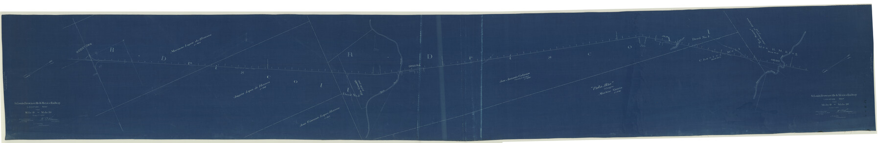
St. Louis, Brownsville & Mexico
Location Map from Mile 0 to Mile 60
Z-2-21
-
Map/Doc
89280
-
Collection
General Map Collection
-
Object Dates
1906 (Creation Date)
-
Counties
Cameron
-
Height x Width
21.2 x 130.5 inches
53.8 x 331.5 cm
-
Comments
Segment 1. See counter no. 64076 for segment 2.
See counter 89280 for digital composite.
See counter nos. 64077 through 64080 for other related sheets and counters 89281 and 89282 for related digital composites.
Part of: General Map Collection
Hardeman County Rolled Sketch 14

Print $20.00
- Digital $50.00
Hardeman County Rolled Sketch 14
1884
Size 18.2 x 29.1 inches
Map/Doc 6071
Culberson County Sketch File 24

Print $34.00
- Digital $50.00
Culberson County Sketch File 24
1934
Size 11.2 x 9.0 inches
Map/Doc 20242
Kinney County Rolled Sketch 21

Print $40.00
- Digital $50.00
Kinney County Rolled Sketch 21
1992
Size 39.2 x 57.2 inches
Map/Doc 9358
Map of Young County

Print $20.00
- Digital $50.00
Map of Young County
1896
Size 41.6 x 35.0 inches
Map/Doc 4172
Real County Working Sketch 43

Print $20.00
- Digital $50.00
Real County Working Sketch 43
1953
Size 32.4 x 30.5 inches
Map/Doc 71935
Flight Mission No. BRA-16M, Frame 103, Jefferson County

Print $20.00
- Digital $50.00
Flight Mission No. BRA-16M, Frame 103, Jefferson County
1953
Size 18.5 x 22.3 inches
Map/Doc 85715
Real County Working Sketch 39

Print $20.00
- Digital $50.00
Real County Working Sketch 39
1951
Size 33.5 x 36.6 inches
Map/Doc 71931
Taylor County Rolled Sketch 25

Print $20.00
- Digital $50.00
Taylor County Rolled Sketch 25
1962
Size 27.1 x 46.0 inches
Map/Doc 7917
Hansford County Boundary File 1

Print $24.00
- Digital $50.00
Hansford County Boundary File 1
Size 9.2 x 8.6 inches
Map/Doc 54232
Topographical Map of the Rio Grande, Sheet No. 21

Print $20.00
- Digital $50.00
Topographical Map of the Rio Grande, Sheet No. 21
1912
Map/Doc 89545
Jasper County Boundary File 3

Print $54.00
- Digital $50.00
Jasper County Boundary File 3
Size 9.3 x 31.0 inches
Map/Doc 55480
Carson County Boundary File 2

Print $56.00
- Digital $50.00
Carson County Boundary File 2
Size 14.0 x 8.6 inches
Map/Doc 51121
You may also like
Coleman County Sketch File A1

Print $6.00
- Digital $50.00
Coleman County Sketch File A1
Size 5.4 x 7.7 inches
Map/Doc 18664
General Highway Map. Detail of Cities and Towns in Lubbock County, Texas [Lubbock and vicinity]
![79181, General Highway Map. Detail of Cities and Towns in Lubbock County, Texas [Lubbock and vicinity], Texas State Library and Archives](https://historictexasmaps.com/wmedia_w700/maps/79181.tif.jpg)
Print $20.00
General Highway Map. Detail of Cities and Towns in Lubbock County, Texas [Lubbock and vicinity]
1940
Size 18.3 x 24.8 inches
Map/Doc 79181
Nueces County Rolled Sketch 120

Print $100.00
Nueces County Rolled Sketch 120
1989
Size 11.2 x 10.7 inches
Map/Doc 9636
Presidio County Rolled Sketch 3A

Print $20.00
- Digital $50.00
Presidio County Rolled Sketch 3A
Size 18.5 x 16.8 inches
Map/Doc 7327
Floyd County, Texas

Print $20.00
- Digital $50.00
Floyd County, Texas
1889
Size 24.8 x 19.2 inches
Map/Doc 626
Flight Mission No. CRK-3P, Frame 175, Refugio County

Print $20.00
- Digital $50.00
Flight Mission No. CRK-3P, Frame 175, Refugio County
1956
Size 18.6 x 21.7 inches
Map/Doc 86922
San Patricio County Sketch File 3

Print $10.00
- Digital $50.00
San Patricio County Sketch File 3
1850
Size 11.0 x 15.6 inches
Map/Doc 36029
Live Oak County Rolled Sketch 6

Print $20.00
- Digital $50.00
Live Oak County Rolled Sketch 6
1947
Size 43.6 x 25.9 inches
Map/Doc 6634

Presidio County Working Sketch 138

Print $20.00
- Digital $50.00
Presidio County Working Sketch 138
1990
Size 17.4 x 41.2 inches
Map/Doc 71816
Parker County Sketch File 3a

Print $40.00
- Digital $50.00
Parker County Sketch File 3a
Size 12.7 x 12.8 inches
Map/Doc 33523
Stephens County Rolled Sketch 4

Print $20.00
- Digital $50.00
Stephens County Rolled Sketch 4
Size 20.0 x 18.5 inches
Map/Doc 7841