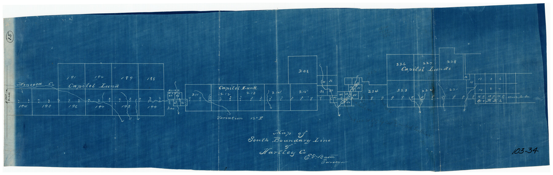
Map of South Boundary Line of Hartley County
103-34
-
Map/Doc
90685
-
Collection
Twichell Survey Records
-
People and Organizations
E.F. Batte (Surveyor/Engineer)
-
Counties
Hartley
-
Height x Width
26.3 x 8.2 inches
66.8 x 20.8 cm
Part of: Twichell Survey Records
[Working Sketch Survey 46]
![90955, [Working Sketch Survey 46], Twichell Survey Records](https://historictexasmaps.com/wmedia_w700/maps/90955-1.tif.jpg)
Print $20.00
- Digital $50.00
[Working Sketch Survey 46]
Size 19.0 x 11.8 inches
Map/Doc 90955
C.C. Slaughter's Running Water Ranch situated in Hale and Lamb Counties

Print $20.00
- Digital $50.00
C.C. Slaughter's Running Water Ranch situated in Hale and Lamb Counties
Size 26.5 x 18.8 inches
Map/Doc 91050
Wichita County, State of Texas 1889

Print $20.00
- Digital $50.00
Wichita County, State of Texas 1889
1889
Size 44.3 x 32.6 inches
Map/Doc 89649
[University Lands Blocks 16, 18, 19 and 20]
![91594, [University Lands Blocks 16, 18, 19 and 20], Twichell Survey Records](https://historictexasmaps.com/wmedia_w700/maps/91594-1.tif.jpg)
Print $20.00
- Digital $50.00
[University Lands Blocks 16, 18, 19 and 20]
Size 13.9 x 16.7 inches
Map/Doc 91594
Subdivision Map of Fisher County School Land situated in Bailey and Cochran Counties, Texas

Print $20.00
- Digital $50.00
Subdivision Map of Fisher County School Land situated in Bailey and Cochran Counties, Texas
1924
Size 17.3 x 21.3 inches
Map/Doc 90111
J. O. Jones Land, Gaines County, Texas - Cedar Lake Meridian

Print $20.00
- Digital $50.00
J. O. Jones Land, Gaines County, Texas - Cedar Lake Meridian
Size 8.5 x 32.1 inches
Map/Doc 90792
[Blocks C, M and B, north of Morris County School Land]
![90493, [Blocks C, M and B, north of Morris County School Land], Twichell Survey Records](https://historictexasmaps.com/wmedia_w700/maps/90493-1.tif.jpg)
Print $20.00
- Digital $50.00
[Blocks C, M and B, north of Morris County School Land]
Size 21.0 x 14.2 inches
Map/Doc 90493
Working Sketch from Fisher County [around Roby]
![90911, Working Sketch from Fisher County [around Roby], Twichell Survey Records](https://historictexasmaps.com/wmedia_w700/maps/90911-1.tif.jpg)
Print $20.00
- Digital $50.00
Working Sketch from Fisher County [around Roby]
1901
Size 22.7 x 31.1 inches
Map/Doc 90911
Cliffside Situated on Section 21, Block 9, Potter County, Texas

Print $2.00
- Digital $50.00
Cliffside Situated on Section 21, Block 9, Potter County, Texas
Size 6.1 x 11.5 inches
Map/Doc 92100
Working Sketch in Armstrong County

Print $20.00
- Digital $50.00
Working Sketch in Armstrong County
1918
Size 31.5 x 24.3 inches
Map/Doc 90265
G. T. Oliver's Subdivisions of the Motley and Foard County School Leagues situated in Bailey Co., Texas

Print $20.00
- Digital $50.00
G. T. Oliver's Subdivisions of the Motley and Foard County School Leagues situated in Bailey Co., Texas
1909
Size 24.5 x 37.3 inches
Map/Doc 90181
O'Neall Terrace, a Re-Subdivision of Blocks 37-38-39-40-43-44-45-46-110-112-113-114 and Parts of Blocks 111 and 115, McCrummens Second Addition to the City of Lubbock, Texas

Print $20.00
- Digital $50.00
O'Neall Terrace, a Re-Subdivision of Blocks 37-38-39-40-43-44-45-46-110-112-113-114 and Parts of Blocks 111 and 115, McCrummens Second Addition to the City of Lubbock, Texas
Size 22.6 x 27.5 inches
Map/Doc 92743
You may also like
Terry County Sketch File 15

Print $10.00
- Digital $50.00
Terry County Sketch File 15
1944
Size 11.3 x 8.9 inches
Map/Doc 38034
Calhoun County Rolled Sketch 14

Print $20.00
- Digital $50.00
Calhoun County Rolled Sketch 14
Size 22.3 x 40.8 inches
Map/Doc 5456

Montgomery County Rolled Sketch 15

Print $40.00
- Digital $50.00
Montgomery County Rolled Sketch 15
1932
Size 23.7 x 49.0 inches
Map/Doc 9527
Presidio County Working Sketch 23

Print $20.00
- Digital $50.00
Presidio County Working Sketch 23
1945
Size 35.7 x 23.3 inches
Map/Doc 71699
Flight Mission No. CGI-1N, Frame 180, Cameron County

Print $20.00
- Digital $50.00
Flight Mission No. CGI-1N, Frame 180, Cameron County
1955
Size 18.5 x 22.2 inches
Map/Doc 84515
Stonewall County Sketch File 31

Print $77.00
- Digital $50.00
Stonewall County Sketch File 31
2001
Size 11.3 x 8.9 inches
Map/Doc 37308
English Field Notes of the Spanish Archives - Book 1

English Field Notes of the Spanish Archives - Book 1
1833
Map/Doc 96527
The Republic County of Rusk. Created, January 16, 1843

Print $20.00
The Republic County of Rusk. Created, January 16, 1843
2020
Size 19.1 x 21.7 inches
Map/Doc 96265
Richardsons New Map of the State of Texas Including Part of Mexico Compiled from Government Surveys and other Authentic Documents

Print $20.00
Richardsons New Map of the State of Texas Including Part of Mexico Compiled from Government Surveys and other Authentic Documents
1860
Size 26.7 x 34.5 inches
Map/Doc 79735
Map of Winkler County

Print $20.00
- Digital $50.00
Map of Winkler County
1900
Size 42.4 x 38.6 inches
Map/Doc 16931
