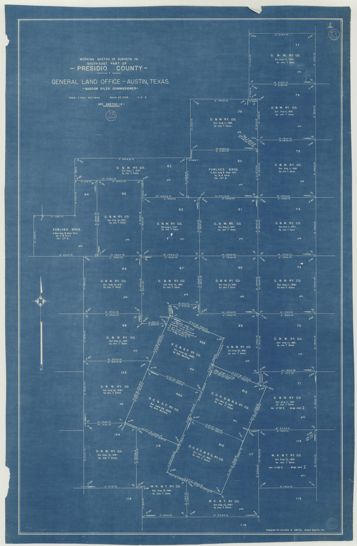
Presidio County Working Sketch 23
- 
                          Map/Doc71699
- 
                            CollectionGeneral Map Collection
- 
                            Object Dates3/27/1945 (Creation Date)
- 
                            People and OrganizationsOtto G. Kurio (Draftsman)
- 
                            CountiesPresidio
- 
                            SubjectsSurveying Working Sketch
- 
                            Height x Width35.7 x 23.3 inches90.7 x 59.2 cm
- 
                            Scale1" = 500 varas
Part of: General Map Collection
            International Boundary Line in the Rio Grande delineated in accordance with the Treaty of 1970 - (1982/1983 Aerial Photographs)


            International Boundary Line in the Rio Grande delineated in accordance with the Treaty of 1970 - (1982/1983 Aerial Photographs)
1982
Map/Doc 74827
            
            Flight Mission No. BRA-16M, Frame 149, Jefferson County


                                            Print $20.00                    
                                             -                         Digital $50.00                                    
                Flight Mission No. BRA-16M, Frame 149, Jefferson County
1953
Size 18.6 x 22.3 inches
                                Map/Doc 85755
            
            Jalisco Banco Number 67, cut from Mexico in 1909


                                            Print $3.00                    
                                             -                         Digital $50.00                                    
                Jalisco Banco Number 67, cut from Mexico in 1909
1912
Size 14.2 x 11.2 inches
                                Map/Doc 2064
            
            Northern Part of Laguna Madre


                                            Print $20.00                    
                                             -                         Digital $50.00                                    
                Northern Part of Laguna Madre
1972
Size 44.2 x 35.0 inches
                                Map/Doc 73529
            
            W. M. Kuykendall Ranch, Matagorda County, Texas


                                            Print $20.00                    
                                             -                         Digital $50.00                                    
                W. M. Kuykendall Ranch, Matagorda County, Texas
1926
Size 24.3 x 39.6 inches
                                Map/Doc 3028
            
            El Paso County Working Sketch 16


                                            Print $20.00                    
                                             -                         Digital $50.00                                    
                El Paso County Working Sketch 16
1957
Size 18.5 x 20.4 inches
                                Map/Doc 69038
            
            Parker County Working Sketch 5


                                            Print $20.00                    
                                             -                         Digital $50.00                                    
                Parker County Working Sketch 5
1952
Map/Doc 71455
            
            Flight Mission No. BRA-6M, Frame 95, Jefferson County


                                            Print $20.00                    
                                             -                         Digital $50.00                                    
                Flight Mission No. BRA-6M, Frame 95, Jefferson County
1953
Size 18.5 x 22.2 inches
                                Map/Doc 85438
            
            Cameron County NRC Article 33.136 Location Key Sheet


                                            Print $20.00                    
                                             -                         Digital $50.00                                    
                Cameron County NRC Article 33.136 Location Key Sheet
1983
Size 27.0 x 23.0 inches
                                Map/Doc 89294
            
            Freestone County Sketch File 1


                                            Print $7.00                    
                                             -                         Digital $50.00                                    
                Freestone County Sketch File 1
1857
Size 10.6 x 8.6 inches
                                Map/Doc 23034
            
            Houston County Sketch File 34


                                            Print $6.00                    
                                             -                         Digital $50.00                                    
                Houston County Sketch File 34
1914
Size 13.3 x 11.0 inches
                                Map/Doc 26811
            You may also like
            Flight Mission No. DQO-1K, Frame 118, Galveston County


                                            Print $20.00                    
                                             -                         Digital $50.00                                    
                Flight Mission No. DQO-1K, Frame 118, Galveston County
1952
Size 18.9 x 22.6 inches
                                Map/Doc 84996
            
            Nueces County Sketch File 72


                                            Print $13.00                    
                                             -                         Digital $50.00                                    
                Nueces County Sketch File 72
1991
Size 11.1 x 8.8 inches
                                Map/Doc 33020
            
            Intracoastal Waterway in Texas - Corpus Christi to Point Isabel including Arroyo Colorado to Mo. Pac. R.R. Bridge Near Harlingen


                                            Print $20.00                    
                                             -                         Digital $50.00                                    
                Intracoastal Waterway in Texas - Corpus Christi to Point Isabel including Arroyo Colorado to Mo. Pac. R.R. Bridge Near Harlingen
1933
Size 27.7 x 40.7 inches
                                Map/Doc 61858
            
            Cameron Empresario Colony. September 28, 1828


                                            Print $20.00                    
                                    
                Cameron Empresario Colony. September 28, 1828
2020
Size 10.4 x 21.7 inches
                                Map/Doc 95987
            
            Medina County Working Sketch 12


                                            Print $20.00                    
                                             -                         Digital $50.00                                    
                Medina County Working Sketch 12
1971
Size 24.2 x 23.9 inches
                                Map/Doc 70927
            
            Kaufman County Boundary File 1


                                            Print $8.00                    
                                             -                         Digital $50.00                                    
                Kaufman County Boundary File 1
Size 7.7 x 3.6 inches
                                Map/Doc 55903
            
            Cass County Working Sketch 15


                                            Print $20.00                    
                                             -                         Digital $50.00                                    
                Cass County Working Sketch 15
1957
Size 29.7 x 19.0 inches
                                Map/Doc 67918
            
            [Sketch of part of Blks. 4, B5, 6, 2Z, M6, M8, and M13]
            
                                    ![89645, [Sketch of part of Blks. 4, B5, 6, 2Z, M6, M8, and M13], Twichell Survey Records](https://historictexasmaps.com/wmedia_w700/maps/89645-1.tif.jpg) 


    ![89645, [Sketch of part of Blks. 4, B5, 6, 2Z, M6, M8, and M13], Twichell Survey Records](https://historictexasmaps.com/wmedia_w700/maps/89645-1.tif.jpg) 
                                
            
                                            Print $40.00                    
                                             -                         Digital $50.00                                    
                [Sketch of part of Blks. 4, B5, 6, 2Z, M6, M8, and M13]
Size 22.7 x 55.3 inches
                                Map/Doc 89645
            
            Rusk County Working Sketch 33


                                            Print $20.00                    
                                             -                         Digital $50.00                                    
                Rusk County Working Sketch 33
1919
Size 20.1 x 16.6 inches
                                Map/Doc 63670
            
            Trinity County Working Sketch 24


                                            Print $20.00                    
                                             -                         Digital $50.00                                    
                Trinity County Working Sketch 24
2010
Size 18.2 x 36.5 inches
                                Map/Doc 89599
            
            [Area north of League 1, Morris County School Land]
            
                                    ![90351, [Area north of League 1, Morris County School Land], Twichell Survey Records](https://historictexasmaps.com/wmedia_w700/maps/90351-1.tif.jpg) 


    ![90351, [Area north of League 1, Morris County School Land], Twichell Survey Records](https://historictexasmaps.com/wmedia_w700/maps/90351-1.tif.jpg) 
                                
            
                                            Print $20.00                    
                                             -                         Digital $50.00                                    
                [Area north of League 1, Morris County School Land]
Size 12.9 x 14.1 inches
                                Map/Doc 90351
            
            Sketch Showing Original Corners and Connections affecting Blocks T1, T2, and T3 in Lamb and Castro Counties, Texas


                                            Print $20.00                    
                                             -                         Digital $50.00                                    
                Sketch Showing Original Corners and Connections affecting Blocks T1, T2, and T3 in Lamb and Castro Counties, Texas
Size 17.3 x 29.1 inches
                                Map/Doc 92982
             
                        