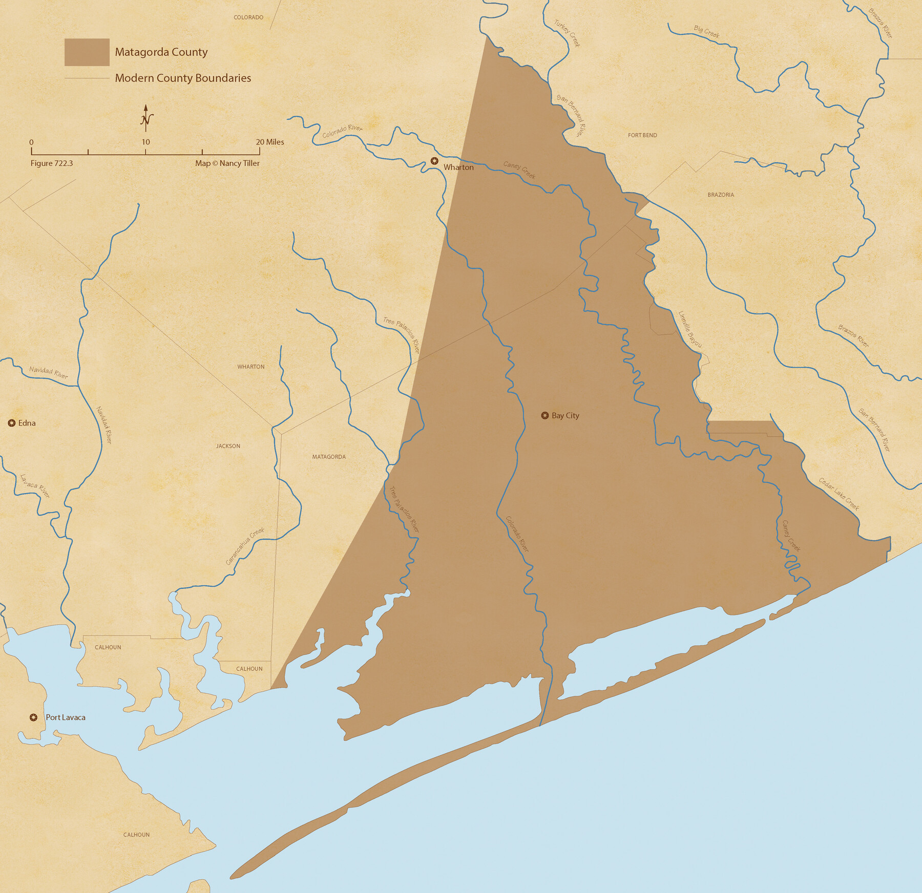
The Republic County of Matagorda. January 1, 1838
Figure No. 722.3 from 'A Boundary Atlas of Texas, 1821-1845' by Jim Tiller
-
Map/Doc
96216
-
Collection
Nancy and Jim Tiller Digital Collection
-
Object Dates
2020/1/1 (Creation Date)
-
People and Organizations
Jim Tiller (Author)
Nancy Tiller (Cartographer)
Gang Gong (GIS Professional)
-
Counties
Matagorda
-
Subjects
Atlas County Republic of Texas Texas Boundaries
-
Height x Width
21.0 x 21.7 inches
53.3 x 55.1 cm
-
Medium
digital image
-
Comments
To purchase a digital PDF copy of "A Boundary Atlas of Texas, 1821-1845" see 96437.
Part of: Nancy and Jim Tiller Digital Collection
The Republic County of Bastrop. Boundaries Defined, December 18, 1837

Print $20.00
The Republic County of Bastrop. Boundaries Defined, December 18, 1837
2020
Size 14.7 x 21.7 inches
Map/Doc 96089
The Republic County of Bexar. Spring 1842

Print $20.00
The Republic County of Bexar. Spring 1842
2020
Size 14.7 x 21.7 inches
Map/Doc 96100
The Judicial District/County of Neches. Created, January 29, 1842

Print $20.00
The Judicial District/County of Neches. Created, January 29, 1842
2020
Size 15.5 x 21.7 inches
Map/Doc 96338
The Republic County of Colorado. Proposed, Late Fall 1837

Print $20.00
The Republic County of Colorado. Proposed, Late Fall 1837
2020
Size 18.4 x 21.7 inches
Map/Doc 96118
The Republic County of Milam. Spring 1842

Print $20.00
The Republic County of Milam. Spring 1842
2020
Size 17.4 x 21.6 inches
Map/Doc 96232
de Leon Empresario Colony. Absorbed by DeWitt Colony. April 15, 1825

Print $20.00
de Leon Empresario Colony. Absorbed by DeWitt Colony. April 15, 1825
2020
Size 18.5 x 21.7 inches
Map/Doc 95989
Republic Counties. January 1, 1841

Print $20.00
Republic Counties. January 1, 1841
2020
Size 24.5 x 21.7 inches
Map/Doc 96314
The Republic County of Harrison. January 8, 1844

Print $20.00
The Republic County of Harrison. January 8, 1844
2020
Size 18.6 x 21.7 inches
Map/Doc 96175
The Republic County of Washington. May 24, 1838

Print $20.00
The Republic County of Washington. May 24, 1838
2020
Size 20.3 x 21.7 inches
Map/Doc 96303

Zavala Empresario Colony. March 12, 1829

Print $20.00
Zavala Empresario Colony. March 12, 1829
2020
Size 24.7 x 21.7 inches
Map/Doc 96012
The Republic County of Austin. January 28, 1841

Print $20.00
The Republic County of Austin. January 28, 1841
2020
Size 14.7 x 21.7 inches
Map/Doc 96085
You may also like
Lubbock County Sketch File 15

Print $6.00
- Digital $50.00
Lubbock County Sketch File 15
1902
Size 11.2 x 8.8 inches
Map/Doc 30440

Flight Mission No. DQN-7K, Frame 90, Calhoun County

Print $20.00
- Digital $50.00
Flight Mission No. DQN-7K, Frame 90, Calhoun County
1953
Size 18.6 x 22.2 inches
Map/Doc 84481
Upshur County Working Sketch 15a

Print $20.00
- Digital $50.00
Upshur County Working Sketch 15a
1996
Size 42.6 x 34.7 inches
Map/Doc 69573
Flight Mission No. CRC-3R, Frame 211, Chambers County

Print $20.00
- Digital $50.00
Flight Mission No. CRC-3R, Frame 211, Chambers County
1956
Size 18.6 x 22.2 inches
Map/Doc 84866
San Saba County Sketch File 10

Print $20.00
- Digital $50.00
San Saba County Sketch File 10
1883
Size 20.4 x 16.5 inches
Map/Doc 12290
Map of San Saba County

Print $20.00
- Digital $50.00
Map of San Saba County
1887
Size 41.1 x 40.9 inches
Map/Doc 16809
Flight Mission No. DAH-17M, Frame 18, Orange County

Print $20.00
- Digital $50.00
Flight Mission No. DAH-17M, Frame 18, Orange County
1953
Size 18.5 x 22.6 inches
Map/Doc 86881
Brazoria County Rolled Sketch AH

Print $20.00
- Digital $50.00
Brazoria County Rolled Sketch AH
Size 43.9 x 31.2 inches
Map/Doc 10714
Cass County Working Sketch 13

Print $20.00
- Digital $50.00
Cass County Working Sketch 13
1945
Size 29.8 x 33.5 inches
Map/Doc 67916

Flight Mission No. DIX-7P, Frame 92, Aransas County

Print $20.00
- Digital $50.00
Flight Mission No. DIX-7P, Frame 92, Aransas County
1956
Size 18.7 x 22.4 inches
Map/Doc 83886