Gurley Transit
Manufacturer: Gurley Engineering Instruments Serial Number: 31292 State Inventory Tag: 305-901 Case: Wooden Box Manufacture Location: Troy, NY
-
Map/Doc
97297
-
Collection
General Map Collection
-
Object Dates
1931 (Creation Date)
-
Height x Width
16.0 x 13.3 inches
40.6 x 33.7 cm
Part of: General Map Collection
Hockley County Sketch File 1

Print $20.00
- Digital $50.00
Hockley County Sketch File 1
Size 20.3 x 18.9 inches
Map/Doc 11767
Cherokee County Boundary File 6 and 15

Print $8.00
- Digital $50.00
Cherokee County Boundary File 6 and 15
Size 8.3 x 6.7 inches
Map/Doc 51301

Wharton County Rolled Sketch 11

Print $20.00
- Digital $50.00
Wharton County Rolled Sketch 11
Size 27.7 x 37.1 inches
Map/Doc 8236
San Patricio County Rolled Sketch 49

Print $20.00
- Digital $50.00
San Patricio County Rolled Sketch 49
1979
Size 21.2 x 20.3 inches
Map/Doc 7735

Hardeman County Sketch File 8a

Print $20.00
- Digital $50.00
Hardeman County Sketch File 8a
Size 16.0 x 32.0 inches
Map/Doc 11623
Martin County Working Sketch 12

Print $40.00
- Digital $50.00
Martin County Working Sketch 12
1971
Size 48.2 x 35.6 inches
Map/Doc 70830

Scurry County Rolled Sketch 4

Print $20.00
- Digital $50.00
Scurry County Rolled Sketch 4
Size 35.7 x 26.0 inches
Map/Doc 7765
Jefferson County Working Sketch 23

Print $4.00
- Digital $50.00
Jefferson County Working Sketch 23
1970
Size 23.9 x 29.2 inches
Map/Doc 66566
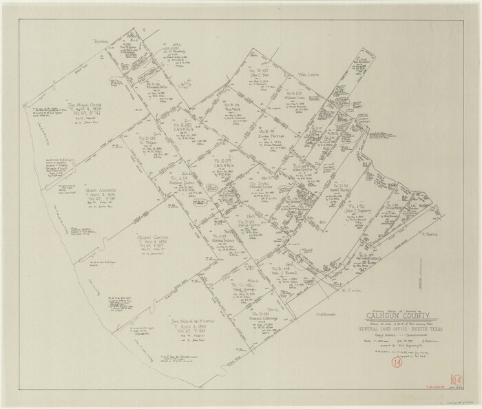
Calhoun County Working Sketch 14
Print $20.00
- Digital $50.00
Calhoun County Working Sketch 14
1991
Size 28.7 x 33.9 inches
Map/Doc 67830
You may also like
Bexar County Boundary File 3

Print $6.00
- Digital $50.00
Bexar County Boundary File 3
Size 8.2 x 3.6 inches
Map/Doc 50536
Red River County Working Sketch 14

Print $20.00
- Digital $50.00
Red River County Working Sketch 14
Size 37.8 x 22.9 inches
Map/Doc 71997
Wharton County Boundary File 1b

Print $20.00
- Digital $50.00
Wharton County Boundary File 1b
Size 15.1 x 26.6 inches
Map/Doc 59855
McCulloch County Sketch File 8

Print $4.00
- Digital $50.00
McCulloch County Sketch File 8
1904
Size 11.3 x 8.7 inches
Map/Doc 31182
Mrs. Alex A. Slaughter Ranch Hockley County, Texas

Print $20.00
- Digital $50.00
Mrs. Alex A. Slaughter Ranch Hockley County, Texas
Size 26.2 x 19.7 inches
Map/Doc 92237
Titus County Working Sketch 1

Print $20.00
- Digital $50.00
Titus County Working Sketch 1
Size 18.2 x 17.3 inches
Map/Doc 69362
Map of Kyle, Lockhart & Southern Ry.

Print $40.00
- Digital $50.00
Map of Kyle, Lockhart & Southern Ry.
1882
Size 14.5 x 94.9 inches
Map/Doc 64285
General Highway Map, Burnet County, Texas

Print $20.00
General Highway Map, Burnet County, Texas
1961
Size 18.0 x 24.6 inches
Map/Doc 79392
Van Zandt County Sketch File 27

Print $4.00
- Digital $50.00
Van Zandt County Sketch File 27
1859
Size 13.1 x 8.3 inches
Map/Doc 39447
Cameron County Rolled Sketch 20E

Print $20.00
- Digital $50.00
Cameron County Rolled Sketch 20E
Size 13.0 x 12.5 inches
Map/Doc 5478
Map of Winkler County

Print $20.00
- Digital $50.00
Map of Winkler County
1900
Size 42.4 x 38.6 inches
Map/Doc 16931
Upton County Working Sketch 8

Print $20.00
- Digital $50.00
Upton County Working Sketch 8
Size 21.9 x 16.8 inches
Map/Doc 69504