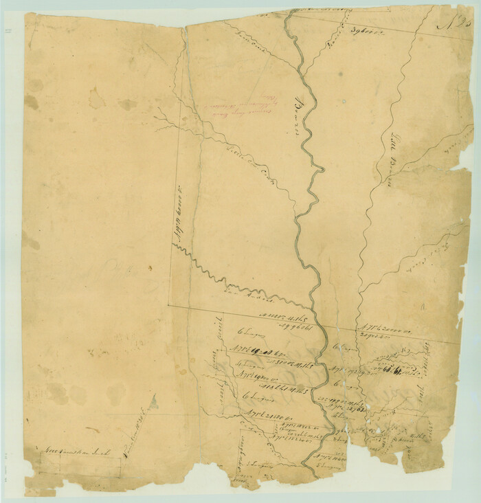
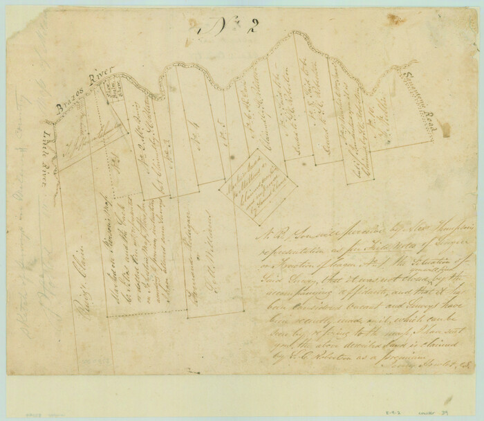
[Surveys in Austin's Colony along the Brazos River]
Print $20.00
- Digital $50.00
[Surveys in Austin's Colony along the Brazos River]
1833
Size: 25.0 x 23.9 inches
164
Burleson County Sketch File 2

Print $4.00
- Digital $50.00
Burleson County Sketch File 2
1847
Size: 10.7 x 8.0 inches
16645
Burleson County Sketch File 3

Print $4.00
- Digital $50.00
Burleson County Sketch File 3
1848
Size: 6.4 x 7.4 inches
16647
Burleson County Sketch File 6

Print $4.00
- Digital $50.00
Burleson County Sketch File 6
1865
Size: 8.0 x 9.3 inches
16651
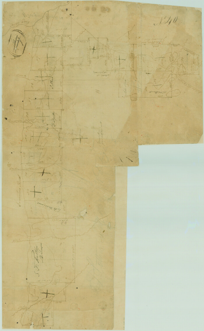
Burleson County Sketch File 7

Print $40.00
- Digital $50.00
Burleson County Sketch File 7
1935
Size: 17.0 x 14.5 inches
16653
Burleson County Sketch File 8

Print $6.00
- Digital $50.00
Burleson County Sketch File 8
Size: 8.7 x 5.3 inches
16654
Burleson County Sketch File 9

Print $12.00
- Digital $50.00
Burleson County Sketch File 9
1929
Size: 14.2 x 8.1 inches
16657
Burleson County Sketch File 10

Print $14.00
- Digital $50.00
Burleson County Sketch File 10
Size: 11.5 x 8.3 inches
16663
[Surveys in Austin's Colony along Hickory Creek, Hog Creek, and the Yegua River]
Print $20.00
- Digital $50.00
[Surveys in Austin's Colony along Hickory Creek, Hog Creek, and the Yegua River]
1831
Size: 19.4 x 23.9 inches
195
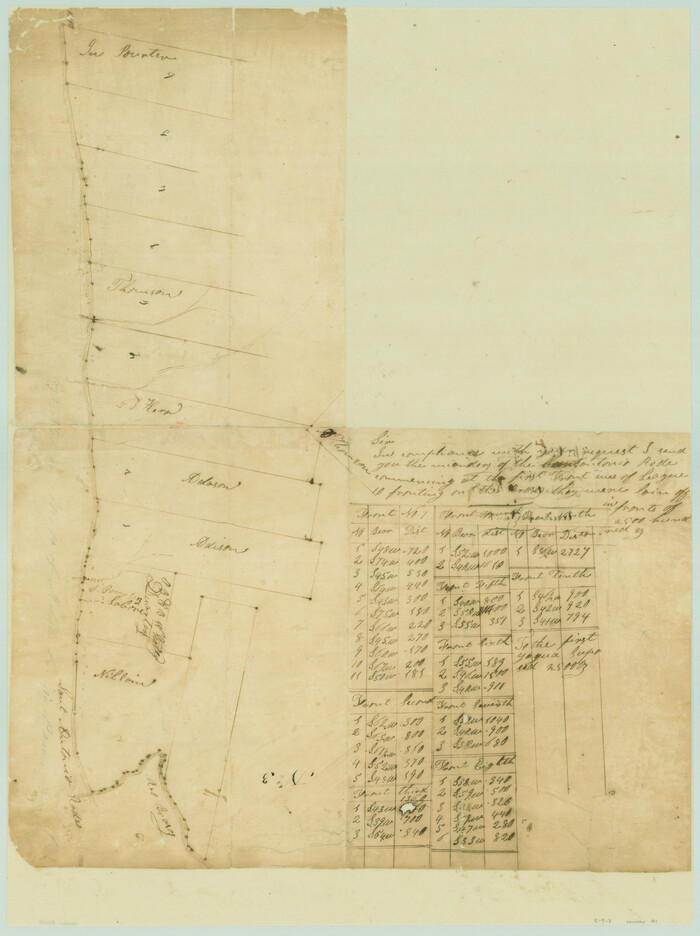
[Surveys in Austin's Colony along the San Antonio Road and the Brazos and Yegua Rivers]
Print $20.00
- Digital $50.00
[Surveys in Austin's Colony along the San Antonio Road and the Brazos and Yegua Rivers]
1831
Size: 30.8 x 19.1 inches
203
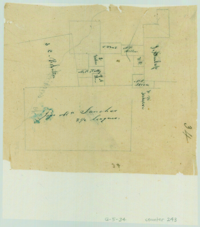
[Surveys along Davidson's Creek]
Print $2.00
- Digital $50.00
[Surveys along Davidson's Creek]
Size: 5.3 x 4.7 inches
243
Surveys in the Milam District at the fork of the Yegua and Brazos Rivers and on the Leon River

Print $2.00
- Digital $50.00
Surveys in the Milam District at the fork of the Yegua and Brazos Rivers and on the Leon River
1846
Size: 9.2 x 16.0 inches
254
Map of Burleson County

Print $20.00
- Digital $50.00
Map of Burleson County
1856
Size: 22.0 x 31.5 inches
3345
Lee County & Burleson County

Print $20.00
- Digital $50.00
Lee County & Burleson County
1867
Size: 18.0 x 31.9 inches
3346
[Surveys along the Brazos River]
Print $3.00
- Digital $50.00
[Surveys along the Brazos River]
1840
Size: 9.5 x 10.9 inches
39
[Sketch of Surveys on San Antonio Road]
Print $20.00
- Digital $50.00
[Sketch of Surveys on San Antonio Road]
1840
Size: 20.6 x 15.4 inches
41
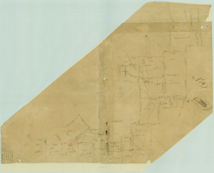
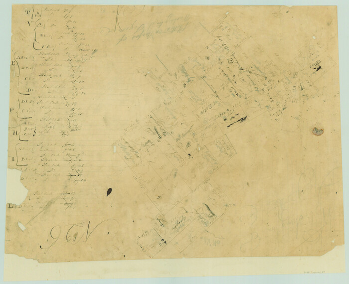
Burleson County Rolled Sketch 1

Print $631.00
- Digital $50.00
Burleson County Rolled Sketch 1
Size: 10.2 x 16.5 inches
43342
Map of Burleson County

Print $20.00
- Digital $50.00
Map of Burleson County
1867
Size: 19.1 x 30.0 inches
4511

Brazos River, Sandpit Special Sheet

Print $6.00
- Digital $50.00
Brazos River, Sandpit Special Sheet
1936
Size: 33.8 x 24.7 inches
65279
Brazos River, Jones Bridge Special Map Sheet

Print $4.00
- Digital $50.00
Brazos River, Jones Bridge Special Map Sheet
1936
Size: 29.8 x 28.2 inches
65280
Brazos River, Brazos River Sheet 1

Print $4.00
- Digital $50.00
Brazos River, Brazos River Sheet 1
1926
Size: 21.5 x 25.4 inches
65293
Brazos River, Brazos River Sheet 2

Print $6.00
- Digital $50.00
Brazos River, Brazos River Sheet 2
1926
Size: 25.0 x 31.4 inches
65294
Map of Burleson County, Texas

Print $20.00
- Digital $50.00
Map of Burleson County, Texas
1879
Size: 16.1 x 21.1 inches
667
[Surveys in Austin's Colony along the Yegua River and Cedar Creek]
Print $20.00
- Digital $50.00
[Surveys in Austin's Colony along the Yegua River and Cedar Creek]
1835
Size: 15.7 x 19.3 inches
67
[Surveys in Austin's Colony along the Brazos River]
Print $20.00
- Digital $50.00
[Surveys in Austin's Colony along the Brazos River]
1833
-
Size
25.0 x 23.9 inches
-
Map/Doc
164
-
Creation Date
1833
Burleson County Sketch File 2
Print $4.00
- Digital $50.00
Burleson County Sketch File 2
1847
-
Size
10.7 x 8.0 inches
-
Map/Doc
16645
-
Creation Date
1847
Burleson County Sketch File 3
Print $4.00
- Digital $50.00
Burleson County Sketch File 3
1848
-
Size
6.4 x 7.4 inches
-
Map/Doc
16647
-
Creation Date
1848
Burleson County Sketch File 6
Print $4.00
- Digital $50.00
Burleson County Sketch File 6
1865
-
Size
8.0 x 9.3 inches
-
Map/Doc
16651
-
Creation Date
1865
Burleson County Sketch File 7
Print $40.00
- Digital $50.00
Burleson County Sketch File 7
1935
-
Size
17.0 x 14.5 inches
-
Map/Doc
16653
-
Creation Date
1935
Burleson County Sketch File 8
Print $6.00
- Digital $50.00
Burleson County Sketch File 8
-
Size
8.7 x 5.3 inches
-
Map/Doc
16654
Burleson County Sketch File 9
Print $12.00
- Digital $50.00
Burleson County Sketch File 9
1929
-
Size
14.2 x 8.1 inches
-
Map/Doc
16657
-
Creation Date
1929
Burleson County Sketch File 10
Print $14.00
- Digital $50.00
Burleson County Sketch File 10
-
Size
11.5 x 8.3 inches
-
Map/Doc
16663
[Surveys in Austin's Colony along Hickory Creek, Hog Creek, and the Yegua River]
Print $20.00
- Digital $50.00
[Surveys in Austin's Colony along Hickory Creek, Hog Creek, and the Yegua River]
1831
-
Size
19.4 x 23.9 inches
-
Map/Doc
195
-
Creation Date
1831
[Surveys in Austin's Colony along the San Antonio Road and the Brazos and Yegua Rivers]
Print $20.00
- Digital $50.00
[Surveys in Austin's Colony along the San Antonio Road and the Brazos and Yegua Rivers]
1831
-
Size
30.8 x 19.1 inches
-
Map/Doc
203
-
Creation Date
1831
[Surveys along Davidson's Creek]
Print $2.00
- Digital $50.00
[Surveys along Davidson's Creek]
-
Size
5.3 x 4.7 inches
-
Map/Doc
243
Surveys in the Milam District at the fork of the Yegua and Brazos Rivers and on the Leon River
Print $2.00
- Digital $50.00
Surveys in the Milam District at the fork of the Yegua and Brazos Rivers and on the Leon River
1846
-
Size
9.2 x 16.0 inches
-
Map/Doc
254
-
Creation Date
1846
Map of Burleson County
Print $20.00
- Digital $50.00
Map of Burleson County
1856
-
Size
22.0 x 31.5 inches
-
Map/Doc
3345
-
Creation Date
1856
Lee County & Burleson County
Print $20.00
- Digital $50.00
Lee County & Burleson County
1867
-
Size
18.0 x 31.9 inches
-
Map/Doc
3346
-
Creation Date
1867
Burleson County

Print $20.00
- Digital $50.00
Burleson County
1884
-
Size
18.2 x 23.4 inches
-
Map/Doc
3347
-
Creation Date
1884
Burleson County

Print $20.00
- Digital $50.00
Burleson County
1884
-
Size
21.9 x 25.2 inches
-
Map/Doc
3349
-
Creation Date
1884
[Surveys along the Brazos River]
Print $3.00
- Digital $50.00
[Surveys along the Brazos River]
1840
-
Size
9.5 x 10.9 inches
-
Map/Doc
39
-
Creation Date
1840
[Sketch of Surveys on San Antonio Road]
Print $20.00
- Digital $50.00
[Sketch of Surveys on San Antonio Road]
1840
-
Size
20.6 x 15.4 inches
-
Map/Doc
41
-
Creation Date
1840
Burleson County Rolled Sketch 1
Print $631.00
- Digital $50.00
Burleson County Rolled Sketch 1
-
Size
10.2 x 16.5 inches
-
Map/Doc
43342
Map of Burleson County
Print $20.00
- Digital $50.00
Map of Burleson County
1867
-
Size
19.1 x 30.0 inches
-
Map/Doc
4511
-
Creation Date
1867
Burleson County

Print $20.00
- Digital $50.00
Burleson County
1920
-
Size
38.0 x 45.0 inches
-
Map/Doc
4790
-
Creation Date
1920
Burleson County

Print $20.00
- Digital $50.00
Burleson County
1920
-
Size
40.6 x 45.7 inches
-
Map/Doc
4896
-
Creation Date
1920
Brazos River, Sandpit Special Sheet
Print $6.00
- Digital $50.00
Brazos River, Sandpit Special Sheet
1936
-
Size
33.8 x 24.7 inches
-
Map/Doc
65279
-
Creation Date
1936
Brazos River, Jones Bridge Special Map Sheet
Print $4.00
- Digital $50.00
Brazos River, Jones Bridge Special Map Sheet
1936
-
Size
29.8 x 28.2 inches
-
Map/Doc
65280
-
Creation Date
1936
Brazos River, Brazos River Sheet 1
Print $4.00
- Digital $50.00
Brazos River, Brazos River Sheet 1
1926
-
Size
21.5 x 25.4 inches
-
Map/Doc
65293
-
Creation Date
1926
Brazos River, Brazos River Sheet 2
Print $6.00
- Digital $50.00
Brazos River, Brazos River Sheet 2
1926
-
Size
25.0 x 31.4 inches
-
Map/Doc
65294
-
Creation Date
1926
Map of Burleson County, Texas
Print $20.00
- Digital $50.00
Map of Burleson County, Texas
1879
-
Size
16.1 x 21.1 inches
-
Map/Doc
667
-
Creation Date
1879
Burleson County

Print $20.00
- Digital $50.00
Burleson County
1920
-
Size
40.7 x 45.2 inches
-
Map/Doc
66740
-
Creation Date
1920
[Surveys in Austin's Colony along the Yegua River and Cedar Creek]
Print $20.00
- Digital $50.00
[Surveys in Austin's Colony along the Yegua River and Cedar Creek]
1835
-
Size
15.7 x 19.3 inches
-
Map/Doc
67
-
Creation Date
1835