[Surveys along Rabb's Creek]
Print $2.00
- Digital $50.00
[Surveys along Rabb's Creek]
1841
Size: 8.7 x 11.0 inches
154
Bastrop County Boundary File 6

Print $40.00
- Digital $50.00
Bastrop County Boundary File 6
1923
Size: 15.4 x 102.0 inches
1691
Surveys in Austin's Colony along the Colorado River below the San Antonio Road

Print $20.00
- Digital $50.00
Surveys in Austin's Colony along the Colorado River below the San Antonio Road
1830
Size: 38.2 x 13.5 inches
193
Connected Map of DeWitt's Colony compiled from the surveys of Byrd Lockhart

Print $40.00
- Digital $50.00
Connected Map of DeWitt's Colony compiled from the surveys of Byrd Lockhart
1831
Size: 39.2 x 54.0 inches
1942
[Surveys in Austin's Colony along the Colorado River]
Print $20.00
- Digital $50.00
[Surveys in Austin's Colony along the Colorado River]
1830
Size: 38.9 x 23.2 inches
198
[Surveys in Austin's Colony along the Navidad River, Caney Fork, and upper Rocky Creek]
Print $20.00
- Digital $50.00
[Surveys in Austin's Colony along the Navidad River, Caney Fork, and upper Rocky Creek]
1831
Size: 20.5 x 26.7 inches
201
[Traverse up the Brazos and Colorado River showing distance from county site to county site]
Print $40.00
- Digital $50.00
[Traverse up the Brazos and Colorado River showing distance from county site to county site]
1871
Size: 16.2 x 98.8 inches
2054
Fayette County Sketch File 1

Print $4.00
- Digital $50.00
Fayette County Sketch File 1
Size: 8.4 x 7.2 inches
22497
Fayette County Sketch File 2

Print $4.00
- Digital $50.00
Fayette County Sketch File 2
1862
Size: 10.3 x 8.4 inches
22499
Fayette County Sketch File 3

Print $6.00
- Digital $50.00
Fayette County Sketch File 3
1863
Size: 8.3 x 10.7 inches
22501
Fayette County Sketch File 4

Print $4.00
- Digital $50.00
Fayette County Sketch File 4
Size: 11.7 x 7.9 inches
22504
Fayette County Sketch File 5

Print $4.00
- Digital $50.00
Fayette County Sketch File 5
Size: 14.3 x 8.7 inches
22506
Fayette County Sketch File 6

Print $114.00
- Digital $50.00
Fayette County Sketch File 6
1981
Size: 14.9 x 9.5 inches
22508
Fayette County Sketch File 7

Print $4.00
- Digital $50.00
Fayette County Sketch File 7
1873
Size: 8.5 x 12.8 inches
22547
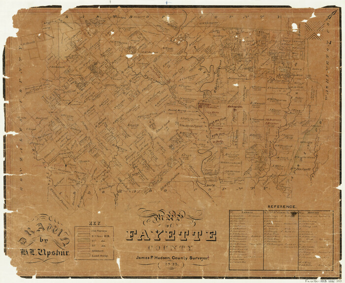
Map of Fayette County
Print $20.00
- Digital $50.00
Map of Fayette County
1843
Size: 21.9 x 26.7 inches
3537
Map of Fayette County

Print $20.00
- Digital $50.00
Map of Fayette County
1871
Size: 19.2 x 22.0 inches
3538
Map of Fayette County Texas

Print $20.00
- Digital $50.00
Map of Fayette County Texas
1840
Size: 26.4 x 22.6 inches
3539
Map of Fayette County

Print $20.00
- Digital $50.00
Map of Fayette County
1865
Size: 23.2 x 28.8 inches
3540
Washington County Sketch File 5

Print $4.00
- Digital $50.00
Washington County Sketch File 5
Size: 8.0 x 7.0 inches
39652
Fayette County, Texas

Print $20.00
- Digital $50.00
Fayette County, Texas
1879
Size: 19.9 x 23.0 inches
419
Fayette County Boundary File 1

Print $2.00
- Digital $50.00
Fayette County Boundary File 1
Size: 11.1 x 8.7 inches
53330
Fayette County Boundary File 2

Print $53.00
- Digital $50.00
Fayette County Boundary File 2
Size: 11.2 x 9.0 inches
53331
Fayette County Boundary File 2a

Print $8.00
- Digital $50.00
Fayette County Boundary File 2a
Size: 14.9 x 9.3 inches
53345
Fayette County Boundary File 3

Print $29.00
- Digital $50.00
Fayette County Boundary File 3
Size: 14.4 x 9.0 inches
53348
Fayette County Boundary File 4

Print $19.00
- Digital $50.00
Fayette County Boundary File 4
Size: 14.4 x 9.0 inches
53362
Fayette County Boundary File 5

Print $59.00
- Digital $50.00
Fayette County Boundary File 5
Size: 14.4 x 9.0 inches
53371
Fayette County Boundary File 6

Print $20.00
- Digital $50.00
Fayette County Boundary File 6
Size: 14.4 x 9.0 inches
53391
Fayette County Boundary File 7

Print $40.00
- Digital $50.00
Fayette County Boundary File 7
Size: 18.1 x 13.1 inches
53400
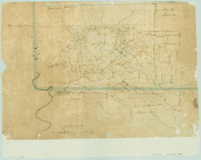
[Surveys along Rabb's Creek]
Print $2.00
- Digital $50.00
[Surveys along Rabb's Creek]
1841
-
Size
8.7 x 11.0 inches
-
Map/Doc
154
-
Creation Date
1841
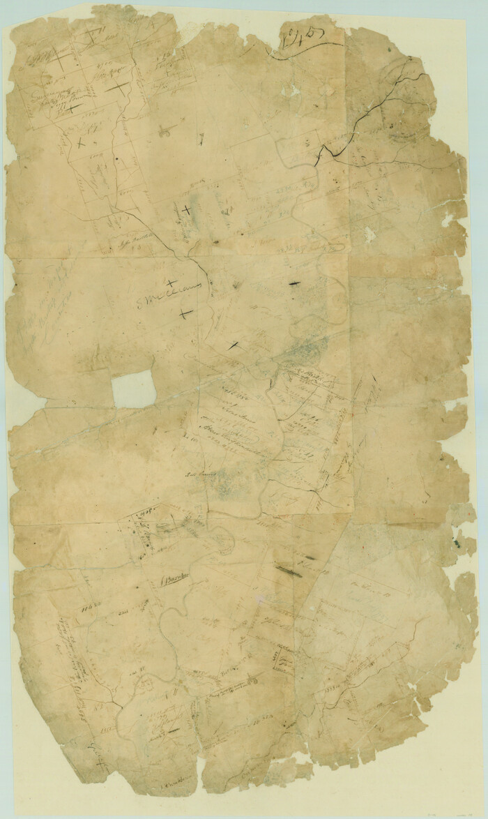
Bastrop County Boundary File 6
Print $40.00
- Digital $50.00
Bastrop County Boundary File 6
1923
-
Size
15.4 x 102.0 inches
-
Map/Doc
1691
-
Creation Date
1923
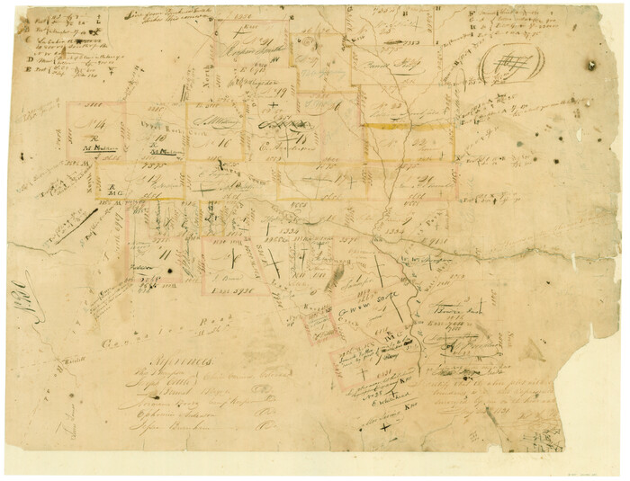
Surveys in Austin's Colony along the Colorado River below the San Antonio Road
Print $20.00
- Digital $50.00
Surveys in Austin's Colony along the Colorado River below the San Antonio Road
1830
-
Size
38.2 x 13.5 inches
-
Map/Doc
193
-
Creation Date
1830
Connected Map of DeWitt's Colony compiled from the surveys of Byrd Lockhart
Print $40.00
- Digital $50.00
Connected Map of DeWitt's Colony compiled from the surveys of Byrd Lockhart
1831
-
Size
39.2 x 54.0 inches
-
Map/Doc
1942
-
Creation Date
1831
[Surveys in Austin's Colony along the Colorado River]
Print $20.00
- Digital $50.00
[Surveys in Austin's Colony along the Colorado River]
1830
-
Size
38.9 x 23.2 inches
-
Map/Doc
198
-
Creation Date
1830
[Surveys in Austin's Colony along the Navidad River, Caney Fork, and upper Rocky Creek]
Print $20.00
- Digital $50.00
[Surveys in Austin's Colony along the Navidad River, Caney Fork, and upper Rocky Creek]
1831
-
Size
20.5 x 26.7 inches
-
Map/Doc
201
-
Creation Date
1831
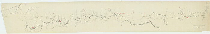
[Traverse up the Brazos and Colorado River showing distance from county site to county site]
Print $40.00
- Digital $50.00
[Traverse up the Brazos and Colorado River showing distance from county site to county site]
1871
-
Size
16.2 x 98.8 inches
-
Map/Doc
2054
-
Creation Date
1871
Fayette County Sketch File 1
Print $4.00
- Digital $50.00
Fayette County Sketch File 1
-
Size
8.4 x 7.2 inches
-
Map/Doc
22497
Fayette County Sketch File 2
Print $4.00
- Digital $50.00
Fayette County Sketch File 2
1862
-
Size
10.3 x 8.4 inches
-
Map/Doc
22499
-
Creation Date
1862
Fayette County Sketch File 3
Print $6.00
- Digital $50.00
Fayette County Sketch File 3
1863
-
Size
8.3 x 10.7 inches
-
Map/Doc
22501
-
Creation Date
1863
Fayette County Sketch File 4
Print $4.00
- Digital $50.00
Fayette County Sketch File 4
-
Size
11.7 x 7.9 inches
-
Map/Doc
22504
Fayette County Sketch File 5
Print $4.00
- Digital $50.00
Fayette County Sketch File 5
-
Size
14.3 x 8.7 inches
-
Map/Doc
22506
Fayette County Sketch File 6
Print $114.00
- Digital $50.00
Fayette County Sketch File 6
1981
-
Size
14.9 x 9.5 inches
-
Map/Doc
22508
-
Creation Date
1981
Fayette County Sketch File 7
Print $4.00
- Digital $50.00
Fayette County Sketch File 7
1873
-
Size
8.5 x 12.8 inches
-
Map/Doc
22547
-
Creation Date
1873
Map of Fayette County
Print $20.00
- Digital $50.00
Map of Fayette County
1843
-
Size
21.9 x 26.7 inches
-
Map/Doc
3537
-
Creation Date
1843
Map of Fayette County
Print $20.00
- Digital $50.00
Map of Fayette County
1871
-
Size
19.2 x 22.0 inches
-
Map/Doc
3538
-
Creation Date
1871
Map of Fayette County Texas
Print $20.00
- Digital $50.00
Map of Fayette County Texas
1840
-
Size
26.4 x 22.6 inches
-
Map/Doc
3539
-
Creation Date
1840
Map of Fayette County
Print $20.00
- Digital $50.00
Map of Fayette County
1865
-
Size
23.2 x 28.8 inches
-
Map/Doc
3540
-
Creation Date
1865
Washington County Sketch File 5
Print $4.00
- Digital $50.00
Washington County Sketch File 5
-
Size
8.0 x 7.0 inches
-
Map/Doc
39652
Fayette County, Texas
Print $20.00
- Digital $50.00
Fayette County, Texas
1879
-
Size
19.9 x 23.0 inches
-
Map/Doc
419
-
Creation Date
1879
Fayette County

Print $40.00
- Digital $50.00
Fayette County
1920
-
Size
40.7 x 49.0 inches
-
Map/Doc
4716
-
Creation Date
1920
Fayette County

Print $40.00
- Digital $50.00
Fayette County
1920
-
Size
42.7 x 49.8 inches
-
Map/Doc
4945
-
Creation Date
1920
Fayette County Boundary File 1
Print $2.00
- Digital $50.00
Fayette County Boundary File 1
-
Size
11.1 x 8.7 inches
-
Map/Doc
53330
Fayette County Boundary File 2
Print $53.00
- Digital $50.00
Fayette County Boundary File 2
-
Size
11.2 x 9.0 inches
-
Map/Doc
53331
Fayette County Boundary File 2a
Print $8.00
- Digital $50.00
Fayette County Boundary File 2a
-
Size
14.9 x 9.3 inches
-
Map/Doc
53345
Fayette County Boundary File 3
Print $29.00
- Digital $50.00
Fayette County Boundary File 3
-
Size
14.4 x 9.0 inches
-
Map/Doc
53348
Fayette County Boundary File 4
Print $19.00
- Digital $50.00
Fayette County Boundary File 4
-
Size
14.4 x 9.0 inches
-
Map/Doc
53362
Fayette County Boundary File 5
Print $59.00
- Digital $50.00
Fayette County Boundary File 5
-
Size
14.4 x 9.0 inches
-
Map/Doc
53371
Fayette County Boundary File 6
Print $20.00
- Digital $50.00
Fayette County Boundary File 6
-
Size
14.4 x 9.0 inches
-
Map/Doc
53391
Fayette County Boundary File 7
Print $40.00
- Digital $50.00
Fayette County Boundary File 7
-
Size
18.1 x 13.1 inches
-
Map/Doc
53400