The Republic County of Fayette. Created, December 14, 1837

Print $20.00
The Republic County of Fayette. Created, December 14, 1837
2020
Size: 14.7 x 21.7 inches
96131
The Republic County of Fayette. May 3, 1838

Print $20.00
The Republic County of Fayette. May 3, 1838
2020
Size: 14.7 x 21.7 inches
96132
The Republic County of Fayette. May 24, 1838

Print $20.00
The Republic County of Fayette. May 24, 1838
2020
Size: 14.7 x 21.7 inches
96133
The Republic County of Fayette. January 29, 1842

Print $20.00
The Republic County of Fayette. January 29, 1842
2020
Size: 14.7 x 21.7 inches
96134
The Republic County of Fayette. Spring 1842

Print $20.00
The Republic County of Fayette. Spring 1842
2020
Size: 14.7 x 21.7 inches
96135
The Republic County of Fayette. December 29, 1845

Print $20.00
The Republic County of Fayette. December 29, 1845
2020
Size: 14.7 x 21.7 inches
96136
Fayette County Working Sketch 11

Print $20.00
- Digital $50.00
Fayette County Working Sketch 11
1990
Size: 30.8 x 35.0 inches
69175
Fayette County Working Sketch 10

Print $20.00
- Digital $50.00
Fayette County Working Sketch 10
1985
Size: 27.1 x 38.5 inches
69174
Fayette County Rolled Sketch 1

Print $20.00
- Digital $50.00
Fayette County Rolled Sketch 1
1981
Size: 20.9 x 25.8 inches
5876
Fayette County Sketch File 6

Print $114.00
- Digital $50.00
Fayette County Sketch File 6
1981
Size: 14.9 x 9.5 inches
22508
Fayette County Working Sketch 9

Print $20.00
- Digital $50.00
Fayette County Working Sketch 9
1981
Size: 34.4 x 32.3 inches
69173
Fayette County Working Sketch 8

Print $20.00
- Digital $50.00
Fayette County Working Sketch 8
1981
Size: 14.4 x 11.5 inches
69172
Fayette County Working Sketch 7

Print $20.00
- Digital $50.00
Fayette County Working Sketch 7
1981
Size: 24.1 x 15.6 inches
69171
Fayette County Working Sketch 6

Print $20.00
- Digital $50.00
Fayette County Working Sketch 6
1981
Size: 17.0 x 15.1 inches
69170
Fayette County Working Sketch 5

Print $20.00
- Digital $50.00
Fayette County Working Sketch 5
1981
Size: 16.2 x 14.6 inches
69169
Fayette County Working Sketch 4

Print $20.00
- Digital $50.00
Fayette County Working Sketch 4
1980
Size: 31.7 x 36.7 inches
69168
Fayette County Working Sketch 3

Print $20.00
- Digital $50.00
Fayette County Working Sketch 3
1980
Size: 29.0 x 36.3 inches
69167
Fayette County Working Sketch 2

Print $20.00
- Digital $50.00
Fayette County Working Sketch 2
1979
Size: 40.6 x 37.8 inches
69166
Fayette County Working Sketch Graphic Index

Print $40.00
- Digital $50.00
Fayette County Working Sketch Graphic Index
1978
Size: 42.9 x 54.7 inches
76541
General Highway Map, Fayette County, Texas

Print $20.00
General Highway Map, Fayette County, Texas
1961
Size: 18.2 x 24.5 inches
79465
Fayette County Working Sketch 1

Print $20.00
- Digital $50.00
Fayette County Working Sketch 1
1949
Size: 25.4 x 18.0 inches
69165
General Highway Map, Fayette County, Texas

Print $20.00
General Highway Map, Fayette County, Texas
1940
Size: 18.5 x 25.0 inches
79089
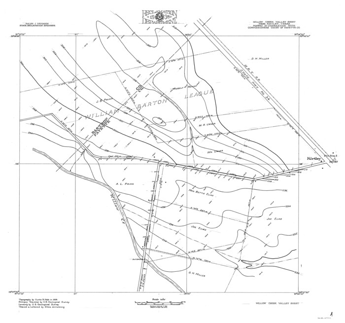
Colorado River, Willow Creek Valley Sheet[/Near Kirtley, Texas Mapped in Cooperation with Commissioner's Court of Fayette Co.]
Print $20.00
- Digital $50.00
Colorado River, Willow Creek Valley Sheet[/Near Kirtley, Texas Mapped in Cooperation with Commissioner's Court of Fayette Co.]
1938
Size: 38.2 x 40.8 inches
65322
Fayette County Rolled Sketch K

Print $20.00
- Digital $50.00
Fayette County Rolled Sketch K
1936
Size: 41.2 x 40.0 inches
8886
Colorado River, LaGrange Sheet

Print $20.00
- Digital $50.00
Colorado River, LaGrange Sheet
1934
Size: 37.8 x 32.9 inches
65302
Water-Shed of the Colorado River

Print $40.00
- Digital $50.00
Water-Shed of the Colorado River
1925
Size: 37.1 x 79.8 inches
65261
Bastrop County Boundary File 6

Print $40.00
- Digital $50.00
Bastrop County Boundary File 6
1923
Size: 15.4 x 102.0 inches
1691
The Republic County of Fayette. Created, December 14, 1837
Print $20.00
The Republic County of Fayette. Created, December 14, 1837
2020
-
Size
14.7 x 21.7 inches
-
Map/Doc
96131
-
Creation Date
2020
The Republic County of Fayette. May 3, 1838
Print $20.00
The Republic County of Fayette. May 3, 1838
2020
-
Size
14.7 x 21.7 inches
-
Map/Doc
96132
-
Creation Date
2020
The Republic County of Fayette. May 24, 1838
Print $20.00
The Republic County of Fayette. May 24, 1838
2020
-
Size
14.7 x 21.7 inches
-
Map/Doc
96133
-
Creation Date
2020
The Republic County of Fayette. January 29, 1842
Print $20.00
The Republic County of Fayette. January 29, 1842
2020
-
Size
14.7 x 21.7 inches
-
Map/Doc
96134
-
Creation Date
2020
The Republic County of Fayette. Spring 1842
Print $20.00
The Republic County of Fayette. Spring 1842
2020
-
Size
14.7 x 21.7 inches
-
Map/Doc
96135
-
Creation Date
2020
The Republic County of Fayette. December 29, 1845
Print $20.00
The Republic County of Fayette. December 29, 1845
2020
-
Size
14.7 x 21.7 inches
-
Map/Doc
96136
-
Creation Date
2020
Fayette County Working Sketch 11
Print $20.00
- Digital $50.00
Fayette County Working Sketch 11
1990
-
Size
30.8 x 35.0 inches
-
Map/Doc
69175
-
Creation Date
1990
Fayette County Working Sketch 10
Print $20.00
- Digital $50.00
Fayette County Working Sketch 10
1985
-
Size
27.1 x 38.5 inches
-
Map/Doc
69174
-
Creation Date
1985
Fayette County Rolled Sketch 1
Print $20.00
- Digital $50.00
Fayette County Rolled Sketch 1
1981
-
Size
20.9 x 25.8 inches
-
Map/Doc
5876
-
Creation Date
1981
Fayette County Sketch File 6
Print $114.00
- Digital $50.00
Fayette County Sketch File 6
1981
-
Size
14.9 x 9.5 inches
-
Map/Doc
22508
-
Creation Date
1981
Fayette County Working Sketch 9
Print $20.00
- Digital $50.00
Fayette County Working Sketch 9
1981
-
Size
34.4 x 32.3 inches
-
Map/Doc
69173
-
Creation Date
1981
Fayette County Working Sketch 8
Print $20.00
- Digital $50.00
Fayette County Working Sketch 8
1981
-
Size
14.4 x 11.5 inches
-
Map/Doc
69172
-
Creation Date
1981
Fayette County Working Sketch 7
Print $20.00
- Digital $50.00
Fayette County Working Sketch 7
1981
-
Size
24.1 x 15.6 inches
-
Map/Doc
69171
-
Creation Date
1981
Fayette County Working Sketch 6
Print $20.00
- Digital $50.00
Fayette County Working Sketch 6
1981
-
Size
17.0 x 15.1 inches
-
Map/Doc
69170
-
Creation Date
1981
Fayette County Working Sketch 5
Print $20.00
- Digital $50.00
Fayette County Working Sketch 5
1981
-
Size
16.2 x 14.6 inches
-
Map/Doc
69169
-
Creation Date
1981
Fayette County Working Sketch 4
Print $20.00
- Digital $50.00
Fayette County Working Sketch 4
1980
-
Size
31.7 x 36.7 inches
-
Map/Doc
69168
-
Creation Date
1980
Fayette County Working Sketch 3
Print $20.00
- Digital $50.00
Fayette County Working Sketch 3
1980
-
Size
29.0 x 36.3 inches
-
Map/Doc
69167
-
Creation Date
1980
Fayette County Working Sketch 2
Print $20.00
- Digital $50.00
Fayette County Working Sketch 2
1979
-
Size
40.6 x 37.8 inches
-
Map/Doc
69166
-
Creation Date
1979
Fayette County

Print $40.00
- Digital $50.00
Fayette County
1978
-
Size
43.6 x 56.1 inches
-
Map/Doc
95496
-
Creation Date
1978
Fayette County

Print $40.00
- Digital $50.00
Fayette County
1978
-
Size
42.5 x 54.7 inches
-
Map/Doc
73146
-
Creation Date
1978
Fayette County Working Sketch Graphic Index
Print $40.00
- Digital $50.00
Fayette County Working Sketch Graphic Index
1978
-
Size
42.9 x 54.7 inches
-
Map/Doc
76541
-
Creation Date
1978
Fayette County

Print $40.00
- Digital $50.00
Fayette County
1978
-
Size
42.8 x 54.5 inches
-
Map/Doc
77278
-
Creation Date
1978
General Highway Map, Fayette County, Texas
Print $20.00
General Highway Map, Fayette County, Texas
1961
-
Size
18.2 x 24.5 inches
-
Map/Doc
79465
-
Creation Date
1961
Fayette County Working Sketch 1
Print $20.00
- Digital $50.00
Fayette County Working Sketch 1
1949
-
Size
25.4 x 18.0 inches
-
Map/Doc
69165
-
Creation Date
1949
General Highway Map, Fayette County, Texas
Print $20.00
General Highway Map, Fayette County, Texas
1940
-
Size
18.5 x 25.0 inches
-
Map/Doc
79089
-
Creation Date
1940
Colorado River, Willow Creek Valley Sheet[/Near Kirtley, Texas Mapped in Cooperation with Commissioner's Court of Fayette Co.]
Print $20.00
- Digital $50.00
Colorado River, Willow Creek Valley Sheet[/Near Kirtley, Texas Mapped in Cooperation with Commissioner's Court of Fayette Co.]
1938
-
Size
38.2 x 40.8 inches
-
Map/Doc
65322
-
Creation Date
1938
Fayette County Rolled Sketch K
Print $20.00
- Digital $50.00
Fayette County Rolled Sketch K
1936
-
Size
41.2 x 40.0 inches
-
Map/Doc
8886
-
Creation Date
1936
Colorado River, LaGrange Sheet
Print $20.00
- Digital $50.00
Colorado River, LaGrange Sheet
1934
-
Size
37.8 x 32.9 inches
-
Map/Doc
65302
-
Creation Date
1934
Water-Shed of the Colorado River
Print $40.00
- Digital $50.00
Water-Shed of the Colorado River
1925
-
Size
37.1 x 79.8 inches
-
Map/Doc
65261
-
Creation Date
1925
Bastrop County Boundary File 6
Print $40.00
- Digital $50.00
Bastrop County Boundary File 6
1923
-
Size
15.4 x 102.0 inches
-
Map/Doc
1691
-
Creation Date
1923