Bandera County Sketch File 10

Print $40.00
- Digital $50.00
Bandera County Sketch File 10
Size: 15.0 x 17.4 inches
10892
Bandera County Sketch File 28

Print $40.00
- Digital $50.00
Bandera County Sketch File 28
Size: 23.5 x 20.0 inches
10897
Bexar County Sketch File 46

Print $40.00
- Digital $50.00
Bexar County Sketch File 46
1888
Size: 24.7 x 22.6 inches
10924
Kendall County Sketch File 21

Print $20.00
- Digital $50.00
Kendall County Sketch File 21
1931
Size: 17.9 x 22.7 inches
11909
Kendall County Sketch File 22

Print $20.00
- Digital $50.00
Kendall County Sketch File 22
1926
Size: 17.0 x 25.8 inches
11910
Kendall County Sketch File 22B

Print $20.00
- Digital $50.00
Kendall County Sketch File 22B
1937
Size: 19.3 x 24.6 inches
11911
Kerr County Sketch File 14

Print $20.00
- Digital $50.00
Kerr County Sketch File 14
Size: 14.9 x 17.8 inches
11918
Kerr County Sketch File 18

Print $20.00
- Digital $50.00
Kerr County Sketch File 18
1950
Size: 16.9 x 20.3 inches
11921
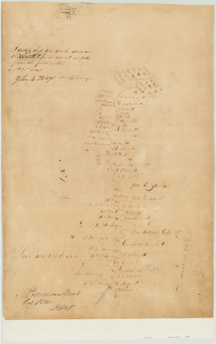
[Surveys in the Bexar District along the Guadalupe River]
Print $3.00
- Digital $50.00
[Surveys in the Bexar District along the Guadalupe River]
1841
Size: 17.2 x 10.8 inches
124
Blanco County Sketch File 34

Print $4.00
- Digital $50.00
Blanco County Sketch File 34
1879
Size: 12.7 x 8.2 inches
14637
Blanco County Sketch File 39

Print $4.00
- Digital $50.00
Blanco County Sketch File 39
Size: 8.6 x 13.9 inches
14650
Comal County Sketch File 1

Print $6.00
- Digital $50.00
Comal County Sketch File 1
1846
Size: 16.4 x 10.5 inches
18995
Comal County Sketch File 3b

Print $20.00
- Digital $50.00
Comal County Sketch File 3b
1847
Size: 12.4 x 16.1 inches
19003
Gillespie County Sketch File 3

Print $4.00
- Digital $50.00
Gillespie County Sketch File 3
1847
Size: 11.2 x 8.0 inches
24129
Gillespie County Sketch File 3a

Print $4.00
- Digital $50.00
Gillespie County Sketch File 3a
1860
Size: 7.6 x 8.3 inches
24131
Gillespie County Sketch File 3b

Print $4.00
- Digital $50.00
Gillespie County Sketch File 3b
1860
Size: 8.2 x 12.6 inches
24133
Gillespie County Sketch File 12

Print $4.00
- Digital $50.00
Gillespie County Sketch File 12
1877
Size: 9.6 x 6.3 inches
24151
Kendall County Sketch File 1

Print $4.00
- Digital $50.00
Kendall County Sketch File 1
Size: 9.6 x 8.3 inches
28671
Kendall County Sketch File 1a

Print $18.00
- Digital $50.00
Kendall County Sketch File 1a
1873
Size: 5.3 x 6.7 inches
28673
Kendall County Sketch File 2

Print $6.00
- Digital $50.00
Kendall County Sketch File 2
1847
Size: 14.6 x 10.9 inches
28682
Kendall County Sketch File 4

Print $4.00
- Digital $50.00
Kendall County Sketch File 4
Size: 7.8 x 8.6 inches
28684
Kendall County Sketch File 5

Print $4.00
- Digital $50.00
Kendall County Sketch File 5
1854
Size: 8.7 x 7.6 inches
28686
Kendall County Sketch File 7

Print $4.00
- Digital $50.00
Kendall County Sketch File 7
1848
Size: 8.2 x 10.4 inches
28688
Kendall County Sketch File 8

Print $4.00
- Digital $50.00
Kendall County Sketch File 8
1879
Size: 10.1 x 8.0 inches
28690
Kendall County Sketch File 9

Print $6.00
- Digital $50.00
Kendall County Sketch File 9
1879
Size: 4.6 x 9.3 inches
28692
Kendall County Sketch File 11

Print $8.00
- Digital $50.00
Kendall County Sketch File 11
1924
Size: 11.2 x 8.7 inches
28695
Kendall County Sketch File 13

Print $4.00
- Digital $50.00
Kendall County Sketch File 13
1860
Size: 10.1 x 8.0 inches
28699
Kendall County Sketch File 14

Print $4.00
- Digital $50.00
Kendall County Sketch File 14
1860
Size: 8.1 x 10.2 inches
28701
Kendall County Sketch File 15

Print $4.00
- Digital $50.00
Kendall County Sketch File 15
1860
Size: 12.4 x 7.8 inches
28703
Bandera County Sketch File 10
Print $40.00
- Digital $50.00
Bandera County Sketch File 10
-
Size
15.0 x 17.4 inches
-
Map/Doc
10892
Bandera County Sketch File 28
Print $40.00
- Digital $50.00
Bandera County Sketch File 28
-
Size
23.5 x 20.0 inches
-
Map/Doc
10897
Bexar County Sketch File 46
Print $40.00
- Digital $50.00
Bexar County Sketch File 46
1888
-
Size
24.7 x 22.6 inches
-
Map/Doc
10924
-
Creation Date
1888
Kendall County Sketch File 21
Print $20.00
- Digital $50.00
Kendall County Sketch File 21
1931
-
Size
17.9 x 22.7 inches
-
Map/Doc
11909
-
Creation Date
1931
Kendall County Sketch File 22
Print $20.00
- Digital $50.00
Kendall County Sketch File 22
1926
-
Size
17.0 x 25.8 inches
-
Map/Doc
11910
-
Creation Date
1926
Kendall County Sketch File 22B
Print $20.00
- Digital $50.00
Kendall County Sketch File 22B
1937
-
Size
19.3 x 24.6 inches
-
Map/Doc
11911
-
Creation Date
1937
Kerr County Sketch File 14
Print $20.00
- Digital $50.00
Kerr County Sketch File 14
-
Size
14.9 x 17.8 inches
-
Map/Doc
11918
Kerr County Sketch File 18
Print $20.00
- Digital $50.00
Kerr County Sketch File 18
1950
-
Size
16.9 x 20.3 inches
-
Map/Doc
11921
-
Creation Date
1950
[Surveys in the Bexar District along the Guadalupe River]
Print $3.00
- Digital $50.00
[Surveys in the Bexar District along the Guadalupe River]
1841
-
Size
17.2 x 10.8 inches
-
Map/Doc
124
-
Creation Date
1841
Blanco County Sketch File 34
Print $4.00
- Digital $50.00
Blanco County Sketch File 34
1879
-
Size
12.7 x 8.2 inches
-
Map/Doc
14637
-
Creation Date
1879
Blanco County Sketch File 39
Print $4.00
- Digital $50.00
Blanco County Sketch File 39
-
Size
8.6 x 13.9 inches
-
Map/Doc
14650
Kendall County

Print $20.00
- Digital $50.00
Kendall County
1946
-
Size
41.6 x 35.9 inches
-
Map/Doc
1872
-
Creation Date
1946
Comal County Sketch File 1
Print $6.00
- Digital $50.00
Comal County Sketch File 1
1846
-
Size
16.4 x 10.5 inches
-
Map/Doc
18995
-
Creation Date
1846
Comal County Sketch File 3b
Print $20.00
- Digital $50.00
Comal County Sketch File 3b
1847
-
Size
12.4 x 16.1 inches
-
Map/Doc
19003
-
Creation Date
1847
Gillespie County Sketch File 3
Print $4.00
- Digital $50.00
Gillespie County Sketch File 3
1847
-
Size
11.2 x 8.0 inches
-
Map/Doc
24129
-
Creation Date
1847
Gillespie County Sketch File 3a
Print $4.00
- Digital $50.00
Gillespie County Sketch File 3a
1860
-
Size
7.6 x 8.3 inches
-
Map/Doc
24131
-
Creation Date
1860
Gillespie County Sketch File 3b
Print $4.00
- Digital $50.00
Gillespie County Sketch File 3b
1860
-
Size
8.2 x 12.6 inches
-
Map/Doc
24133
-
Creation Date
1860
Gillespie County Sketch File 12
Print $4.00
- Digital $50.00
Gillespie County Sketch File 12
1877
-
Size
9.6 x 6.3 inches
-
Map/Doc
24151
-
Creation Date
1877
Kendall County Sketch File 1
Print $4.00
- Digital $50.00
Kendall County Sketch File 1
-
Size
9.6 x 8.3 inches
-
Map/Doc
28671
Kendall County Sketch File 1a
Print $18.00
- Digital $50.00
Kendall County Sketch File 1a
1873
-
Size
5.3 x 6.7 inches
-
Map/Doc
28673
-
Creation Date
1873
Kendall County Sketch File 2
Print $6.00
- Digital $50.00
Kendall County Sketch File 2
1847
-
Size
14.6 x 10.9 inches
-
Map/Doc
28682
-
Creation Date
1847
Kendall County Sketch File 4
Print $4.00
- Digital $50.00
Kendall County Sketch File 4
-
Size
7.8 x 8.6 inches
-
Map/Doc
28684
Kendall County Sketch File 5
Print $4.00
- Digital $50.00
Kendall County Sketch File 5
1854
-
Size
8.7 x 7.6 inches
-
Map/Doc
28686
-
Creation Date
1854
Kendall County Sketch File 7
Print $4.00
- Digital $50.00
Kendall County Sketch File 7
1848
-
Size
8.2 x 10.4 inches
-
Map/Doc
28688
-
Creation Date
1848
Kendall County Sketch File 8
Print $4.00
- Digital $50.00
Kendall County Sketch File 8
1879
-
Size
10.1 x 8.0 inches
-
Map/Doc
28690
-
Creation Date
1879
Kendall County Sketch File 9
Print $6.00
- Digital $50.00
Kendall County Sketch File 9
1879
-
Size
4.6 x 9.3 inches
-
Map/Doc
28692
-
Creation Date
1879
Kendall County Sketch File 11
Print $8.00
- Digital $50.00
Kendall County Sketch File 11
1924
-
Size
11.2 x 8.7 inches
-
Map/Doc
28695
-
Creation Date
1924
Kendall County Sketch File 13
Print $4.00
- Digital $50.00
Kendall County Sketch File 13
1860
-
Size
10.1 x 8.0 inches
-
Map/Doc
28699
-
Creation Date
1860
Kendall County Sketch File 14
Print $4.00
- Digital $50.00
Kendall County Sketch File 14
1860
-
Size
8.1 x 10.2 inches
-
Map/Doc
28701
-
Creation Date
1860
Kendall County Sketch File 15
Print $4.00
- Digital $50.00
Kendall County Sketch File 15
1860
-
Size
12.4 x 7.8 inches
-
Map/Doc
28703
-
Creation Date
1860