Ward County Rolled Sketch 24D

Print $40.00
- Digital $50.00
Ward County Rolled Sketch 24D
Size: 45.6 x 69.0 inches
10113
Ward County Rolled Sketch 24E

Print $40.00
- Digital $50.00
Ward County Rolled Sketch 24E
1967
Size: 42.3 x 64.9 inches
10116
Ward County Rolled Sketch 24F

Print $40.00
- Digital $50.00
Ward County Rolled Sketch 24F
1967
Size: 43.0 x 72.4 inches
10117
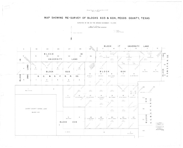
Pecos County Rolled Sketch 82

Print $20.00
- Digital $50.00
Pecos County Rolled Sketch 82
1930
Size: 28.4 x 25.7 inches
10190
Pecos County Rolled Sketch 82

Print $20.00
- Digital $50.00
Pecos County Rolled Sketch 82
1930
Size: 28.3 x 25.8 inches
10191
Pecos County Rolled Sketch 82

Print $20.00
- Digital $50.00
Pecos County Rolled Sketch 82
1930
Size: 29.0 x 26.4 inches
10192
Pecos County Sketch File 7

Print $20.00
- Digital $50.00
Pecos County Sketch File 7
Size: 29.7 x 44.5 inches
10568
Pecos County Sketch File 55

Print $20.00
- Digital $50.00
Pecos County Sketch File 55
Size: 43.1 x 20.4 inches
10570
Pecos County Sketch File 56

Print $20.00
- Digital $50.00
Pecos County Sketch File 56
Size: 35.6 x 28.6 inches
10571
Reeves County Sketch File 9

Print $20.00
- Digital $50.00
Reeves County Sketch File 9
Size: 46.3 x 38.2 inches
10587
Pecos County Rolled Sketch 89

Print $40.00
- Digital $50.00
Pecos County Rolled Sketch 89
1934
Size: 56.2 x 41.4 inches
10719
Pecos County Rolled Sketch 141

Print $40.00
- Digital $50.00
Pecos County Rolled Sketch 141
1927
Size: 60.5 x 20.4 inches
10722
Pecos County Rolled Sketch 128A
Print $40.00
- Digital $50.00
Pecos County Rolled Sketch 128A
1949
Size: 43.3 x 53.5 inches
10730
Brewster County Sketch File N-20

Print $40.00
- Digital $50.00
Brewster County Sketch File N-20
1941
Size: 16.5 x 20.5 inches
10967
Brewster County Sketch File N-21

Print $40.00
- Digital $50.00
Brewster County Sketch File N-21
1951
Size: 18.0 x 18.6 inches
10968
Jeff Davis County Sketch File 8

Print $20.00
- Digital $50.00
Jeff Davis County Sketch File 8
1889
Size: 19.5 x 28.5 inches
11857
Pecos County Sketch File 1A

Print $20.00
- Digital $50.00
Pecos County Sketch File 1A
1919
Size: 34.3 x 23.7 inches
12155
Pecos County Sketch File 13

Print $20.00
- Digital $50.00
Pecos County Sketch File 13
Size: 22.7 x 18.8 inches
12156
Pecos County Sketch File 14

Print $20.00
- Digital $50.00
Pecos County Sketch File 14
Size: 27.7 x 16.5 inches
12157
Pecos County Sketch File 14A

Print $20.00
- Digital $50.00
Pecos County Sketch File 14A
Size: 33.7 x 23.0 inches
12158
Pecos County Sketch File 18

Print $32.00
- Digital $50.00
Pecos County Sketch File 18
1884
Size: 24.5 x 9.6 inches
12159
Pecos County Sketch File 20

Print $20.00
- Digital $50.00
Pecos County Sketch File 20
Size: 25.9 x 12.0 inches
12160
Pecos County Sketch File 21

Print $20.00
- Digital $50.00
Pecos County Sketch File 21
1886
Size: 21.6 x 18.5 inches
12161
Pecos County Sketch File 23

Print $20.00
- Digital $50.00
Pecos County Sketch File 23
1886
Size: 18.0 x 18.0 inches
12162
Pecos County Sketch File 25

Print $20.00
- Digital $50.00
Pecos County Sketch File 25
Size: 17.6 x 24.9 inches
12164
Pecos County Sketch File 27

Print $20.00
- Digital $50.00
Pecos County Sketch File 27
1900
Size: 18.1 x 14.5 inches
12165
Pecos County Sketch File 27A

Print $20.00
- Digital $50.00
Pecos County Sketch File 27A
Size: 26.7 x 19.8 inches
12166
Pecos County Sketch File 27B

Print $20.00
- Digital $50.00
Pecos County Sketch File 27B
1908
Size: 25.7 x 20.8 inches
12167
Pecos County Sketch File 28

Print $20.00
- Digital $50.00
Pecos County Sketch File 28
1927
Size: 23.4 x 21.6 inches
12168
Pecos County Sketch File 28a

Print $20.00
- Digital $50.00
Pecos County Sketch File 28a
Size: 24.3 x 26.6 inches
12169
Ward County Rolled Sketch 24D
Print $40.00
- Digital $50.00
Ward County Rolled Sketch 24D
-
Size
45.6 x 69.0 inches
-
Map/Doc
10113
Ward County Rolled Sketch 24E
Print $40.00
- Digital $50.00
Ward County Rolled Sketch 24E
1967
-
Size
42.3 x 64.9 inches
-
Map/Doc
10116
-
Creation Date
1967
Ward County Rolled Sketch 24F
Print $40.00
- Digital $50.00
Ward County Rolled Sketch 24F
1967
-
Size
43.0 x 72.4 inches
-
Map/Doc
10117
-
Creation Date
1967
Pecos County Rolled Sketch 82
Print $20.00
- Digital $50.00
Pecos County Rolled Sketch 82
1930
-
Size
28.4 x 25.7 inches
-
Map/Doc
10190
-
Creation Date
1930
Pecos County Rolled Sketch 82
Print $20.00
- Digital $50.00
Pecos County Rolled Sketch 82
1930
-
Size
28.3 x 25.8 inches
-
Map/Doc
10191
-
Creation Date
1930
Pecos County Rolled Sketch 82
Print $20.00
- Digital $50.00
Pecos County Rolled Sketch 82
1930
-
Size
29.0 x 26.4 inches
-
Map/Doc
10192
-
Creation Date
1930
Pecos County Sketch File 7
Print $20.00
- Digital $50.00
Pecos County Sketch File 7
-
Size
29.7 x 44.5 inches
-
Map/Doc
10568
Pecos County Sketch File 55
Print $20.00
- Digital $50.00
Pecos County Sketch File 55
-
Size
43.1 x 20.4 inches
-
Map/Doc
10570
Pecos County Sketch File 56
Print $20.00
- Digital $50.00
Pecos County Sketch File 56
-
Size
35.6 x 28.6 inches
-
Map/Doc
10571
Reeves County Sketch File 9
Print $20.00
- Digital $50.00
Reeves County Sketch File 9
-
Size
46.3 x 38.2 inches
-
Map/Doc
10587
Pecos County Rolled Sketch 89
Print $40.00
- Digital $50.00
Pecos County Rolled Sketch 89
1934
-
Size
56.2 x 41.4 inches
-
Map/Doc
10719
-
Creation Date
1934
Pecos County Rolled Sketch 141
Print $40.00
- Digital $50.00
Pecos County Rolled Sketch 141
1927
-
Size
60.5 x 20.4 inches
-
Map/Doc
10722
-
Creation Date
1927
Pecos County Rolled Sketch 128A
Print $40.00
- Digital $50.00
Pecos County Rolled Sketch 128A
1949
-
Size
43.3 x 53.5 inches
-
Map/Doc
10730
-
Creation Date
1949
Brewster County Sketch File N-20
Print $40.00
- Digital $50.00
Brewster County Sketch File N-20
1941
-
Size
16.5 x 20.5 inches
-
Map/Doc
10967
-
Creation Date
1941
Brewster County Sketch File N-21
Print $40.00
- Digital $50.00
Brewster County Sketch File N-21
1951
-
Size
18.0 x 18.6 inches
-
Map/Doc
10968
-
Creation Date
1951
Jeff Davis County Sketch File 8
Print $20.00
- Digital $50.00
Jeff Davis County Sketch File 8
1889
-
Size
19.5 x 28.5 inches
-
Map/Doc
11857
-
Creation Date
1889
Pecos County Sketch File 1A
Print $20.00
- Digital $50.00
Pecos County Sketch File 1A
1919
-
Size
34.3 x 23.7 inches
-
Map/Doc
12155
-
Creation Date
1919
Pecos County Sketch File 13
Print $20.00
- Digital $50.00
Pecos County Sketch File 13
-
Size
22.7 x 18.8 inches
-
Map/Doc
12156
Pecos County Sketch File 14
Print $20.00
- Digital $50.00
Pecos County Sketch File 14
-
Size
27.7 x 16.5 inches
-
Map/Doc
12157
Pecos County Sketch File 14A
Print $20.00
- Digital $50.00
Pecos County Sketch File 14A
-
Size
33.7 x 23.0 inches
-
Map/Doc
12158
Pecos County Sketch File 18
Print $32.00
- Digital $50.00
Pecos County Sketch File 18
1884
-
Size
24.5 x 9.6 inches
-
Map/Doc
12159
-
Creation Date
1884
Pecos County Sketch File 20
Print $20.00
- Digital $50.00
Pecos County Sketch File 20
-
Size
25.9 x 12.0 inches
-
Map/Doc
12160
Pecos County Sketch File 21
Print $20.00
- Digital $50.00
Pecos County Sketch File 21
1886
-
Size
21.6 x 18.5 inches
-
Map/Doc
12161
-
Creation Date
1886
Pecos County Sketch File 23
Print $20.00
- Digital $50.00
Pecos County Sketch File 23
1886
-
Size
18.0 x 18.0 inches
-
Map/Doc
12162
-
Creation Date
1886
Pecos County Sketch File 25
Print $20.00
- Digital $50.00
Pecos County Sketch File 25
-
Size
17.6 x 24.9 inches
-
Map/Doc
12164
Pecos County Sketch File 27
Print $20.00
- Digital $50.00
Pecos County Sketch File 27
1900
-
Size
18.1 x 14.5 inches
-
Map/Doc
12165
-
Creation Date
1900
Pecos County Sketch File 27A
Print $20.00
- Digital $50.00
Pecos County Sketch File 27A
-
Size
26.7 x 19.8 inches
-
Map/Doc
12166
Pecos County Sketch File 27B
Print $20.00
- Digital $50.00
Pecos County Sketch File 27B
1908
-
Size
25.7 x 20.8 inches
-
Map/Doc
12167
-
Creation Date
1908
Pecos County Sketch File 28
Print $20.00
- Digital $50.00
Pecos County Sketch File 28
1927
-
Size
23.4 x 21.6 inches
-
Map/Doc
12168
-
Creation Date
1927
Pecos County Sketch File 28a
Print $20.00
- Digital $50.00
Pecos County Sketch File 28a
-
Size
24.3 x 26.6 inches
-
Map/Doc
12169