Carta de las provincias de Tejas Nuevo Santander, Nuevo Reino de Leon y Nueva Estremadura

Print $20.00
- Digital $50.00
Carta de las provincias de Tejas Nuevo Santander, Nuevo Reino de Leon y Nueva Estremadura
1773
Size: 21.5 x 26.6 inches
3031
Primera parte del Mapa, que comprende la Frontera, de los Dominios del Rey, en la America Septentrional

Print $40.00
- Digital $50.00
Primera parte del Mapa, que comprende la Frontera, de los Dominios del Rey, en la America Septentrional
1769
Size: 25.8 x 63.2 inches
3062
Segunda parte del Mapa, que comprende la Frontera, de los Dominios del Rey, en la America Septentrional

Print $40.00
- Digital $50.00
Segunda parte del Mapa, que comprende la Frontera, de los Dominios del Rey, en la America Septentrional
1769
Size: 26.7 x 63.8 inches
4667
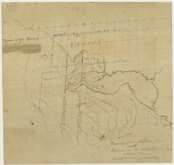
Tracing From [Melish's] Map with Kansas and the Panhandle of Texas plotted thereon Showing the disputed Territory
Print $20.00
Tracing From [Melish's] Map with Kansas and the Panhandle of Texas plotted thereon Showing the disputed Territory
1818
Size: 18.8 x 19.8 inches
76190
A Map of the Internal Provinces of New Spain

Print $20.00
A Map of the Internal Provinces of New Spain
1807
Size: 18.9 x 19.5 inches
76234
The Continent and Islands of the West Indies

Print $20.00
The Continent and Islands of the West Indies
1804
Size: 22.8 x 26.0 inches
79318
Carte du Mexique ou de la Nouvelle Espagne

Print $20.00
Carte du Mexique ou de la Nouvelle Espagne
1750
Size: 12.4 x 15.5 inches
79741
Spanish Province of Texas Compiled from map on file among archives at Saltillo

Print $20.00
Spanish Province of Texas Compiled from map on file among archives at Saltillo
Size: 13.8 x 16.2 inches
79742
Map of Texas and Adjacent Regions in the Eighteenth Century

Print $20.00
Map of Texas and Adjacent Regions in the Eighteenth Century
1915
Size: 19.3 x 23.3 inches
79743
Catalogue of the Spanish Collection of the Texas General Land Office

Price $15.00
Catalogue of the Spanish Collection of the Texas General Land Office
2003
Size: 10.8 x 8.5 inches
83386
Catalogue of the Spanish Collection of the Texas General Land Office

Digital $15.00
Catalogue of the Spanish Collection of the Texas General Land Office
2003
Size: 10.8 x 8.5 inches
83387
New Guide to Spanish and Mexican Land Grants in South Texas

Price $15.00
New Guide to Spanish and Mexican Land Grants in South Texas
2009
Size: 11.0 x 8.5 inches
83388
Presidio de San Antonio de Bejar y Villa de San Fernando

Print $20.00
- Digital $50.00
Presidio de San Antonio de Bejar y Villa de San Fernando
1986
Size: 21.8 x 26.0 inches
87386
Map of the territory comprised between the Province of New Mexico and the fort of Natchitoches and Texas

Map of the territory comprised between the Province of New Mexico and the fort of Natchitoches and Texas
1789
Size: 8.9 x 15.3 inches
88888
Carta Geografica Della Florida Nell America Settentrionale

Print $20.00
- Digital $50.00
Carta Geografica Della Florida Nell America Settentrionale
1740
Size: 14.1 x 18.5 inches
89222
Spanish North America

Print $20.00
- Digital $50.00
Spanish North America
1814
Size: 21.9 x 29.8 inches
89224
Spanish Province of Texas compiled from map on file among archives at Saltillo

Print $20.00
- Digital $50.00
Spanish Province of Texas compiled from map on file among archives at Saltillo
1897
Size: 13.6 x 16.0 inches
93412
Carte du Mexique et des Pays Limitrophes Situés au Nord et à l'Est

Print $20.00
- Digital $50.00
Carte du Mexique et des Pays Limitrophes Situés au Nord et à l'Est
1811
Size: 17.5 x 29.0 inches
93421
Map of the European Settlements in Mexico or New Spain and the West Indies

Print $20.00
- Digital $50.00
Map of the European Settlements in Mexico or New Spain and the West Indies
1783
Size: 14.1 x 21.1 inches
93643
Mexico or New Spain in which the Motions of Cortes may be traced

Print $20.00
- Digital $50.00
Mexico or New Spain in which the Motions of Cortes may be traced
1795
Size: 14.5 x 16.5 inches
93650
The Western Coast of Louisiana and The Coast of New Leon

Print $20.00
- Digital $50.00
The Western Coast of Louisiana and The Coast of New Leon
1775
Size: 21.1 x 28.7 inches
93705
Reyno de la Nueva España a Principios del Siglo XIX

Print $20.00
- Digital $50.00
Reyno de la Nueva España a Principios del Siglo XIX
1885
Size: 25.6 x 32.7 inches
93751
Spanish and Mexican Land Grants in Texas

Print $20.00
Spanish and Mexican Land Grants in Texas
2015
Size: 34.0 x 44.0 inches
93755
Carte Générale du Royaume de la Nouvelle Espagne depuis le Parallele de 16° jusqu'au Parallele de 38° (Latitude Nord) dressée sur des Observations Astronomiques et sur l'ensemble des Matériaux qui existoient à Mexico, au commencement de l'année 1804

Print $20.00
- Digital $50.00
Carte Générale du Royaume de la Nouvelle Espagne depuis le Parallele de 16° jusqu'au Parallele de 38° (Latitude Nord) dressée sur des Observations Astronomiques et sur l'ensemble des Matériaux qui existoient à Mexico, au commencement de l'année 1804
1809
Size: 21.7 x 32.9 inches
93781
Carte Générale du Royaume de la Nouvelle Espagne depuis le Parallele de 16° jusqu'au Parallele de 38° (Latitude Nord) dressée sur des Observations Astronomiques et sur l'ensemble des Matériaux qui existoient à Mexico, au commencement de l'année 1804

Print $20.00
- Digital $50.00
Carte Générale du Royaume de la Nouvelle Espagne depuis le Parallele de 16° jusqu'au Parallele de 38° (Latitude Nord) dressée sur des Observations Astronomiques et sur l'ensemble des Matériaux qui existoient à Mexico, au commencement de l'année 1804
1809
Size: 21.6 x 32.5 inches
93782
Carte Générale du Royaume de la Nouvelle Espagne depuis le Parallele de 16° jusqu'au Parallele de 38° (Latitude Nord) dressée sur des Observations Astronomiques et sur l'ensemble des Matériaux qui existoient à Mexico, au commencement de l'année 1804

Print $20.00
- Digital $50.00
Carte Générale du Royaume de la Nouvelle Espagne depuis le Parallele de 16° jusqu'au Parallele de 38° (Latitude Nord) dressée sur des Observations Astronomiques et sur l'ensemble des Matériaux qui existoient à Mexico, au commencement de l'année 1804
1809
Size: 41.7 x 33.0 inches
93783
Nueva Hispania Tabula Nova

Print $20.00
- Digital $50.00
Nueva Hispania Tabula Nova
1561
Size: 9.4 x 12.3 inches
93796
Nuevo Mapa Geographico de la America Septentrional, Perteneciente al Virreynato de Mexico

Print $20.00
- Digital $50.00
Nuevo Mapa Geographico de la America Septentrional, Perteneciente al Virreynato de Mexico
1768
Size: 23.1 x 30.3 inches
93835
Carta de las provincias de Tejas Nuevo Santander, Nuevo Reino de Leon y Nueva Estremadura
Print $20.00
- Digital $50.00
Carta de las provincias de Tejas Nuevo Santander, Nuevo Reino de Leon y Nueva Estremadura
1773
-
Size
21.5 x 26.6 inches
-
Map/Doc
3031
-
Creation Date
1773
Primera parte del Mapa, que comprende la Frontera, de los Dominios del Rey, en la America Septentrional
Print $40.00
- Digital $50.00
Primera parte del Mapa, que comprende la Frontera, de los Dominios del Rey, en la America Septentrional
1769
-
Size
25.8 x 63.2 inches
-
Map/Doc
3062
-
Creation Date
1769
Segunda parte del Mapa, que comprende la Frontera, de los Dominios del Rey, en la America Septentrional
Print $40.00
- Digital $50.00
Segunda parte del Mapa, que comprende la Frontera, de los Dominios del Rey, en la America Septentrional
1769
-
Size
26.7 x 63.8 inches
-
Map/Doc
4667
-
Creation Date
1769
Tracing From [Melish's] Map with Kansas and the Panhandle of Texas plotted thereon Showing the disputed Territory
Print $20.00
Tracing From [Melish's] Map with Kansas and the Panhandle of Texas plotted thereon Showing the disputed Territory
1818
-
Size
18.8 x 19.8 inches
-
Map/Doc
76190
-
Creation Date
1818
A Map of the Internal Provinces of New Spain
Print $20.00
A Map of the Internal Provinces of New Spain
1807
-
Size
18.9 x 19.5 inches
-
Map/Doc
76234
-
Creation Date
1807
Mexico or New Spain

Print $20.00
Mexico or New Spain
1814
-
Size
19.8 x 17.2 inches
-
Map/Doc
79313
-
Creation Date
1814
The Continent and Islands of the West Indies
Print $20.00
The Continent and Islands of the West Indies
1804
-
Size
22.8 x 26.0 inches
-
Map/Doc
79318
-
Creation Date
1804
Carte du Mexique ou de la Nouvelle Espagne
Print $20.00
Carte du Mexique ou de la Nouvelle Espagne
1750
-
Size
12.4 x 15.5 inches
-
Map/Doc
79741
-
Creation Date
1750
Spanish Province of Texas Compiled from map on file among archives at Saltillo
Print $20.00
Spanish Province of Texas Compiled from map on file among archives at Saltillo
-
Size
13.8 x 16.2 inches
-
Map/Doc
79742
Map of Texas and Adjacent Regions in the Eighteenth Century
Print $20.00
Map of Texas and Adjacent Regions in the Eighteenth Century
1915
-
Size
19.3 x 23.3 inches
-
Map/Doc
79743
-
Creation Date
1915
Catalogue of the Spanish Collection of the Texas General Land Office
Print $15.00
Catalogue of the Spanish Collection of the Texas General Land Office
2003
This catalogue covers the Spanish and Mexican land grants issued north of the Nueces River in what...
-
Size
10.8 x 8.5 inches
-
Map/Doc
83386
-
Creation Date
2003
Catalogue of the Spanish Collection of the Texas General Land Office
Digital $15.00
Catalogue of the Spanish Collection of the Texas General Land Office
2003
This catalogue describes the official documents such as correspondence, decrees, appointments, and...
-
Size
10.8 x 8.5 inches
-
Map/Doc
83387
-
Creation Date
2003
New Guide to Spanish and Mexican Land Grants in South Texas
Print $15.00
New Guide to Spanish and Mexican Land Grants in South Texas
2009
Featuring 363 expanded entries about Spanish and Mexican land grants in South Texas, this work is...
-
Size
11.0 x 8.5 inches
-
Map/Doc
83388
-
Creation Date
2009
Presidio de San Antonio de Bejar y Villa de San Fernando
Print $20.00
- Digital $50.00
Presidio de San Antonio de Bejar y Villa de San Fernando
1986
-
Size
21.8 x 26.0 inches
-
Map/Doc
87386
-
Creation Date
1986
Map of the territory comprised between the Province of New Mexico and the fort of Natchitoches and Texas
Map of the territory comprised between the Province of New Mexico and the fort of Natchitoches and Texas
1789
-
Size
8.9 x 15.3 inches
-
Map/Doc
88888
-
Creation Date
1789
Carta Geografica Della Florida Nell America Settentrionale
Print $20.00
- Digital $50.00
Carta Geografica Della Florida Nell America Settentrionale
1740
-
Size
14.1 x 18.5 inches
-
Map/Doc
89222
-
Creation Date
1740
Spanish North America
Print $20.00
- Digital $50.00
Spanish North America
1814
-
Size
21.9 x 29.8 inches
-
Map/Doc
89224
-
Creation Date
1814
Spanish Province of Texas compiled from map on file among archives at Saltillo
Print $20.00
- Digital $50.00
Spanish Province of Texas compiled from map on file among archives at Saltillo
1897
-
Size
13.6 x 16.0 inches
-
Map/Doc
93412
-
Creation Date
1897
Carte du Mexique et des Pays Limitrophes Situés au Nord et à l'Est
Print $20.00
- Digital $50.00
Carte du Mexique et des Pays Limitrophes Situés au Nord et à l'Est
1811
-
Size
17.5 x 29.0 inches
-
Map/Doc
93421
-
Creation Date
1811
Map of the European Settlements in Mexico or New Spain and the West Indies
Print $20.00
- Digital $50.00
Map of the European Settlements in Mexico or New Spain and the West Indies
1783
-
Size
14.1 x 21.1 inches
-
Map/Doc
93643
-
Creation Date
1783
Mexico or New Spain in which the Motions of Cortes may be traced
Print $20.00
- Digital $50.00
Mexico or New Spain in which the Motions of Cortes may be traced
1795
-
Size
14.5 x 16.5 inches
-
Map/Doc
93650
-
Creation Date
1795
The Land Grants of Texas

Print $20.00
The Land Grants of Texas
2014
-
Size
28.0 x 36.2 inches
-
Map/Doc
93698
-
Creation Date
2014
The Western Coast of Louisiana and The Coast of New Leon
Print $20.00
- Digital $50.00
The Western Coast of Louisiana and The Coast of New Leon
1775
-
Size
21.1 x 28.7 inches
-
Map/Doc
93705
-
Creation Date
1775
Reyno de la Nueva España a Principios del Siglo XIX
Print $20.00
- Digital $50.00
Reyno de la Nueva España a Principios del Siglo XIX
1885
-
Size
25.6 x 32.7 inches
-
Map/Doc
93751
-
Creation Date
1885
Spanish and Mexican Land Grants in Texas
Print $20.00
Spanish and Mexican Land Grants in Texas
2015
-
Size
34.0 x 44.0 inches
-
Map/Doc
93755
-
Creation Date
2015
Carte Générale du Royaume de la Nouvelle Espagne depuis le Parallele de 16° jusqu'au Parallele de 38° (Latitude Nord) dressée sur des Observations Astronomiques et sur l'ensemble des Matériaux qui existoient à Mexico, au commencement de l'année 1804
Print $20.00
- Digital $50.00
Carte Générale du Royaume de la Nouvelle Espagne depuis le Parallele de 16° jusqu'au Parallele de 38° (Latitude Nord) dressée sur des Observations Astronomiques et sur l'ensemble des Matériaux qui existoient à Mexico, au commencement de l'année 1804
1809
-
Size
21.7 x 32.9 inches
-
Map/Doc
93781
-
Creation Date
1809
Carte Générale du Royaume de la Nouvelle Espagne depuis le Parallele de 16° jusqu'au Parallele de 38° (Latitude Nord) dressée sur des Observations Astronomiques et sur l'ensemble des Matériaux qui existoient à Mexico, au commencement de l'année 1804
Print $20.00
- Digital $50.00
Carte Générale du Royaume de la Nouvelle Espagne depuis le Parallele de 16° jusqu'au Parallele de 38° (Latitude Nord) dressée sur des Observations Astronomiques et sur l'ensemble des Matériaux qui existoient à Mexico, au commencement de l'année 1804
1809
-
Size
21.6 x 32.5 inches
-
Map/Doc
93782
-
Creation Date
1809
Carte Générale du Royaume de la Nouvelle Espagne depuis le Parallele de 16° jusqu'au Parallele de 38° (Latitude Nord) dressée sur des Observations Astronomiques et sur l'ensemble des Matériaux qui existoient à Mexico, au commencement de l'année 1804
Print $20.00
- Digital $50.00
Carte Générale du Royaume de la Nouvelle Espagne depuis le Parallele de 16° jusqu'au Parallele de 38° (Latitude Nord) dressée sur des Observations Astronomiques et sur l'ensemble des Matériaux qui existoient à Mexico, au commencement de l'année 1804
1809
-
Size
41.7 x 33.0 inches
-
Map/Doc
93783
-
Creation Date
1809
Nueva Hispania Tabula Nova
Print $20.00
- Digital $50.00
Nueva Hispania Tabula Nova
1561
-
Size
9.4 x 12.3 inches
-
Map/Doc
93796
-
Creation Date
1561
Nuevo Mapa Geographico de la America Septentrional, Perteneciente al Virreynato de Mexico
Print $20.00
- Digital $50.00
Nuevo Mapa Geographico de la America Septentrional, Perteneciente al Virreynato de Mexico
1768
-
Size
23.1 x 30.3 inches
-
Map/Doc
93835
-
Creation Date
1768