90 results

New Mexico and Adjacent Lands
96977.tif

New Mexico and Adjacent Lands

2022

Size: 8.5 x 11.0 inches
96977
The Adams-Onís Treaty of 1819
96978.tif

The Adams-Onís Treaty of 1819

2022

Size: 8.5 x 11.0 inches
96978
Texas. 1815
95965.tif
Print $20.00 - Digital $50.00

Texas. 1815

2020

Size: 8.4 x 10.8 inches
95965
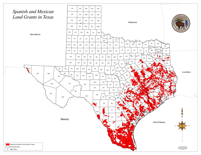
Spanish and Mexican Land Grants in Texas
93755, Spanish and Mexican Land Grants in Texas, General Map Collection
Print $20.00

Spanish and Mexican Land Grants in Texas

2015

Size: 34.0 x 44.0 inches
93755
The Land Grants of Texas
93698, The Land Grants of Texas, General Map Collection
Print $20.00

The Land Grants of Texas

2014

Size: 28.0 x 36.2 inches
93698
New Guide to Spanish and Mexican Land Grants in South Texas
83388.tif
Price $15.00

New Guide to Spanish and Mexican Land Grants in South Texas

2009

Size: 11.0 x 8.5 inches
83388
Land grants from the state of Tamaulipas in the trans-Nueces
94040, Land grants from the state of Tamaulipas in the trans-Nueces, General Map Collection

Land grants from the state of Tamaulipas in the trans-Nueces

2009

Size: 11.0 x 8.5 inches
94040
Layout of the porciones as described in the Visita General of Camargo, 1767
94041, Layout of the porciones as described in the Visita General of Camargo, 1767, General Map Collection

Layout of the porciones as described in the Visita General of Camargo, 1767

2009

Size: 11.0 x 8.5 inches
94041
Layout of the porciones as described in the Visita General of Laredo, 1767
94042, Layout of the porciones as described in the Visita General of Laredo, 1767, General Map Collection

Layout of the porciones as described in the Visita General of Laredo, 1767

2009

Size: 11.0 x 8.5 inches
94042
Layout of the porciones as described in the Visita General of Mier, 1767
94043, Layout of the porciones as described in the Visita General of Mier, 1767, General Map Collection

Layout of the porciones as described in the Visita General of Mier, 1767

2009

Size: 11.0 x 8.5 inches
94043
Layout of the porciones as described in the Visita General of Revilla (Guerrero), 1767, along with six tracts distributed by Gov. Lasaga in 1784 and three others (39-41) assigned at a later date
94044, Layout of the porciones as described in the Visita General of Revilla (Guerrero), 1767, along with six tracts distributed by Gov. Lasaga in 1784 and three others (39-41) assigned at a later date, General Map Collection

Layout of the porciones as described in the Visita General of Revilla (Guerrero), 1767, along with six tracts distributed by Gov. Lasaga in 1784 and three others (39-41) assigned at a later date

2009

Size: 11.0 x 8.5 inches
94044
Layout of the porciones as described in the Visita General of Reynosa, 1767
94045, Layout of the porciones as described in the Visita General of Reynosa, 1767, General Map Collection

Layout of the porciones as described in the Visita General of Reynosa, 1767

2009

Size: 11.0 x 8.5 inches
94045
Spanish land grants (other than porciones) in the trans-Nueces
94046, Spanish land grants (other than porciones) in the trans-Nueces, General Map Collection

Spanish land grants (other than porciones) in the trans-Nueces

2009
Size: 11.0 x 8.5 inches
94046
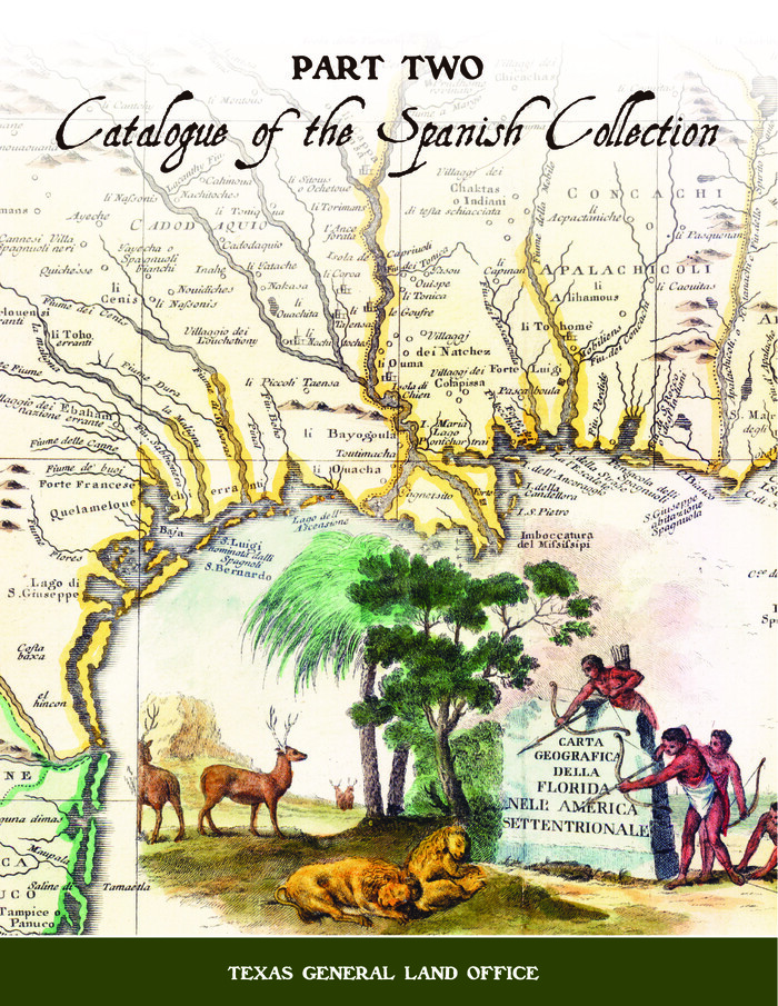
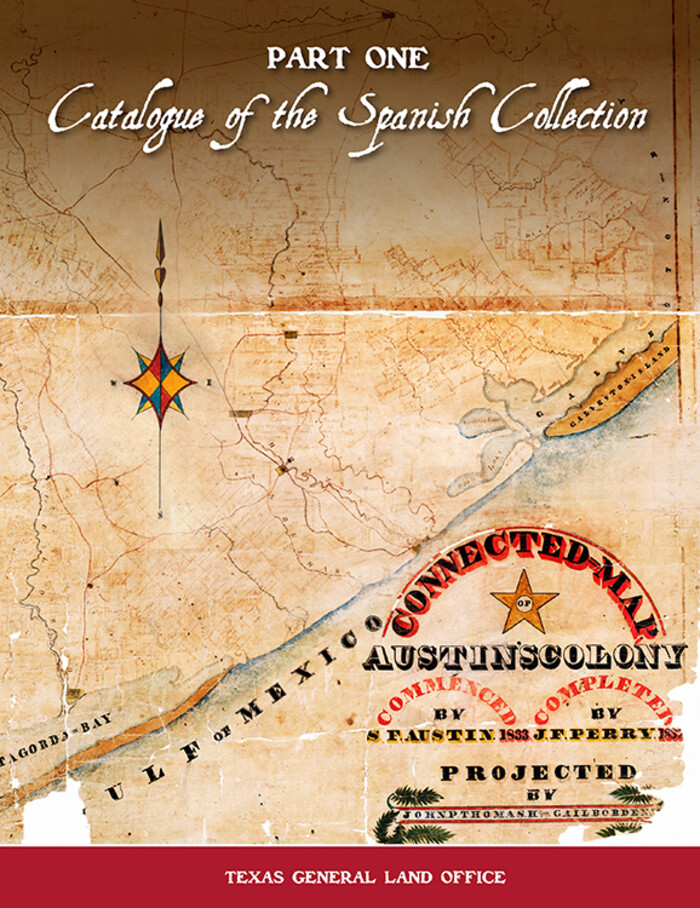
Catalogue of The Spanish Collection of The Texas General Land Office
 Catalogue of The Spanish Collection of The Texas General Land Office (Part 2)
Digital $15.00

Catalogue of The Spanish Collection of The Texas General Land Office

2003

Size: 10.8 x 8.5 inches
83387
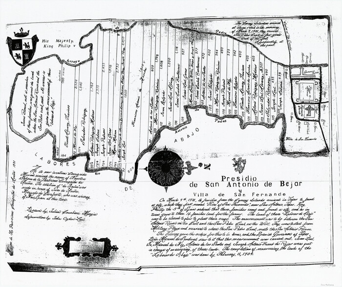
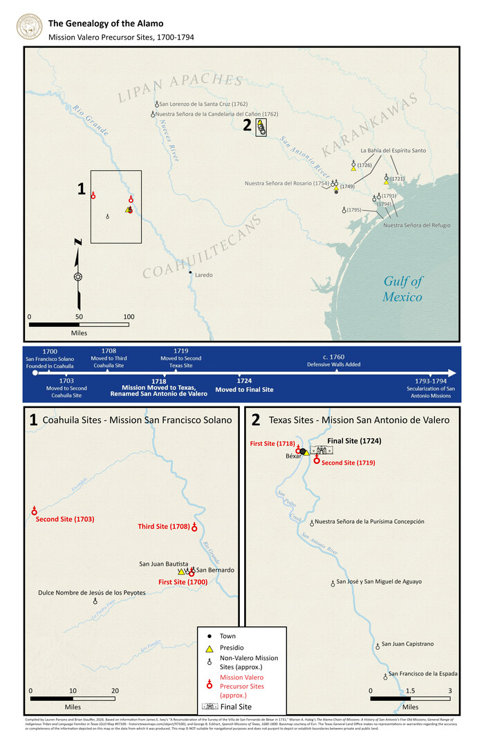
Presidio de San Antonio de Bejar y Villa de San Fernando
87386.tif
Print $20.00 - Digital $50.00

Presidio de San Antonio de Bejar y Villa de San Fernando

1986
Size: 21.8 x 26.0 inches
87386
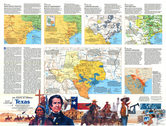
The Making of America - Texas
96825.tif

The Making of America - Texas

1986

Size: 20.7 x 27.3 inches
96825
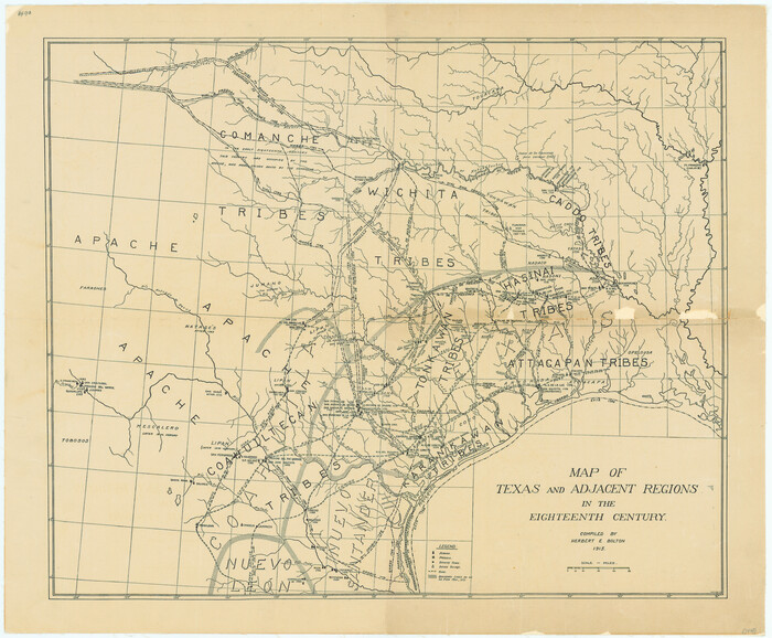
Map of Texas and Adjacent Regions in the Eighteenth Century
79743.tif
Print $20.00

Map of Texas and Adjacent Regions in the Eighteenth Century

1915

Size: 19.3 x 23.3 inches
79743
Spanish Province of Texas compiled from map on file among archives at Saltillo
93412.tif
Print $20.00 - Digital $50.00

Spanish Province of Texas compiled from map on file among archives at Saltillo

1897

Size: 13.6 x 16.0 inches
93412
Reyno de la Nueva España a Principios del Siglo XIX
93751.tif
Print $20.00 - Digital $50.00

Reyno de la Nueva España a Principios del Siglo XIX

1885

Size: 25.6 x 32.7 inches
93751
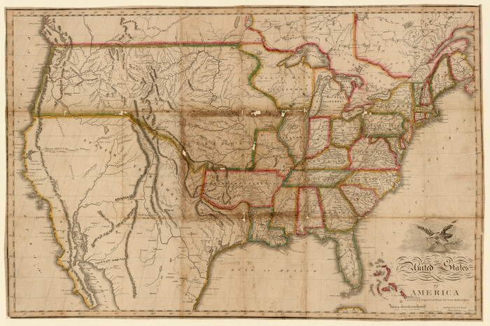
United States of America corrected & improved from the best authorities
93953.tif
Print $20.00 - Digital $50.00

United States of America corrected & improved from the best authorities

1820
Size: 17.5 x 26.3 inches
93953
A Map of Louisiana and Mexico
94945.tif
Print $20.00 - Digital $50.00

A Map of Louisiana and Mexico

1820

Size: 43.8 x 32.9 inches
94945
Tracing From [Melish's] Map with Kansas and the Panhandle of Texas plotted thereon Showing the disputed Territory
76190.tif
Print $20.00

Tracing From [Melish's] Map with Kansas and the Panhandle of Texas plotted thereon Showing the disputed Territory

1818

Size: 18.8 x 19.8 inches
76190
Spanish North America
89224.tif
Print $20.00 - Digital $50.00

Spanish North America

1814

Size: 21.9 x 29.8 inches
89224
Mexico or New Spain
79313.tif
Print $20.00

Mexico or New Spain

1814

Size: 19.8 x 17.2 inches
79313
Map of the Interior of Louisiana with a part of New Mexico
94460.tif
Print $20.00 - Digital $50.00

Map of the Interior of Louisiana with a part of New Mexico

1813

Size: 11.9 x 15.7 inches
94460
Carte du Mexique et des Pays Limitrophes Situés au Nord et à l'Est
93421.tif
Print $20.00 - Digital $50.00

Carte du Mexique et des Pays Limitrophes Situés au Nord et à l'Est

1811

Size: 17.5 x 29.0 inches
93421
El Nuevo México y Tierras Adyacentes Levantado para la Demarcación de los Límites de los Dominios Españoles y de los Estados Unidos
94445.tif

El Nuevo México y Tierras Adyacentes Levantado para la Demarcación de los Límites de los Dominios Españoles y de los Estados Unidos

1811

Size: 9.4 x 12.6 inches
94445
Spanish Dominions in North America, Northern Part
95133.tif
Print $20.00 - Digital $50.00

Spanish Dominions in North America, Northern Part

1811

Size: 22.1 x 30.5 inches
95133
El Nuevo Mexico y Tierras Adyacentes Mapa Levantado para la demarcacion de los Limites de los Dominios Españoles y de los Estados Unidos por el P.D. Jose Pichardo quien lo dedica al Exmo. Sor. D. Fracisco Xavier Venegas Virrey de esta N.E. &. Año de 1811
95360.tif
Print $40.00

El Nuevo Mexico y Tierras Adyacentes Mapa Levantado para la demarcacion de los Limites de los Dominios Españoles y de los Estados Unidos por el P.D. Jose Pichardo quien lo dedica al Exmo. Sor. D. Fracisco Xavier Venegas Virrey de esta N.E. &. Año de 1811

1811

Size: 35.8 x 49.6 inches
95360
Carte Générale du Royaume de la Nouvelle Espagne depuis le Parallele de 16° jusqu'au Parallele de 38° (Latitude Nord) dressée sur des Observations Astronomiques et sur l'ensemble des Matériaux qui existoient à Mexico, au commencement de l'année 1804
93781.tif
Print $20.00 - Digital $50.00

Carte Générale du Royaume de la Nouvelle Espagne depuis le Parallele de 16° jusqu'au Parallele de 38° (Latitude Nord) dressée sur des Observations Astronomiques et sur l'ensemble des Matériaux qui existoient à Mexico, au commencement de l'année 1804

1809

Size: 21.7 x 32.9 inches
93781
New Mexico and Adjacent Lands
96977, New Mexico and Adjacent Lands, General Map Collection

New Mexico and Adjacent Lands

2022

  • Size

    8.5 x 11.0 inches

  • Map/Doc

    96977

  • Creation Date

    2022

The Adams-Onís Treaty of 1819
96978, The Adams-Onís Treaty of 1819 - 96978, The Adams-Onís Treaty of 1819, General Map Collection

The Adams-Onís Treaty of 1819

2022

  • Size

    8.5 x 11.0 inches

  • Map/Doc

    96978

  • Creation Date

    2022

Texas. 1815
95965, Texas. 1815, Nancy and Jim Tiller Digital Collection
Print $20.00 - Digital $50.00

Texas. 1815

2020

  • Size

    8.4 x 10.8 inches

  • Map/Doc

    95965

  • Creation Date

    2020

Spanish and Mexican Land Grants in Texas
93755, Spanish and Mexican Land Grants in Texas, General Map Collection
Print $20.00

Spanish and Mexican Land Grants in Texas

2015

  • Size

    34.0 x 44.0 inches

  • Map/Doc

    93755

  • Creation Date

    2015

The Land Grants of Texas
93698, The Land Grants of Texas, General Map Collection
Print $20.00

The Land Grants of Texas

2014

  • Size

    28.0 x 36.2 inches

  • Map/Doc

    93698

  • Creation Date

    2014

New Guide to Spanish and Mexican Land Grants in South Texas
83388, New Guide to Spanish and Mexican Land Grants in South Texas, General Map Collection
Print $15.00

New Guide to Spanish and Mexican Land Grants in South Texas

2009

Featuring 363 expanded entries about Spanish and Mexican land grants in South Texas, this work is...

  • Size

    11.0 x 8.5 inches

  • Map/Doc

    83388

  • Creation Date

    2009

Land grants from the state of Tamaulipas in the trans-Nueces
94040, Land grants from the state of Tamaulipas in the trans-Nueces, General Map Collection

Land grants from the state of Tamaulipas in the trans-Nueces

2009

  • Size

    11.0 x 8.5 inches

  • Map/Doc

    94040

  • Creation Date

    2009

Layout of the porciones as described in the Visita General of Camargo, 1767
94041, Layout of the porciones as described in the Visita General of Camargo, 1767, General Map Collection

Layout of the porciones as described in the Visita General of Camargo, 1767

2009

  • Size

    11.0 x 8.5 inches

  • Map/Doc

    94041

  • Creation Date

    2009

Layout of the porciones as described in the Visita General of Laredo, 1767
94042, Layout of the porciones as described in the Visita General of Laredo, 1767, General Map Collection

Layout of the porciones as described in the Visita General of Laredo, 1767

2009

  • Size

    11.0 x 8.5 inches

  • Map/Doc

    94042

  • Creation Date

    2009

Layout of the porciones as described in the Visita General of Mier, 1767
94043, Layout of the porciones as described in the Visita General of Mier, 1767, General Map Collection

Layout of the porciones as described in the Visita General of Mier, 1767

2009

  • Size

    11.0 x 8.5 inches

  • Map/Doc

    94043

  • Creation Date

    2009

Layout of the porciones as described in the Visita General of Revilla (Guerrero), 1767, along with six tracts distributed by Gov. Lasaga in 1784 and three others (39-41) assigned at a later date
94044, Layout of the porciones as described in the Visita General of Revilla (Guerrero), 1767, along with six tracts distributed by Gov. Lasaga in 1784 and three others (39-41) assigned at a later date, General Map Collection

Layout of the porciones as described in the Visita General of Revilla (Guerrero), 1767, along with six tracts distributed by Gov. Lasaga in 1784 and three others (39-41) assigned at a later date

2009

  • Size

    11.0 x 8.5 inches

  • Map/Doc

    94044

  • Creation Date

    2009

Layout of the porciones as described in the Visita General of Reynosa, 1767
94045, Layout of the porciones as described in the Visita General of Reynosa, 1767, General Map Collection

Layout of the porciones as described in the Visita General of Reynosa, 1767

2009

  • Size

    11.0 x 8.5 inches

  • Map/Doc

    94045

  • Creation Date

    2009

Spanish land grants (other than porciones) in the trans-Nueces
94046, Spanish land grants (other than porciones) in the trans-Nueces, General Map Collection

Spanish land grants (other than porciones) in the trans-Nueces

2009

  • Size

    11.0 x 8.5 inches

  • Map/Doc

    94046

  • Creation Date

    2009

Catalogue of The Spanish Collection of The Texas General Land Office
 Catalogue of The Spanish Collection of The Texas General Land Office (Part 2)
Digital $15.00

Catalogue of The Spanish Collection of The Texas General Land Office

2003

This catalogue describes the official documents such as correspondence, decrees, appointments, and...

  • Size

    10.8 x 8.5 inches

  • Map/Doc

    83387

  • Creation Date

    2003

Presidio de San Antonio de Bejar y Villa de San Fernando
87386, Presidio de San Antonio de Bejar y Villa de San Fernando, General Map Collection
Print $20.00 - Digital $50.00

Presidio de San Antonio de Bejar y Villa de San Fernando

1986

  • Size

    21.8 x 26.0 inches

  • Map/Doc

    87386

  • Creation Date

    1986

The Making of America - Texas
96825, The Making of America - Texas, General Map Collection

The Making of America - Texas

1986

  • Size

    20.7 x 27.3 inches

  • Map/Doc

    96825

  • Creation Date

    1986

Map of Texas and Adjacent Regions in the Eighteenth Century
79743, Map of Texas and Adjacent Regions in the Eighteenth Century, Texas State Library and Archives
Print $20.00

Map of Texas and Adjacent Regions in the Eighteenth Century

1915

  • Size

    19.3 x 23.3 inches

  • Map/Doc

    79743

  • Creation Date

    1915

Spanish Province of Texas compiled from map on file among archives at Saltillo
93412, History of the Geography of Texas, General Map Collection
Print $20.00 - Digital $50.00

Spanish Province of Texas compiled from map on file among archives at Saltillo

1897

  • Size

    13.6 x 16.0 inches

  • Map/Doc

    93412

  • Creation Date

    1897

Reyno de la Nueva España a Principios del Siglo XIX
93751, Reyno de la Nueva España a Principios de Siglo XIX, General Map Collection
Print $20.00 - Digital $50.00

Reyno de la Nueva España a Principios del Siglo XIX

1885

  • Size

    25.6 x 32.7 inches

  • Map/Doc

    93751

  • Creation Date

    1885

United States of America corrected & improved from the best authorities
93953, United States of America corrected & improved from the best authorities, General Map Collection
Print $20.00 - Digital $50.00

United States of America corrected & improved from the best authorities

1820

  • Size

    17.5 x 26.3 inches

  • Map/Doc

    93953

  • Creation Date

    1820

A Map of Louisiana and Mexico
94945, A Map of Louisiana and Mexico, Holcomb Digital Map Collection
Print $20.00 - Digital $50.00

A Map of Louisiana and Mexico

1820

  • Size

    43.8 x 32.9 inches

  • Map/Doc

    94945

  • Creation Date

    1820

Tracing From [Melish's] Map with Kansas and the Panhandle of Texas plotted thereon Showing the disputed Territory
76190, Tracing From [Melish's] Map with Kansas and the Panhandle of Texas plotted thereon Showing the disputed Territory, Texas State Library and Archives
Print $20.00

Tracing From [Melish's] Map with Kansas and the Panhandle of Texas plotted thereon Showing the disputed Territory

1818

  • Size

    18.8 x 19.8 inches

  • Map/Doc

    76190

  • Creation Date

    1818

Spanish North America
89224, Spanish North America, General Map Collection
Print $20.00 - Digital $50.00

Spanish North America

1814

  • Size

    21.9 x 29.8 inches

  • Map/Doc

    89224

  • Creation Date

    1814

Mexico or New Spain
79313, Mexico or New Spain, Texas State Library and Archives
Print $20.00

Mexico or New Spain

1814

  • Size

    19.8 x 17.2 inches

  • Map/Doc

    79313

  • Creation Date

    1814

Map of the Interior of Louisiana with a part of New Mexico
94460, Map of the Interior of Louisiana with a part of New Mexico, General Map Collection
Print $20.00 - Digital $50.00

Map of the Interior of Louisiana with a part of New Mexico

1813

  • Size

    11.9 x 15.7 inches

  • Map/Doc

    94460

  • Creation Date

    1813

Carte du Mexique et des Pays Limitrophes Situés au Nord et à l'Est
93421, Carte du Mexique et des Pays Limitrophes Situés au Nord et à l'Est, General Map Collection
Print $20.00 - Digital $50.00

Carte du Mexique et des Pays Limitrophes Situés au Nord et à l'Est

1811

  • Size

    17.5 x 29.0 inches

  • Map/Doc

    93421

  • Creation Date

    1811

El Nuevo México y Tierras Adyacentes Levantado para la Demarcación de los Límites de los Dominios Españoles y de los Estados Unidos
94445, El Nuevo México y Tierras Adyacentes Levantado para la Demarcación de los Límites de los Dominios Españoles y de los Estados Unidos, Non-GLO Digital Images

El Nuevo México y Tierras Adyacentes Levantado para la Demarcación de los Límites de los Dominios Españoles y de los Estados Unidos

1811

This map was originally commissioned by Viceroy Francisco Xavier Venegas in 1807 as part of a report...

  • Size

    9.4 x 12.6 inches

  • Map/Doc

    94445

  • Creation Date

    1811

Spanish Dominions in North America, Northern Part
95133, Spanish Dominions in North America, Northern Part, General Map Collection
Print $20.00 - Digital $50.00

Spanish Dominions in North America, Northern Part

1811

  • Size

    22.1 x 30.5 inches

  • Map/Doc

    95133

  • Creation Date

    1811

El Nuevo Mexico y Tierras Adyacentes Mapa Levantado para la demarcacion de los Limites de los Dominios Españoles y de los Estados Unidos por el P.D. Jose Pichardo quien lo dedica al Exmo. Sor. D. Fracisco Xavier Venegas Virrey de esta N.E. &. Año de 1811
95360, El Nuevo Mexico y Tierras Adyacentes Mapa Levantado para la demarcacion de los Limites de los Dominios Españoles y de los Estados Unidos por el P.D. Jose Pichardo quien lo dedica al Exmo. Sor. D. Fracisco Xavier Venegas Virrey de esta N.E. &. Año de 1811, Library of Congress
Print $40.00

El Nuevo Mexico y Tierras Adyacentes Mapa Levantado para la demarcacion de los Limites de los Dominios Españoles y de los Estados Unidos por el P.D. Jose Pichardo quien lo dedica al Exmo. Sor. D. Fracisco Xavier Venegas Virrey de esta N.E. &. Año de 1811

1811

  • Size

    35.8 x 49.6 inches

  • Map/Doc

    95360

  • Creation Date

    1811

Carte Générale du Royaume de la Nouvelle Espagne depuis le Parallele de 16° jusqu'au Parallele de 38° (Latitude Nord) dressée sur des Observations Astronomiques et sur l'ensemble des Matériaux qui existoient à Mexico, au commencement de l'année 1804
93781, Carte Générale du Royaume de la Nouvelle Espagne depuis le Parallele de 16° jusqu'au Parallele de 38° (Latitude Nord) dressée sur des Observations Astronomiques et sur l'ensemble des Matériaux qui existoient à Mexico, au commencement de l'année 1804, Texana Foundation Collection
Print $20.00 - Digital $50.00

Carte Générale du Royaume de la Nouvelle Espagne depuis le Parallele de 16° jusqu'au Parallele de 38° (Latitude Nord) dressée sur des Observations Astronomiques et sur l'ensemble des Matériaux qui existoient à Mexico, au commencement de l'année 1804

1809

  • Size

    21.7 x 32.9 inches

  • Map/Doc

    93781

  • Creation Date

    1809