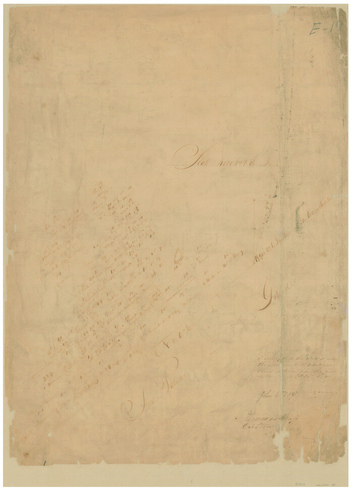
[Surveys in the Bexar District]
Print $20.00
- Digital $50.00
[Surveys in the Bexar District]
1841
Size: 23.0 x 16.5 inches
24
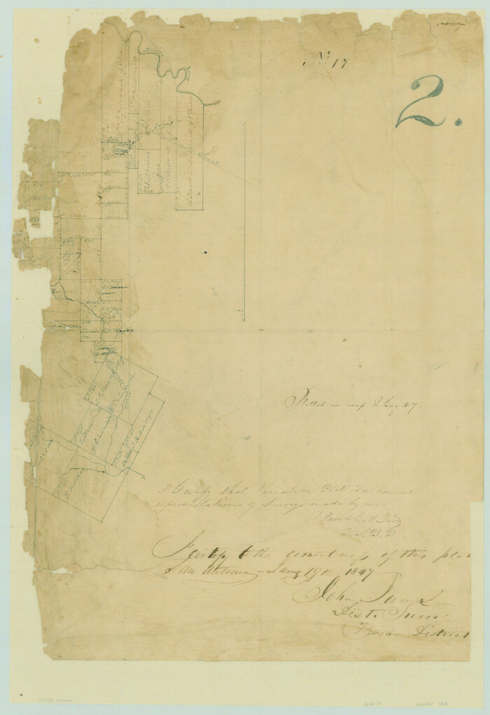
[Surveys in the Bexar District along the Atascosa Creek]
Print $3.00
- Digital $50.00
[Surveys in the Bexar District along the Atascosa Creek]
1847
Size: 16.9 x 11.6 inches
163
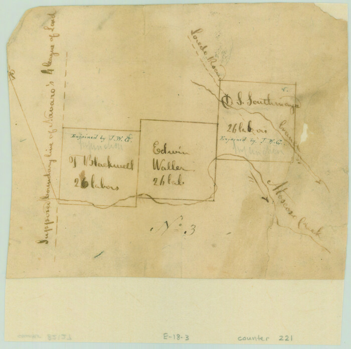
[Surveys in the Bexar District along the Atascosa Creek]
Print $2.00
- Digital $50.00
[Surveys in the Bexar District along the Atascosa Creek]
1842
Size: 5.9 x 5.9 inches
221
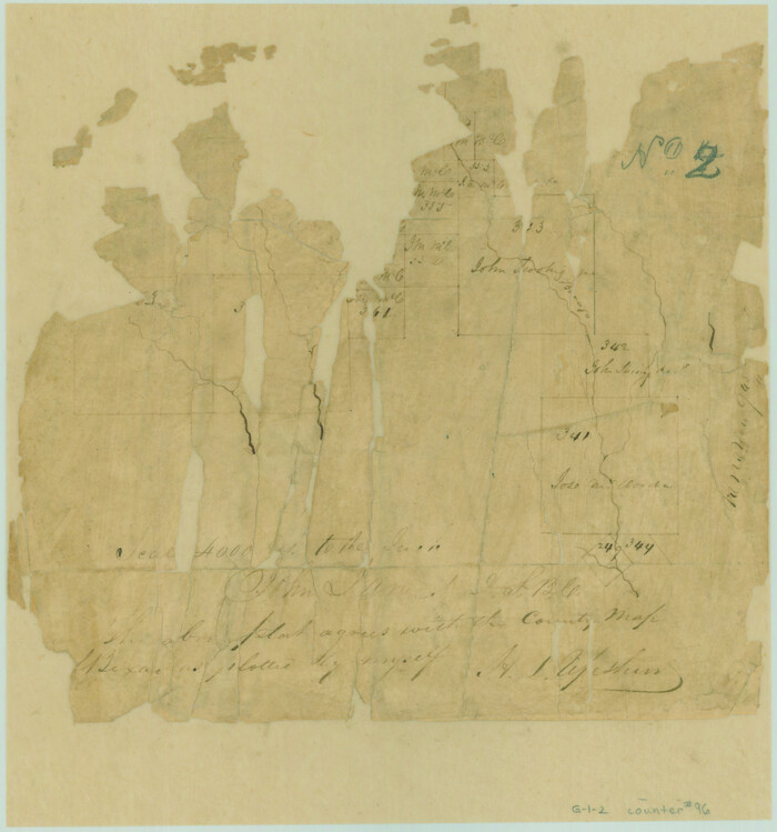
[Surveys in the Bexar District along Borrego Creek prepared by the Deputy Surveyor]
Print $2.00
- Digital $50.00
[Surveys in the Bexar District along Borrego Creek prepared by the Deputy Surveyor]
1847
Size: 7.7 x 7.2 inches
96
[Sketches on Lagoona (sic) Creek, Attascosa (sic) and Laredo Road]
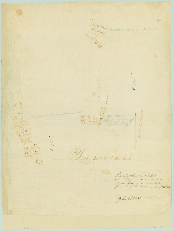
Print $20.00
- Digital $50.00
[Sketches on Lagoona (sic) Creek, Attascosa (sic) and Laredo Road]
1841
Size: 18.0 x 13.5 inches
126
Wilson County Working Sketch 10

Print $20.00
- Digital $50.00
Wilson County Working Sketch 10
1980
Size: 16.6 x 11.7 inches
72590
The Town of Charlotte Situated on the San Antonio, Uvalde and Gulf Railway in Atascosa County, Texas

Print $20.00
- Digital $50.00
The Town of Charlotte Situated on the San Antonio, Uvalde and Gulf Railway in Atascosa County, Texas
1911
Size: 29.7 x 24.5 inches
4823
Surveys made on the San Miguel. March 1847

Print $2.00
- Digital $50.00
Surveys made on the San Miguel. March 1847
1847
Size: 10.4 x 8.4 inches
223
Surveys made on La Parita, March 1847

Print $2.00
- Digital $50.00
Surveys made on La Parita, March 1847
1847
Size: 10.1 x 7.5 inches
222
Survey plat of lots 2, 4, 6, 8, 10-16, Block 322 of the original town site of Jourdanton known as School File 154507

Print $4.00
- Digital $50.00
Survey plat of lots 2, 4, 6, 8, 10-16, Block 322 of the original town site of Jourdanton known as School File 154507
2001
Size: 26.0 x 27.7 inches
60392
Sketch in Atascosa County

Print $3.00
- Digital $50.00
Sketch in Atascosa County
1890
Size: 12.6 x 11.4 inches
578
Medina County Sketch File 6

Print $22.00
- Digital $50.00
Medina County Sketch File 6
1874
Size: 8.4 x 12.0 inches
31454
Medina County Sketch File 19

Print $20.00
- Digital $50.00
Medina County Sketch File 19
1989
Size: 32.5 x 21.0 inches
12071
Medina County Sketch File 14

Print $24.00
- Digital $50.00
Medina County Sketch File 14
1914
Size: 10.6 x 7.0 inches
31471
Medina County Rolled Sketch 6

Print $40.00
- Digital $50.00
Medina County Rolled Sketch 6
1930
Size: 51.1 x 45.2 inches
9506
McMullen County Working Sketch 36

Print $20.00
- Digital $50.00
McMullen County Working Sketch 36
1963
Size: 40.1 x 41.5 inches
70737
McMullen County Sketch File 5

Print $4.00
- Digital $50.00
McMullen County Sketch File 5
1854
Size: 8.7 x 8.3 inches
31343
McMullen County Sketch File 36

Print $8.00
- Digital $50.00
McMullen County Sketch File 36
Size: 4.8 x 8.2 inches
31406
McMullen County Sketch File 10

Print $40.00
- Digital $50.00
McMullen County Sketch File 10
1876
Size: 14.3 x 17.6 inches
31353
Map of Castro's Colony - Bexar District

Print $20.00
- Digital $50.00
Map of Castro's Colony - Bexar District
1851
Size: 36.4 x 33.1 inches
1962
Map of Bexar County

Print $40.00
- Digital $50.00
Map of Bexar County
1845
Size: 90.6 x 81.0 inches
82242
Map of Bexar County

Print $20.00
- Digital $50.00
Map of Bexar County
1845
Size: 47.4 x 44.9 inches
87234
Map of Bexar County

Print $20.00
- Digital $50.00
Map of Bexar County
1845
Size: 47.5 x 41.7 inches
87235
Map of Bexar County

Print $40.00
- Digital $50.00
Map of Bexar County
1845
Size: 49.0 x 46.5 inches
87236
Map of Bexar County

Print $40.00
- Digital $50.00
Map of Bexar County
1845
Size: 48.8 x 43.0 inches
87237
Map of Atascosa County, Texas

Print $20.00
- Digital $50.00
Map of Atascosa County, Texas
1879
Size: 23.7 x 29.0 inches
688
Map of Atascosa County, Texas

Print $20.00
- Digital $50.00
Map of Atascosa County, Texas
1916
Size: 30.0 x 28.6 inches
9006
Map of Atascosa County

Print $20.00
- Digital $50.00
Map of Atascosa County
1879
Size: 24.5 x 24.8 inches
3250
Map of Atascosa Co.

Print $40.00
- Digital $50.00
Map of Atascosa Co.
1894
Size: 49.4 x 46.6 inches
4794
[Surveys in the Bexar District]
Print $20.00
- Digital $50.00
[Surveys in the Bexar District]
1841
-
Size
23.0 x 16.5 inches
-
Map/Doc
24
-
Creation Date
1841
[Surveys in the Bexar District along the Atascosa Creek]
Print $3.00
- Digital $50.00
[Surveys in the Bexar District along the Atascosa Creek]
1847
-
Size
16.9 x 11.6 inches
-
Map/Doc
163
-
Creation Date
1847
[Surveys in the Bexar District along the Atascosa Creek]
Print $2.00
- Digital $50.00
[Surveys in the Bexar District along the Atascosa Creek]
1842
-
Size
5.9 x 5.9 inches
-
Map/Doc
221
-
Creation Date
1842
[Surveys in the Bexar District along Borrego Creek prepared by the Deputy Surveyor]
Print $2.00
- Digital $50.00
[Surveys in the Bexar District along Borrego Creek prepared by the Deputy Surveyor]
1847
-
Size
7.7 x 7.2 inches
-
Map/Doc
96
-
Creation Date
1847
[Sketches on Lagoona (sic) Creek, Attascosa (sic) and Laredo Road]
Print $20.00
- Digital $50.00
[Sketches on Lagoona (sic) Creek, Attascosa (sic) and Laredo Road]
1841
-
Size
18.0 x 13.5 inches
-
Map/Doc
126
-
Creation Date
1841
Wilson County Working Sketch 10
Print $20.00
- Digital $50.00
Wilson County Working Sketch 10
1980
-
Size
16.6 x 11.7 inches
-
Map/Doc
72590
-
Creation Date
1980
The Town of Charlotte Situated on the San Antonio, Uvalde and Gulf Railway in Atascosa County, Texas
Print $20.00
- Digital $50.00
The Town of Charlotte Situated on the San Antonio, Uvalde and Gulf Railway in Atascosa County, Texas
1911
-
Size
29.7 x 24.5 inches
-
Map/Doc
4823
-
Creation Date
1911
Texas Hill Country Trail Region

Texas Hill Country Trail Region
2017
-
Size
18.2 x 24.3 inches
-
Map/Doc
96871
-
Creation Date
2017
Surveys made on the San Miguel. March 1847
Print $2.00
- Digital $50.00
Surveys made on the San Miguel. March 1847
1847
-
Size
10.4 x 8.4 inches
-
Map/Doc
223
-
Creation Date
1847
Surveys made on La Parita, March 1847
Print $2.00
- Digital $50.00
Surveys made on La Parita, March 1847
1847
-
Size
10.1 x 7.5 inches
-
Map/Doc
222
-
Creation Date
1847
Survey plat of lots 2, 4, 6, 8, 10-16, Block 322 of the original town site of Jourdanton known as School File 154507
Print $4.00
- Digital $50.00
Survey plat of lots 2, 4, 6, 8, 10-16, Block 322 of the original town site of Jourdanton known as School File 154507
2001
-
Size
26.0 x 27.7 inches
-
Map/Doc
60392
-
Creation Date
2001
Sketch in Atascosa County
Print $3.00
- Digital $50.00
Sketch in Atascosa County
1890
-
Size
12.6 x 11.4 inches
-
Map/Doc
578
-
Creation Date
1890
Medina County Sketch File 6
Print $22.00
- Digital $50.00
Medina County Sketch File 6
1874
-
Size
8.4 x 12.0 inches
-
Map/Doc
31454
-
Creation Date
1874
Medina County Sketch File 19
Print $20.00
- Digital $50.00
Medina County Sketch File 19
1989
-
Size
32.5 x 21.0 inches
-
Map/Doc
12071
-
Creation Date
1989
Medina County Sketch File 14
Print $24.00
- Digital $50.00
Medina County Sketch File 14
1914
-
Size
10.6 x 7.0 inches
-
Map/Doc
31471
-
Creation Date
1914
Medina County Rolled Sketch 6
Print $40.00
- Digital $50.00
Medina County Rolled Sketch 6
1930
-
Size
51.1 x 45.2 inches
-
Map/Doc
9506
-
Creation Date
1930
McMullen County Working Sketch 36
Print $20.00
- Digital $50.00
McMullen County Working Sketch 36
1963
-
Size
40.1 x 41.5 inches
-
Map/Doc
70737
-
Creation Date
1963
McMullen County Sketch File 5
Print $4.00
- Digital $50.00
McMullen County Sketch File 5
1854
-
Size
8.7 x 8.3 inches
-
Map/Doc
31343
-
Creation Date
1854
McMullen County Sketch File 36
Print $8.00
- Digital $50.00
McMullen County Sketch File 36
-
Size
4.8 x 8.2 inches
-
Map/Doc
31406
McMullen County Sketch File 10
Print $40.00
- Digital $50.00
McMullen County Sketch File 10
1876
-
Size
14.3 x 17.6 inches
-
Map/Doc
31353
-
Creation Date
1876
Map of Castro's Colony - Bexar District
Print $20.00
- Digital $50.00
Map of Castro's Colony - Bexar District
1851
-
Size
36.4 x 33.1 inches
-
Map/Doc
1962
-
Creation Date
1851
Map of Bexar County
Print $40.00
- Digital $50.00
Map of Bexar County
1845
-
Size
90.6 x 81.0 inches
-
Map/Doc
82242
-
Creation Date
1845
Map of Bexar County
Print $20.00
- Digital $50.00
Map of Bexar County
1845
-
Size
47.4 x 44.9 inches
-
Map/Doc
87234
-
Creation Date
1845
Map of Bexar County
Print $20.00
- Digital $50.00
Map of Bexar County
1845
-
Size
47.5 x 41.7 inches
-
Map/Doc
87235
-
Creation Date
1845
Map of Bexar County
Print $40.00
- Digital $50.00
Map of Bexar County
1845
-
Size
49.0 x 46.5 inches
-
Map/Doc
87236
-
Creation Date
1845
Map of Bexar County
Print $40.00
- Digital $50.00
Map of Bexar County
1845
-
Size
48.8 x 43.0 inches
-
Map/Doc
87237
-
Creation Date
1845
Map of Atascosa County, Texas
Print $20.00
- Digital $50.00
Map of Atascosa County, Texas
1879
-
Size
23.7 x 29.0 inches
-
Map/Doc
688
-
Creation Date
1879
Map of Atascosa County, Texas
Print $20.00
- Digital $50.00
Map of Atascosa County, Texas
1916
-
Size
30.0 x 28.6 inches
-
Map/Doc
9006
-
Creation Date
1916
Map of Atascosa County
Print $20.00
- Digital $50.00
Map of Atascosa County
1879
-
Size
24.5 x 24.8 inches
-
Map/Doc
3250
-
Creation Date
1879
Map of Atascosa Co.
Print $40.00
- Digital $50.00
Map of Atascosa Co.
1894
-
Size
49.4 x 46.6 inches
-
Map/Doc
4794
-
Creation Date
1894