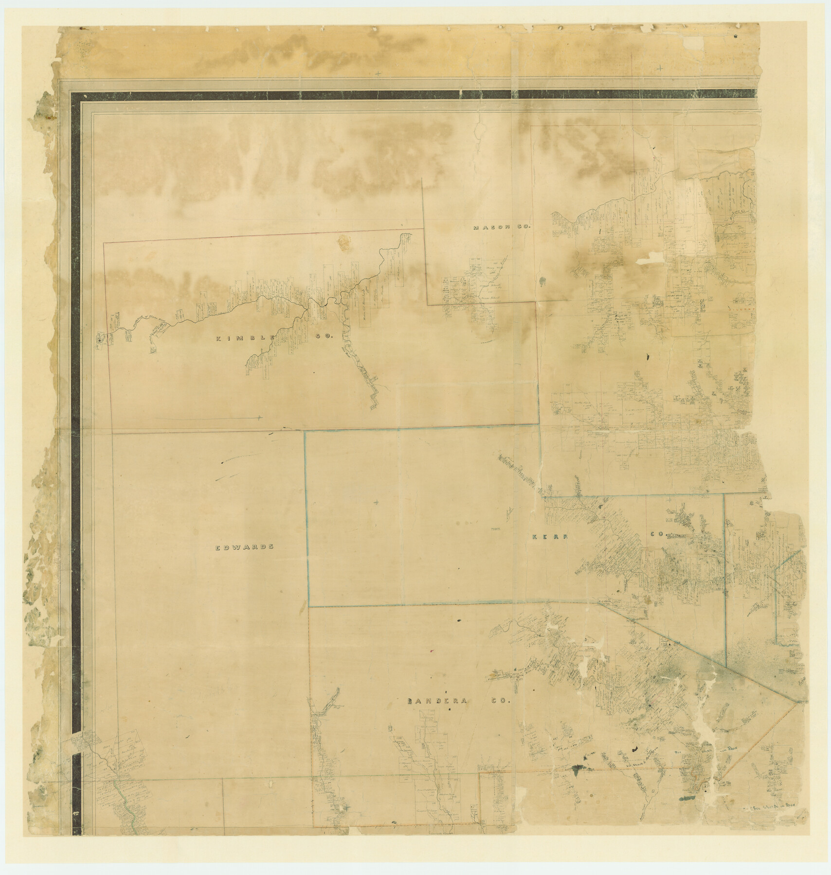
Map of Bexar County
-
Map/Doc
87236
-
Collection
General Map Collection
-
Object Dates
1845 (Creation Date)
-
People and Organizations
John C. Hays (Surveyor/Engineer)
H.L. Upshur (Draftsman)
-
Counties
Bexar Zavala Frio Atascosa Karnes Goliad
-
Subjects
County
-
Height x Width
49.0 x 46.5 inches
124.5 x 118.1 cm
-
Comments
This is the northwest quarter of this large map. For the other pieces see maps 87234, 87235, and 87237.
For a digital composite of the full map see map 82242.
Adopted in 2006 in Memory of Charles Wallace Pratt by loved ones and conservation funded in 2007.
Related maps
Map of Bexar County

Print $40.00
- Digital $50.00
Map of Bexar County
1845
Size 90.6 x 81.0 inches
Map/Doc 82242
Map of Bexar County

Print $20.00
- Digital $50.00
Map of Bexar County
1845
Size 47.4 x 44.9 inches
Map/Doc 87234
Map of Bexar County

Print $20.00
- Digital $50.00
Map of Bexar County
1845
Size 47.5 x 41.7 inches
Map/Doc 87235
Map of Bexar County

Print $40.00
- Digital $50.00
Map of Bexar County
1845
Size 48.8 x 43.0 inches
Map/Doc 87237
Part of: General Map Collection
Township 14 South Range 15 West of the Louisiana Meridian, Louisiana

Print $20.00
- Digital $50.00
Township 14 South Range 15 West of the Louisiana Meridian, Louisiana
1875
Size 19.6 x 24.6 inches
Map/Doc 65859
Bowie County Working Sketch 23

Print $20.00
- Digital $50.00
Bowie County Working Sketch 23
1969
Size 25.5 x 29.7 inches
Map/Doc 67427
Hood County Sketch File 10

Print $20.00
- Digital $50.00
Hood County Sketch File 10
Size 20.6 x 22.9 inches
Map/Doc 11778
Floyd County Boundary File 1

Print $30.00
- Digital $50.00
Floyd County Boundary File 1
Size 8.9 x 4.2 inches
Map/Doc 53445
Map of Shackelford County, North of the Clearfork of the Brazos River Young - South of il Milam - Land District

Print $20.00
- Digital $50.00
Map of Shackelford County, North of the Clearfork of the Brazos River Young - South of il Milam - Land District
1859
Size 24.8 x 19.9 inches
Map/Doc 4027
Polk County Working Sketch 17

Print $20.00
- Digital $50.00
Polk County Working Sketch 17
1948
Size 28.3 x 18.5 inches
Map/Doc 71632
Lynn County Sketch File A2

Print $6.00
- Digital $50.00
Lynn County Sketch File A2
1903
Size 12.7 x 8.0 inches
Map/Doc 30470
Flight Mission No. CRK-8P, Frame 105, Refugio County

Print $20.00
- Digital $50.00
Flight Mission No. CRK-8P, Frame 105, Refugio County
1956
Size 18.2 x 22.0 inches
Map/Doc 86966
San Jacinto County Rolled Sketch 14

Print $20.00
- Digital $50.00
San Jacinto County Rolled Sketch 14
1998
Size 30.0 x 42.7 inches
Map/Doc 7563
Flight Mission No. BRE-1P, Frame 106, Nueces County

Print $20.00
- Digital $50.00
Flight Mission No. BRE-1P, Frame 106, Nueces County
1956
Size 18.6 x 22.6 inches
Map/Doc 86677
Tarrant County Sketch File 23

Print $4.00
- Digital $50.00
Tarrant County Sketch File 23
Size 6.1 x 8.2 inches
Map/Doc 37733
Map No. 1 - Rio Bravo del Norte section of boundary between the United States & Mexico agreed upon by the Joint Commission under the Treaty of Guadalupe Hidalgo

Print $20.00
- Digital $50.00
Map No. 1 - Rio Bravo del Norte section of boundary between the United States & Mexico agreed upon by the Joint Commission under the Treaty of Guadalupe Hidalgo
1852
Size 18.4 x 27.0 inches
Map/Doc 72864
You may also like
Bosque County Working Sketch 29

Print $20.00
- Digital $50.00
Bosque County Working Sketch 29
2009
Size 35.9 x 40.6 inches
Map/Doc 88997
[Divisional Boundary and Brigade Boundary on October 22, 1918, Appendix P]
![94125, [Divisional Boundary and Brigade Boundary on October 22, 1918, Appendix P], Non-GLO Digital Images](https://historictexasmaps.com/wmedia_w700/maps/94125-1.tif.jpg)
Print $20.00
[Divisional Boundary and Brigade Boundary on October 22, 1918, Appendix P]
1918
Size 16.2 x 16.7 inches
Map/Doc 94125
Red River County Working Sketch 70

Print $20.00
- Digital $50.00
Red River County Working Sketch 70
1977
Size 22.6 x 24.0 inches
Map/Doc 72053
Bravo Deed, Instrument 24, Tract A and Tract B

Print $3.00
- Digital $50.00
Bravo Deed, Instrument 24, Tract A and Tract B
Size 11.4 x 14.2 inches
Map/Doc 91479
Val Verde County Working Sketch 11

Print $20.00
- Digital $50.00
Val Verde County Working Sketch 11
1919
Size 32.0 x 26.5 inches
Map/Doc 72146
Hardin County Sketch File 64

Print $24.00
- Digital $50.00
Hardin County Sketch File 64
1936
Size 24.5 x 25.6 inches
Map/Doc 11638
Brewster County Working Sketch 45

Print $40.00
- Digital $50.00
Brewster County Working Sketch 45
1948
Size 53.6 x 36.1 inches
Map/Doc 67579
Clay County Rolled Sketch 4A

Print $20.00
- Digital $50.00
Clay County Rolled Sketch 4A
1949
Size 22.0 x 24.0 inches
Map/Doc 5498
[Leagues 1, 2, 281, 282, 284, and 285]
![92563, [Leagues 1, 2, 281, 282, 284, and 285], Twichell Survey Records](https://historictexasmaps.com/wmedia_w700/maps/92563-1.tif.jpg)
Print $20.00
- Digital $50.00
[Leagues 1, 2, 281, 282, 284, and 285]
Size 23.8 x 19.3 inches
Map/Doc 92563
Midland County Working Sketch Graphic Index

Print $20.00
- Digital $50.00
Midland County Working Sketch Graphic Index
1930
Size 43.3 x 35.3 inches
Map/Doc 76641
Bell County Sketch File 13

Print $4.00
- Digital $50.00
Bell County Sketch File 13
1854
Size 9.3 x 8.1 inches
Map/Doc 14390
Parker County Working Sketch 1

Print $20.00
- Digital $50.00
Parker County Working Sketch 1
Size 22.6 x 17.0 inches
Map/Doc 71451